Fordbridge

Civil Parish in Warwickshire Solihull

England

Fordbridge

Sandra Croft off Auckland Drive, Castle Bromwich
Sandra Croft off Auckland Drive, Castle Bromwich Credit: Ian S

Fordbridge is a civil parish located in Warwickshire, England. It is situated on the outskirts of the town of Warwick, approximately 2 miles northwest of its center. The parish covers an area of about 3 square miles and is bordered by the River Avon to the south.

The area is primarily residential, with a mix of housing types ranging from modern developments to traditional cottages. The population of Fordbridge is relatively small, with around 1,000 residents according to the latest census data.

The landscape of Fordbridge is characterized by its rural charm, with open fields and green spaces surrounding the parish. There are several footpaths and bridleways that provide opportunities for outdoor activities such as walking and cycling.

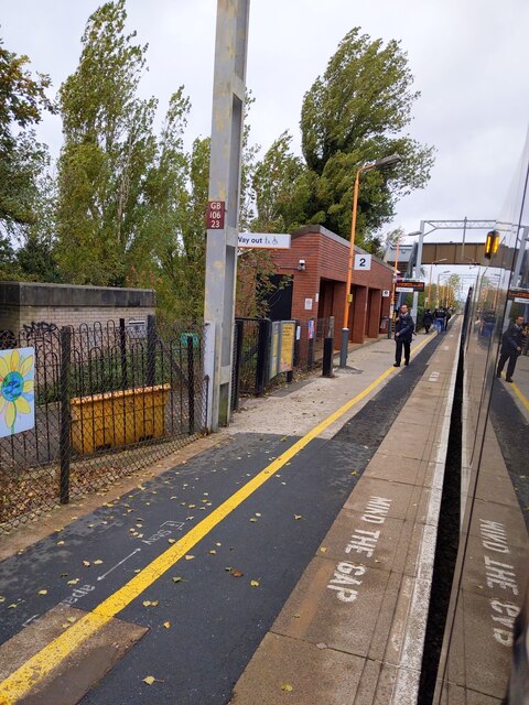
The parish is well-connected in terms of transportation, with easy access to major roads including the A46 and A4177. Warwick Parkway railway station is also nearby, offering direct train services to Birmingham, London, and other major cities.

Fordbridge is home to a few local amenities, including a primary school, a village hall, and a pub. Residents also benefit from the proximity to Warwick, which offers a wider range of services and amenities including shops, restaurants, and leisure facilities.

Overall, Fordbridge is a quiet and picturesque civil parish that offers a rural lifestyle while still being conveniently located near larger towns and transportation links.

If you have any feedback on the listing, please let us know in the comments section below.

Fordbridge Images

Images are sourced within 2km of 52.482269/-1.746813 or Grid Reference SP1787. Thanks to Geograph Open Source API. All images are credited.

Sandra Croft off Auckland Drive, Castle Bromwich
The Centurion public house On Forth Drive, Fordbridge.
The Centurion public house
On Forth Drive, Fordbridge.
The Centurion public house On Forth Drive, Fordbridge.
The Centurion public house
On Forth Drive, Fordbridge.
Hedgetree Croft off Chelmsley Road, Chelmsley Wood
Frensham Close off Chelmsley Road, Chelmsley Wood
Picton Croft off Dunster Road, Chelmsley Wood
Peacock Butterfly at Sheldon Hall School Aglais io, the peacock butterfly, with its distinctive four eyespots, is seen here on the site of the former Sheldon Hall School in Tile Cross.
Peacock Butterfly at Sheldon Hall School
Aglais io, the peacock butterfly, with its distinctive four eyespots, is seen here on the site of the former Sheldon Hall School in Tile Cross.
Marston Green station looking towards Birmingham
Marston Green station
Reflections in the Lake Shard End Lake from beside Pithall Road
Reflections in the Lake
Shard End Lake from beside Pithall Road
Gateway into Sheldon Country Park The park around the northern area of the airport is popular with plane spotters and families; this is one of the paths leading into the country park.
Gateway into Sheldon Country Park
The park around the northern area of the airport is popular with plane spotters and families; this is one of the paths leading into the country park.
A Brutalist Pilgrimage Admirers of Modernist architecture have come to see Our Lady Help of Christians, a Catholic church in Kitts Green, Birmingham, that was completed in 1967 to designs by Richard Gilbert Scott, of the famous Scott dynasty of architects. The tour was led by members of Brutiful Birmingham, which defends and promotes the city's much-maligned Modernist and Brutalist architecture. On Brutiful Birmingham see Joe Holyoak at Building Design <span class="nowrap"><a title="https://www.bdonline.co.uk/briefing/review-birmingham-the-brutiful-years/5119945.article" rel="nofollow ugc noopener" href="https://www.bdonline.co.uk/briefing/review-birmingham-the-brutiful-years/5119945.article">Link</a><img style="margin-left:2px;" alt="External link" title="External link - shift click to open in new window" src="https://s1.geograph.org.uk/img/external.png" width="10" height="10"/></span> .
A Brutalist Pilgrimage
Admirers of Modernist architecture have come to see Our Lady Help of Christians, a Catholic church in Kitts Green, Birmingham, that was completed in 1967 to designs by Richard Gilbert Scott, of the famous Scott dynasty of architects. The tour was led by members of Brutiful Birmingham, which defends and promotes the city's much-maligned Modernist and Brutalist architecture. On Brutiful Birmingham see Joe Holyoak at Building Design LinkExternal link .
Our Lady Help of Christians, Kitts Green This is a Catholic church built in 1966-7 to designs by Richard Gilbert Scott of Giles Scott, Son and Partners. The building is T-shaped in plan; each arm of the T is roofed with an upward-sweeping curve of reinforced concrete with serrated ribbed trusses. The roof is of felt coated with copper. A pair of side chapels nestle in the corners of the T, each with a bell-shaped roof; the Lady Chapel can be seen here. The church is Grade II* listed: see the listing at Historic England <span class="nowrap"><a title="https://historicengland.org.uk/listing/the-list/list-entry/1245546?section=official-list-entry" rel="nofollow ugc noopener" href="https://historicengland.org.uk/listing/the-list/list-entry/1245546?section=official-list-entry">Link</a><img style="margin-left:2px;" alt="External link" title="External link - shift click to open in new window" src="https://s1.geograph.org.uk/img/external.png" width="10" height="10"/></span> and the entry at the Gilbert Scott Dynasty site <span class="nowrap"><a title="https://gilbertscott.org/our-lady-help-of-christians-church/" rel="nofollow ugc noopener" href="https://gilbertscott.org/our-lady-help-of-christians-church/">Link</a><img style="margin-left:2px;" alt="External link" title="External link - shift click to open in new window" src="https://s1.geograph.org.uk/img/external.png" width="10" height="10"/></span> .
Our Lady Help of Christians, Kitts Green
This is a Catholic church built in 1966-7 to designs by Richard Gilbert Scott of Giles Scott, Son and Partners. The building is T-shaped in plan; each arm of the T is roofed with an upward-sweeping curve of reinforced concrete with serrated ribbed trusses. The roof is of felt coated with copper. A pair of side chapels nestle in the corners of the T, each with a bell-shaped roof; the Lady Chapel can be seen here. The church is Grade II* listed: see the listing at Historic England LinkExternal link and the entry at the Gilbert Scott Dynasty site LinkExternal link .
Our Lady Help of Christians with Baptistery, Kitts Green This is a view of the church from the southeast (liturgically north), showing one of its sweeps of zigzag copper-coated concrete roofing and the bell-shaped lantern of the baptistery. The architect, Richard Gilbert Scott, achieved astonishing results on a tight budget and at a time of experimentation and uncertainty - but also opportunity - in Catholic church design following the Second Vatican Council (1962-65) and its reforms. The building is Grade II* listed - see the listing at the Historic England site <span class="nowrap"><a title="https://historicengland.org.uk/listing/the-list/list-entry/1245546" rel="nofollow ugc noopener" href="https://historicengland.org.uk/listing/the-list/list-entry/1245546">Link</a><img style="margin-left:2px;" alt="External link" title="External link - shift click to open in new window" src="https://s1.geograph.org.uk/img/external.png" width="10" height="10"/></span> .
Our Lady Help of Christians with Baptistery, Kitts Green
This is a view of the church from the southeast (liturgically north), showing one of its sweeps of zigzag copper-coated concrete roofing and the bell-shaped lantern of the baptistery. The architect, Richard Gilbert Scott, achieved astonishing results on a tight budget and at a time of experimentation and uncertainty - but also opportunity - in Catholic church design following the Second Vatican Council (1962-65) and its reforms. The building is Grade II* listed - see the listing at the Historic England site LinkExternal link .
Altar, Our Lady Help of Christians, Kitts Green The altar stands on marble steps under the crossing of this T-shaped Catholic church, below the high ceiling where the three upward-sweeping vaults of reinforced concrete meet. The architect, Richard Gilbert Scott, was responding to the liturgical reforms of the Second Vatican Council, which emphasised the participation of the whole people of God in worship. The altar no longer stood against the east wall of the church but was brought forward, with the priest facing the congregation while celebrating mass, not away from them as had been the case before Vatican II. This church, completed in 1967, embodied the new arrangements from the start. The stained glass in the clerestory is by John Chrestien. See the listing (it is a Grade II* listed building) at the Historic England site <span class="nowrap"><a title="https://historicengland.org.uk/listing/the-list/list-entry/1245546" rel="nofollow ugc noopener" href="https://historicengland.org.uk/listing/the-list/list-entry/1245546">Link</a><img style="margin-left:2px;" alt="External link" title="External link - shift click to open in new window" src="https://s1.geograph.org.uk/img/external.png" width="10" height="10"/></span>.
Altar, Our Lady Help of Christians, Kitts Green
The altar stands on marble steps under the crossing of this T-shaped Catholic church, below the high ceiling where the three upward-sweeping vaults of reinforced concrete meet. The architect, Richard Gilbert Scott, was responding to the liturgical reforms of the Second Vatican Council, which emphasised the participation of the whole people of God in worship. The altar no longer stood against the east wall of the church but was brought forward, with the priest facing the congregation while celebrating mass, not away from them as had been the case before Vatican II. This church, completed in 1967, embodied the new arrangements from the start. The stained glass in the clerestory is by John Chrestien. See the listing (it is a Grade II* listed building) at the Historic England site LinkExternal link.
North transept, Our Lady Help of Christians, Kitts Green The vault of ribbed reinforced concrete soars upward like the concave side of a tent. The stained glass is by John Chrestien, an artist so obscure that a Google search brings up results relating mostly to this church and another nearby, St Thomas More in Sheldon, also designed by Richard Gilbert Scott and also with glass by his friend Chrestien, who studied in Paris and lived in India, according to the listing for this church at the Historic England site <span class="nowrap"><a title="https://historicengland.org.uk/listing/the-list/list-entry/1245546" rel="nofollow ugc noopener" href="https://historicengland.org.uk/listing/the-list/list-entry/1245546">Link</a><img style="margin-left:2px;" alt="External link" title="External link - shift click to open in new window" src="https://s1.geograph.org.uk/img/external.png" width="10" height="10"/></span> . The windows and doors under the zigzag ceiling are for confessionals; the doors have diagonal timbers of a design seen elsewhere in this building. The transept is north, liturgically speaking, but actually points more towards the east.
North transept, Our Lady Help of Christians, Kitts Green
The vault of ribbed reinforced concrete soars upward like the concave side of a tent. The stained glass is by John Chrestien, an artist so obscure that a Google search brings up results relating mostly to this church and another nearby, St Thomas More in Sheldon, also designed by Richard Gilbert Scott and also with glass by his friend Chrestien, who studied in Paris and lived in India, according to the listing for this church at the Historic England site LinkExternal link . The windows and doors under the zigzag ceiling are for confessionals; the doors have diagonal timbers of a design seen elsewhere in this building. The transept is north, liturgically speaking, but actually points more towards the east.
Interior of Church of Our Lady Help of Christians, Kitts Green This is a view from the south transept across the sanctuary towards the north transept, with the nave off to the left - if such traditional terms make any sense here. The three arms of this T-shaped church have equal status really, and were intended by the architect, Richard Gilbert Scott, to bring all worshippers close to the altar. The church was completed in 1967 and embodies the liturgical reforms of the Second Vatican Council, which had ended two years previously. The three concave vaults of reinforced concrete resemble the sides of a tent, suggesting perhaps the People of God on the move, on pilgrimage in a time of great change within the Catholic Church and without. See the listing at the Historic England site <span class="nowrap"><a title="https://historicengland.org.uk/listing/the-list/list-entry/1245546" rel="nofollow ugc noopener" href="https://historicengland.org.uk/listing/the-list/list-entry/1245546">Link</a><img style="margin-left:2px;" alt="External link" title="External link - shift click to open in new window" src="https://s1.geograph.org.uk/img/external.png" width="10" height="10"/></span> .
Interior of Church of Our Lady Help of Christians, Kitts Green
This is a view from the south transept across the sanctuary towards the north transept, with the nave off to the left - if such traditional terms make any sense here. The three arms of this T-shaped church have equal status really, and were intended by the architect, Richard Gilbert Scott, to bring all worshippers close to the altar. The church was completed in 1967 and embodies the liturgical reforms of the Second Vatican Council, which had ended two years previously. The three concave vaults of reinforced concrete resemble the sides of a tent, suggesting perhaps the People of God on the move, on pilgrimage in a time of great change within the Catholic Church and without. See the listing at the Historic England site LinkExternal link .
Baptistery, Our Lady Help of Christians, Kitts Green The architect, Richard Gilbert Scott, designed a pair of octagonal structures to fit into the corners of this T-shaped church: the Lady Chapel and this Baptistery, with a font in the form of an inverted truncated cone. The stained glass is by Scott's friend John Chrestien and depicts a fish, an ancient symbol of the Christian faith, and a more abstract design above it, suggesting the Holy Spirit in the form of a dove, as it appeared above Jesus as he was baptised in the River Jordan by John the Baptist according to the Gospels. See the Grade II* listing of this church at the Historic England site <span class="nowrap"><a title="https://historicengland.org.uk/listing/the-list/list-entry/1245546" rel="nofollow ugc noopener" href="https://historicengland.org.uk/listing/the-list/list-entry/1245546">Link</a><img style="margin-left:2px;" alt="External link" title="External link - shift click to open in new window" src="https://s1.geograph.org.uk/img/external.png" width="10" height="10"/></span> .
Baptistery, Our Lady Help of Christians, Kitts Green
The architect, Richard Gilbert Scott, designed a pair of octagonal structures to fit into the corners of this T-shaped church: the Lady Chapel and this Baptistery, with a font in the form of an inverted truncated cone. The stained glass is by Scott's friend John Chrestien and depicts a fish, an ancient symbol of the Christian faith, and a more abstract design above it, suggesting the Holy Spirit in the form of a dove, as it appeared above Jesus as he was baptised in the River Jordan by John the Baptist according to the Gospels. See the Grade II* listing of this church at the Historic England site LinkExternal link .
Show me another place!

Fordbridge is located at Grid Ref: SP1787 (Lat: 52.482269, Lng: -1.746813)

Administrative County: West Midlands

District: Solihull

Police Authority: West Midlands

What 3 Words

///fees.brush.live. Near Chelmsley Wood, West Midlands

Related Wikis

Fordbridge

Fordbridge is a town and civil parish in the Metropolitan Borough of Solihull, in the West Midlands, England. It is 8 miles (13 km) east of Birmingham...

WMG Academy for Young Engineers, Solihull

The WMG Academy for Young Engineers (Solihull) is a mixed university technical college in Solihull which opened in 2016. It caters for students aged 14...

John Henry Newman Catholic College

John Henry Newman Catholic College (JHNCC), formerly Archbishop Grimshaw School, is an English secondary school in the Fordbridge area of Solihull, although...

Tudor Grange Academy, Kingshurst

Tudor Grange Academy, Kingshurst (previously CTC Kingshurst Academy) is a coeducational secondary school and sixth form located in Kingshurst, Solihull...

Kingshurst

Kingshurst is a post-war village and civil parish in the Metropolitan Borough of Solihull, in the West Midlands. It lies about 9 miles (14 km) east of...
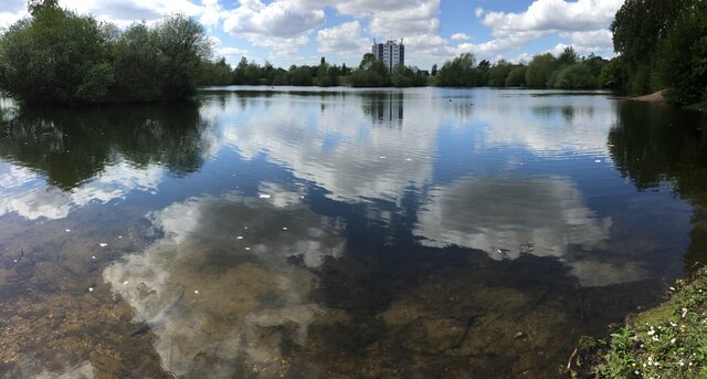
Meriden Park

Meriden Park is a public park located in Chelmsley Wood, near Birmingham, UK. The park has a large natural lake, natural woodland, a children's play area...
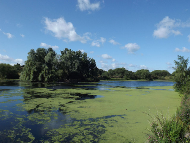
Babbs Mill Lake

Babbs Mill Lake, sometimes called Kingshurst Lake, is a man-made lake in the Kingfisher Country Park in Kingshurst, Solihull in England. The lake was created...

Grace Academy, Solihull

Grace Academy is a non-selective co-educational secondary school within the English Academy programme, at Chelmsley Wood, Solihull, West Midlands. It opened...

Nearby Amenities

Located within 500m of 52.482269,-1.746813
Crossing
Crossing: traffic_signals
Source: Warwicks Aerial Imagery OGL v2
Lat/Long: 52.4789164/-1.7430602
Crossing
Crossing: traffic_signals
Crossing Ref: pelican
Source Type: BCC_CycleData
Lat/Long: 52.4820474/-1.7420231
Turning Circle
Source: bing
Lat/Long: 52.4831915/-1.753269
Source: bing
Traffic Calming: bump
Lat/Long: 52.4864006/-1.7449508
Source: bing
Traffic Calming: bump
Lat/Long: 52.4862367/-1.7441929
Source: bing
Traffic Calming: bump
Lat/Long: 52.4855703/-1.7433706
Source: bing
Traffic Calming: bump
Lat/Long: 52.485447/-1.7430228
Mini Roundabout
Direction: clockwise
Lat/Long: 52.4824633/-1.7446202
Nightclub
Chelmsley and District Conservative Club
Source: survey
Lat/Long: 52.4791245/-1.7458853
Telephone
Booth: KX300
Covered: booth
Source: survey
Lat/Long: 52.4823568/-1.7451202
Source: bing
Traffic Calming: bump
Lat/Long: 52.4795537/-1.7513017
Bus Stop
CN
NaPTANAreaCode: 43000176603
Asset Ref: 807822
Bus: yes
Local Ref: CN
Naptan AtcoCode: 43000176603
Naptan Bearing: NW
Naptan BusStopType: MKD
Naptan CommonName: Winchester Drive
Naptan Indicator: Stop CN
Naptan NaptanCode: nwmwapga
Naptan Status: ACT
Naptan StopType: BCT
Naptan Street: BOSWORTH DR
Naptan Towards: Birmingham
Public Transport: platform
Route Ref: 71;97;97A
Shelter: yes
Shelter Ref: 807822
Source: WMCA
Lat/Long: 52.4787294/-1.7425276
Bus Stop
A
Bus: yes
Local Ref: A
Naptan AtcoCode: 43000177001
Naptan Bearing: W
Naptan BusStopType: MKD
Naptan CommonName: Chelmsley Wood Library
Naptan Indicator: Stop A
Naptan NaptanCode: nwmagdpg
Naptan PlusbusZoneRef: BHAMNWS
Naptan Status: ACT
Naptan StopType: BCT
Naptan Street: STEPHENSON DR
Naptan Verified: no
Public Transport: platform
Route Ref: 91
Source: WMCA
Lat/Long: 52.4805263/-1.7413459
Bus Stop
Bosworth Dr / Coleford Drive
NaPTANAreaCode: 43000177101
Bus: yes
Naptan AtcoCode: 43000177101
Naptan Bearing: W
Naptan BusStopType: MKD
Naptan CommonName: Coleford Drive
Naptan Indicator: adj
Naptan NaptanCode: nwmagdpj
Naptan PlusbusZoneRef: BHAMNWS
Naptan Status: ACT
Naptan StopType: BCT
Naptan Street: BOSWORTH DR
Naptan Towards: Birmingham
Public Transport: platform
Route Ref: 71;97;97A
Shelter: yes
Shelter Ref: 807820
Source: WMCA
Lat/Long: 52.4794055/-1.7481641
Bus Stop
Bosworth Dr / Brickhill Drive
NaPTANAreaCode: 43000177201
Asset Ref: 807716
Bus: yes
Naptan AtcoCode: 43000177201
Naptan Bearing: E
Naptan BusStopType: MKD
Naptan CommonName: Brickhill Drive
Naptan Indicator: adj
Naptan NaptanCode: nwmagdpt
Naptan PlusbusZoneRef: BHAMNWS
Naptan Status: ACT
Naptan StopType: BCT
Naptan Street: BOSWORTH DR
Naptan Towards: Chelmsley Wood
Public Transport: platform
Route Ref: 71;97;97A
Shelter: yes
Shelter Ref: 807716
Source: WMCA
Towards: Chelmsley Wood
Lat/Long: 52.4796058/-1.7516383
Bus Stop
Bosworth Dr / Brickhill Drive
NaPTANAreaCode: 43000177202
Bus: yes
Naptan AtcoCode: 43000177202
Naptan Bearing: W
Naptan BusStopType: MKD
Naptan CommonName: Brickhill Drive
Naptan Indicator: opp
Naptan NaptanCode: nwmagdpw
Naptan PlusbusZoneRef: BHAMNWS
Naptan Status: ACT
Naptan StopType: BCT
Naptan Street: BOSWORTH DR
Naptan Towards: Birmingham
Naptan Verified: no
Public Transport: platform
Route Ref: 71;97;97A
Shelter: yes
Shelter Ref: 807709
Source: WMCA
Lat/Long: 52.4794785/-1.7516444
Bus Stop
Bosworth Dr / Chapelhouse Rd
NaPTANAreaCode: 43000177701
Bus: yes
Naptan AtcoCode: 43000177701
Naptan Bearing: W
Naptan BusStopType: MKD
Naptan CommonName: Chapelhouse Rd
Naptan Indicator: adj
Naptan NaptanCode: nwmagdtm
Naptan PlusbusZoneRef: BHAMNWS
Naptan Status: ACT
Naptan StopType: BCT
Naptan Street: BOSWORTH DR
Naptan Towards: Birmingham
Public Transport: platform
Route Ref: 71;97;97A
Shelter: yes
Shelter Ref: 807875
Source: WMCA
Lat/Long: 52.4792449/-1.7457734
Bus Stop
Chelmsley Rd / Conway Rd
NaPTANAreaCode: 43000178101
Bus: yes
Naptan AtcoCode: 43000178101
Naptan Bearing: E
Naptan BusStopType: MKD
Naptan CommonName: Conway Rd
Naptan Indicator: adj
Naptan Landmark: Swimming Baths
Naptan NaptanCode: nwmagdtp
Naptan PlusbusZoneRef: BHAMNWS
Naptan Status: ACT
Naptan StopType: BCT
Naptan Street: CHELMSLEY RD
Naptan Towards: Chelmsley Wood
Naptan Verified: no
Public Transport: platform
Route Ref: 71;71A;91;94
Shelter: yes
Shelter Ref: 807817
Source: WMCA
Lat/Long: 52.4825937/-1.7453243
Bus Stop
Chelmsley Rd / Conway Rd
NaPTANAreaCode: 43000178102
Bus: yes
Naptan AtcoCode: 43000178102
Naptan Bearing: W
Naptan BusStopType: MKD
Naptan CommonName: Conway Rd
Naptan Indicator: opp
Naptan Landmark: Swimming Baths
Naptan NaptanCode: nwmagdtw
Naptan PlusbusZoneRef: BHAMNWS
Naptan Status: ACT
Naptan StopType: BCT
Naptan Street: CHELMSLEY RD
Naptan Towards: Castle Bromwich
Naptan Verified: no
Public Transport: platform
Route Ref: 71;71A;91;94
Shelter: yes
Shelter Ref: 807818
Source: WMCA
Lat/Long: 52.4822323/-1.7445018
Bus Stop
Chelmsley Rd / Blackcat Close
Bus: yes
Naptan AtcoCode: 43000178201
Naptan Bearing: E
Naptan BusStopType: MKD
Naptan CommonName: Blackcat Close
Naptan Indicator: opp
Naptan NaptanCode: nwmagdwa
Naptan PlusbusZoneRef: BHAMNWS
Naptan Status: ACT
Naptan StopType: BCT
Naptan Street: CHELMSLEY RD
Naptan Towards: Chelmsley Wood
Naptan Verified: no
Public Transport: platform
Route Ref: 71;71A;91;94
Source: WMCA
Lat/Long: 52.4827615/-1.7482372
Bus Stop
Chelmsley Rd / Blackcat Close
NaPTANAreaCode: 43000178202
Bus: yes
Naptan AtcoCode: 43000178202
Naptan Bearing: W
Naptan BusStopType: MKD
Naptan CommonName: Blackcat Close
Naptan Indicator: adj
Naptan NaptanCode: nwmagdwd
Naptan PlusbusZoneRef: BHAMNWS
Naptan Status: ACT
Naptan StopType: BCT
Naptan Street: CHELMSLEY RD
Naptan Towards: Castle Bromwich
Naptan Verified: no
Public Transport: platform
Route Ref: 71;71A;94
Shelter: yes
Shelter Ref: 807816
Source: WMCA
Lat/Long: 52.4826374/-1.7501647
Bus Stop
Chelmsley Rd / Newman College
NaPTANAreaCode: 43000178301
Bus: yes
Naptan AtcoCode: 43000178301
Naptan Bearing: W
Naptan BusStopType: MKD
Naptan CommonName: Archbishop Grimshaw School
Naptan Indicator: opp
Naptan NaptanCode: nwmagdwg
Naptan PlusbusZoneRef: BHAMNWS
Naptan Status: ACT
Naptan StopType: BCT
Naptan Street: CHELMSLEY RD
Naptan Towards: Castle Bromwich
Naptan Verified: no
Public Transport: platform
Route Ref: 71;71A;94
Shelter: yes
Shelter Ref: 0178301
Source: WMCA
Lat/Long: 52.4827183/-1.7532165
Bus Stop
Chelmsley Rd / Newman College
NaPTANAreaCode: 43000178302
Bus: yes
Naptan AtcoCode: 43000178302
Naptan Bearing: E
Naptan BusStopType: MKD
Naptan CommonName: Archbishop Grimshaw School
Naptan Indicator: adj
Naptan NaptanCode: nwmagdwj
Naptan PlusbusZoneRef: BHAMNWS
Naptan Status: ACT
Naptan StopType: BCT
Naptan Street: CHELMSLEY RD
Naptan Towards: Chelmsley Wood
Naptan Verified: no
Public Transport: platform
Route Ref: 71;71A;94
Shelter: yes
Shelter Ref: 0178302
Source: WMCA
Lat/Long: 52.4829056/-1.7514353
Bus Stop
Cooks Lane / City Technology College
NaPTANAreaCode: 43000179201
Bench: yes
Bus: yes
Naptan AtcoCode: 43000179201
Naptan Bearing: SW
Naptan BusStopType: MKD
Naptan CommonName: City Technology College
Naptan Indicator: adj
Naptan NaptanCode: nwmagjag
Naptan PlusbusZoneRef: BHAMNWS
Naptan Status: ACT
Naptan StopType: BCT
Naptan Street: COOKS LANE
Naptan Towards: Chelmsley Wood
Naptan Verified: no
Public Transport: platform
Route Ref: 71;71A;94
Shelter: yes
Shelter Ref: 807704
Source: WMCA
Tactile Paving: no
Lat/Long: 52.4857139/-1.7508772
Bus Stop
Cooks Lane / City Technology College
NaPTANAreaCode: 43000179202
Bus: yes
Naptan AtcoCode: 43000179202
Naptan Bearing: NE
Naptan BusStopType: MKD
Naptan CommonName: City Technology College
Naptan Indicator: opp
Naptan NaptanCode: nwmtdpam
Naptan PlusbusZoneRef: BHAMNWS
Naptan Status: ACT
Naptan StopType: BCT
Naptan Street: COOKS LANE
Naptan Towards: Castle Bromwich
Naptan Verified: no
Public Transport: platform
Route Ref: 71;71A;94
Shelter: yes
Shelter Ref: 0179202
Source: WMCA
Lat/Long: 52.4856186/-1.7515067
Mini Roundabout
Direction: clockwise
Source: survey
Lat/Long: 52.4810911/-1.7397079
Power: substation
Ref: 2391
Source: survey
Lat/Long: 52.4800188/-1.7411908
Man Made: surveillance
Source: survey
Lat/Long: 52.4802017/-1.7422915
Fordbridge
Is In: Solihull,West Midlands,England,UK,EU
Place: suburb
Wikidata: Q4454196
Wikipedia: en:Fordbridge
Lat/Long: 52.4854415/-1.7472627
Man Made: surveillance
Source: survey
Lat/Long: 52.4799288/-1.7430203
Brand: National Grid
Brand Wikidata: Q1465461
Operator: National Grid Electricity Distribution Plc
Operator Old: Western Power Distribution
Operator Wikidata: Q7988183
Owner: National Grid Electricity Distribution (West Midlands) Plc
Owner Wikidata: Q114397791
Power: substation
Source: survey
Lat/Long: 52.480613/-1.7416411
Man Made: surveillance
Source: survey
Lat/Long: 52.4781875/-1.7437899
Man Made: surveillance
Source: survey
Lat/Long: 52.4784492/-1.7439562
Man Made: surveillance
Source: survey
Lat/Long: 52.4788859/-1.743634
Recycling
Source: survey
Lat/Long: 52.4810986/-1.7420637
Man Made: tower
Operator: Orange
Source: survey
Tower Type: communication
Lat/Long: 52.480028/-1.7409985
Man Made: tower
Operator: O2
Source: survey
Tower Type: communication
Lat/Long: 52.4800146/-1.7407869
Shop: convenience
Source: survey
Lat/Long: 52.4811626/-1.7474217
Noexit: yes
Lat/Long: 52.4824571/-1.748639
Man Made: surveillance
Source: survey
Lat/Long: 52.4811741/-1.7489626
Man Made: surveillance
Source: survey
Lat/Long: 52.4813584/-1.7491986
Recycling
Source: GPS Survey
Lat/Long: 52.4837662/-1.7464427
Bicycle Parking
Access: private
Source: survey
Lat/Long: 52.4834207/-1.751956
Bicycle Parking
Source: survey
Lat/Long: 52.4847195/-1.7521495
Post Box
Postal Code: B37
Ref: B37 1151
Source: GPS Survey
Lat/Long: 52.4795781/-1.7523418
Man Made: surveillance
Source: survey
Lat/Long: 52.4798063/-1.7529608
Barrier: cycle_barrier
Source: survey
Lat/Long: 52.4808345/-1.7527149
Pharmacy
Healthcare: pharmacy
Source: survey
Lat/Long: 52.4805738/-1.7528669
Addr City: Solihull
Addr Housenumber: 16
Addr Postcode: B37 5BU
Addr Street: Crabtree Drive
Addr Suburb: Chelmsley Wood
Source: survey
Lat/Long: 52.4806757/-1.7527022
Brand: National Grid
Brand Wikidata: Q1465461
Operator: National Grid Electricity Distribution Plc
Operator Old: Western Power Distribution
Operator Wikidata: Q7988183
Owner: National Grid Electricity Distribution (West Midlands) Plc
Owner Wikidata: Q114397791
Power: substation
Ref: 6634
Source: survey
Lat/Long: 52.4799993/-1.752564
Source: bing
Traffic Calming: bump
Lat/Long: 52.4853162/-1.743919
Crossing
Crossing: traffic_signals
Crossing Ref: puffin
Source Type: BCC_CycleData
Lat/Long: 52.4813929/-1.7407643
Crossing
Crossing: traffic_signals
Crossing Ref: puffin
Source Type: BCC_CycleData
Lat/Long: 52.4814441/-1.7411794
Crossing
Crossing: traffic_signals
Crossing Ref: pelican
Source Type: BCC_CycleData
Lat/Long: 52.4819406/-1.7419584
Crossing
Crossing: traffic_signals
Crossing Ref: pelican
Source: BING;BCC_CycleData
Lat/Long: 52.4827629/-1.7523644
Crossing
Crossing: traffic_signals
Crossing Ref: pelican
Source: BING;BCC_CycleData
Lat/Long: 52.4828655/-1.7525087
Traffic Signals
Crossing: traffic_signals
Lat/Long: 52.4790723/-1.7432888
Traffic Signals
Crossing: traffic_signals
Lat/Long: 52.4788315/-1.7429557
Crossing
Lat/Long: 52.4788413/-1.7430067
Crossing
Lat/Long: 52.4787865/-1.7433746
Traffic Signals
Crossing: traffic_signals
Lat/Long: 52.4787596/-1.7433594
Crossing
Source: Warwicks Aerial Imagery OGL v2
Lat/Long: 52.4790324/-1.7432824
Crossing
Crossing: traffic_signals
Lat/Long: 52.479088/-1.7434318
Traffic Signals
Lat/Long: 52.4790014/-1.7436773
Crossing
Crossing: traffic_signals
Lat/Long: 52.478749/-1.7432602
Give Way
Source: Warwicks Aerial Imagery OGL v2
Lat/Long: 52.4792983/-1.7454408
Traffic Calming: bump
Lat/Long: 52.4791627/-1.7463045
Give Way
Source: Warwicks Aerial Imagery OGL v2
Lat/Long: 52.4793269/-1.7462642
Crossing
Lat/Long: 52.4794089/-1.746027
Entrance: yes
Lat/Long: 52.4795565/-1.7413666
Give Way
Lat/Long: 52.4863631/-1.7449446
Crossing
Crossing: zebra
Lat/Long: 52.4831022/-1.7520193
Evening Mail
Addr City: Birmingham
Addr Housenumber: 262
Addr Postcode: B37 5LH
Addr Street: Conway Road
Shop: convenience
Lat/Long: 52.4833849/-1.743061
Fast Food
Greggs
Brand: Greggs
Brand Wikidata: Q3403981
Brand Wikipedia: en:Greggs
Contact Website: https://www.greggs.co.uk/shop-finder?shop-code=2235
Cuisine: sandwich;bakery
Takeaway: yes
Lat/Long: 52.4795829/-1.7412859
Atm
Cash In: no
Drive Through: no
Lat/Long: 52.4792518/-1.7415784
Post Box
Ref: B37 1152
Lat/Long: 52.4826772/-1.7509324
Post Box
Ref: B37 1123
Lat/Long: 52.4833523/-1.7414513
Generator Method: photovoltaic
Generator Output Electricity: yes
Generator Source: solar
Generator Type: solar_photovoltaic_panel
Power: generator
Lat/Long: 52.4818597/-1.7444886
Generator Method: photovoltaic
Generator Output Electricity: yes
Generator Source: solar
Generator Type: solar_photovoltaic_panel
Power: generator
Lat/Long: 52.4815077/-1.7437577
Generator Method: photovoltaic
Generator Output Electricity: yes
Generator Source: solar
Generator Type: solar_photovoltaic_panel
Power: generator
Lat/Long: 52.4818679/-1.7446107
Generator Method: photovoltaic
Generator Output Electricity: yes
Generator Source: solar
Generator Type: solar_photovoltaic_panel
Power: generator
Lat/Long: 52.481859/-1.7444282
Generator Method: photovoltaic
Generator Output Electricity: yes
Generator Source: solar
Generator Type: solar_photovoltaic_panel
Power: generator
Lat/Long: 52.4821987/-1.7451284
Generator Method: photovoltaic
Generator Output Electricity: yes
Generator Source: solar
Generator Type: solar_photovoltaic_panel
Power: generator
Lat/Long: 52.4821522/-1.7446187
Generator Method: photovoltaic
Generator Output Electricity: yes
Generator Source: solar
Generator Type: solar_photovoltaic_panel
Power: generator
Lat/Long: 52.48218/-1.7449553
Generator Method: photovoltaic
Generator Output Electricity: yes
Generator Source: solar
Generator Type: solar_photovoltaic_panel
Power: generator
Lat/Long: 52.4823621/-1.7474431
Generator Method: photovoltaic
Generator Output Electricity: yes
Generator Source: solar
Generator Type: solar_photovoltaic_panel
Location: roof
Power: generator
Lat/Long: 52.4783468/-1.7438985
Generator Method: photovoltaic
Generator Output Electricity: yes
Generator Source: solar
Generator Type: solar_photovoltaic_panel
Location: roof
Power: generator
Lat/Long: 52.479309/-1.7488271
Generator Method: photovoltaic
Generator Output Electricity: yes
Generator Source: solar
Generator Type: solar_photovoltaic_panel
Location: roof
Power: generator
Lat/Long: 52.4809213/-1.7489827
Generator Method: photovoltaic
Generator Output Electricity: yes
Generator Source: solar
Generator Type: solar_photovoltaic_panel
Location: roof
Power: generator
Lat/Long: 52.4809148/-1.7486689
Generator Method: photovoltaic
Generator Output Electricity: yes
Generator Source: solar
Generator Type: solar_photovoltaic_panel
Location: roof
Power: generator
Lat/Long: 52.4813346/-1.7490551
Generator Method: photovoltaic
Generator Output Electricity: yes
Generator Source: solar
Generator Type: solar_photovoltaic_panel
Location: roof
Power: generator
Lat/Long: 52.4782618/-1.7493743
Generator Method: photovoltaic
Generator Output Electricity: yes
Generator Source: solar
Generator Type: solar_photovoltaic_panel
Location: roof
Power: generator
Lat/Long: 52.4785804/-1.7510158
Generator Method: photovoltaic
Generator Output Electricity: yes
Generator Source: solar
Generator Type: solar_photovoltaic_panel
Location: roof
Power: generator
Lat/Long: 52.4785755/-1.7508897
Generator Method: photovoltaic
Generator Output Electricity: yes
Generator Source: solar
Generator Type: solar_photovoltaic_panel
Location: roof
Power: generator
Lat/Long: 52.4804476/-1.7502245
Generator Method: photovoltaic
Generator Output Electricity: yes
Generator Source: solar
Generator Type: solar_photovoltaic_panel
Location: roof
Power: generator
Lat/Long: 52.4804459/-1.7505544
Generator Method: photovoltaic
Generator Output Electricity: yes
Generator Source: solar
Generator Type: solar_photovoltaic_panel
Location: roof
Power: generator
Lat/Long: 52.4797468/-1.7528772
Direction: forward
Surface: asphalt
Traffic Calming: cushion
Lat/Long: 52.4823351/-1.7446381
Generator Method: photovoltaic
Generator Output Electricity: yes
Generator Source: solar
Generator Type: solar_photovoltaic_panel
Location: roof
Power: generator
Lat/Long: 52.4812104/-1.7474404
Generator Method: photovoltaic
Generator Output Electricity: yes
Generator Source: solar
Generator Type: solar_photovoltaic_panel
Location: roof
Power: generator
Lat/Long: 52.4812096/-1.7473908
Generator Method: photovoltaic
Generator Output Electricity: yes
Generator Source: solar
Generator Type: solar_photovoltaic_panel
Location: roof
Power: generator
Lat/Long: 52.4834009/-1.7437309
Generator Method: photovoltaic
Generator Output Electricity: yes
Generator Source: solar
Generator Type: solar_photovoltaic_panel
Location: roof
Power: generator
Lat/Long: 52.4833977/-1.7436612
Generator Method: photovoltaic
Generator Output Electricity: yes
Generator Source: solar
Generator Type: solar_photovoltaic_panel
Location: roof
Power: generator
Lat/Long: 52.4833985/-1.7435807
Generator Method: photovoltaic
Generator Output Electricity: yes
Generator Source: solar
Generator Type: solar_photovoltaic_panel
Location: roof
Power: generator
Lat/Long: 52.4834026/-1.7434345
Power: substation
Source: bing
Lat/Long: 52.4836868/-1.7420907
Generator Method: photovoltaic
Generator Output Electricity: yes
Generator Source: solar
Generator Type: solar_photovoltaic_panel
Location: roof
Power: generator
Lat/Long: 52.4844725/-1.741966
Crossing
Lat/Long: 52.4808121/-1.7534734
Bus Stop
Bosworth Dr / Coleford Drive
NaPTANAreaCode: 43000177102
Bus: yes
Naptan AtcoCode: 43000177102
Naptan Bearing: E
Naptan BusStopType: MKD
Naptan CommonName: Coleford Drive
Naptan Indicator: opp
Naptan NaptanCode: nwmagdpm
Naptan PlusbusZoneRef: BHAMNWS
Naptan Status: ACT
Naptan StopType: BCT
Naptan Street: BOSWORTH DR
Naptan Towards: Chelmsley Wood
Naptan Verified: no
Public Transport: platform
Route Ref: 71;97;97A
Shelter: yes
Shelter Ref: 807819
Source: WMCA
Lat/Long: 52.4795001/-1.7478468
The data included in this document is from www.openstreetmap.org. The data is made available under ODbL.

Have you been to Fordbridge?

Leave your review of Fordbridge below (or comments, questions and feedback).