Fleet

Civil Parish in Lincolnshire South Holland

England

Fleet

View over the fields to Gedney St Mary Magdalene Church on the horizon
View over the fields to Gedney Credit: Eirian Evans

Fleet is a civil parish located in the county of Lincolnshire, England. It is situated approximately 10 miles north-east of the city of Lincoln and covers an area of about 8 square miles. The parish is bordered by several neighboring parishes including Wellingore, Martin, and Eagle.

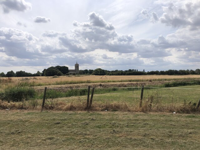
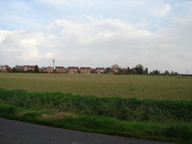
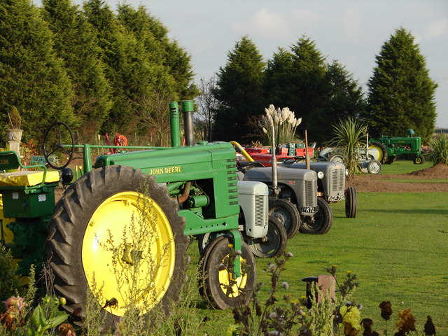
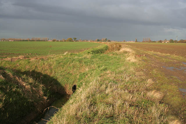
Fleet is a predominantly rural area with a small population of around 600 residents. The landscape is characterized by rolling hills, farmlands, and picturesque countryside, offering stunning views and a peaceful atmosphere. The parish is known for its agricultural heritage, with farming being a significant economic activity.

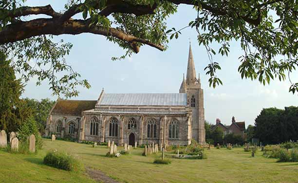
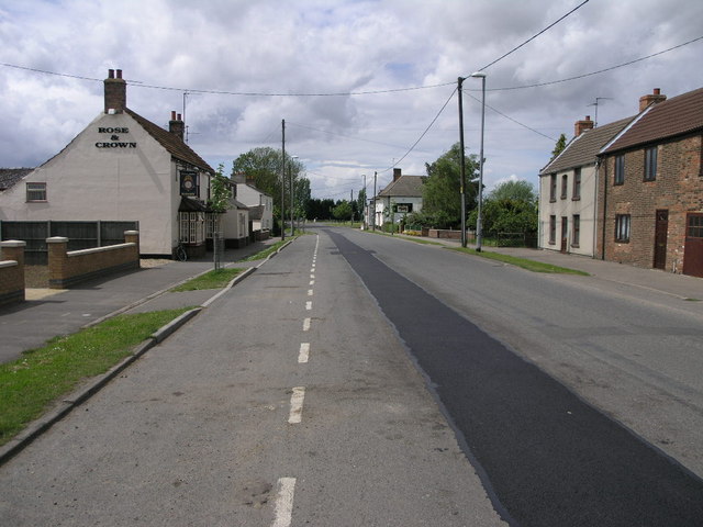
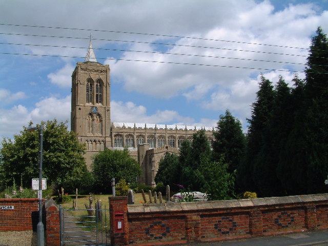
The village of Fleet itself is a charming settlement with a close-knit community. It features a parish church, St. Mary Magdalene, which dates back to the 12th century and is a notable historical landmark. The church's architecture showcases a mix of Norman and Gothic styles.

In terms of amenities, Fleet offers limited facilities including a village hall and a small primary school. However, residents have easy access to nearby towns and cities for their daily needs and services.

The area surrounding Fleet is known for its natural beauty, making it an ideal location for outdoor enthusiasts. There are several walking and cycling routes, as well as opportunities for fishing and birdwatching in the nearby countryside and waterways.

Overall, Fleet, Lincolnshire is a peaceful and scenic civil parish, providing a rural lifestyle and a close community for its residents.

If you have any feedback on the listing, please let us know in the comments section below.

Fleet Images

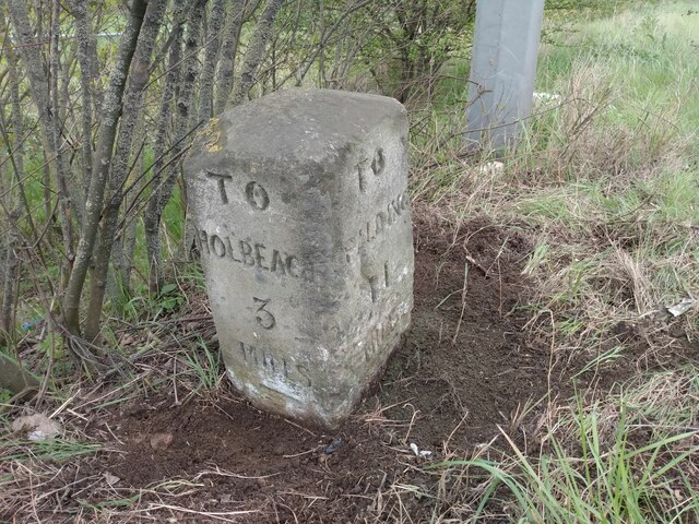
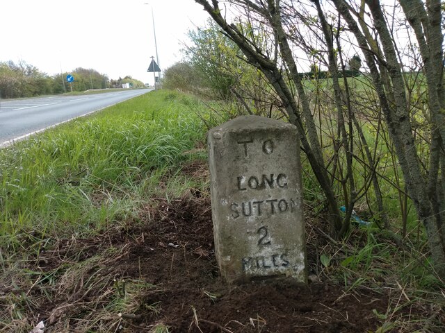
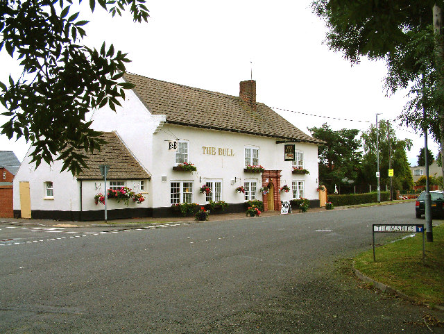
Images are sourced within 2km of 52.793988/0.05931 or Grid Reference TF3823. Thanks to Geograph Open Source API. All images are credited.

View over the fields to Gedney St Mary Magdalene Church on the horizon
View over the fields to Gedney
St Mary Magdalene Church on the horizon
Old Milestone by A17, Long Sutton Road, beyond end of dual carriageway The Milestone is located on the verge on the South of the road.  Parish of Gedney (South Holland District). Carved stone post, erected by the Holbeach turnpike trust in the 19th Century. An earlier photograph can be found here: <a title="https://www.geograph.org.uk/photo/2730276" href="https://www.geograph.org.uk/photo/2730276">Link</a> 

Inscription reads:-  
TO / SPALDING / 11 / : : TO / HOLBEACH / 3  : : TO / LONG / SUTTON / 2 / MILES 

Grade II listed. List Entry Number: 1064581 <span class="nowrap"><a title="https://historicengland.org.uk/listing/the-list/list-entry/1064581" rel="nofollow ugc noopener" href="https://historicengland.org.uk/listing/the-list/list-entry/1064581">Link</a><img style="margin-left:2px;" alt="External link" title="External link - shift click to open in new window" src="https://s1.geograph.org.uk/img/external.png" width="10" height="10"/></span> 

Milestone Society National ID: LI_HBSU03
Old Milestone by A17, Long Sutton Road, beyond end of dual carriageway
The Milestone is located on the verge on the South of the road.  Parish of Gedney (South Holland District). Carved stone post, erected by the Holbeach turnpike trust in the 19th Century. An earlier photograph can be found here: Link  Inscription reads:- TO / SPALDING / 11 / : : TO / HOLBEACH / 3 : : TO / LONG / SUTTON / 2 / MILES Grade II listed. List Entry Number: 1064581 LinkExternal link Milestone Society National ID: LI_HBSU03
Old Milestone by B1515, Fleet Road The Milestone is located on the verge on the South of the road.  Parish of Fleet (South Holland District). Carved stone post,  erected by the Holbeach turnpike trust in the 19th Century. An earlier photograph can be found here: <a title="https://www.geograph.org.uk/photo/6728737" href="https://www.geograph.org.uk/photo/6728737">Link</a> 

Inscription reads:-   
HOLBEACH / 1 / MILE / FLEET / 2 : : SUTTON / 4 / MILES / FLEET / 2

Grade II listed. List Entry Number: 1064519 <span class="nowrap"><a title="https://historicengland.org.uk/listing/the-list/list-entry/1064519" rel="nofollow ugc noopener" href="https://historicengland.org.uk/listing/the-list/list-entry/1064519">Link</a><img style="margin-left:2px;" alt="External link" title="External link - shift click to open in new window" src="https://s1.geograph.org.uk/img/external.png" width="10" height="10"/></span> 

Milestone Society National ID: LI_HBSU01
Old Milestone by B1515, Fleet Road
The Milestone is located on the verge on the South of the road.  Parish of Fleet (South Holland District). Carved stone post, erected by the Holbeach turnpike trust in the 19th Century. An earlier photograph can be found here: Link  Inscription reads:- HOLBEACH / 1 / MILE / FLEET / 2 : : SUTTON / 4 / MILES / FLEET / 2 Grade II listed. List Entry Number: 1064519 LinkExternal link Milestone Society National ID: LI_HBSU01
Old Milestone by B1515, Fleet Road The Milestone is located on the verge on the South of the road.  Parish of Fleet (South Holland District). Carved stone post,  erected by the Holbeach turnpike trust in the 19th Century. An earlier photograph can be found here: <a title="https://www.geograph.org.uk/photo/6728737" href="https://www.geograph.org.uk/photo/6728737">Link</a> 

Inscription reads:-   HOLBEACH / 1 / MILE / FLEET / 2 : : SUTTON / 4 / MILES / FLEET / 2 

Grade II listed. List Entry Number: 1064519 <span class="nowrap"><a title="https://historicengland.org.uk/listing/the-list/list-entry/1064519" rel="nofollow ugc noopener" href="https://historicengland.org.uk/listing/the-list/list-entry/1064519">Link</a><img style="margin-left:2px;" alt="External link" title="External link - shift click to open in new window" src="https://s1.geograph.org.uk/img/external.png" width="10" height="10"/></span> 

Milestone Society National ID: LI_HBSU01
Old Milestone by B1515, Fleet Road
The Milestone is located on the verge on the South of the road.  Parish of Fleet (South Holland District). Carved stone post, erected by the Holbeach turnpike trust in the 19th Century. An earlier photograph can be found here: Link  Inscription reads:- HOLBEACH / 1 / MILE / FLEET / 2 : : SUTTON / 4 / MILES / FLEET / 2 Grade II listed. List Entry Number: 1064519 LinkExternal link Milestone Society National ID: LI_HBSU01
The Bull at Fleet Hargate The village of Fleet Hargate formerly Fleet Harbourgate a small port
The Bull at Fleet Hargate
The village of Fleet Hargate formerly Fleet Harbourgate a small port
Fleet View of Fleet Rd Garage looking along Fleet Rd towards Holbeach from the Industrial Estate
Fleet
View of Fleet Rd Garage looking along Fleet Rd towards Holbeach from the Industrial Estate
Fleet parish church The steeple is detached from the body of the church, a feature of several other churches in the area.
Fleet parish church
The steeple is detached from the body of the church, a feature of several other churches in the area.
Private farm track off Maisdyke Lane, Fleet. Looking west.
Private farm track off Maisdyke Lane, Fleet.
Looking west.
Fleet Road Industry As the sign clearly states this is Fleet Road Industrial Estate to the east of Holbeach.
Fleet Road Industry
As the sign clearly states this is Fleet Road Industrial Estate to the east of Holbeach.
Two Pubs The Bull and The Rose and Crown cluster together on the main street through Fleet Hargate.  The road repair doesn't quite match colour.
Two Pubs
The Bull and The Rose and Crown cluster together on the main street through Fleet Hargate. The road repair doesn't quite match colour.
Windbreaks and Potatoes The black windbreaks are clearly in place to protect the greenhouses next to them.  The field in the foreground was growing potatoes.
Windbreaks and Potatoes
The black windbreaks are clearly in place to protect the greenhouses next to them. The field in the foreground was growing potatoes.
Field and Cafe The cafe is beyond the busy A17.  The field is protected by this unusual one bar gate.
Field and Cafe
The cafe is beyond the busy A17. The field is protected by this unusual one bar gate.
Haven Close from Hockle's Gate
Tractor Garden A collection of tractors old and new adorn the garden of this roadside house.
Tractor Garden
A collection of tractors old and new adorn the garden of this roadside house.
Hawker Hunter One of the exhibits at the roadside motel.
Hawker Hunter
One of the exhibits at the roadside motel.
Fleet Fen Fleet Drain in the foreground. Photograph taken from the footpath on the east bank looking towards Maisdike Lane.
Fleet Fen
Fleet Drain in the foreground. Photograph taken from the footpath on the east bank looking towards Maisdike Lane.
Sunlit Fens Looking along the footpath towards Pinstock Lane and dark rain clouds. Fleet Drain runs through the centre and is the boundary between Fleet Fen on the left and Gedney Fen on the right.
Sunlit Fens
Looking along the footpath towards Pinstock Lane and dark rain clouds. Fleet Drain runs through the centre and is the boundary between Fleet Fen on the left and Gedney Fen on the right.
Show me another place!

Fleet is located at Grid Ref: TF3823 (Lat: 52.793988, Lng: 0.05931)

Administrative County: Lincolnshire

District: South Holland

Police Authority: Lincolnshire

What 3 Words

///socket.scarecrow.compacts. Near Fleet, Lincolnshire

Nearby Locations

Fleet

Related Wikis

Fleet, Lincolnshire

Fleet is a village, civil parish and electoral ward in the South Holland district of Lincolnshire, England. It lies on Delph Bank, 3 miles (4.8 km) south...

Fleet railway station (Lincolnshire)

Fleet railway station was a station in Fleet, Lincolnshire. It opened in 1862 and closed to passengers in 1959, with the goods yard closing on 3 February...

Fleet Hargate

Fleet Hargate is a village in the South Holland district of Lincolnshire, England. It is situated 2 miles (3.2 km) east from Holbeach, and just south from...

St Mary Magdalene Church, Gedney

St Mary Magdalene Church is an Anglican parish church of medieval origin in Gedney, Lincolnshire. Renowned for its large size in the surrounding low-lying...

Gedney, Lincolnshire

Gedney is a village, civil parish and electoral ward in the South Holland district of Lincolnshire, England. It is just to the south of the A17 Boston...

Gedney Broadgate

Gedney Broadgate is a hamlet in the civil parish of Gedney and the South Holland district of Lincolnshire, England. It is situated west from the A17 road...

Gedney railway station

Gedney railway station was a station in Gedney, Lincolnshire. It was a station on the Midland and Great Northern Joint Railway network. It opened on 1...

East Elloe Rural District

East Elloe was a rural district in Holland in Lincolnshire from 1894 to 1974. == History == The district had its origins in the Holbeach Poor Law Union...

Nearby Amenities

Located within 500m of 52.793988,0.05931
Fleet
Is In: Lincolnshire, England, UK
Is In County: Lincolnshire
Is In District: South Holland
Name Lt: Flitas
Place: village
Wikidata: Q5458375
Wikipedia: en:Fleet, Lincolnshire
Lat/Long: 52.7934253/0.0581494
Bus Stop
St Mary Magdelene's Church
Naptan AtcoCode: 270002700912
Naptan Bearing: SE
Naptan CommonName: St Mary Magdelene's Church
Naptan Indicator: opp
Naptan Landmark: St Mary Magdelene's Church
Naptan Street: Church Gate
Naptan Verified: no
Source: naptan_import
Lat/Long: 52.7933887/0.0584935
Bus Stop
St Mary Magdelene's Church
Naptan AtcoCode: 2700LFC04631
Naptan Bearing: NW
Naptan CommonName: St Mary Magdelene's Church
Naptan Indicator: adj
Naptan Landmark: St Mary Magdelene's Church
Naptan NaptanCode: lindmjpa
Naptan Street: Church Gate
Naptan Verified: no
Source: naptan_import
Lat/Long: 52.7932724/0.0584583
Bus Stop
Wood Lane Primary School
Naptan AtcoCode: 2700LFWL3064
Naptan Bearing: N
Naptan CommonName: Wood Lane Primary School
Naptan Indicator: adj
Naptan Landmark: Wood Lane Primary School
Naptan NaptanCode: linawgwg
Naptan Street: Fleet
Naptan Verified: no
Source: naptan_import
Lat/Long: 52.7947348/0.0565426
Post Box
Collection Times: Mo-Sa 10:00
Description: In wall of yard of church of Saint Mary Magdalene, to the right of its entrance pillar, raised up above height of the wall.
This part of Hallgate is called Church End./Churchgate / Hallgate / Eastgate;
Fixme: Again, check junction layout. Not convinced
Post Box Type: wall
Ref: PE12 39
Lat/Long: 52.793114/0.059119
Ravensdale
Place: isolated_dwelling
Source: Bing
Lat/Long: 52.7918297/0.0528317
Manor House
Place: isolated_dwelling
Source: Bing
Lat/Long: 52.7934587/0.0601739
Skylands Farm
Place: farm
Source: Bing
Lat/Long: 52.7971937/0.0620035
Entrance: yes
Lat/Long: 52.7946621/0.0567451
Entrance: main
Lat/Long: 52.7947529/0.0566876
Entrance: yes
Lat/Long: 52.7948217/0.0567585
Power: pole
Lat/Long: 52.7951135/0.0659823
Power: pole
Lat/Long: 52.7953211/0.0641799
Power: pole
Lat/Long: 52.7955611/0.0622326
Power: pole
Lat/Long: 52.7957427/0.0603336
Power: pole
Lat/Long: 52.7959925/0.0581396
Power: pole
Lat/Long: 52.7961936/0.0560528
Power: pole
Lat/Long: 52.7963947/0.0542235
The data included in this document is from www.openstreetmap.org. The data is made available under ODbL.

Have you been to Fleet?

Leave your review of Fleet below (or comments, questions and feedback).