Firsby
Civil Parish in Lincolnshire East Lindsey
England
Firsby

Firsby is a civil parish located in the East Lindsey district of Lincolnshire, England. Situated approximately 8 miles south-west of Skegness, it is a small rural village with a population of around 250 people. Firsby is surrounded by picturesque countryside, offering residents and visitors a serene and peaceful environment.
The village dates back to the medieval period and still retains some of its historic charm. The parish church of St. Andrew, which dates back to the 12th century, is one of the prominent landmarks in Firsby. Its architectural beauty and historical significance make it a popular destination for history enthusiasts and tourists.
Despite its small size, Firsby offers a few amenities to its residents. The village has a local pub, The Firsby Manor, which serves as a social hub for the community. There is also a village hall that hosts various events and activities throughout the year.
Firsby benefits from its location, as it is within easy reach of the coastal town of Skegness, offering residents the opportunity to enjoy the seaside attractions and amenities. The village is well-connected to surrounding areas through a network of roads, making it convenient for commuting to nearby towns and cities.
In conclusion, Firsby is a charming and idyllic village in Lincolnshire, offering a peaceful countryside setting for its residents. With its rich history, beautiful parish church, and proximity to Skegness, Firsby provides a welcoming community and a desirable place to live or visit.
If you have any feedback on the listing, please let us know in the comments section below.
Firsby Images
Images are sourced within 2km of 53.144603/0.180365 or Grid Reference TF4563. Thanks to Geograph Open Source API. All images are credited.


Firsby is located at Grid Ref: TF4563 (Lat: 53.144603, Lng: 0.180365)
Administrative County: Lincolnshire
District: East Lindsey
Police Authority: Lincolnshire
What 3 Words
///domestic.outbound.drop. Near Burgh le Marsh, Lincolnshire
Related Wikis

Firsby
Firsby is a small rural linear village and civil parish in the East Lindsey district of Lincolnshire, England. It is situated 30 miles (48 km) east from...
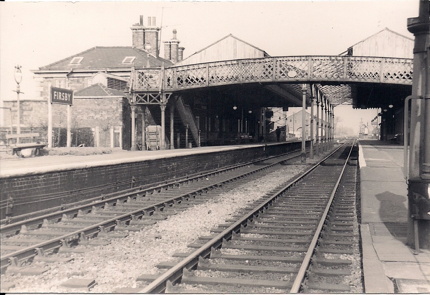
Firsby railway station
Firsby railway station was a station in Firsby, Lincolnshire. It served as a main line station and a terminus for two branch lines to Skegness and Spilsby...

Irby in the Marsh
Irby in the Marsh is a village and civil parish in the East Lindsey district of Lincolnshire, England. It is situated on the B1195 road, geographically...

RAF Spilsby
Royal Air Force Spilsby or more simply RAF Spilsby is a former Royal Air Force station during the Second World War and the Cold War located in the rural...

Little Steeping
Little Steeping is a village and civil parish in the East Lindsey district of Lincolnshire, England, about 3 miles (5 km) south-east from the town of Spilsby...
Great Steeping
Great Steeping is a village and civil parish in the East Lindsey district of Lincolnshire, England. It is situated approximately 3 miles (5 km) from Spilsby...

Bratoft
Bratoft is a small hamlet in the East Lindsey district of Lincolnshire, England. It is situated approximately 5 miles (8 km) east from Spilsby, 2 miles...

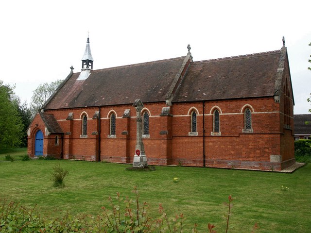
Old All Saints Church, Great Steeping
Old All Saints Church is a redundant Anglican church in the village of Great Steeping, Lincolnshire, England. It is recorded in the National Heritage...
Nearby Amenities
Located within 500m of 53.144603,0.180365Have you been to Firsby?
Leave your review of Firsby below (or comments, questions and feedback).