Fifield

Civil Parish in Oxfordshire West Oxfordshire

England

Fifield

St Nicholas, Idbury
St Nicholas, Idbury Credit: John Salmon

Fifield is a civil parish located in the county of Oxfordshire, in the south-central region of England. Situated about 10 miles west of the city of Oxford, Fifield covers an area of approximately 2.5 square miles. The parish is part of the West Oxfordshire district.

Characterized by its picturesque rural setting, Fifield is surrounded by rolling hills and lush green fields, offering residents and visitors a tranquil and scenic environment. The landscape is dotted with charming cottages, farmhouses, and historic buildings, reflecting the area's rich heritage.

The parish has a small population, with approximately 200 residents. The community is tightly knit and fosters a friendly and welcoming atmosphere. The local economy primarily revolves around agriculture, with farming playing a significant role in sustaining the livelihood of the residents.

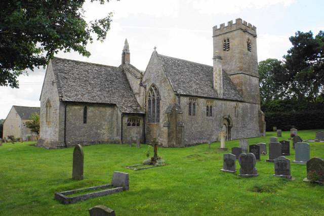
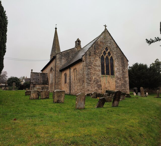
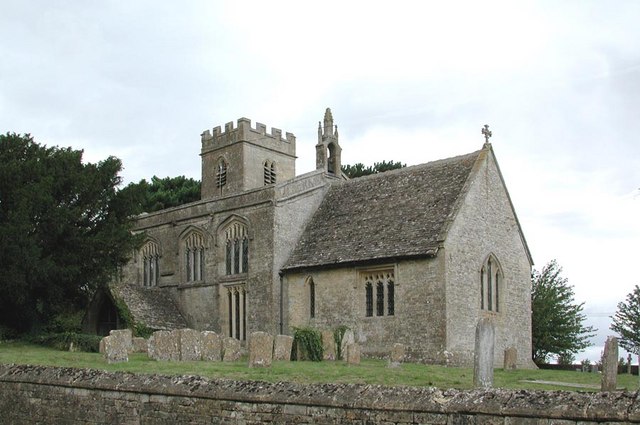
Fifield boasts a rich history, with archaeological evidence suggesting that the area has been inhabited since prehistoric times. The village church, St. John the Baptist, is a notable landmark, dating back to the 12th century. It is renowned for its stunning architecture and historical significance.

Despite its rural setting, Fifield benefits from its proximity to nearby towns and cities. Oxford, with its world-renowned university and cultural attractions, offers a range of amenities including shopping centers, restaurants, and entertainment venues. Additionally, the parish is well-connected by road, making it easily accessible to commuters and tourists alike.

Overall, Fifield, Oxfordshire, offers a charming and idyllic countryside lifestyle, with a strong community spirit and a rich historical heritage.

If you have any feedback on the listing, please let us know in the comments section below.

Fifield Images

Images are sourced within 2km of 51.868583/-1.653761 or Grid Reference SP2318. Thanks to Geograph Open Source API. All images are credited.

St Nicholas, Idbury
St Nicholas, Idbury
St Nicholas, Idbury
St Nicholas, Idbury
St Nicholas, Idbury - Grave
St Nicholas, Idbury - Font
St Nicholas, Idbury - East end
St Nicholas, Idbury - Chancel
St Nicholas, Idbury - Pulpit
Church Street, Idbury The church is on the left just past the trees. There isn't much else of the village beyond this point.
Church Street, Idbury
The church is on the left just past the trees. There isn't much else of the village beyond this point.
St Nicholas' Church, Idbury A Grade I listed building dating from the 12th Century with subsequent modifications.
St Nicholas' Church, Idbury
A Grade I listed building dating from the 12th Century with subsequent modifications.
Entering Idbury In addition to entering a 30 mph zone, the bend will slow motorists down.
Entering Idbury
In addition to entering a 30 mph zone, the bend will slow motorists down.
Field edge by Starveall Wood I should have been in the wood to the right.
Field edge by Starveall Wood
I should have been in the wood to the right.
Path in Bould Wood This is part of Foxholes Nature Reserve but it was eerily silent. There may be trees and a bit of undergrowth here, but not a lot else.
Path in Bould Wood
This is part of Foxholes Nature Reserve but it was eerily silent. There may be trees and a bit of undergrowth here, but not a lot else.
Path heading to the A424 Path from Nether Westcote heading to the A424
Path heading to the A424
Path from Nether Westcote heading to the A424
Church of St John the Baptist, Fifield
Ground-level fungi This fungus seems to be growing out of the ground but is actually growing from a tree that has been cut right down to ground level. It is Shaggy Dryad's Saddle (Polyporus squamosus).
Ground-level fungi
This fungus seems to be growing out of the ground but is actually growing from a tree that has been cut right down to ground level. It is Shaggy Dryad's Saddle (Polyporus squamosus).
Seven Shires Way Seven Shires Way on road heading into Idbury
Seven Shires Way
Seven Shires Way on road heading into Idbury
Seven Shires Way Seven Shires Way going through Nether Westcote village
Seven Shires Way
Seven Shires Way going through Nether Westcote village
Barn by the road This dutch barn, probably part of Church Farm, is seen from the road.
Barn by the road
This dutch barn, probably part of Church Farm, is seen from the road.
Show me another place!

Fifield is located at Grid Ref: SP2318 (Lat: 51.868583, Lng: -1.653761)

Administrative County: Oxfordshire

District: West Oxfordshire

Police Authority: Thames Valley

What 3 Words

///robots.topic.unloads. Near Shipton under Wychwood, Oxfordshire

Nearby Locations

Fifield Fifield

Related Wikis

Fifield, Oxfordshire

Fifield is a village and civil parish about 4 miles (6.4 km) north of Burford in Oxfordshire. The western boundary of the parish forms part of the county...

Bruern

Bruern or Bruern Abbey is a hamlet and civil parish on the River Evenlode about 6 miles (10 km) north of Burford in West Oxfordshire. The 2001 Census recorded...
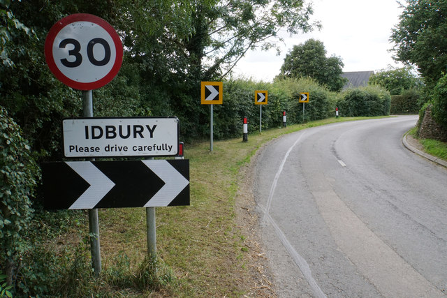
Idbury

Idbury is a village and civil parish in the Cotswold Hills in Oxfordshire, about 4+1⁄2 miles (7 km) southeast of Stow-on-the-Wold in neighbouring Gloucestershire...

Bould

Bould is a hamlet in Idbury civil parish, Oxfordshire, about 4.5 miles (7.2 km) southeast of Stow-on-the-Wold in neighbouring Gloucestershire. The hamlet...

Nearby Amenities

Located within 500m of 51.868583,-1.653761
Stow Road
Naptan AtcoCode: 340000313OPP
Naptan Bearing: S
Naptan BusStopType: CUS
Naptan CommonName: Stow Road
Naptan Indicator: Opposite
Naptan Landmark: Shelter
Naptan NaptanCode: oxfamagw
Naptan Street: Main Street
Naptan Verified: no
Source: naptan_import
Lat/Long: 51.867246/-1.6547739
Bus Stop
Stow Road
Bus: yes
Naptan AtcoCode: 340000313SHE
Naptan Bearing: N
Naptan CommonName: Stow Road
Naptan Indicator: Corner
Naptan Landmark: Shelter
Naptan NaptanCode: oxfamamt
Naptan Street: Main Street
Naptan Verified: no
Public Transport: platform
Source: naptan_import
Lat/Long: 51.8673187/-1.6550347
Fifield
Place: village
Wikidata: Q2896983
Wikipedia: en:Fifield, Oxfordshire
Lat/Long: 51.867225/-1.6535283
Power: pole
Source: Bing
Lat/Long: 51.8642986/-1.6541011
Power: pole
Source: Bing
Lat/Long: 51.8673959/-1.6589468
Power: pole
Source: Bing
Lat/Long: 51.867805/-1.6578682
Power: pole
Source: Bing
Lat/Long: 51.8689376/-1.6547784
Power: pole
Source: Bing
Lat/Long: 51.8686563/-1.6555428
Power: pole
Source: Bing
Lat/Long: 51.8705808/-1.6502208
Power: pole
Source: Bing
Lat/Long: 51.8669983/-1.6600086
Power: pole
Source: Bing
Lat/Long: 51.8696417/-1.6528042
Power: pole
Source: Bing
Lat/Long: 51.865969/-1.6564265
Power: pole
Source: Bing
Lat/Long: 51.8652096/-1.6560389
Power: pole
Source: Bing
Lat/Long: 51.8683713/-1.6563206
Power: pole
Source: Bing
Lat/Long: 51.8725911/-1.6521498
Power: pole
Source: Bing
Lat/Long: 51.8702974/-1.6510206
Power: pole
Source: Bing
Lat/Long: 51.8670961/-1.6572299
Power: pole
Source: Bing
Lat/Long: 51.8647507/-1.6550788
Power: pole
Source: Bing
Lat/Long: 51.8681974/-1.6567927
Power: pole
Source: Bing
Lat/Long: 51.8692673/-1.6537913
Power: pole
Source: Bing
Lat/Long: 51.8715893/-1.65116
Post Office
Fifield Post Office
Addr City: Fifield
Addr Housename: Fifield Village Hall
Addr Postcode: OX7 6HL
Addr Street: High Street
Brand: Post Office
Brand Wikidata: Q1783168
Opening Hours: Th 14:00-16:00
Lat/Long: 51.867925/-1.6532489
The data included in this document is from www.openstreetmap.org. The data is made available under ODbL.

Have you been to Fifield?

Leave your review of Fifield below (or comments, questions and feedback).