Elton

Civil Parish in Huntingdonshire Huntingdonshire

England

Elton

Elton Mill Largely rebuilt in 1840 and now derelict <span class="nowrap"><a title="https://historicengland.org.uk/listing/the-list/list-entry/1130073" rel="nofollow ugc noopener" href="https://historicengland.org.uk/listing/the-list/list-entry/1130073">Link</a><img style="margin-left:2px;" alt="External link" title="External link - shift click to open in new window" src="https://s1.geograph.org.uk/img/external.png" width="10" height="10"/></span>
Elton Mill Credit: Jonathan Thacker

Elton is a civil parish located in the district of Huntingdonshire, in the county of Cambridgeshire, England. It is situated approximately 5 miles west of the town of Peterborough and 78 miles north of London. The parish covers an area of around 1,035 hectares and has a population of around 1,200 people.

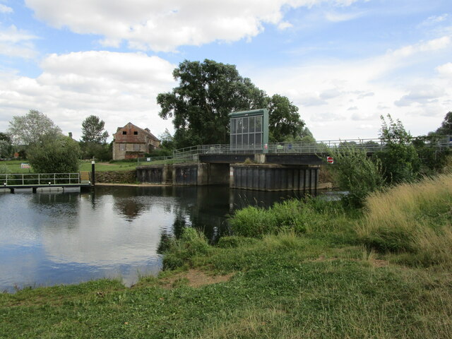
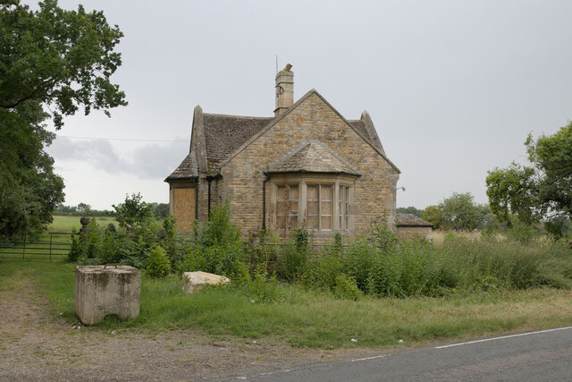
The village of Elton is known for its picturesque rural setting and historic charm. It is surrounded by beautiful countryside, including farmland, woodlands, and the nearby River Nene. The village itself is characterized by a mixture of old and new buildings, with many traditional thatched cottages and timber-framed houses.

Elton has a rich history dating back to medieval times. The village church, St. Mary's, is a prominent feature and dates back to the 13th century. It is renowned for its stunning stained glass windows and intricate stone carvings.

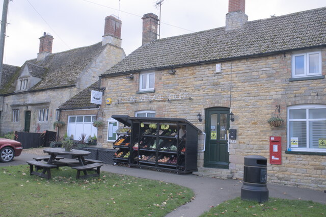
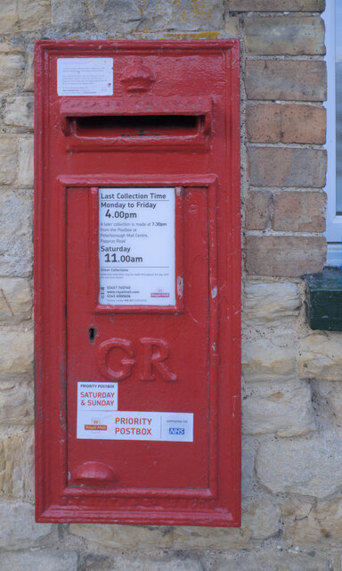
The village has a strong sense of community, with various amenities and activities available to its residents. These include a primary school, a village hall, a post office, and a pub. There are also several sports clubs and social groups, providing opportunities for recreational activities and socializing.

In terms of transportation, Elton is well-connected to neighboring towns and cities. The A1 road runs close to the village, providing convenient access to Peterborough, Stamford, and further afield. There are also regular bus services connecting Elton to nearby towns and villages.

Overall, Elton offers a peaceful and idyllic countryside living experience, with a strong community spirit and a rich historical heritage.

If you have any feedback on the listing, please let us know in the comments section below.

Elton Images

Images are sourced within 2km of 52.530936/-0.379607 or Grid Reference TL1093. Thanks to Geograph Open Source API. All images are credited.

Elton Mill Largely rebuilt in 1840 and now derelict <span class="nowrap"><a title="https://historicengland.org.uk/listing/the-list/list-entry/1130073" rel="nofollow ugc noopener" href="https://historicengland.org.uk/listing/the-list/list-entry/1130073">Link</a><img style="margin-left:2px;" alt="External link" title="External link - shift click to open in new window" src="https://s1.geograph.org.uk/img/external.png" width="10" height="10"/></span>
Elton Mill
Largely rebuilt in 1840 and now derelict LinkExternal link
Footpath by the River Nene The river is hidden by the vegetation on the right.
Footpath by the River Nene
The river is hidden by the vegetation on the right.
Elton flood relief channel
The River Nene below Elton Mill This is the mill channel; the main course of the river is just to the west.
The River Nene below Elton Mill
This is the mill channel; the main course of the river is just to the west.
Elton Mill Dates from around 1800 with alterations and extensions of 1840. Derelict. <span class="nowrap"><a title="https://historicengland.org.uk/listing/the-list/list-entry/1130073" rel="nofollow ugc noopener" href="https://historicengland.org.uk/listing/the-list/list-entry/1130073">Link</a><img style="margin-left:2px;" alt="External link" title="External link - shift click to open in new window" src="https://s1.geograph.org.uk/img/external.png" width="10" height="10"/></span>
Elton Mill
Dates from around 1800 with alterations and extensions of 1840. Derelict. LinkExternal link
The River Nene below Elton Lock
Elton Lock
Elton Lock
Elton Lock and Elton Mill Both thanks to the River Nene.
Elton Lock and Elton Mill
Both thanks to the River Nene.
A channel of the River Nene near Elton Mill
A channel of the River Nene near Elton Mill A footbridge carries a footpath from Elton to Fotheringhay across the channel.
A channel of the River Nene near Elton Mill
A footbridge carries a footpath from Elton to Fotheringhay across the channel.
Footbridge over a channel of the River Nene at Elton
Footpath to Elton Crosses a large grass field.
Footpath to Elton
Crosses a large grass field.
The River Nene at Elton
Keepers Cottage, Oundle Road, Elton
The village shop
The village shop
Hand Sanitiser On the windowsill at <a href="https://www.geograph.org.uk/photo/6997860">TL0893 : The village shop</a>, part of the Covid-19 precautions.
Hand Sanitiser
On the windowsill at TL0893 : The village shop, part of the Covid-19 precautions.
Wallbox The postbox at <a href="https://www.geograph.org.uk/photo/6997860">TL0893 : The village shop</a> is one of the COvid-19 priority boxes used for returning postal PCR tests
Wallbox
The postbox at TL0893 : The village shop is one of the COvid-19 priority boxes used for returning postal PCR tests
Change of schedule Notice pasted on <a href="https://www.geograph.org.uk/photo/6998016">TL0893 : Wallbox</a>.
Change of schedule
Notice pasted on TL0893 : Wallbox.
Show me another place!

Elton is located at Grid Ref: TL1093 (Lat: 52.530936, Lng: -0.379607)

Administrative County: Cambridgeshire

District: Huntingdonshire

Police Authority: Cambridgeshire

What 3 Words

///mime.dockers.texted. Near Castor, Cambridgeshire

Nearby Locations

Elton

Related Wikis

Elton, Cambridgeshire

Elton is a village and civil parish in Cambridgeshire, England. Elton lies approximately 7 miles (11 km) south-west of Peterborough. Elton is situated...
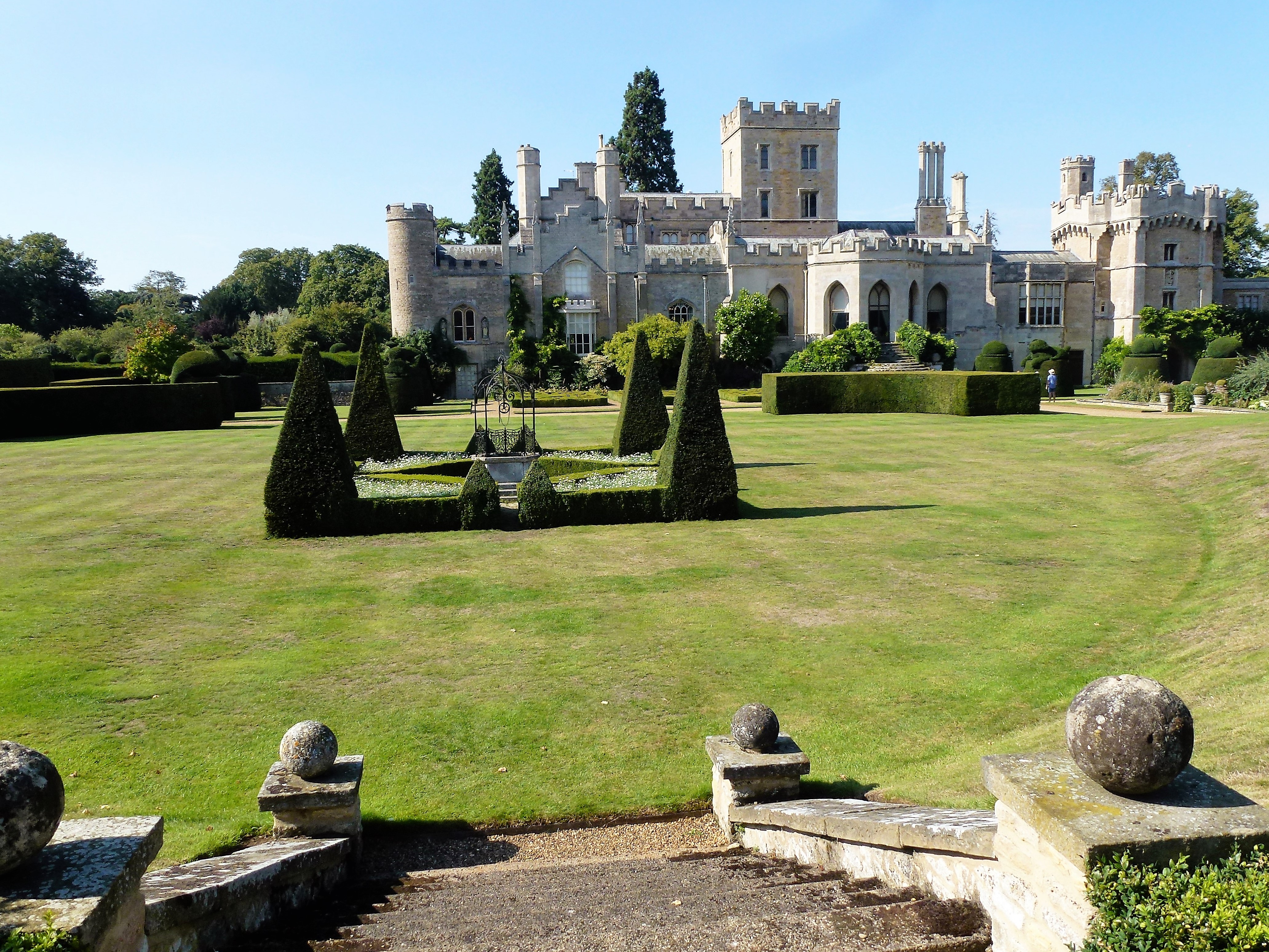
Elton Hall

Elton Hall is a baronial hall in Elton, Cambridgeshire. It has been the ancestral home of the Proby family (sometime known as the Earls of Carysfort)...

RAF Sibson

Royal Air Force Sibson or more simply RAF Sibson is a former Royal Air Force satellite station located in Sibson, Cambridgeshire, England, west of Peterborough...

Elton railway station

Elton railway station is a former railway station in Elton, Cambridgeshire on former Northampton and Peterborough Railway which connected Peterborough...

Peterborough/Sibson Airfield

Peterborough/Sibson Airfield (ICAO: EGSP), also known as Sibson Aerodrome, is an unlicensed aerodrome located 6 NM (11 km; 6.9 mi) west of Peterborough...

Chesterton, Huntingdonshire

Chesterton is a small village and civil parish of exactly 56 households in Cambridgeshire, England. The village lies approximately 5 miles (8 km) west...

Water Newton

Water Newton is a village and civil parish in Cambridgeshire, England. Water Newton lies approximately 5 miles (8 km) west of Peterborough. Water Newton...

Warmington, Northamptonshire

Warmington is a village and civil parish in North Northamptonshire, England with a population of 874 (as of the 2001 census), increasing to 939 at the...

Nearby Amenities

Located within 500m of 52.530936,-0.379607
Place: farm
Lat/Long: 52.5297862/-0.3727048
path
Fixme: stub
Note: https://www.openstreetmap.org/note/1515637
Lat/Long: 52.5331951/-0.3823551
Colour: red and white
Marker: aerial
Utility: gas
Lat/Long: 52.5331319/-0.3845794
The data included in this document is from www.openstreetmap.org. The data is made available under ODbL.

Have you been to Elton?

Leave your review of Elton below (or comments, questions and feedback).