Broadwell
Settlement in Oxfordshire West Oxfordshire
England
Broadwell

Broadwell is a charming village located in the county of Oxfordshire, England. Situated in the Cotswolds, it offers picturesque views and a tranquil atmosphere, making it an ideal destination for nature lovers and those seeking a peaceful retreat.
The village itself is small, with a population of approximately 300 residents. It is characterized by its traditional stone cottages and well-preserved architecture, giving visitors a glimpse into the region's rich history. The village is surrounded by beautiful countryside, featuring rolling hills, meadows, and ancient woodlands that provide ample opportunities for leisurely walks and outdoor activities.
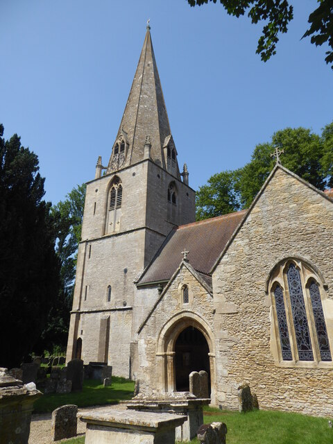
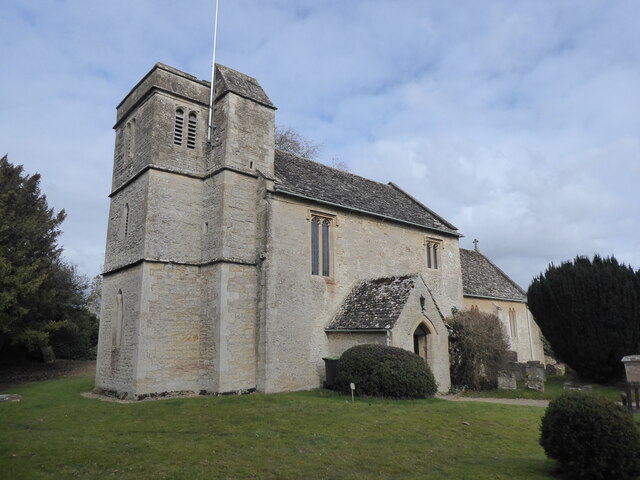
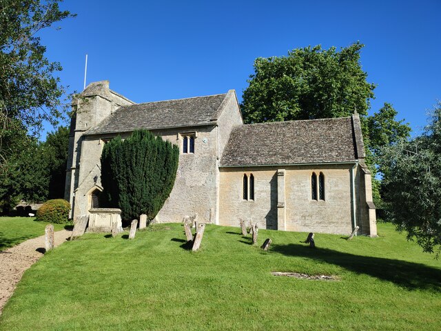
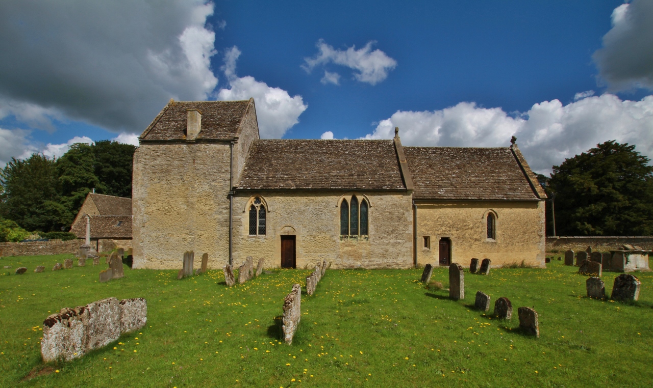
One of Broadwell's notable landmarks is the St. Peter and St. Paul Church, a Grade II listed building dating back to the 14th century. Its stunning architecture and historic significance attract visitors interested in exploring the village's heritage. Additionally, the village boasts a charming local pub, The Fox Inn, offering a warm welcome to both residents and visitors.
Broadwell's location is advantageous for those looking to explore the wider region. It is conveniently situated close to the market town of Burford, renowned for its medieval streets and historic buildings. The city of Oxford is also within easy reach, providing access to its world-famous university, museums, and cultural attractions.
Overall, Broadwell offers a quintessential English countryside experience, with its idyllic setting, historic charm, and proximity to other noteworthy destinations. It provides a tranquil escape from the hustle and bustle of city life, allowing visitors to immerse themselves in the natural beauty and rich heritage of Oxfordshire.
If you have any feedback on the listing, please let us know in the comments section below.
Broadwell Images
Images are sourced within 2km of 51.731878/-1.6376252 or Grid Reference SP2503. Thanks to Geograph Open Source API. All images are credited.


Broadwell is located at Grid Ref: SP2503 (Lat: 51.731878, Lng: -1.6376252)
Administrative County: Oxfordshire
District: West Oxfordshire
Police Authority: Thames Valley
What 3 Words
///singing.logbook.dust. Near Carterton, Oxfordshire
Nearby Locations
Related Wikis

Broadwell, Oxfordshire
Broadwell is a village and civil parish about 2 miles (3 km) south-west of Carterton in West Oxfordshire. The 2011 Census recorded the parish's population...

Langford, Oxfordshire
Langford is a village and civil parish in West Oxfordshire, about 3 miles (5 km) northeast of Lechlade in neighbouring Gloucestershire. The 2011 Census...
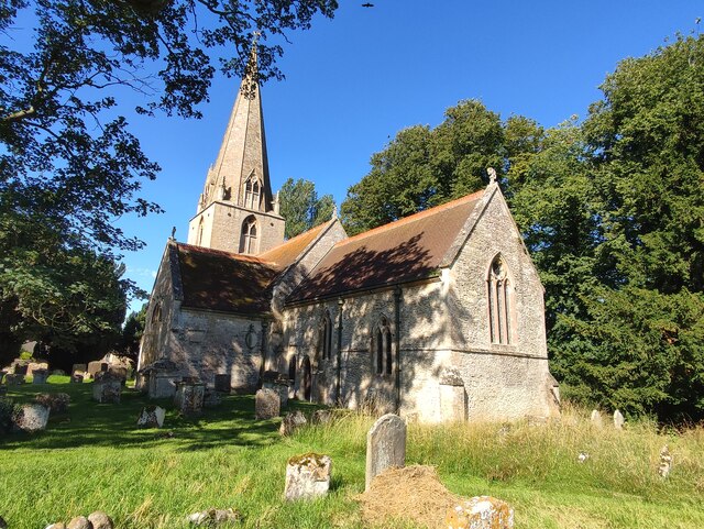
St Matthew's Church, Langford
The Parish Church of Saint Matthew, Langford is the Church of England parish church of Langford, a village in West Oxfordshire about 3 miles (5 km) northeast...

Filkins
For people with the surname, see Filkins (surname). Filkins is a village in the civil parish of Filkins and Broughton Poggs, about 2.5 miles (4 km) southwest...

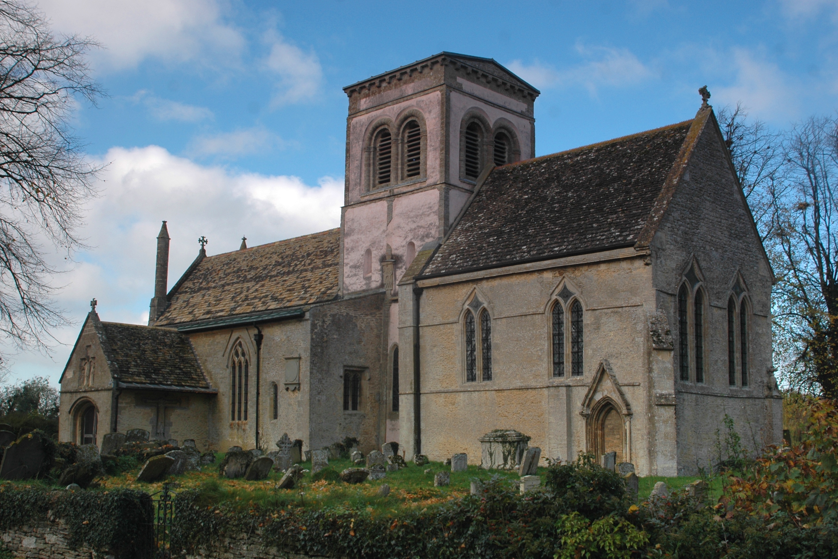
Swinford Museum
The Swinford Museum is a small museum in the village of Filkins, west Oxfordshire, England.The collection covers local domestic, agricultural, trade and...
Filkins and Broughton Poggs
Filkins and Broughton Poggs is a civil parish in West Oxfordshire, on the Oxfordshire county boundary with Gloucestershire. The parish includes the villages...
Broughton Poggs
Broughton Poggs is a village in the civil parish of Filkins and Broughton Poggs in West Oxfordshire. Broughton Poggs is 3 miles (5 km) southwest of Carterton...

Kelmscott and Langford railway station
Kelmscott and Langford railway station was a railway station south of the village of Langford on the Oxford, Witney and Fairford Railway, between Oxford...
Nearby Amenities
Located within 500m of 51.731878,-1.6376252Have you been to Broadwell?
Leave your review of Broadwell below (or comments, questions and feedback).