Ellastone

Civil Parish in Staffordshire East Staffordshire

England

Ellastone

Norbury: Harvested cereal crop, the field now being used as an overflow car park for the church
Norbury: Harvested cereal crop, the field now being used as an overflow car park for the church Credit: Michael Garlick

Ellastone is a civil parish located in the county of Staffordshire, England. Nestled in the picturesque countryside of the Dove Valley, it is a small and charming village with a population of around 500 residents. The parish covers an area of approximately 11 square kilometers.

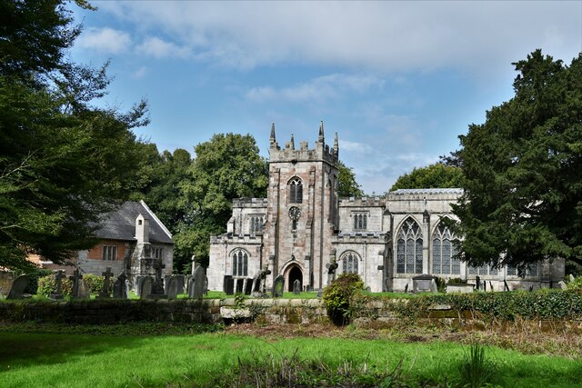
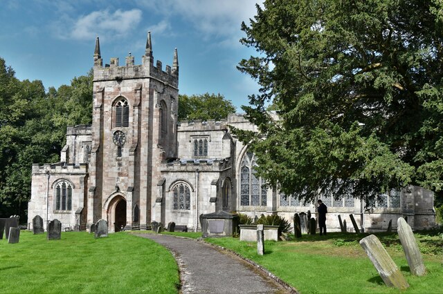
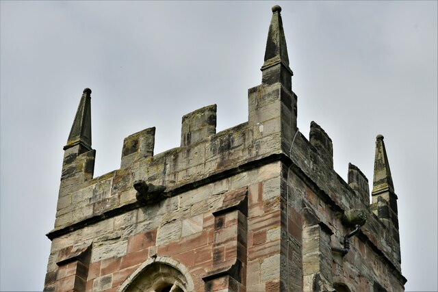
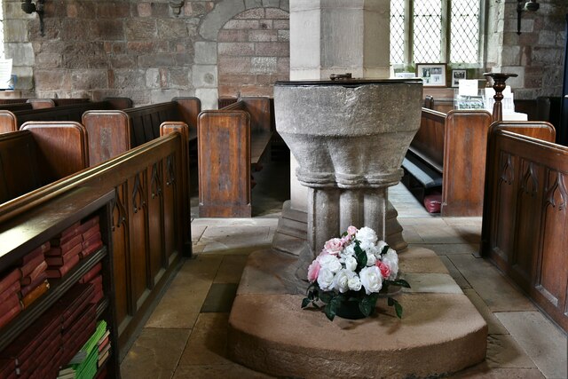
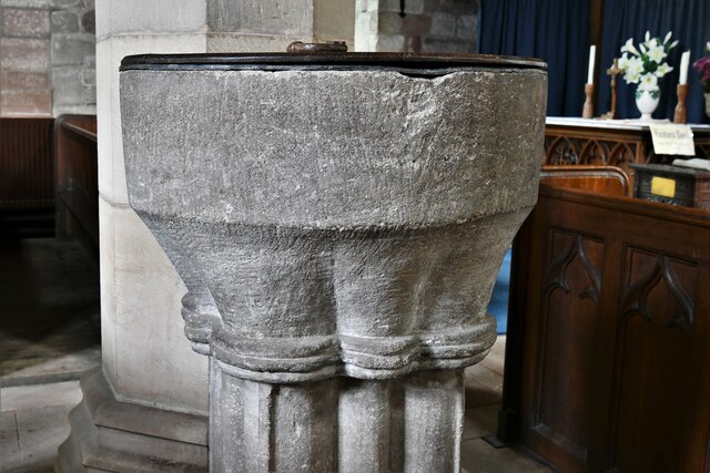
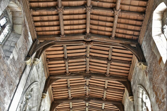
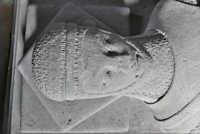
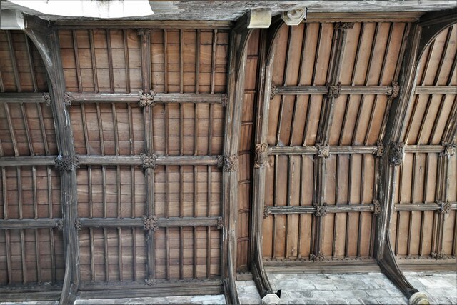
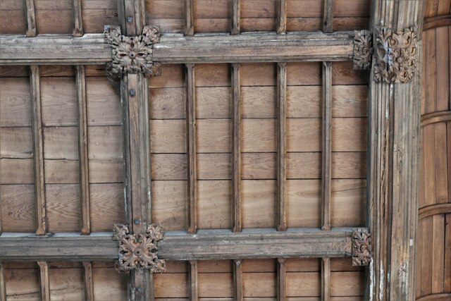
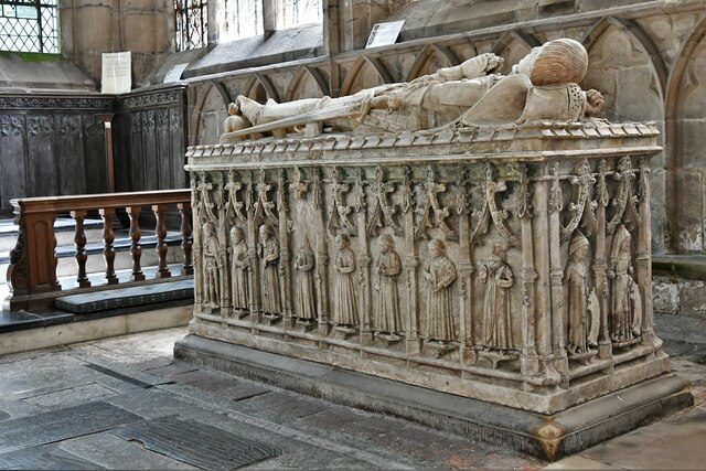
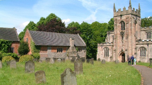
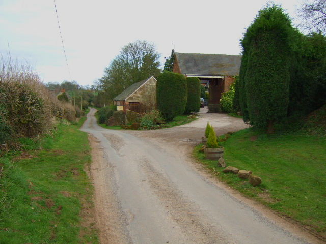
The village of Ellastone has a rich history dating back to the medieval period, with the original church, St. Peter's, believed to have been built in the 12th century. The architecture in the village is predominantly traditional, with many well-preserved historic buildings, including thatched cottages and stone farmhouses.

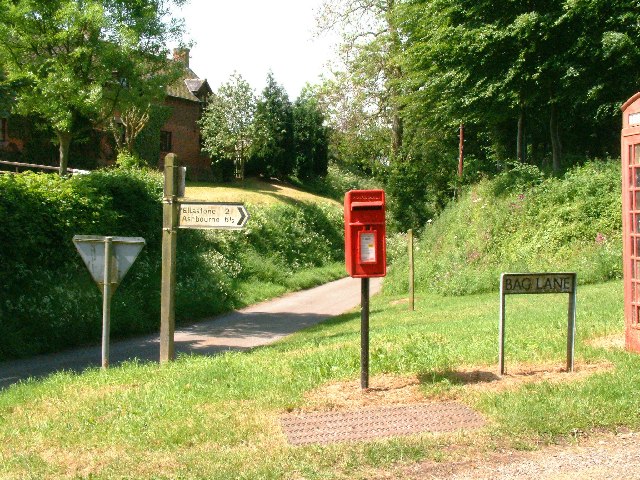
The village is surrounded by beautiful natural landscapes, offering opportunities for hiking and outdoor activities. The nearby River Dove, famous for its trout fishing, flows through the village, adding to its scenic appeal. The surrounding countryside is characterized by rolling hills, meadows, and woodland, providing a tranquil and idyllic setting for residents and visitors alike.

Despite its small size, Ellastone boasts a strong sense of community. The village has a primary school, a village hall, and a pub, serving as central meeting points for locals. The annual Ellastone Show is a popular event, showcasing local crafts, produce, and livestock, and bringing the community together.

Overall, Ellastone is a picturesque and welcoming village in the heart of Staffordshire, offering a peaceful rural lifestyle and a close-knit community. Its historic charm, natural beauty, and sense of community make it a desirable place to live or visit.

If you have any feedback on the listing, please let us know in the comments section below.

Ellastone Images

Images are sourced within 2km of 52.987829/-1.821835 or Grid Reference SK1243. Thanks to Geograph Open Source API. All images are credited.

Norbury: Harvested cereal crop, the field now being used as an overflow car park for the church
Norbury: Harvested cereal crop and a small woodland beyond
Green Lane At the junction with Lid Lane, Green Lane or the B5033 runs towards the village of Ellastone.
Green Lane
At the junction with Lid Lane, Green Lane or the B5033 runs towards the village of Ellastone.
Norbury, St. Mary and St. Barlok Church: Southern aspect
Norbury, St. Mary and St. Barlok Church: c14th tower
Norbury, St. Mary and St. Barlok Church: c1200 font
Norbury, St. Mary and St. Barlok Church: Nave roof
Norbury, St. Mary and St. Barlok Church: Memorial to Sir Henry Fitzherbert, a c13th knight
Norbury, St. Mary and St. Barlok Church: Roof
Norbury, St. Mary and St. Barlok Church: Memorial to Nicholas Fitzherbert (d.1473)
Norbury, St. Mary and St. Barlok Church: Memorial to Nicholas Fitzherbert (d.1473) detail 1
Norbury, St. Mary and St. Barlok Church: c15th memorial brass
Show me another place!

Ellastone is located at Grid Ref: SK1243 (Lat: 52.987829, Lng: -1.821835)

Administrative County: Staffordshire

District: East Staffordshire

Police Authority: Staffordshire

What 3 Words

///parts.defends.dislikes. Near Mayfield, Staffordshire

Related Wikis

Ellastone

Ellastone is a village in the East Staffordshire borough of Staffordshire, in the West Midlands of England. It is on the Staffordshire side of the River...

Calwich Abbey

Calwich Abbey, previously Calwich Priory, was in turn the name of a medieval Augustinian priory and two successive country houses built on the same site...

Norbury and Roston

Norbury with Roston is a civil parish in west Derbyshire incorporating the villages of Norbury and Roston. == See also == Listed buildings in Norbury and...

Norbury, Derbyshire

Norbury is a village in Derbyshire, England. It is located 3 miles (4.8 km) north of Rocester, on the B5033 road and the River Dove (which is the traditional...

Norbury and Ellaston railway station

Norbury and Ellaston railway station was on a branch of the North Staffordshire Railway between Rocester and Ashbourne. The station, which had a waiting...

Norbury Manor

Norbury Manor is a 15th-century Elizabethan manor house and the adjoining 13th-century stone-built medieval hall house, Norbury Hall, known as The Old...

St Mary and St Barlock's Church, Norbury

St Mary and St Barlock's Church, Norbury is a Grade I listed parish church in the Church of England: 289  in Norbury, Derbyshire. == History == The present...

Prestwood, East Staffordshire

Prestwood is a hamlet and former civil parish, now in the parish of Denstone, in the East Staffordshire district, in the county of Staffordshire, England...

Nearby Amenities

Located within 500m of 52.987829,-1.821835
Post Box
Collection Times: Mo-Sa 07:00
Operator: Royal Mail
Operator Wikidata: Q638098
Ref: DE6 890
Lat/Long: 52.9873418/-1.8277436
Ele: 101.3038330
Lat/Long: 52.9915737/-1.8194237
Ele: 101.5441895
Lat/Long: 52.9915944/-1.8194907
Ele: 100.5828857
Lat/Long: 52.991608/-1.8195424
Ele: 101.5441895
Lat/Long: 52.9916624/-1.8195886
Barrier: stile
Ele: 106.5910645
Steps: 1
Stile: stepover
Lat/Long: 52.9907181/-1.8191156
Ele: 105.8701172
Lat/Long: 52.9906712/-1.8191259
Ellastone
Place: village
Lat/Long: 52.9861825/-1.8272643
Pub
The Duncombe Arms
Addr City: Ashbourne
Addr Postcode: DE6 2GZ
Addr Street: Main Road
Addr Village: Ellastone
Cuisine: gastro
Ele: 100
Fhrs Id: 1247645
Note: Now open again! (currently closed mon/tues)
Lat/Long: 52.986212/-1.8263677
Ele: 123.1737061
Lat/Long: 52.9883647/-1.8280092
Ele: 122.9333496
Lat/Long: 52.9880839/-1.8280513
Ele: 121.4913330
Lat/Long: 52.9877895/-1.827945
Ele: 115.2429199
Lat/Long: 52.9879768/-1.8276756
Ele: 104.4281006
Lat/Long: 52.9909414/-1.8236562
Ele: 104.4281006
Lat/Long: 52.9909503/-1.8236417
Ele: 105.3894043
Lat/Long: 52.9910013/-1.8235455
Barrier: stile
Ele: 104.6684570
Steps: 1
Stile: stepover
Lat/Long: 52.9910126/-1.8235126
Barrier: stile
Ele: 112.3590088
Material: wood
Steps: 2
Stile: stepover
Lat/Long: 52.9916584/-1.8217545
Ele: 104.6684570
Lat/Long: 52.9906125/-1.8241708
Ele: 103.7071533
Lat/Long: 52.9906054/-1.8241817
Ele: 113.8009033
Lat/Long: 52.989887/-1.8256741
Barrier: stile
Ele: 113.8009033
Steps: 2
Stile: stepover
Lat/Long: 52.989926/-1.8256195
Bench
Ele: 116.4444580
Lat/Long: 52.9883094/-1.8270947
Bench
Lat/Long: 52.9880333/-1.8276768
Barrier: stile
Ele: 112.1186523
Steps: 1
Stile: stepover
Lat/Long: 52.9888423/-1.8265567
Ele: 121.7316895
Lat/Long: 52.9881368/-1.8283568
Ele: 103.7071533
Lat/Long: 52.9879437/-1.8218522
Ele: 103.2264404
Lat/Long: 52.987011/-1.8227428
Ele: 104.1877441
Lat/Long: 52.9866846/-1.8227547
Barrier: stile
Stile: squeezer
Lat/Long: 52.9884427/-1.8214103
Barrier: stile
Steps: 1
Stile: stepover
Lat/Long: 52.9884192/-1.8214261
Barrier: stile
Ele: 104.9086914
Steps: 1
Stile: stepover
Lat/Long: 52.9877172/-1.8220837
Barrier: stile
Ele: 103.2264404
Stile: squeezer
Lat/Long: 52.9877101/-1.8221269
Barrier: stile
Ele: 101.0634766
Steps: 1
Stile: stepover
Lat/Long: 52.9852625/-1.8199632
Ele: 101.7845459
Lat/Long: 52.9852705/-1.819586
Barrier: stile
Ele: 101.0634766
Steps: 1
Stile: stepover
Lat/Long: 52.9853067/-1.8189589
Ele: 100
Lat/Long: 52.9853007/-1.8188437
Ele: 96.2570801
Lat/Long: 52.9834091/-1.8215543
Ele: 96.2570801
Lat/Long: 52.9834584/-1.8215591
Ele: 96.2570801
Lat/Long: 52.9834642/-1.8216089
Ele: 98.9006348
Lat/Long: 52.9848352/-1.8194846
Ele: 100.1022949
Lat/Long: 52.9851646/-1.8190448
Barrier: stile
Ele: 103.0000000
Steps: 4
Stile: stepover
Lat/Long: 52.9879523/-1.8290344
Barrier: stile
Ele: 102.0000000
Steps: 1
Stile: stepover
Lat/Long: 52.9880187/-1.8288634
Ele: 100.0000000
Lat/Long: 52.9875605/-1.8289242
Bench
Backrest: yes
Colour: brown
Ele: 113.0000000
Material: wood
Seats: 3
Lat/Long: 52.9873737/-1.8278352
Ele: 113.0000000
Information: board
Tourism: information
Lat/Long: 52.9873052/-1.8276897
Ele: 95.0000000
Lat/Long: 52.9848528/-1.8255467
Ele: 95.0000000
Lat/Long: 52.9848123/-1.8255746
Barrier: stile
Ele: 96.0000000
Steps: 1
Stile: stepover
Lat/Long: 52.9844134/-1.8254608
Ele: 96.0000000
Lat/Long: 52.9842505/-1.8253995
Barrier: stile
Ele: 96.0000000
Steps: 2
Stile: stepover
Lat/Long: 52.984161/-1.8253649
Barrier: stile
Ele: 94.0000000
Steps: 1
Stile: stepover
Lat/Long: 52.9841108/-1.8253538
Barrier: stile
Ele: 95.0000000
Steps: 1
Stile: stepover
Lat/Long: 52.9840288/-1.8253854
Ele: 97.0000000
Lat/Long: 52.9850805/-1.8260907
Defibrillator
Access: yes
Check Date: 2023-03-10
Defibrillator Location: In the entrance doorway on the left on the wall
Emergency: defibrillator
Indoor: no
Ref GB The Circuit: 020AE30A-CDCC-4488-8F18-86762DE586CE
Lat/Long: 52.9879595/-1.8281448
Barrier: stile
Material: wood
Source: survey;gps
Stile: stepover
Lat/Long: 52.9920553/-1.8198219
Post Office
Ellastone Post Office
Addr City: Ashbourne
Addr Housename: Ellastone Parish Hall
Addr Postcode: DE6 2HB
Addr Street: Church Lane
Addr Village: Ellastone
Brand: Post Office
Brand Wikidata: Q1783168
Old Ref Pol Id: 86470
Opening Hours: Mo 09:30-11:30; Th 09:30-11:30
Ref Pol Id: 175324
Source: pol_branch_list_2022‑05‑27
Website: https://www.postoffice.co.uk/branch-finder/4434714/ellastone
Lat/Long: 52.9879797/-1.828227
Bus Stop
Duncombe Arms PH
Naptan AtcoCode: 3800C305300
Naptan NaptanCode: stagpmpw
Public Transport: platform
Lat/Long: 52.9864542/-1.8266682
Bus Stop
Duncombe Arms PH
Bus: yes
Description: Wooden Bus Shelter
Operator: Trent Barton
Public Transport: platform
Shelter: yes
Lat/Long: 52.9864737/-1.8268043
The data included in this document is from www.openstreetmap.org. The data is made available under ODbL.

Have you been to Ellastone?

Leave your review of Ellastone below (or comments, questions and feedback).