Edenthorpe

Civil Parish in Yorkshire Doncaster

England

Edenthorpe

Electricity pylons Marching across fields to the east of Kirk Sandall.
Electricity pylons Credit: Graham Hogg

Edenthorpe is a civil parish located in Yorkshire, a historic county in England. Situated about 5 miles northeast of Doncaster, the parish covers an area of approximately 3 square miles. Edenthorpe is part of the Metropolitan Borough of Doncaster and falls within the Yorkshire and the Humber region.

The village of Edenthorpe is nestled in a rural setting, surrounded by beautiful countryside and farmland. It is primarily a residential area with a mix of housing types, including detached and semi-detached houses, as well as some bungalows and apartments. The village has a small but bustling community, with a range of local amenities such as shops, a post office, and a pub.

Edenthorpe is well-connected to neighboring towns and cities, with good transport links. The A630 road runs through the parish, providing easy access to Doncaster and other nearby towns. The village is also served by regular bus services connecting it to the wider region. Doncaster Sheffield Airport is within a short driving distance, offering convenient air travel options.

The area surrounding Edenthorpe offers plenty of opportunities for outdoor activities and leisure pursuits. The picturesque countryside is perfect for walking, cycling, and exploring nature. There are also several parks and green spaces nearby, providing recreational areas for residents and visitors.

Overall, Edenthorpe is a charming and peaceful civil parish in Yorkshire, boasting a close-knit community, convenient amenities, and a beautiful natural environment.

If you have any feedback on the listing, please let us know in the comments section below.
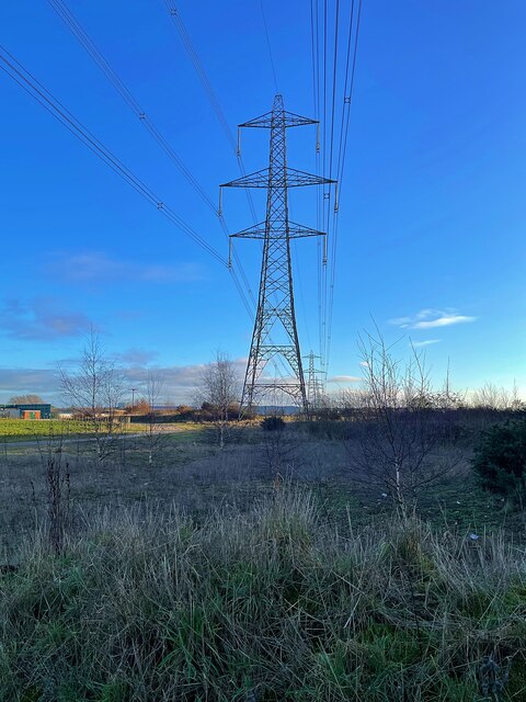
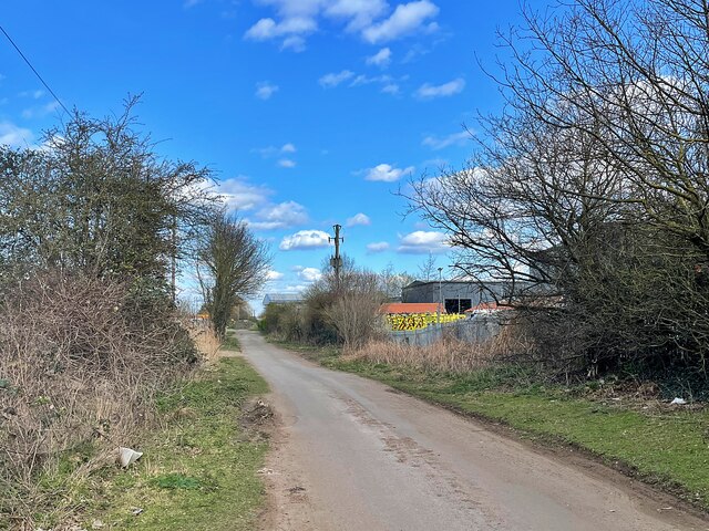
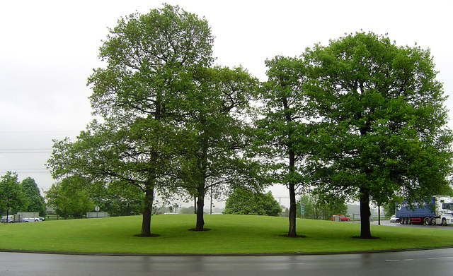
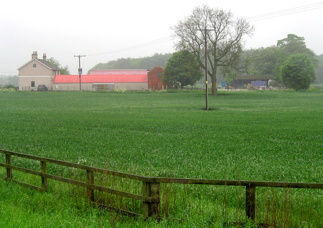
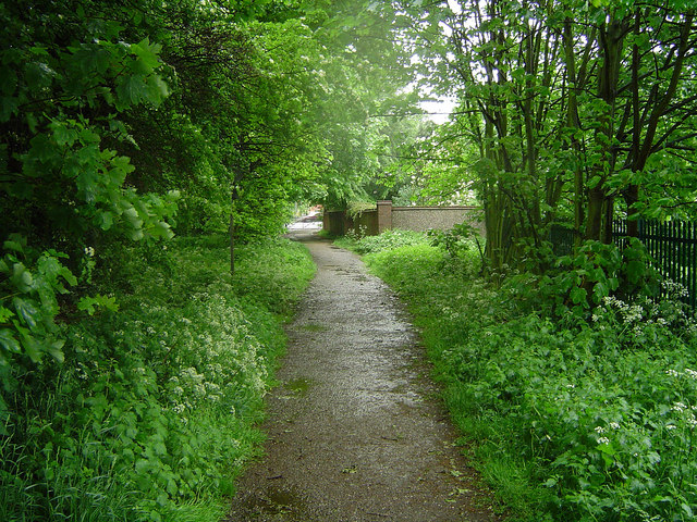
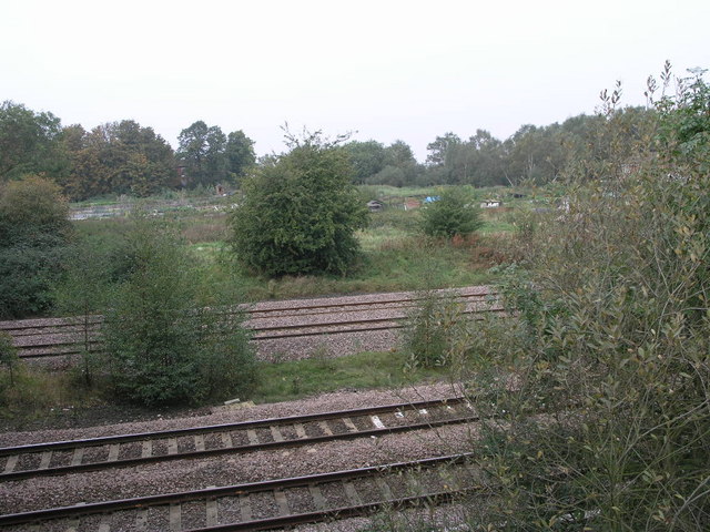
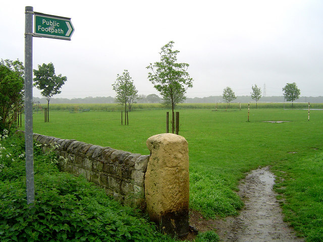
Edenthorpe Images

Images are sourced within 2km of 53.552324/-1.061091 or Grid Reference SE6206. Thanks to Geograph Open Source API. All images are credited.

Electricity pylons Marching across fields to the east of Kirk Sandall.
Electricity pylons
Marching across fields to the east of Kirk Sandall.
Hatfield Lane Approaching the roundabout junction with the A630.
Hatfield Lane
Approaching the roundabout junction with the A630.
Electricity pylon off Hatfield Lane
Church of Our Lady of Sorrows and St Francis Opened in 1959 to serve the growing population in Armthorpe
Church of Our Lady of Sorrows and St Francis
Opened in 1959 to serve the growing population in Armthorpe
The church of St Leonard & St Mary Grade II listed parish church dating from the 11th century.
The church of St Leonard & St Mary
Grade II listed parish church dating from the 11th century.
Path in Hag Wood
Path in Hag Wood
Fence under construction The posts are formed from old telegraph poles so the fence should be very robust when it's finished.
Fence under construction
The posts are formed from old telegraph poles so the fence should be very robust when it's finished.
West Moor Lane The lane has become a no through road to facilitate the development of the business estates in the area.
West Moor Lane
The lane has become a no through road to facilitate the development of the business estates in the area.
Old milestone This West Riding CC milestone is on the A18 at the west end of Dunsville close to Wyndthorpe Hall entrance.   It was stripped of old flaking paint and repainted in 2016 by a local resident.   Because none of the place names are more than 10 letters long, the legends were cast horizontally.   It is Grade II listed 1314827.
Old milestone
This West Riding CC milestone is on the A18 at the west end of Dunsville close to Wyndthorpe Hall entrance. It was stripped of old flaking paint and repainted in 2016 by a local resident. Because none of the place names are more than 10 letters long, the legends were cast horizontally. It is Grade II listed 1314827.
Armthorpe Typical housing in Armthorpe, Doncaster.
Armthorpe
Typical housing in Armthorpe, Doncaster.
Hatfield Lane Roundabout
Grange Farm Grange Farm near Armthorpe - the birth place of Kevin Keegan!
Grange Farm
Grange Farm near Armthorpe - the birth place of Kevin Keegan!
Edenthorpe Playing Field The history of Edenthorpe can be found following the link.
<span class="nowrap"><a title="http://www.edenthorpe.com/history.htm" rel="nofollow ugc noopener" href="http://www.edenthorpe.com/history.htm">Link</a><img style="margin-left:2px;" alt="External link" title="External link - shift click to open in new window" src="https://s1.geograph.org.uk/img/external.png" width="10" height="10"/></span>
Edenthorpe Playing Field
The history of Edenthorpe can be found following the link. LinkExternal link
Edenthorpe Lanes The history of Edenthorpe can be found following the link.
<span class="nowrap"><a title="http://www.edenthorpe.com/history.htm" rel="nofollow ugc noopener" href="http://www.edenthorpe.com/history.htm">Link</a><img style="margin-left:2px;" alt="External link" title="External link - shift click to open in new window" src="https://s1.geograph.org.uk/img/external.png" width="10" height="10"/></span>
Edenthorpe Lanes
The history of Edenthorpe can be found following the link. LinkExternal link
Bridleway in Edenthorpe The history of Edenthorpe can be found following the link.
<span class="nowrap"><a title="http://www.edenthorpe.com/history.htm" rel="nofollow ugc noopener" href="http://www.edenthorpe.com/history.htm">Link</a><img style="margin-left:2px;" alt="External link" title="External link - shift click to open in new window" src="https://s1.geograph.org.uk/img/external.png" width="10" height="10"/></span>
Bridleway in Edenthorpe
The history of Edenthorpe can be found following the link. LinkExternal link
St.Mary & St.Leonard's church, Armthorpe A Norman nave, chancel arch and south door, the rest largely of 1885, including the pretty bell turret.
St.Mary & St.Leonard's church, Armthorpe
A Norman nave, chancel arch and south door, the rest largely of 1885, including the pretty bell turret.
Railway and Allotments The four railway tracks pass by these allotments on the edge of Barnby Dun.
Railway and Allotments
The four railway tracks pass by these allotments on the edge of Barnby Dun.
Path Through the Woods This footpath passes through more trees than it did on the 1940s OS map, a few more houses too.
Path Through the Woods
This footpath passes through more trees than it did on the 1940s OS map, a few more houses too.
Show me another place!

Edenthorpe is located at Grid Ref: SE6206 (Lat: 53.552324, Lng: -1.061091)

Division: West Riding

Administrative County: South Yorkshire

District: Doncaster

Police Authority: South Yorkshire

What 3 Words

///impaired.helpfully.dwell. Near Kirk Sandall, South Yorkshire

Nearby Locations

Edenthorpe

Related Wikis

Edenthorpe

Edenthorpe is a village and civil parish on the eastern edge of Doncaster, South Yorkshire, England. At the 2001 census, it had a population of 4,752...

Hungerhill School

Hungerhill School is a coeducational secondary school located on Hungerhill Lane, off of 'Thorne Road' (the A18) in Edenthorpe, Doncaster, South Yorkshire...

Edenthorpe & Kirk Sandall (ward)

Edenthorpe & Kirk Sandall—consisting of Edenthorpe and Kirk Sandall—is one of 21 electoral wards in the Metropolitan Borough of Doncaster, South Yorkshire...

The Armthorpe Academy

The Armthorpe Academy (formerly Armthorpe School) is a secondary school located in Armthorpe, Doncaster, England. It has approximately 770 pupils, serves...

Kirk Sandall

Kirk Sandall is an outer suburb of Doncaster, located around 4 miles (6.4 km) north-east of the city centre in the English county of South Yorkshire. It...

Kirk Sandall railway station

Kirk Sandall railway station serves the suburb of Kirk Sandall in Doncaster, South Yorkshire, England. The station is 4 miles (6 km) north of Doncaster...

Barnby Dun railway station

Barnby Dun railway station was a small station on the South Yorkshire Railway's line between Doncaster and Thorne. It served the village of Barnby Dun...

Markham Main Colliery

Markham Main Colliery was a coal mine in Armthorpe, on the eastern edge of Doncaster, South Yorkshire, England. It could be seen, and was a landmark, from...

Nearby Amenities

Located within 500m of 53.552324,-1.061091
Edenthorpe
Place: village
Lat/Long: 53.5529148/-1.0659478
Traffic Signals
Lat/Long: 53.5543978/-1.0608247
Bus Stop
Church Balk/Athelstane Crescent
Naptan AtcoCode: 370040460
Naptan Bearing: N
Naptan CommonName: Church Balk/Athelstane Crescent
Naptan Indicator: 40460
Naptan Landmark: OPPOSITE HOUSE NUMBER 9
Naptan PlusbusZoneRef: ROTHCEN
Naptan Street: Church Balk
Naptan Verified: no
Source: naptan_import
Lat/Long: 53.5542253/-1.0670229
Bus Stop
Edenfield Road/Thorne Road
Alt Name: Edenfield Road/Thorne Road
Naptan AltCommonName: Edenfield Road/Thorne Road
Naptan AtcoCode: 370041138
Naptan Bearing: N
Naptan CommonName: Edenfield Road/Thorne Road
Naptan Indicator: 41138
Naptan Landmark: Outside Tesco
Naptan PlusbusZoneRef: ROTHCEN
Naptan Street: Edenfield Road
Naptan Verified: no
Source: naptan_import
Lat/Long: 53.5553735/-1.0609744
Bus Stop
Edenfield Road/Longfield Road
Alt Name: Edenfield Road/Longfield Road
Naptan AltCommonName: Edenfield Road/Longfield Road
Naptan AtcoCode: 370041139
Naptan Bearing: N
Naptan CommonName: Edenfield Road/Longfield Road
Naptan Indicator: 41139
Naptan Landmark: THE EDEN ARMS PUB/OPPOSITE TES
Naptan PlusbusZoneRef: ROTHCEN
Naptan Street: Edenfield Road
Naptan Verified: no
Source: naptan_import
Lat/Long: 53.5561263/-1.060686
Bus Stop
Thorne Road/Clovelly Road
Naptan AtcoCode: 370045351
Naptan Bearing: NE
Naptan CommonName: Thorne Road/Clovelly Road
Naptan Indicator: 45351
Naptan Landmark: THE RIDGEWOOD PUB
Naptan PlusbusZoneRef: ROTHCEN
Naptan Street: Thorne Road
Naptan Verified: no
Source: naptan_import
Lat/Long: 53.5525949/-1.0682559
Bus Stop
Thorne Road/Cedric Road
Alt Name: Thorne Road/Cedric Road
Naptan AltCommonName: Thorne Road/Cedric Road
Naptan AtcoCode: 370045353
Naptan Bearing: SW
Naptan CommonName: Thorne Road/Cedric Road
Naptan Indicator: 45353
Naptan Landmark: 45353
Naptan PlusbusZoneRef: ROTHCEN
Naptan Street: Thorne Road
Naptan Verified: no
Source: naptan_import
Lat/Long: 53.5531956/-1.0663813
Church Balk/Athelstane Crescent
Naptan AtcoCode: 370045876
Naptan Bearing: N
Naptan BusStopType: CUS
Naptan CommonName: Church Balk/Athelstane Crescent
Naptan Indicator: 45876
Naptan Landmark: OPPOSITE HOUSE NUMBER 9
Naptan PlusbusZoneRef: ROTHCEN
Naptan Street: Thorne Road
Naptan Verified: no
Source: naptan_import
Lat/Long: 53.554065/-1.0671899
Bus Stop
Thorne Road/Eden Field Road
Naptan AtcoCode: 370045019
Naptan Bearing: W
Naptan CommonName: Thorne Road/Eden Field Road
Naptan Indicator: 45019
Naptan Landmark: TESCO SUPERMARKET
Naptan PlusbusZoneRef: ROTHCEN
Naptan Street: Thorne Road
Naptan Verified: no
Source: naptan_import
Lat/Long: 53.5542019/-1.0628721
Bus Stop
Thorne Road/Eden Field Road
Naptan AtcoCode: 370045020
Naptan Bearing: E
Naptan CommonName: Thorne Road/Eden Field Road
Naptan Indicator: 45020
Naptan Landmark: TESCO SUPERMARKET
Naptan PlusbusZoneRef: ROTHCEN
Naptan Street: Thorne Road
Naptan Verified: no
Source: naptan_import
Lat/Long: 53.5543796/-1.0619366
The Beverley Inn
Addr City: Doncaster
Addr Housename: The Beverley Inn
Addr Housenumber: 117
Addr Postcode: DN3 2JE
Addr Street: Thorne Road
Tourism: hotel
Lat/Long: 53.5528511/-1.0680802
Pub
Eden arms
Brand: Ember Inns
Brand Wikidata: Q116272278
Contact Website: https://www.emberinns.co.uk/nationalsearch/yorkshireandthehumber/the-eden-arms-edenthorpe
Operator: Ember Inns
Lat/Long: 53.555971/-1.061042
Turning Circle
Lat/Long: 53.5556734/-1.0584344
Turning Circle
Lat/Long: 53.5556066/-1.0566513
Power: pole
Lat/Long: 53.5495273/-1.0560618
Power: pole
Lat/Long: 53.5508058/-1.0556195
Power: pole
Lat/Long: 53.5522822/-1.0551113
Power: pole
Lat/Long: 53.5533161/-1.054806
Power: pole
Lat/Long: 53.5543142/-1.0553342
Power: pole
Lat/Long: 53.555384/-1.0558604
Crossing
Lat/Long: 53.554597/-1.0608464
Noexit: yes
Lat/Long: 53.5490279/-1.063445
Leisure: playground
Lat/Long: 53.5496364/-1.0618748
Bus Stop
Lat/Long: 53.5551618/-1.0608739
Bench
Lat/Long: 53.5527751/-1.0673468
Bench
Lat/Long: 53.5527576/-1.0673871
Crossing
Crossing: traffic_signals
Crossing Ref: pelican
Lat/Long: 53.5530235/-1.0670214
Pharmacy
Weldricks Pharmacy
Dispensing: yes
Lat/Long: 53.5527225/-1.0669472
Generator Method: photovoltaic
Generator Output Electricity: yes
Generator Source: solar
Generator Type: solar_photovoltaic_panel
Location: roof
Power: generator
Lat/Long: 53.5531126/-1.0617256
Generator Method: photovoltaic
Generator Output Electricity: yes
Generator Source: solar
Generator Type: solar_photovoltaic_panel
Location: roof
Power: generator
Lat/Long: 53.5531429/-1.0617176
Generator Method: photovoltaic
Generator Output Electricity: yes
Generator Source: solar
Generator Type: solar_photovoltaic_panel
Location: roof
Power: generator
Lat/Long: 53.5526234/-1.0618034
Generator Method: photovoltaic
Generator Output Electricity: yes
Generator Source: solar
Generator Type: solar_photovoltaic_panel
Location: roof
Power: generator
Lat/Long: 53.5538743/-1.0632062
Generator Method: photovoltaic
Generator Output Electricity: yes
Generator Source: solar
Generator Type: solar_photovoltaic_panel
Location: roof
Power: generator
Lat/Long: 53.5515431/-1.0684097
Generator Method: photovoltaic
Generator Output Electricity: yes
Generator Source: solar
Generator Type: solar_photovoltaic_panel
Location: roof
Power: generator
Lat/Long: 53.5515016/-1.0683507
Generator Method: photovoltaic
Generator Output Electricity: yes
Generator Source: solar
Generator Type: solar_photovoltaic_panel
Location: roof
Power: generator
Lat/Long: 53.5519542/-1.0683909
Generator Method: photovoltaic
Generator Output Electricity: yes
Generator Source: solar
Generator Type: solar_photovoltaic_panel
Location: roof
Power: generator
Lat/Long: 53.5519988/-1.0683668
Generator Method: photovoltaic
Generator Output Electricity: yes
Generator Source: solar
Generator Type: solar_photovoltaic_panel
Location: roof
Power: generator
Lat/Long: 53.5516116/-1.067538
Generator Method: photovoltaic
Generator Output Electricity: yes
Generator Source: solar
Generator Type: solar_photovoltaic_panel
Location: roof
Power: generator
Lat/Long: 53.5510554/-1.0631499
Generator Method: photovoltaic
Generator Output Electricity: yes
Generator Source: solar
Generator Type: solar_photovoltaic_panel
Location: roof
Power: generator
Lat/Long: 53.5510698/-1.063115
Generator Method: photovoltaic
Generator Output Electricity: yes
Generator Source: solar
Generator Type: solar_photovoltaic_panel
Location: roof
Power: generator
Lat/Long: 53.551763/-1.0649952
Generator Method: photovoltaic
Generator Output Electricity: yes
Generator Source: solar
Generator Type: solar_photovoltaic_panel
Location: roof
Power: generator
Lat/Long: 53.5504642/-1.0642764
Generator Method: photovoltaic
Generator Output Electricity: yes
Generator Source: solar
Generator Type: solar_photovoltaic_panel
Location: roof
Power: generator
Lat/Long: 53.5512068/-1.0654029
Generator Method: photovoltaic
Generator Output Electricity: yes
Generator Source: solar
Generator Type: solar_photovoltaic_panel
Location: roof
Power: generator
Lat/Long: 53.5511925/-1.0655344
Generator Method: photovoltaic
Generator Output Electricity: yes
Generator Source: solar
Generator Type: solar_photovoltaic_panel
Location: roof
Power: generator
Lat/Long: 53.5497296/-1.0633054
Generator Method: photovoltaic
Generator Output Electricity: yes
Generator Source: solar
Generator Type: solar_photovoltaic_panel
Location: roof
Power: generator
Lat/Long: 53.5494603/-1.0652125
Generator Method: photovoltaic
Generator Output Electricity: yes
Generator Source: solar
Generator Type: solar_photovoltaic_panel
Location: roof
Power: generator
Lat/Long: 53.5488962/-1.0634342
Generator Method: photovoltaic
Generator Output Electricity: yes
Generator Source: solar
Generator Type: solar_photovoltaic_panel
Location: roof
Power: generator
Lat/Long: 53.5488707/-1.0634047
Generator Method: photovoltaic
Generator Output Electricity: yes
Generator Source: solar
Generator Type: solar_photovoltaic_panel
Location: roof
Power: generator
Lat/Long: 53.548893/-1.0633403
Generator Method: photovoltaic
Generator Output Electricity: yes
Generator Source: solar
Generator Type: solar_photovoltaic_panel
Location: roof
Power: generator
Lat/Long: 53.5490715/-1.0648745
Generator Method: photovoltaic
Generator Output Electricity: yes
Generator Source: solar
Generator Type: solar_photovoltaic_panel
Location: roof
Power: generator
Lat/Long: 53.5486077/-1.0641074
Generator Method: photovoltaic
Generator Output Electricity: yes
Generator Source: solar
Generator Type: solar_photovoltaic_panel
Location: roof
Power: generator
Lat/Long: 53.5482715/-1.0641986
Generator Method: photovoltaic
Generator Output Electricity: yes
Generator Source: solar
Generator Type: solar_photovoltaic_panel
Location: roof
Power: generator
Lat/Long: 53.548144/-1.0638231
Generator Method: photovoltaic
Generator Output Electricity: yes
Generator Source: solar
Generator Type: solar_photovoltaic_panel
Location: roof
Power: generator
Lat/Long: 53.5483129/-1.0636783
Generator Method: photovoltaic
Generator Output Electricity: yes
Generator Source: solar
Generator Type: solar_photovoltaic_panel
Location: roof
Power: generator
Lat/Long: 53.5482667/-1.0635549
Generator Method: photovoltaic
Generator Output Electricity: yes
Generator Source: solar
Generator Type: solar_photovoltaic_panel
Location: roof
Power: generator
Lat/Long: 53.5483432/-1.0635066
Post Box
Collection Times: Mo-Fr 09:00; Sa 07:00
Operator: Royal Mail
Operator Wikidata: Q638098
Post Box Design: type_b
Post Box Type: pillar
Ref: DN3 119
Lat/Long: 53.5501825/-1.0664819
The data included in this document is from www.openstreetmap.org. The data is made available under ODbL.

Have you been to Edenthorpe?

Leave your review of Edenthorpe below (or comments, questions and feedback).