Eckington

Civil Parish in Worcestershire Wychavon

England

Eckington

George V postbox, Bredon's Norton Postbox No. GL20 12.

See <a href="https://www.geograph.org.uk/photo/6935335">SO9339 : George V postbox and telephone box, Bredon's Norton</a> and <a href="https://www.geograph.org.uk/photo/6935338">SO9339 : House in Bredon's Norton</a> for context.
George V postbox, Bredon's Norton Credit: JThomas

Eckington is a civil parish located in the county of Worcestershire, in the West Midlands region of England. Situated approximately 10 miles southwest of the city of Worcester, the parish covers an area of around 9 square miles.

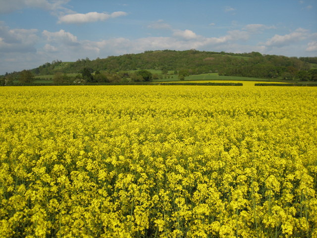
The village of Eckington is nestled in the picturesque countryside, surrounded by rolling hills and lush green fields. The River Avon flows through the parish, adding to its natural beauty. The area is known for its tranquil and serene atmosphere, making it an ideal location for those seeking a peaceful rural retreat.

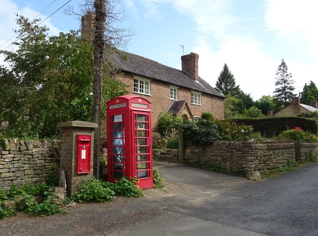
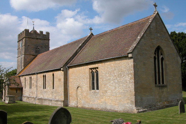
Eckington has a rich history dating back to medieval times. The parish is home to several historical landmarks, including the 13th-century St. John the Baptist Church, which is renowned for its impressive architecture and stained glass windows. There are also a number of well-preserved timber-framed houses that showcase the area's traditional architecture.

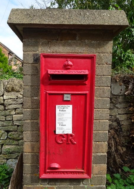
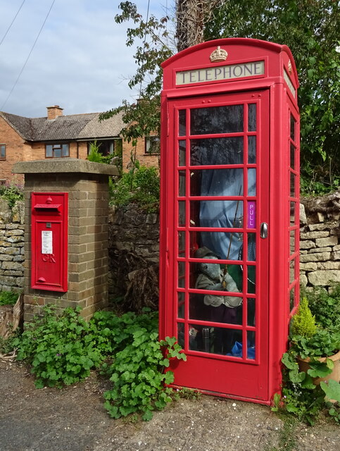
Despite its small size, Eckington offers a range of amenities to its residents. The village has a primary school, a post office, and a community center, which serves as a hub for various social activities. Additionally, there are several pubs and restaurants where locals and visitors can enjoy traditional English cuisine and hospitality.

The surrounding countryside provides ample opportunities for outdoor activities such as hiking, cycling, and fishing. The nearby Bredon Hill offers stunning panoramic views of the surrounding area and is a popular spot for nature lovers and walkers.

Overall, Eckington is a charming and idyllic parish that combines natural beauty with a rich historical heritage, offering a peaceful and picturesque setting for residents and visitors alike.

If you have any feedback on the listing, please let us know in the comments section below.

Eckington Images

Images are sourced within 2km of 52.06802/-2.099958 or Grid Reference SO9341. Thanks to Geograph Open Source API. All images are credited.

George V postbox, Bredon's Norton Postbox No. GL20 12.

See <a href="https://www.geograph.org.uk/photo/6935335">SO9339 : George V postbox and telephone box, Bredon's Norton</a> and <a href="https://www.geograph.org.uk/photo/6935338">SO9339 : House in Bredon's Norton</a> for context.
George V postbox, Bredon's Norton
George V postbox and telephone box, Bredon's Norton Postbox No. GL20 12.

See <a href="https://www.geograph.org.uk/photo/6935332">SO9339 : George V postbox, Bredon's Norton</a> for postbox.
George V postbox and telephone box, Bredon's Norton
Postbox No. GL20 12. See SO9339 : George V postbox, Bredon's Norton for postbox.
House in Bredon's Norton Showing position of Postbox No. GL20 12.

See <a href="https://www.geograph.org.uk/photo/6935332">SO9339 : George V postbox, Bredon's Norton</a> for postbox.
House in Bredon's Norton
Showing position of Postbox No. GL20 12. See SO9339 : George V postbox, Bredon's Norton for postbox.
House at a lane junction, Bredon's Norton
B4080 at the access for Nortonside Farm The signpost to the farm can be seen pointing left from the main road.
B4080 at the access for Nortonside Farm
The signpost to the farm can be seen pointing left from the main road.
Oil seed rape and Bredon Hill View to Bredon Hill from the west over a field of oil seed rape in blossom, to the north of Bredon's Norton.
Oil seed rape and Bredon Hill
View to Bredon Hill from the west over a field of oil seed rape in blossom, to the north of Bredon's Norton.
Bredon's Norton A quiet hamlet to the west of Bredon Hill.
Bredon's Norton
A quiet hamlet to the west of Bredon Hill.
Norton Lane Bredon's Norton.
Norton Lane
Bredon's Norton.
Farmland at Bredon's Norton The profile of the Malvern Hills, on the far side of the Avon and Severn rivers, can be seen faintly on the horizon.
Farmland at Bredon's Norton
The profile of the Malvern Hills, on the far side of the Avon and Severn rivers, can be seen faintly on the horizon.
Bare winter tree Bare winter tree on the slopes of Bredon Hill.
Bare winter tree
Bare winter tree on the slopes of Bredon Hill.
Grazing near Nortonside Farm
Norton Park Once the home of the only American woman to be nominated for the Presidency of the USA.
Norton Park
Once the home of the only American woman to be nominated for the Presidency of the USA.
Bredon's Norton Thatched cottage in Bredon's Norton.
Bredon's Norton
Thatched cottage in Bredon's Norton.
Sheep grazing in a meadow, Bredon's Norton Sheep grazing on a field beside the Worcester to Cheltenham railway at Bredon's Norton.
Sheep grazing in a meadow, Bredon's Norton
Sheep grazing on a field beside the Worcester to Cheltenham railway at Bredon's Norton.
Norton Park grounds Large area of sheep grazing land above Norton Park, which is just in view on the extreme left. The whole nine-mile range of the Malvern Hills in the distance.
Norton Park grounds
Large area of sheep grazing land above Norton Park, which is just in view on the extreme left. The whole nine-mile range of the Malvern Hills in the distance.
Approaching White's Farm Crossing
White's Farm Level Crossing near Bredon's Norton
View North-west from Bredon Hill In this view the lake towards the left at SO 938 419 is just beyond the River Avon, which has a line of trees along it. Great Comberton (at SO 955 422) is on the far right. Fields on the right beyond Comberton are covered in fabric - this makes the view different from the way it would have appeared fifty years ago, and there are probably more bright yellow fields of rape now. The view is from the crest of Bredon Hill above a scarp.
View North-west from Bredon Hill
In this view the lake towards the left at SO 938 419 is just beyond the River Avon, which has a line of trees along it. Great Comberton (at SO 955 422) is on the far right. Fields on the right beyond Comberton are covered in fabric - this makes the view different from the way it would have appeared fifty years ago, and there are probably more bright yellow fields of rape now. The view is from the crest of Bredon Hill above a scarp.
Show me another place!

Eckington is located at Grid Ref: SO9341 (Lat: 52.06802, Lng: -2.099958)

Administrative County: Worcestershire

District: Wychavon

Police Authority: West Mercia

What 3 Words

///scrolled.photocopy.lawfully. Near Eckington, Worcestershire

Nearby Locations

Eckington

Related Wikis

Eckington railway station

Eckington railway station was a railway station to serve Eckington in Worcestershire. The station was opened by the Birmingham and Gloucester Railway...

Eckington, Worcestershire

Eckington is a small village near to the southern border of the English county of Worcestershire, according to the 2001 census it had a population of 1...

Eckington Bridge

Eckington Bridge is a stone bridge over the River Avon in Eckington in the English county of Worcestershire. It is a Grade II* listed building and has...

Birlingham

Birlingham is a village and civil parish in the Wychavon district of Worcestershire. The village is south of Pershore, located in a bend of the River Avon...

Bow Brook

The Bow Brook is a substantial brook that flows for 28.8 miles (46.3 km) through Worcestershire, England. It is a lower tributary of the River Avon which...

Bredon's Norton

Bredon's Norton or Norton-by-Bredon is a village and civil parish 11 miles (18 km) south east of Worcester, in the Wychavon district, in the county of...

St John the Baptist's Church, Strensham

St John the Baptist's Church is a redundant Anglican church in the village of Strensham, Worcestershire, England. It is recorded in the National Heritage...

Defford railway station

Defford railway station was a station in Defford, Worcestershire, England. The station was opened in 1840 and closed in 1965. == References == == Further... ==

Nearby Amenities

Located within 500m of 52.06802,-2.099958
Generator Method: photovoltaic
Generator Output Electricity: yes
Generator Source: solar
Generator Type: solar_photovoltaic_panel
Location: roof
Power: generator
Lat/Long: 52.0702394/-2.104075
Power: pole
Lat/Long: 52.0710633/-2.1026494
Power: pole
Lat/Long: 52.0700436/-2.1030732
Power: pole
Lat/Long: 52.0705543/-2.1028633
Power: pole
Lat/Long: 52.064151/-2.1019936
Power: pole
Lat/Long: 52.0645303/-2.1036552
Eckington Cathodic Protection Plant
Power: pole
Transformer: distribution
Voltage Primary: 11000
Lat/Long: 52.0648056/-2.1024857
Power: pole
Lat/Long: 52.0654875/-2.102817
Power: pole
Lat/Long: 52.0656639/-2.1053946
Power: pole
Lat/Long: 52.0659005/-2.1043459
Power: pole
Lat/Long: 52.0661635/-2.1031469
Power: pole
Lat/Long: 52.0667208/-2.1033253
Power: pole
Lat/Long: 52.0672411/-2.1034688
Power: pole
Lat/Long: 52.0677258/-2.1036096
Power: pole
Lat/Long: 52.0683656/-2.1037799
Power: pole
Lat/Long: 52.0691182/-2.103454
Power: pole
Lat/Long: 52.0695585/-2.1032824
Power: pole
Lat/Long: 52.0718267/-2.102986
Power: pole
Lat/Long: 52.0715522/-2.1024422
The data included in this document is from www.openstreetmap.org. The data is made available under ODbL.

Have you been to Eckington?

Leave your review of Eckington below (or comments, questions and feedback).