Ebrington

Civil Parish in Gloucestershire Cotswold

England

Ebrington

Lane to Goose Hill From the hamlet of Charingworth.
Lane to Goose Hill Credit: Trevor Harris

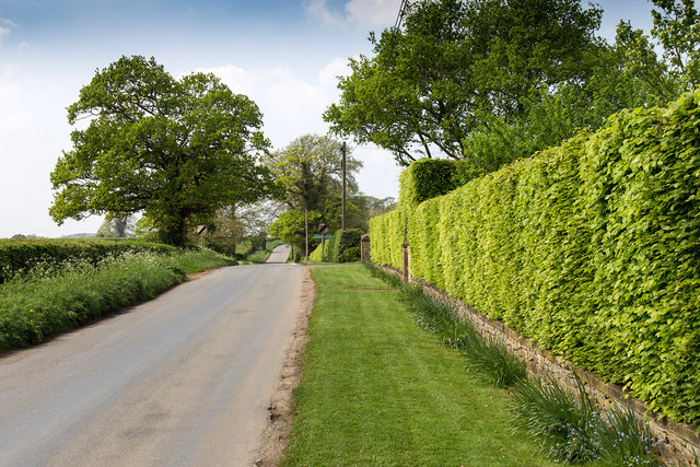
Ebrington is a civil parish located in the county of Gloucestershire, England. Situated in the North Cotswolds, it occupies an area of approximately 1,400 acres. The village is nestled amidst picturesque countryside, boasting breathtaking landscapes and charming rural surroundings.

Ebrington is a small, quaint village with a population of around 400 people. The settlement dates back to medieval times and still retains its historic character, with many buildings dating back several centuries. The centerpiece of the village is the Grade I listed St. Eadburgha's Church, a beautiful example of Norman architecture. This ancient church has stood for over 900 years and is a significant landmark in the area.

The village is known for its strong sense of community, with various local events and activities being organized throughout the year. Ebrington also has a village hall, which serves as a hub for social gatherings and community meetings.

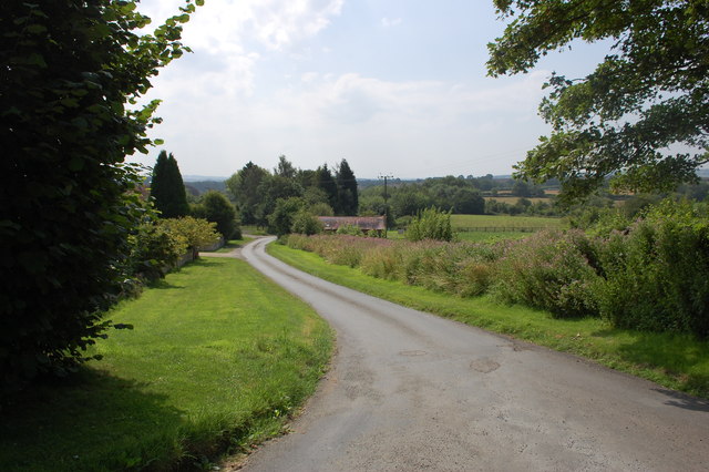
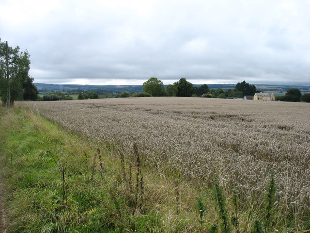
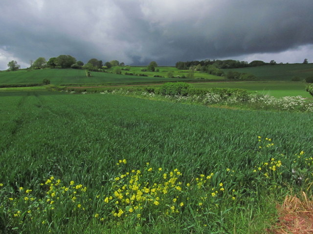
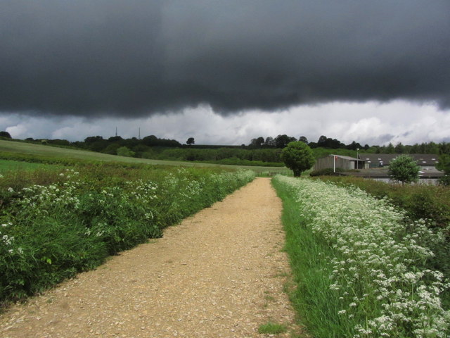
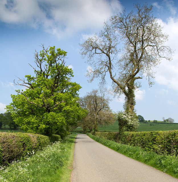
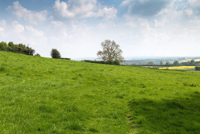
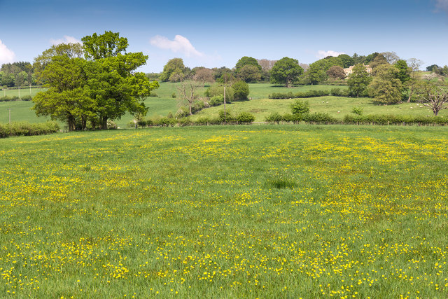
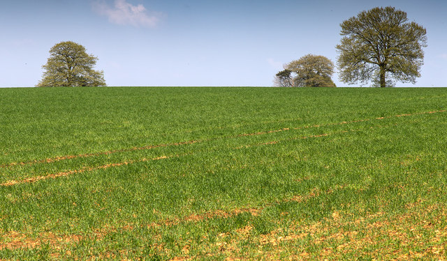
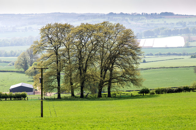
Surrounding Ebrington are rolling hills and farmland, making it an idyllic location for walking, hiking, and exploring the natural beauty of the Cotswolds. The village is also close to several popular tourist destinations, including Chipping Campden and Stratford-upon-Avon.

Overall, Ebrington offers a peaceful and picturesque setting, steeped in history and natural beauty. It is a place where residents and visitors alike can enjoy the tranquility of rural England and immerse themselves in the charm of a traditional Cotswold village.

If you have any feedback on the listing, please let us know in the comments section below.

Ebrington Images

Images are sourced within 2km of 52.057668/-1.723594 or Grid Reference SP1939. Thanks to Geograph Open Source API. All images are credited.

Lane to Goose Hill From the hamlet of Charingworth.
Lane to Goose Hill
From the hamlet of Charingworth.
Farmland above Charingworth
Threatening clouds towards Ebrington Hill
Threatening clouds, on track through Foxcote Farm near Ilmington
A field of cabbages A field of cabbages opposite Rye Piece Farm, Ebrington.  There was a very strong cabbage smell here.
A field of cabbages
A field of cabbages opposite Rye Piece Farm, Ebrington. There was a very strong cabbage smell here.
Road to Rye Piece Farm Road to Rye Piece Farm on the western edge of the village of Ebrington.
Road to Rye Piece Farm
Road to Rye Piece Farm on the western edge of the village of Ebrington.
Campden Road, Ebrington Campden Road west out of Ebrington.
Campden Road, Ebrington
Campden Road west out of Ebrington.
Ebrington Hill View NE up the hill.
Ebrington Hill
View NE up the hill.
Footpath to Ebrington Footpath down Ebrington Hill towards the village.
Footpath to Ebrington
Footpath down Ebrington Hill towards the village.
Field north east of Hidcote Road Field of buttercups off Hidcote Road.
Field north east of Hidcote Road
Field of buttercups off Hidcote Road.
Road out of Ebrington The road running WNW out of Ebrington towards Hidcote Boyce.
Road out of Ebrington
The road running WNW out of Ebrington towards Hidcote Boyce.
Footpath leaves Ebrington Hill The footpath to Ebrington leaves the road.
Footpath leaves Ebrington Hill
The footpath to Ebrington leaves the road.
Trees in a field View NNE from a gateway at the road junction on Ebrington Hill.
Trees in a field
View NNE from a gateway at the road junction on Ebrington Hill.
Junction on Ebrington Hill View SW towards the junction.
Junction on Ebrington Hill
View SW towards the junction.
Five trees in a field View WSW from the junction on Ebrington Hill.
There was a distinct haze in the atmosphere on this day.
Five trees in a field
View WSW from the junction on Ebrington Hill. There was a distinct haze in the atmosphere on this day.
Campden Road west out of Ebrington Lane towards Chipping Campden.
Campden Road west out of Ebrington
Lane towards Chipping Campden.
Poplars south of Campden Road A line of poplars by the side of a track off Campden Road.
Poplars south of Campden Road
A line of poplars by the side of a track off Campden Road.
Fields north of Nash's Lane Nash's Lane is a bridleway running from Ebrington towards Ilmington.
On the horizon to the left can be seen the two transmitter towers in <a href="https://www.geograph.org.uk/gridref/SP1942">SP1942</a>.
Fields north of Nash's Lane
Nash's Lane is a bridleway running from Ebrington towards Ilmington. On the horizon to the left can be seen the two transmitter towers in SP1942.
Show me another place!

Ebrington is located at Grid Ref: SP1939 (Lat: 52.057668, Lng: -1.723594)

Administrative County: Gloucestershire

District: Cotswold

Police Authority: Gloucestershire

What 3 Words

///distorts.prosper.blaring. Near Chipping Campden, Gloucestershire

Nearby Locations

Ebrington

Related Wikis

Ebrington

Ebrington (known locally as Yabberton or Yubberton) is a village and civil parish in Gloucestershire, England, about 2 miles (3.2 km) from Chipping Campden...

Church of St Eadburga, Ebrington

The Anglican Church of St Eadburga at Ebrington in the Cotswold District of Gloucestershire, England was built in the 13th century. It is a grade I listed...

Ebrington Manor

Ebrington Manor is a grade II listed manor house in the parish of Ebrington in Gloucestershire, England. Since 1476 it has been a seat of the Fortescue...

Fruit and Vegetable Preservation Research Station

The Fruit and Vegetable Preservation Research Station (FVPRS) was a former British government research institute, now a private research company, that...

Chipping Campden railway station

Chipping Campden, or for most of its existence simply Campden, is a closed railway station on the Cotswold Line, which served the town of Chipping Campden...

Touch FM (Stratford-upon-Avon)

102 Touch FM was an Independent Local Radio station broadcasting to the town of Stratford-upon-Avon and much of the counties of Warwickshire, Worcestershire...

Ebrington Hill

Ebrington Hill is a hill in Warwickshire, England, which at 261 m (856 ft) is the highest in the county. It is situated between the villages of Ebrington...

Ilmington Downs

The Ilmington Downs are a large open area situated in Warwickshire, just above the small village of Ilmington. It is the highest point in Warwickshire...

Nearby Amenities

Located within 500m of 52.057668,-1.723594
Bus Stop
New Rd
Bus: yes
Naptan AtcoCode: 1600GL1788
Naptan Bearing: S
Naptan CommonName: New Rd
Naptan NaptanCode: glogjdjg
Naptan Street: Charingworth Road
Naptan Verified: no
Public Transport: platform
Source: naptan_import
Lat/Long: 52.0582125/-1.7253268
Post Box
Lat/Long: 52.0590668/-1.7273745
Generator Method: photovoltaic
Generator Output Electricity: yes
Generator Source: solar
Generator Type: solar_photovoltaic_panel
Location: roof
Power: generator
Lat/Long: 52.058235/-1.7291451
Power: pole
Lat/Long: 52.0588559/-1.7171314
Power: pole
Lat/Long: 52.0594298/-1.717912
Power: pole
Lat/Long: 52.0599929/-1.7186764
Location Transition: yes
Power: pole
Lat/Long: 52.060559/-1.7194401
Home Farm Ebrington
Power: pole
Transformer: distribution
Voltage Primary: 11000
Lat/Long: 52.0577748/-1.730336
The Grove Ebrington
Power: pole
Transformer: distribution
Voltage Primary: 11000
Lat/Long: 52.0587874/-1.725508
Location Transition: yes
Power: pole
Lat/Long: 52.0598033/-1.7245625
Power: pole
Lat/Long: 52.0604225/-1.7253953
Location Transition: yes
Power: pole
Lat/Long: 52.0610183/-1.7260914
Ebrington Vicarage
Power: pole
Transformer: distribution
Voltage Primary: 11000
Lat/Long: 52.0615616/-1.7267646
The data included in this document is from www.openstreetmap.org. The data is made available under ODbL.

Have you been to Ebrington?

Leave your review of Ebrington below (or comments, questions and feedback).