Eaton and Alsop

Civil Parish in Derbyshire Derbyshire Dales

England

Eaton and Alsop

Single Arched Viaduct over the Tissington Trail A grand structure supporting a track that gives access between fields - spanning the Tissington Trail as it passes through a cutting.
Single Arched Viaduct over the Tissington Trail Credit: Chris Heaton

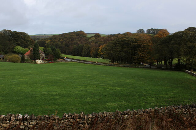
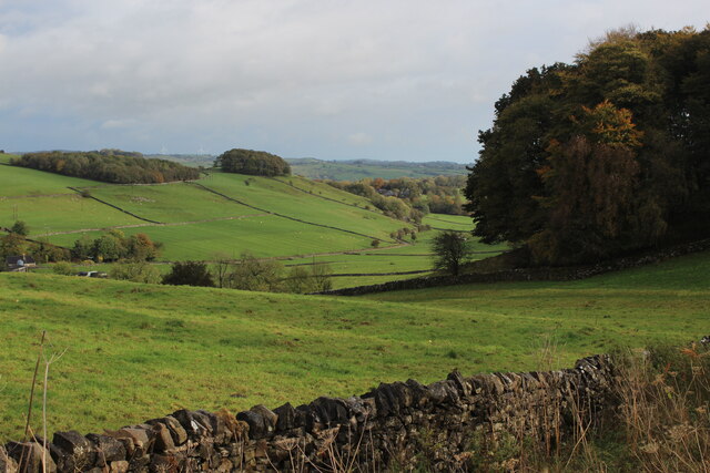
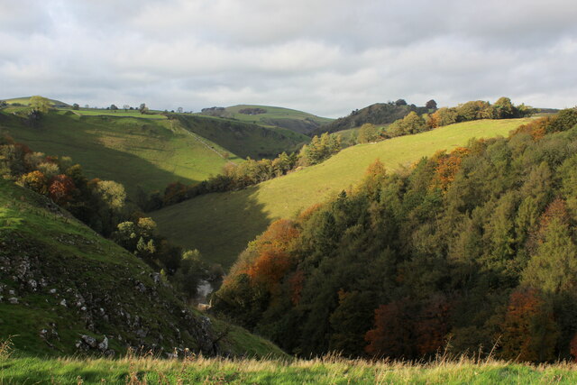
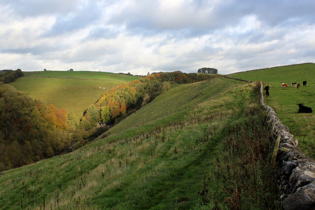
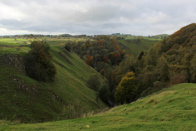
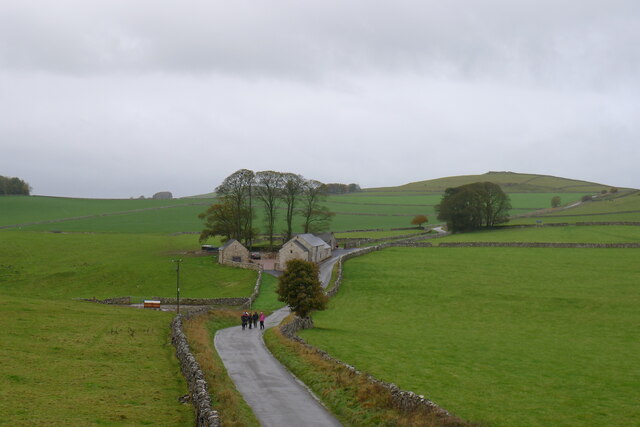
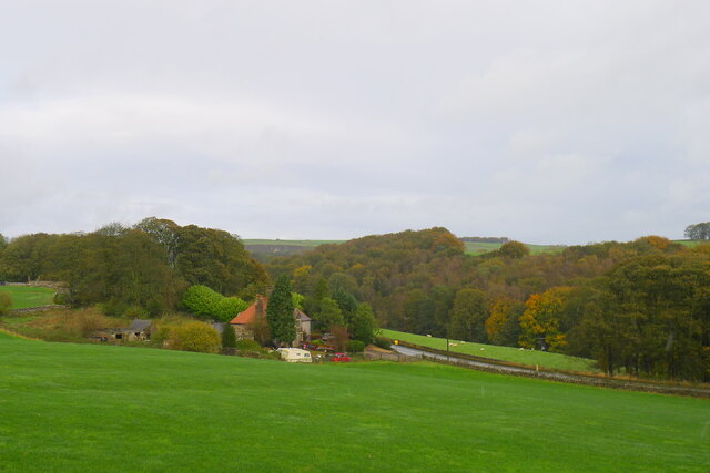
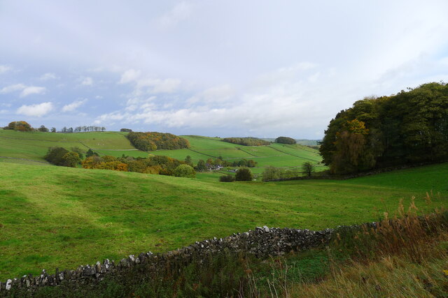
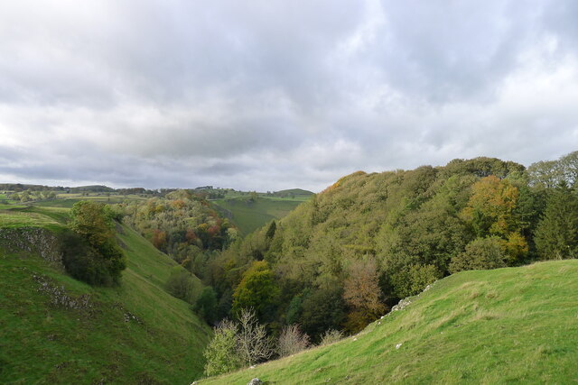
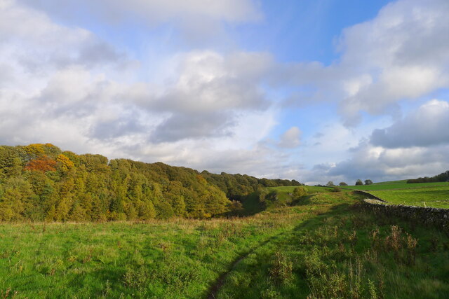
Eaton and Alsop is a civil parish located in the Derbyshire Dales district of Derbyshire, England. It is situated in the eastern part of the county, approximately 6 miles north of Ashbourne. The parish consists of two villages, Eaton and Alsop-en-le-Dale, which are separated by the River Dove.

Eaton is a small village with a population of around 100 residents. It is known for its picturesque countryside, charming cottages, and traditional English village atmosphere. The village is surrounded by rolling hills and farmland, making it an ideal location for those seeking a peaceful and rural setting.

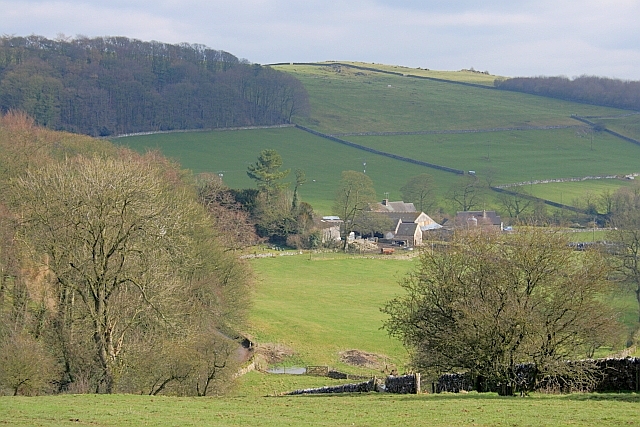
Alsop-en-le-Dale is a slightly larger village with a population of around 150 residents. It is located on the western bank of the River Dove and offers stunning views of the surrounding countryside. The village features a mix of old and new buildings, including a medieval church and several historic cottages.

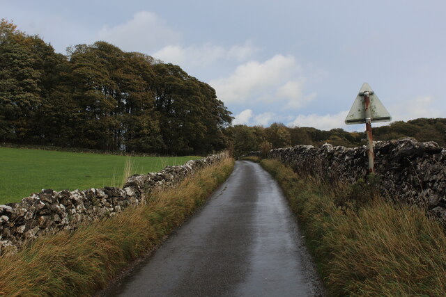
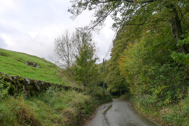
Both villages are popular with tourists and outdoor enthusiasts due to their proximity to the Peak District National Park. The area offers a wide range of outdoor activities, including hiking, cycling, and fishing. The River Dove is particularly renowned for its trout fishing.

Overall, Eaton and Alsop provide a tranquil and idyllic setting for those looking to escape the hustle and bustle of city life. With its beautiful landscapes, historic buildings, and outdoor recreational opportunities, this civil parish is a hidden gem in the heart of Derbyshire.

If you have any feedback on the listing, please let us know in the comments section below.

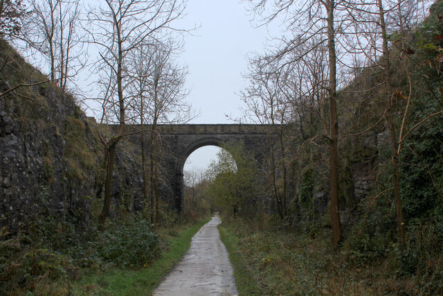
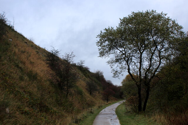
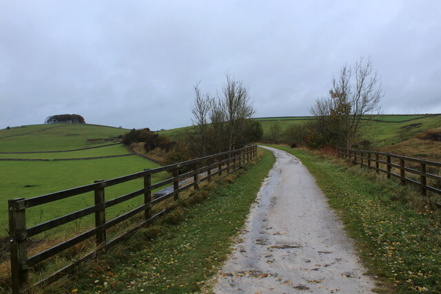
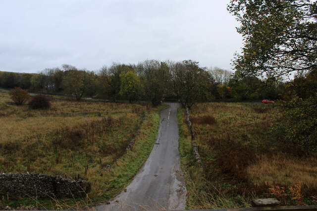
Eaton and Alsop Images

Images are sourced within 2km of 53.103014/-1.767544 or Grid Reference SK1556. Thanks to Geograph Open Source API. All images are credited.

Single Arched Viaduct over the Tissington Trail A grand structure supporting a track that gives access between fields - spanning the Tissington Trail as it passes through a cutting.
Single Arched Viaduct over the Tissington Trail
A grand structure supporting a track that gives access between fields - spanning the Tissington Trail as it passes through a cutting.
Cutting on the Tissington Trail Section of the leisure trail, popular among cyclists, horse riders and the walking fraternity - once part of the railway link between Buxton and Ashbourne
Cutting on the Tissington Trail
Section of the leisure trail, popular among cyclists, horse riders and the walking fraternity - once part of the railway link between Buxton and Ashbourne
Tissington Trail crossing Liffs Road The former railway heading north towards Johnson's Knoll - topped by a stand of trees.
Tissington Trail crossing Liffs Road
The former railway heading north towards Johnson's Knoll - topped by a stand of trees.
Liffs Road approaching the A515 As seen from the former railway bridge that carries the Tissington Trail across Liffs Road
Liffs Road approaching the A515
As seen from the former railway bridge that carries the Tissington Trail across Liffs Road
Looking towards Greenlowfield and the A515 As seen from the Tissington Trail, slightly to the north of the former Alsop station.
Looking towards Greenlowfield and the A515
As seen from the Tissington Trail, slightly to the north of the former Alsop station.
Countryside near Alsop en le Dale As seen from the Tissington Trail beside Stonepit Plantation
Countryside near Alsop en le Dale
As seen from the Tissington Trail beside Stonepit Plantation
Oxclose Lane Climbing out of the trench of Dovedale towards the A515
Oxclose Lane
Climbing out of the trench of Dovedale towards the A515
View from Above Shining Tor Overlooks the deep trench that is Dovedale
View from Above Shining Tor
Overlooks the deep trench that is Dovedale
Footpath High above Milldale The public footpath follows the wall, with ground falling away sharply to the left towards Milldale
Footpath High above Milldale
The public footpath follows the wall, with ground falling away sharply to the left towards Milldale
Looking over Mill Dale
Bridge over the former Ashbourne to Buxton railway Looking at old OS maps this bridge, built at the end of the 19th century, has never carried any substantial road or track. It seems to be a very expensive structure if its only purpose was to connect farmland on either side of the railway.
Bridge over the former Ashbourne to Buxton railway
Looking at old OS maps this bridge, built at the end of the 19th century, has never carried any substantial road or track. It seems to be a very expensive structure if its only purpose was to connect farmland on either side of the railway.
Entrance to old track leading off the former Ashbourne to Buxton railway line The track gave access to a quarry on the other side of the line
Entrance to old track leading off the former Ashbourne to Buxton railway line
The track gave access to a quarry on the other side of the line
Walkers on the road past Lees Barn The group was on its way to join the Tissington Trail
Walkers on the road past Lees Barn
The group was on its way to join the Tissington Trail
Greenlowfield from the Tissington Trail Semi-detached cottages on the A515
Greenlowfield from the Tissington Trail
Semi-detached cottages on the A515
Alsop en le Dale from the Tissington Trail
The road down to Mill Dale Aptly named 'The Pinch'
The road down to Mill Dale
Aptly named 'The Pinch'
Mill Dale
Mill Dale
The path above Mill Dale After a steep climb up from the village of Milldale, the path here is running east on more level ground towards the A515 and the Tissington Trail
The path above Mill Dale
After a steep climb up from the village of Milldale, the path here is running east on more level ground towards the A515 and the Tissington Trail
Show me another place!

Eaton and Alsop is located at Grid Ref: SK1556 (Lat: 53.103014, Lng: -1.767544)

Administrative County: Derbyshire

District: Derbyshire Dales

Police Authority: Derbyshire

What 3 Words

///blown.cage.firewall. Near Newhaven, Derbyshire

Related Wikis

Eaton and Alsop

Eaton and Alsop is a civil parish within the Derbyshire Dales district, in the county of Derbyshire, England. Largely rural, in 2021 Eaton and Alsop had...
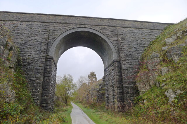
Tissington Trail

The Tissington Trail is a bridleway, footpath and cycleway in Derbyshire, England, along part of the trackbed of the former railway line connecting Ashbourne...

Alsop en le Dale

Alsop en le Dale is a village in Derbyshire, England about 5 miles (8.0 km) north of Ashbourne close to the Staffordshire border, and a mile from Dovedale...

St Michael and All Angels' Church, Alsop-en-le-Dale

St Michael and all Angels' Church, Alsop en le Dale is a Grade II listed parish church in the Church of England in Alsop en le Dale, Derbyshire. ��2�...

Nearby Amenities

Located within 500m of 53.103014,-1.767544
Parking
Ele: 301.0000000
Lat/Long: 53.1061685/-1.763036
Parking
Ele: 293.0000000
Lat/Long: 53.1038185/-1.7673428
Cafe
Cuisine: ice_cream
Drink Coffee: yes
Drink Tea: yes
Lat/Long: 53.1040487/-1.767156
Barrier: stile
Material: stone
Source: survey;gps
Stile: squeezer
Lat/Long: 53.1021279/-1.7608798
Barrier: stile
Material: stone
Source: survey;gps
Stile: squeezer
Lat/Long: 53.1042968/-1.7746912
Barrier: stile
Material: stone
Source: survey;gps
Stile: squeezer
Lat/Long: 53.1044514/-1.7744189
Barrier: kissing_gate
Fixme: where exactly is this?
Lat/Long: 53.1048415/-1.7635624
The data included in this document is from www.openstreetmap.org. The data is made available under ODbL.

Have you been to Eaton and Alsop?

Leave your review of Eaton and Alsop below (or comments, questions and feedback).