Easton

Civil Parish in Lincolnshire South Kesteven

England

Easton

Easton Hall and Park: aerial 2021 (1) See: <span class="nowrap"><a title="https://houseandheritage.org/2015/10/23/easton-hall/" rel="nofollow ugc noopener" href="https://houseandheritage.org/2015/10/23/easton-hall/">Link</a><img style="margin-left:2px;" alt="External link" title="External link - shift click to open in new window" src="https://s1.geograph.org.uk/img/external.png" width="10" height="10"/></span>
Easton Hall and Park: aerial 2021 (1) Credit: Chris

Easton is a civil parish located in the county of Lincolnshire, England. Situated approximately 8 miles south of the city of Lincoln, the parish covers an area of about 7.5 square miles. Easton is surrounded by picturesque countryside and is known for its rural charm.

The village of Easton is home to a small population of around 300 residents. It is primarily an agricultural community, with a number of farms and agricultural businesses dotting the landscape. The parish is characterized by its open fields, meadows, and hedgerows, which contribute to its scenic beauty.

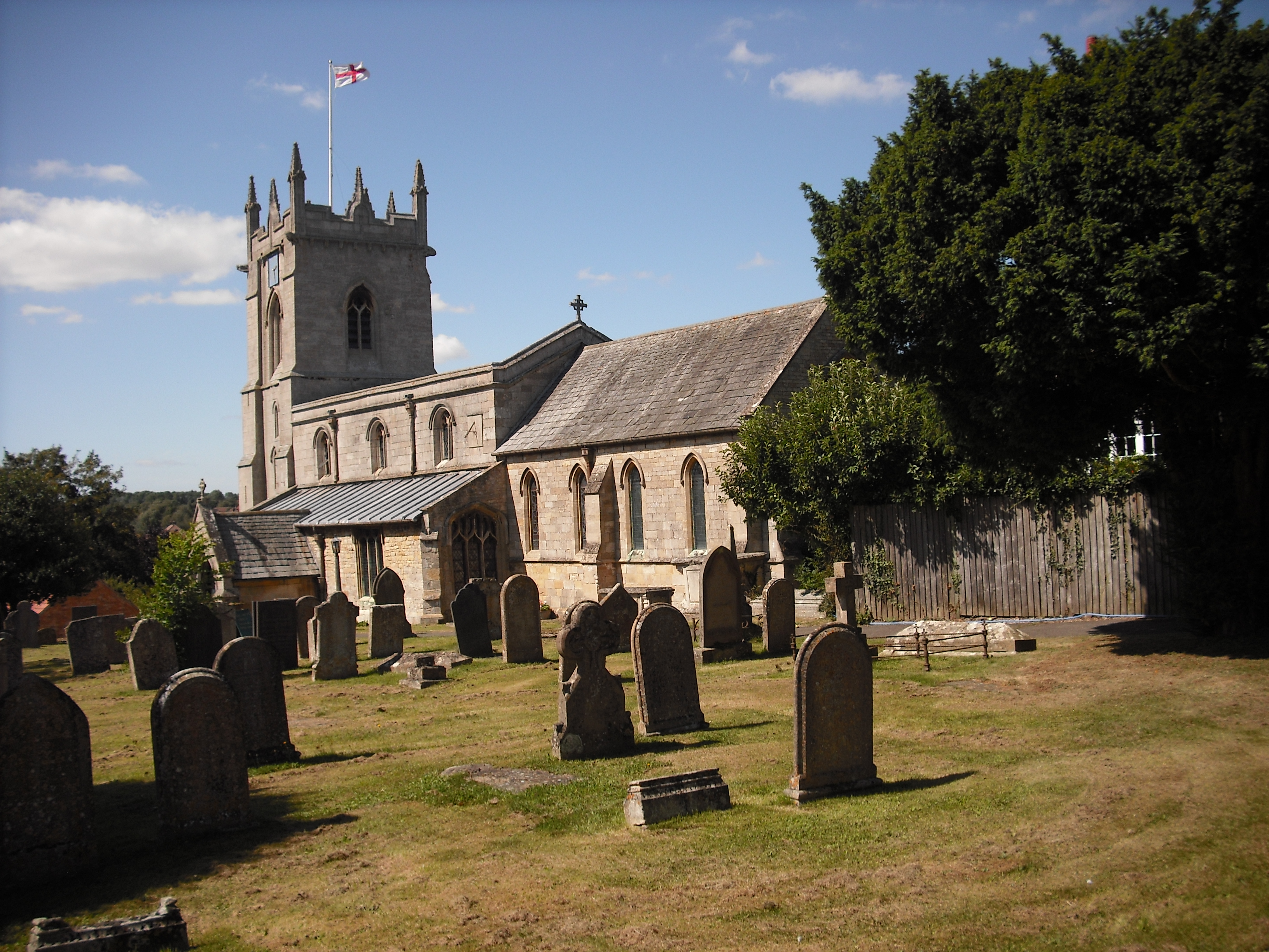
Easton is also home to a historic church, St. Peter's Church, which dates back to the 14th century. The church is a prominent landmark in the village and serves as a hub for the local community. Additionally, there is a primary school in Easton, providing education for children in the area.

Despite its small size, Easton offers a range of amenities for its residents. These include a village hall, a pub, and a post office. The village hall hosts various community events and gatherings, fostering a sense of community spirit.

The surrounding area of Easton is rich in natural beauty, with numerous walking and cycling routes available for outdoor enthusiasts. The nearby city of Lincoln offers further amenities and attractions, including shopping centers, historical sites, and cultural events.

Overall, Easton, Lincolnshire, is a picturesque and close-knit community, offering a peaceful and rural way of life for its residents.

If you have any feedback on the listing, please let us know in the comments section below.
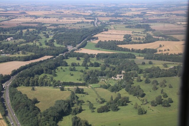
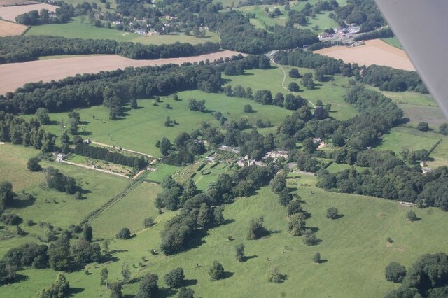
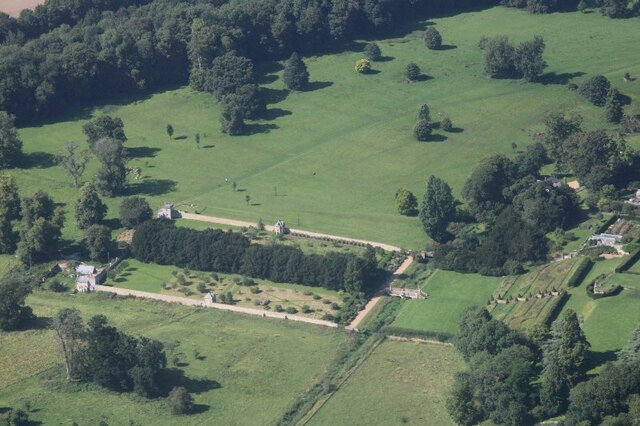
Easton Images

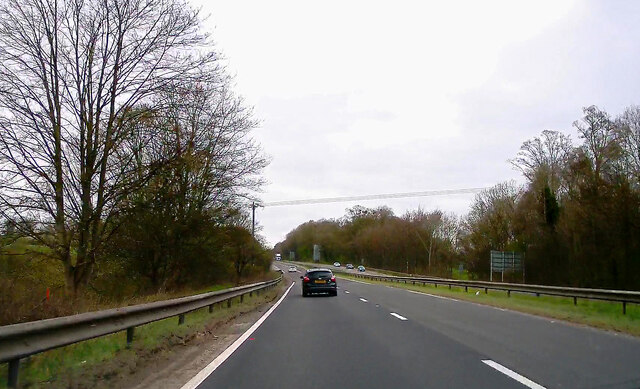
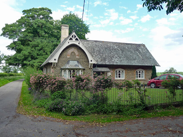
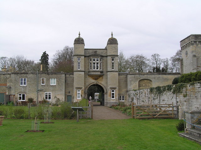
Images are sourced within 2km of 52.822875/-0.60145 or Grid Reference SK9425. Thanks to Geograph Open Source API. All images are credited.

Easton Hall and Park: aerial 2021 (1) See: <span class="nowrap"><a title="https://houseandheritage.org/2015/10/23/easton-hall/" rel="nofollow ugc noopener" href="https://houseandheritage.org/2015/10/23/easton-hall/">Link</a><img style="margin-left:2px;" alt="External link" title="External link - shift click to open in new window" src="https://s1.geograph.org.uk/img/external.png" width="10" height="10"/></span>
Easton Hall and Park: aerial 2021 (1)
See: LinkExternal link
Easton Hall and Park: aerial 2021 (2) See: <span class="nowrap"><a title="https://houseandheritage.org/2015/10/23/easton-hall/" rel="nofollow ugc noopener" href="https://houseandheritage.org/2015/10/23/easton-hall/">Link</a><img style="margin-left:2px;" alt="External link" title="External link - shift click to open in new window" src="https://s1.geograph.org.uk/img/external.png" width="10" height="10"/></span>
Easton Hall and Park: aerial 2021 (2)
See: LinkExternal link
Easton Hall and Park: aerial 2021 (3) Detail of garden.
Easton Hall and Park: aerial 2021 (3)
Detail of garden.
Co-op food store
Co-op food store
A1 northbound near Colsterworth
Old School, Easton Dated 1878. Grade II listed.
Now a private house. See also <a href="https://www.geograph.org.uk/photo/212693">SK9326 : Former school at Easton</a>.
Old School, Easton
Dated 1878. Grade II listed. Now a private house. See also SK9326 : Former school at Easton.
Tree Nursery Broadleaf trees being grown up for transplanting
Tree Nursery
Broadleaf trees being grown up for transplanting
Planting Road leading to Easton The delightful Easton walled gardens are at the end of this quiet lane <span class="nowrap"><a title="https://www.visiteaston.co.uk/" rel="nofollow ugc noopener" href="https://www.visiteaston.co.uk/">Link</a><img style="margin-left:2px;" alt="External link" title="External link - shift click to open in new window" src="https://s1.geograph.org.uk/img/external.png" width="10" height="10"/></span>
Planting Road leading to Easton
The delightful Easton walled gardens are at the end of this quiet lane LinkExternal link
Magnavale Easton Phase II Easton Cold Store has changed hands a few times in my lifetime, but has always majored on the manufacture and distribution of potato products.  The latest owner, Magnavale, has massively expanded the business and variations in products, and is now investing further in what they say will be the "Greenest, Most-Efficient UK Cold Store".

Their web site says "the 101,000 pallet cold store development known as Magnavale Easton II accompanies an existing 44,000 pallet cold store located on the same site. Once built, the site will house a huge 145,000 pallet positions, the majority of which will be fully-automated. The facility, due in Q2 2024, will be run entirely on renewable energy."
Magnavale Easton Phase II
Easton Cold Store has changed hands a few times in my lifetime, but has always majored on the manufacture and distribution of potato products. The latest owner, Magnavale, has massively expanded the business and variations in products, and is now investing further in what they say will be the "Greenest, Most-Efficient UK Cold Store". Their web site says "the 101,000 pallet cold store development known as Magnavale Easton II accompanies an existing 44,000 pallet cold store located on the same site. Once built, the site will house a huge 145,000 pallet positions, the majority of which will be fully-automated. The facility, due in Q2 2024, will be run entirely on renewable energy."
New building at Easton The new structure described in <a href="https://www.geograph.org.uk/photo/7482369">SK9426 : Magnavale Easton Phase II</a> will dominate the skyline.
New building at Easton
The new structure described in SK9426 : Magnavale Easton Phase II will dominate the skyline.
Farm track Off Burton Lane, high on the Lincolnshire Limestone plateau
Farm track
Off Burton Lane, high on the Lincolnshire Limestone plateau
It's called Dumpling Farm A splendid spring morning in Burton Lane, the verges bright with cowslips.  The wood behind the house is Pasture Holt, the farm itself is Dumpling Farm.    There are several woodland called Holt hereabouts, it is an Old English, Germanic, word for woodland.
It's called Dumpling Farm
A splendid spring morning in Burton Lane, the verges bright with cowslips. The wood behind the house is Pasture Holt, the farm itself is Dumpling Farm. There are several woodland called Holt hereabouts, it is an Old English, Germanic, word for woodland.
A field in Lincolnshire
Great North Road, Colsterworth
A1 northbound, approaching Colsterworth The A1 is the longest numbered road in the UK at 410 miles long. It connects London with Edinburgh, via the east of England. 
For much of its path it follows the Great North Road the old coaching route between London and Edinburgh. Several sections of the route are classified as motorway A1(M). The modern A1 bypasses the towns the Great North Road passed through and is dual carriageway for most of its route through England.
A1 northbound, approaching Colsterworth
The A1 is the longest numbered road in the UK at 410 miles long. It connects London with Edinburgh, via the east of England. For much of its path it follows the Great North Road the old coaching route between London and Edinburgh. Several sections of the route are classified as motorway A1(M). The modern A1 bypasses the towns the Great North Road passed through and is dual carriageway for most of its route through England.
Old railway embankment This old line runs next to the B6403 just after leaving the A1 south of Grantham.
Old railway embankment
This old line runs next to the B6403 just after leaving the A1 south of Grantham.
Dangerous square edge This is the crossroads junction of the A1 dual carriageway and the B6403. There is no traffic control and the A1 traffic thunders by at high speed. The square boundary is in the centre of the central reservation. Very dangerous way of crossing the A1.
Dangerous square edge
This is the crossroads junction of the A1 dual carriageway and the B6403. There is no traffic control and the A1 traffic thunders by at high speed. The square boundary is in the centre of the central reservation. Very dangerous way of crossing the A1.
Former school at Easton Former school-house at Easton, now a private house. The datestone in the gable has the Cholmeley family crest with the motto ‘Cassis Tutissima Virtus’ meaning ‘Virtue is the safest helmet’. It is dated 1878 and advises pupils that ‘The fear of the Lord is the beginning of knowledge’.
Former school at Easton
Former school-house at Easton, now a private house. The datestone in the gable has the Cholmeley family crest with the motto ‘Cassis Tutissima Virtus’ meaning ‘Virtue is the safest helmet’. It is dated 1878 and advises pupils that ‘The fear of the Lord is the beginning of knowledge’.
Show me another place!

Easton is located at Grid Ref: SK9425 (Lat: 52.822875, Lng: -0.60145)

Administrative County: Lincolnshire

District: South Kesteven

Police Authority: Lincolnshire

What 3 Words

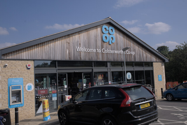
///office.factually.podcast. Near Colsterworth, Lincolnshire

Nearby Locations

Easton

Related Wikis

Easton, Lincolnshire

Easton is a village in the South Kesteven district of Lincolnshire, England, almost 2 miles (3.2 km) north of Colsterworth, and 1 mile (1.6 km) east of...

Colsterworth

Colsterworth is a village and civil parish in the South Kesteven district of Lincolnshire, England, less than half a mile (0.8 km) west of the A1, about...

Woolsthorpe-by-Colsterworth

Woolsthorpe-by-Colsterworth (to distinguish it from Woolsthorpe-by-Belvoir in the same county) is a hamlet in the South Kesteven district of Lincolnshire...

Stoke Bank

Stoke Bank is an inclined stretch of the East Coast Main Line (ECML) between Peterborough and Grantham. It is named after the village of Stoke Rochford...
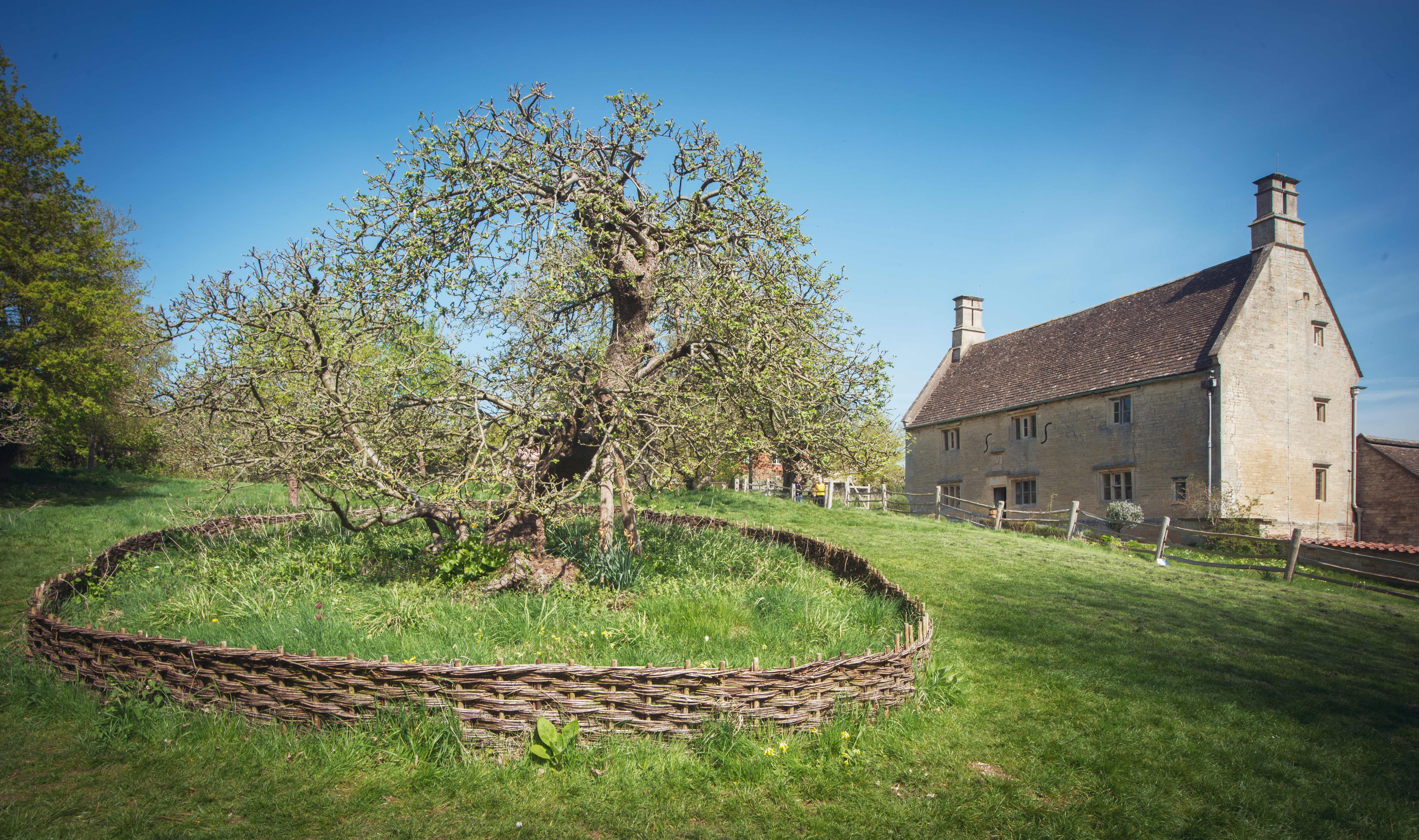
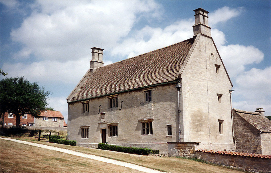
Woolsthorpe Manor

Woolsthorpe Manor in Woolsthorpe-by-Colsterworth, near Grantham, Lincolnshire, England, is the birthplace and was the family home of Sir Isaac Newton....

Isaac Newton's apple tree

Isaac Newton's apple tree at Woolsthorpe Manor represents the inspiration behind Sir Isaac Newton's theory of gravity. While the precise details of the...

St Andrew and St Mary's Church, Stoke Rochford

St Andrew and St Mary's Church is a Grade I listed Church of England parish church dedicated to Saint Andrew and Saint Mary, in the parish of Easton and...

Stoke Rochford

Stoke Rochford is a small English village and civil parish 5.5 miles (9 km) south of Grantham in the South Kesteven district of Lincolnshire. The population...

Nearby Amenities

Located within 500m of 52.822875,-0.60145
Power: pole
Lat/Long: 52.8246562/-0.6081514
Power: pole
Lat/Long: 52.826625/-0.6043835
Power: pole
Lat/Long: 52.8263503/-0.6011689
Power: pole
Lat/Long: 52.8258714/-0.5999739
Power: pole
Lat/Long: 52.8268073/-0.5994912
The data included in this document is from www.openstreetmap.org. The data is made available under ODbL.

Have you been to Easton?

Leave your review of Easton below (or comments, questions and feedback).