East Kennett

Civil Parish in Wiltshire

England

East Kennett

West Kennet Long Barrow and Silbury Hill A Neolithic chambered tomb, managed by English Heritage <span class="nowrap"><a title="https://www.english-heritage.org.uk/visit/places/west-kennet-long-barrow/" rel="nofollow ugc noopener" href="https://www.english-heritage.org.uk/visit/places/west-kennet-long-barrow/">Link</a><img style="margin-left:2px;" alt="External link" title="External link - shift click to open in new window" src="https://s1.geograph.org.uk/img/external.png" width="10" height="10"/></span>.  Silbury Hill, seen on the right, is 900m beyond.
West Kennet Long Barrow and Silbury Hill Credit: David Martin

East Kennett is a civil parish located in the county of Wiltshire, England. Situated approximately 3 miles east of the town of Avebury, it is part of the local government district of Wiltshire Council. The village is nestled in the heart of the picturesque Marlborough Downs, with its rolling hills and lush green landscapes.

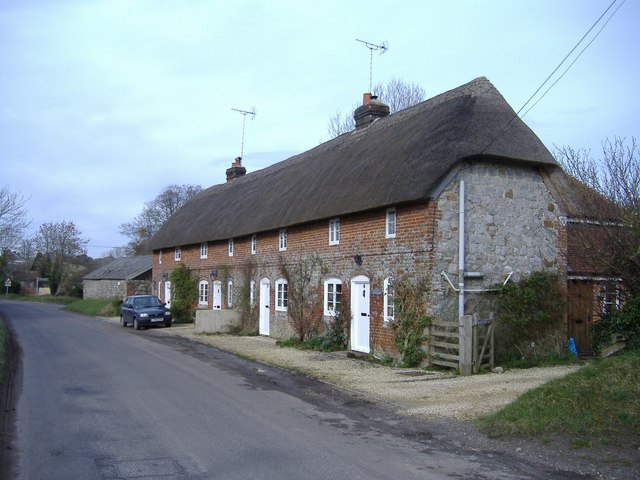
East Kennett is a small and tranquil village, with a population of around 200 residents. The parish is known for its charming rural character and quintessential English countryside. It is home to a mix of traditional thatched cottages and modern houses, surrounded by fields and farmland.

The parish is primarily an agricultural area, with farming playing a prominent role in the local economy. The fertile soil and favorable climate make it an ideal location for arable farming and livestock rearing. The village is surrounded by a patchwork of fields, which are often dotted with grazing sheep and cows.

The village itself does not have many amenities, with no shops or pubs. However, the nearby town of Avebury offers a range of amenities, including shops, pubs, and a primary school. East Kennett is also conveniently located close to the larger town of Marlborough, which provides a wider range of services and facilities.

Overall, East Kennett is a picturesque and idyllic village that offers a peaceful and rural lifestyle. It is a perfect destination for those seeking a close-knit community and a slower pace of life amidst the stunning natural beauty of the Wiltshire countryside.

If you have any feedback on the listing, please let us know in the comments section below.

East Kennett Images

Images are sourced within 2km of 51.3992/-1.834256 or Grid Reference SU1166. Thanks to Geograph Open Source API. All images are credited.

West Kennet Long Barrow and Silbury Hill A Neolithic chambered tomb, managed by English Heritage <span class="nowrap"><a title="https://www.english-heritage.org.uk/visit/places/west-kennet-long-barrow/" rel="nofollow ugc noopener" href="https://www.english-heritage.org.uk/visit/places/west-kennet-long-barrow/">Link</a><img style="margin-left:2px;" alt="External link" title="External link - shift click to open in new window" src="https://s1.geograph.org.uk/img/external.png" width="10" height="10"/></span>.  Silbury Hill, seen on the right, is 900m beyond.
West Kennet Long Barrow and Silbury Hill
A Neolithic chambered tomb, managed by English Heritage LinkExternal link. Silbury Hill, seen on the right, is 900m beyond.
Partly harvested field, close to West Kennet Long Barrow
Tumulus beside the path, close to The Sanctuary
Downland view at West Kennet The A4 crosses this scene, hidden behind trees in the valley bottom.
Downland view at West Kennet
The A4 crosses this scene, hidden behind trees in the valley bottom.
The Sanctuary, Avebury The modern concrete blocks and posts indicate the positions of the original posts and standing stones. There is more information on the English Heritage site <span class="nowrap"><a title="https://www.english-heritage.org.uk/visit/places/the-sanctuary/" rel="nofollow ugc noopener" href="https://www.english-heritage.org.uk/visit/places/the-sanctuary/">Link</a><img style="margin-left:2px;" alt="External link" title="External link - shift click to open in new window" src="https://s1.geograph.org.uk/img/external.png" width="10" height="10"/></span>.
The Sanctuary, Avebury
The modern concrete blocks and posts indicate the positions of the original posts and standing stones. There is more information on the English Heritage site LinkExternal link.
Weed-choked River Kennet Lots of vegetation, but no visible water in July 2022.
Weed-choked River Kennet
Lots of vegetation, but no visible water in July 2022.
Site of The Sanctuary near Avebury Positions of the original stones are marked by concrete blocks.
Site of The Sanctuary near Avebury
Positions of the original stones are marked by concrete blocks.
Welcome shade on a sunny ridgeway
Bridge over the River Kennett Constructed in 1842, apparently - by EPO, perhaps?
Bridge over the River Kennett
Constructed in 1842, apparently - by EPO, perhaps?
Shady tree on field boundary
West Kennett House Elegant 18th century Manor House - a Grade II listed building
West Kennett House
Elegant 18th century Manor House - a Grade II listed building
Captured in time A group of Geographers visiting West Kennett Long Barrow - and perhaps adding to their personal points score.
Captured in time
A group of Geographers visiting West Kennett Long Barrow - and perhaps adding to their personal points score.
Silbury Hill across the stubble
Wild flowers adorning West Kennett Long Barrow
Looking out from within A giant boulder was used to seal the entrance to the ancient burial chamber at West Kennett.
Looking out from within
A giant boulder was used to seal the entrance to the ancient burial chamber at West Kennett.
What lies beyond? Actually reconstruction work has been carried out - obviously - within the burial chamber.  Interesting to speculate, though.  And wonderfully atmospheric!
What lies beyond?
Actually reconstruction work has been carried out - obviously - within the burial chamber. Interesting to speculate, though. And wonderfully atmospheric!
Entrance to the burial chamber at West Kennett
Harvest time at West Kennett
Show me another place!

East Kennett is located at Grid Ref: SU1166 (Lat: 51.3992, Lng: -1.834256)

Unitary Authority: Wiltshire

Police Authority: Wiltshire

What 3 Words

///misted.coached.lightens. Near Avebury, Wiltshire

Related Wikis

East Kennett

East Kennett is a small village and civil parish in Wiltshire, England, 5 miles (8.0 km) west of Marlborough. The United Kingdom Census 2011 recorded a...
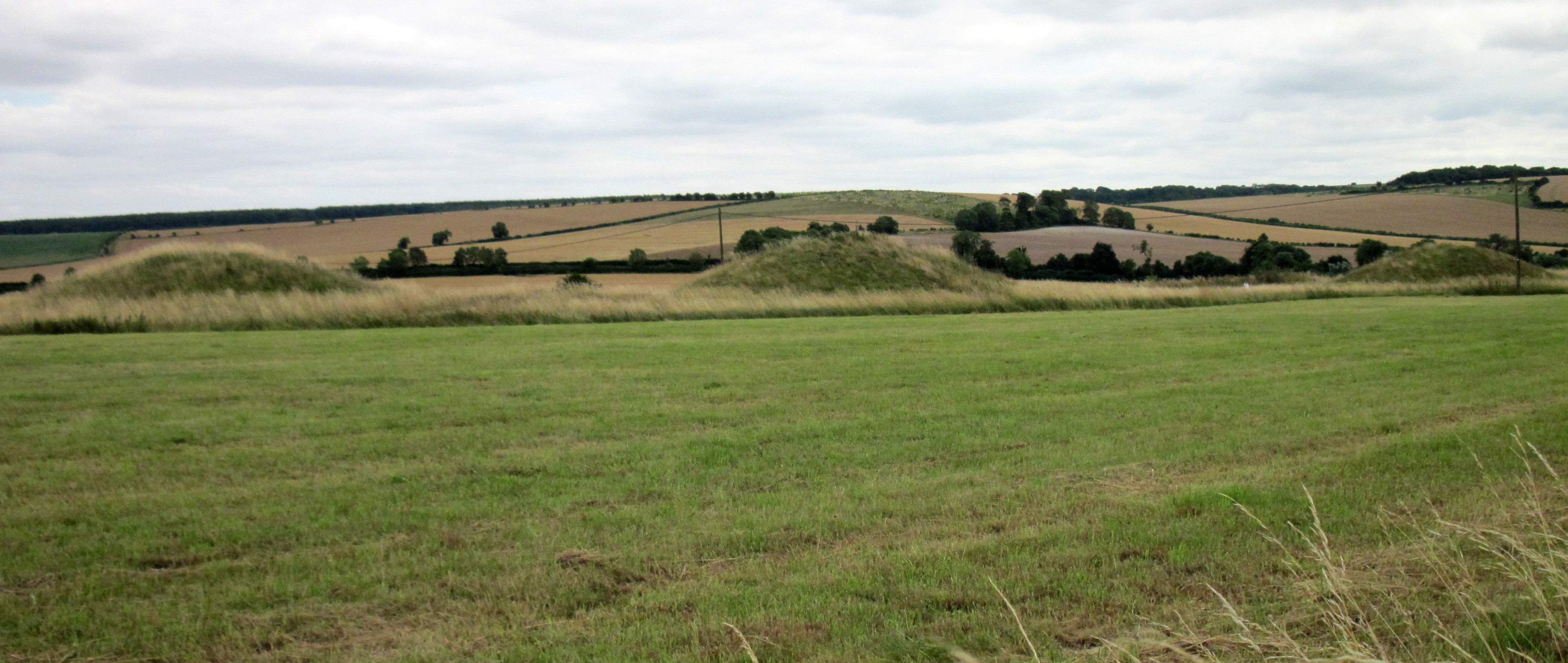
Overton Hill

Overton Hill is a 571 ft (174 m) hill at the southern edge of the Marlborough Downs in Wiltshire, England. It lies just west of the village of West Overton...
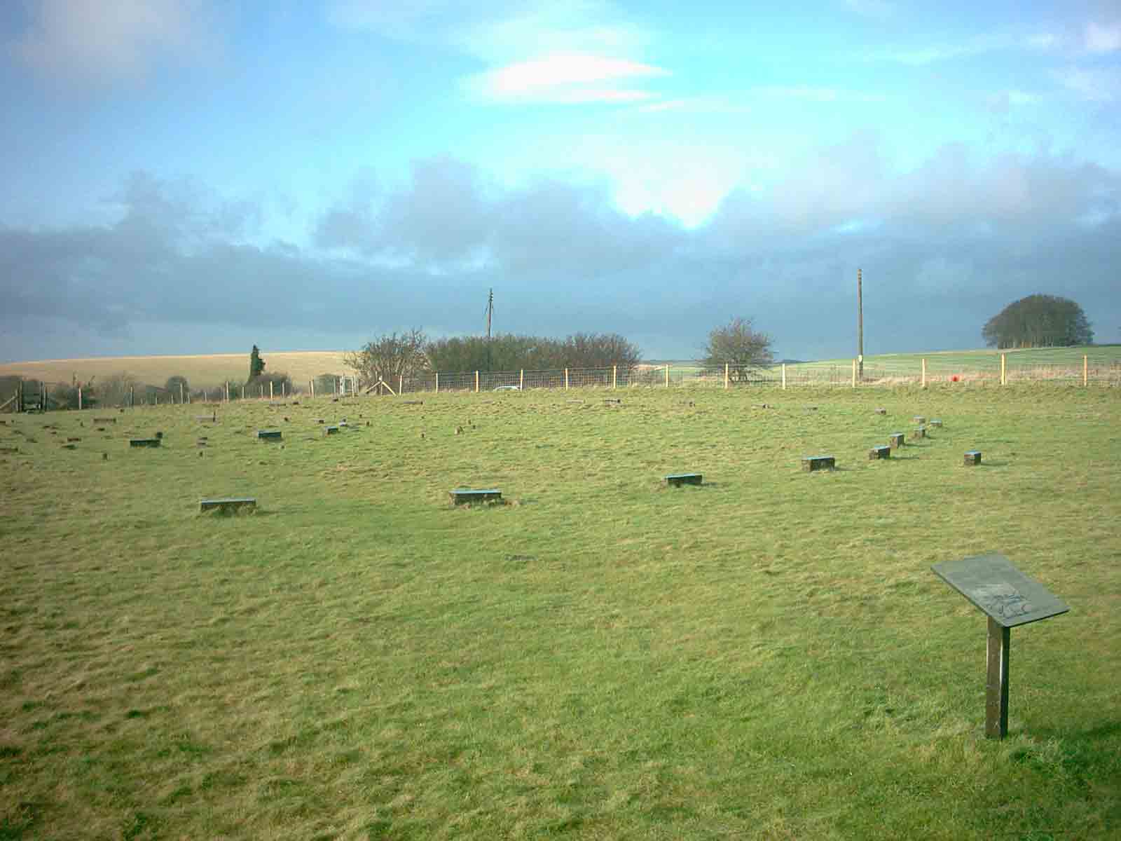
The Sanctuary

The Sanctuary was a stone and timber circle near the village of Avebury in the south-western English county of Wiltshire. Excavation has revealed the location...

West Kennet Long Barrow

The West Kennet Long Barrow, also known as South Long Barrow, is a chambered long barrow near the village of Avebury in the south-western English county...

Nearby Amenities

Located within 500m of 51.3992,-1.834256
East Kennett Long Barrow
Archaeological Site: megalith
Historic: archaeological_site
Megalith Type: long_barrow
Wikidata: Q17670550
Lat/Long: 51.4006157/-1.8342199
Power: pole
Source: Bing
Lat/Long: 51.3972931/-1.8278773
The data included in this document is from www.openstreetmap.org. The data is made available under ODbL.

Have you been to East Kennett?

Leave your review of East Kennett below (or comments, questions and feedback).