Earith

Civil Parish in Huntingdonshire Huntingdonshire

England

Earith

Counterwash and Sutton Fen Looking down from the bank of the Ouse Washes.
Counterwash and Sutton Fen Credit: Hugh Venables

Earith is a civil parish located in the district of Huntingdonshire, Cambridgeshire, England. Situated on the eastern bank of the River Great Ouse, it lies approximately 13 miles northeast of Huntingdon and 6 miles south of the market town of St Ives. The parish covers an area of around 6 square miles.

Earith's history dates back to Roman times, with evidence of settlements and pottery found in the area. In medieval times, the village flourished as a trading center due to its proximity to the river, which allowed for transportation of goods. The name "Earith" is believed to derive from the Old English word "eorth," meaning earth or land.

The village is home to a population of around 2,000 residents. It offers a range of amenities and services, including a primary school, a village hall, a post office, a convenience store, and several pubs. The local community is active and organizes various events throughout the year, including a summer carnival and a Christmas market.

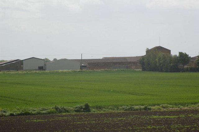
Earith is known for its stunning natural beauty, with the River Great Ouse and the surrounding Fenland providing picturesque views and opportunities for outdoor activities such as boating, fishing, and bird-watching. The area is also home to the RSPB Fen Drayton Lakes, a nature reserve offering habitats for a diverse range of wildlife.

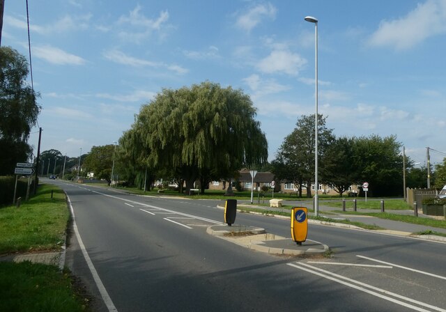
Transport links in Earith are well-connected, with regular bus services to nearby towns and villages, as well as easy access to major roads like the A1123 and A14. The village offers a peaceful and idyllic rural lifestyle, making it an attractive place to live for those seeking a quiet retreat with natural surroundings.

If you have any feedback on the listing, please let us know in the comments section below.
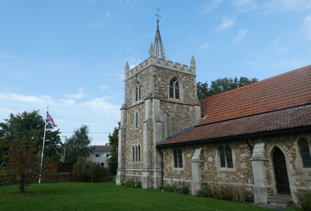
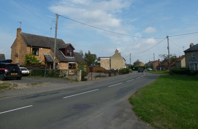
Earith Images

Images are sourced within 2km of 52.360893/0.032896 or Grid Reference TL3875. Thanks to Geograph Open Source API. All images are credited.

Counterwash and Sutton Fen Looking down from the bank of the Ouse Washes.
Counterwash and Sutton Fen
Looking down from the bank of the Ouse Washes.
Flooded hedgerow This amount of water on the washes in May means many ground nesting birds can't breed, often having their nest inundated. It is unfortunately getting more common.
Flooded hedgerow
This amount of water on the washes in May means many ground nesting birds can't breed, often having their nest inundated. It is unfortunately getting more common.
Belt of trees near Hermitage Farm, Earith
Bales of wheat straw, Sutton, Cambs beside the B1381 road and Hundred Foot Bank from Sutton to Earith.
Bales of wheat straw, Sutton, Cambs
beside the B1381 road and Hundred Foot Bank from Sutton to Earith.
Hermitage Farm
Hermitage Farm
Excavator on river bank RB22 on the bank of the Hundred Foot river.
Excavator on river bank
RB22 on the bank of the Hundred Foot river.
From the bank of The Ouse Washes near Earith A row of trees near Hermitage Farm
From the bank of The Ouse Washes near Earith
A row of trees near Hermitage Farm
Flood protection bank - The Ouse Washes near Earith ...
Flood protection bank - The Ouse Washes near Earith
...
Cold and grey - The Ouse Washes near Earith ...
Cold and grey - The Ouse Washes near Earith
...
A strip of land - The Ouse Washes near Earith ...
A strip of land - The Ouse Washes near Earith
...
The Bulwark in flood - The Ouse Washes near Earith ...
The Bulwark in flood - The Ouse Washes near Earith
...
Flood gate ? - The Ouse Washes near Earith ...
Flood gate ? - The Ouse Washes near Earith
...
Hermitage Farm From Upper Delph Grove.
Hermitage Farm
From Upper Delph Grove.
St Mary, Bluntisham: late September 2021
Approaching the junction of the A1123 with Holliday's Road
Village sign, Colne
Village sign, Colne
St Helen, Colne: late September 2021
Looking north-east along the High Street
Show me another place!

Earith is located at Grid Ref: TL3875 (Lat: 52.360893, Lng: 0.032896)

Administrative County: Cambridgeshire

District: Huntingdonshire

Police Authority: Cambridgeshire

What 3 Words

///trackers.improving.unlisted. Near Earith, Cambridgeshire

Nearby Locations

Earith The Meadows

Related Wikis

Old Bedford River

The Old Bedford River is an artificial, partial diversion of the waters of the River Great Ouse in the Fens of Cambridgeshire, England. It was named after...

Berry Fen

Berry Fen is a 15.3-hectare (38-acre) biological Site of Special Scientific Interest on the western outskirts of Earith in Cambridgeshire.This neutral...

Earith Bridge railway station

Earith Bridge railway station was a station in Earith, Cambridgeshire on the Ely and St Ives Railway. It was closed to regular passenger trains in 1931...
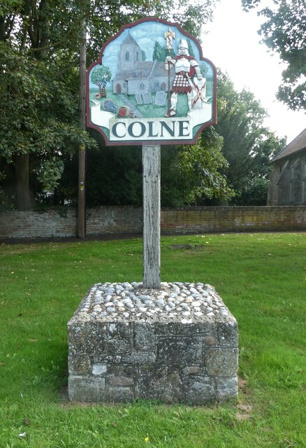
Earith

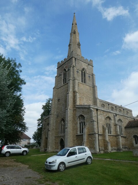
Earith is a village and civil parish in Cambridgeshire, England. Lying approximately 10 miles (16 km) east of Huntingdon, Earith is situated within Huntingdonshire...

Nearby Amenities

Located within 500m of 52.360893,0.032896
Earith
Place: village
Lat/Long: 52.3566155/0.0321921
Turning Circle
Lat/Long: 52.3575151/0.0363766
Turning Circle
Lat/Long: 52.3573362/0.0349245
Bus Stop
Parrens Road
Bus: yes
Naptan AtcoCode: 0500HEARI002
Naptan Bearing: W
Naptan BusStopType: CUS
Naptan CommonName: Parrens Road
Naptan Indicator: opp No 1
Naptan Landmark: Parrens Road
Naptan NaptanCode: cmbdmwgd
Naptan ShortCommonName: Parrens Road
Naptan Street: Parrens Road
Naptan Verified: no
Public Transport: platform
Source: naptan_import
Lat/Long: 52.358514/0.0370433
Bus Stop
Greenfields
Bus: yes
Naptan AtcoCode: 0500HEARI008
Naptan Bearing: S
Naptan BusStopType: CUS
Naptan CommonName: Greenfields
Naptan Indicator: opp No 146
Naptan Landmark: Greenfields
Naptan NaptanCode: cmbdmwja
Naptan ShortCommonName: Greenfields
Naptan Street: Greenfields
Naptan Verified: no
Public Transport: platform
Source: naptan_import
Lat/Long: 52.357776/0.0329119
Bus Stop
Greenfields
Bus: yes
Naptan AtcoCode: 0500HEARI009
Naptan Bearing: N
Naptan CommonName: Greenfields
Naptan Indicator: o/s No 146
Naptan Landmark: Greenfields
Naptan NaptanCode: cmbdmwjd
Naptan ShortCommonName: Greenfields
Naptan Street: Greenfields
Naptan Verified: no
Public Transport: platform
Source: naptan_import
Lat/Long: 52.3577687/0.0328087
Bus Stop
Parrens Road
Bus: yes
Naptan AtcoCode: 0500HEARI011
Naptan Bearing: E
Naptan CommonName: Parrens Road
Naptan Indicator: o/s No 1
Naptan Landmark: Parrens Road
Naptan NaptanCode: cmbdmwjm
Naptan ShortCommonName: Parrens Road
Naptan Street: Parrens Road
Naptan Verified: no
Public Transport: platform
Source: naptan_import
Lat/Long: 52.3585949/0.037047
Post Box
Brand: Royal Mail
Brand Wikidata: Q638098
Brand Wikipedia: en:Royal Mail
Collection Times: Mo-Fr 09:00; Sa 07:00
Operator: Royal Mail
Operator Wikidata: Q638098
Post Box Type: lamp
Ref: PE28 108D
Royal Cypher: EIIR
Royal Cypher Wikidata: Q33102113
Lat/Long: 52.3574706/0.032907
Turning Circle
Lat/Long: 52.3582107/0.0338259
Long Island Lake Caravan Site
Leisure: fishing
Lat/Long: 52.3605229/0.0382972
Power: pole
Lat/Long: 52.3630364/0.0276857
Power: pole
Lat/Long: 52.3646612/0.0290885
Power: pole
Lat/Long: 52.3633641/0.0286808
Power: pole
Lat/Long: 52.3639996/0.0288685
Power: pole
Lat/Long: 52.3626957/0.026712
Addr City: Earith
Addr Housenumber: 109
Addr Postcode: PE28 3QZ
Addr Street: Greenfields
Lat/Long: 52.3568351/0.033563
The data included in this document is from www.openstreetmap.org. The data is made available under ODbL.

Have you been to Earith?

Leave your review of Earith below (or comments, questions and feedback).