Dunton

Civil Parish in Bedfordshire

England

Dunton

Parish church, Dunton, Beds View from Chapel St from the south; dedicated to St Mary Magdalene, the stone building is in the Early English, Decorated and Perpendicular styles, consisting of chancel, nave of four bays, aisles, and an embattled western tower, containing 5 bells (hung in 1887 in commemoration of the jubilee of Queen Victoria), and south porch.
Parish church, Dunton, Beds Credit: Rodney Burton

Dunton is a civil parish located in the county of Bedfordshire, England. Situated approximately 8 miles south of Bedford and 10 miles northeast of Luton, Dunton covers an area of about 7 square miles. The parish is nestled in a rural setting, surrounded by picturesque countryside and farmland.

Dunton has a small population, with around 350 residents. The village itself is characterized by its charming and idyllic atmosphere, with a mix of traditional thatched cottages, historic buildings, and more modern houses. The heart of the village is centered around a small green, which serves as a focal point for community gatherings and events.

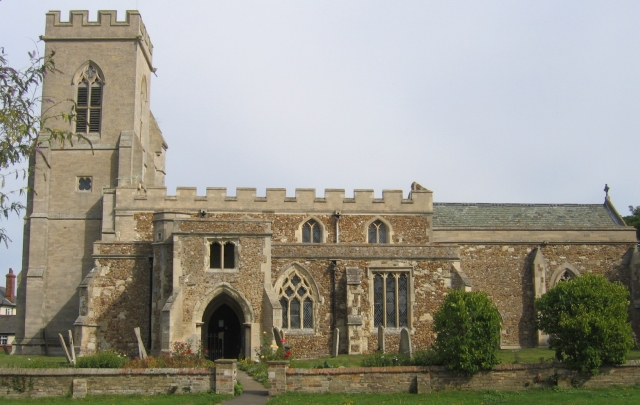
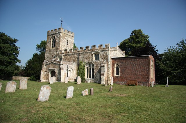
The parish also boasts a beautiful 13th-century parish church, St. Mary Magdalene, which stands as a testament to the village's rich history. The church features stunning architectural details and is a popular spot for visitors and locals alike.

Despite its small size, Dunton has a strong sense of community spirit, with various local organizations and clubs catering to the needs and interests of its residents. The village offers a range of amenities, including a primary school, a village hall, and a pub, providing essential services and a gathering place for locals.

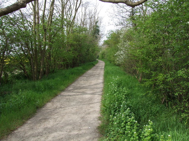
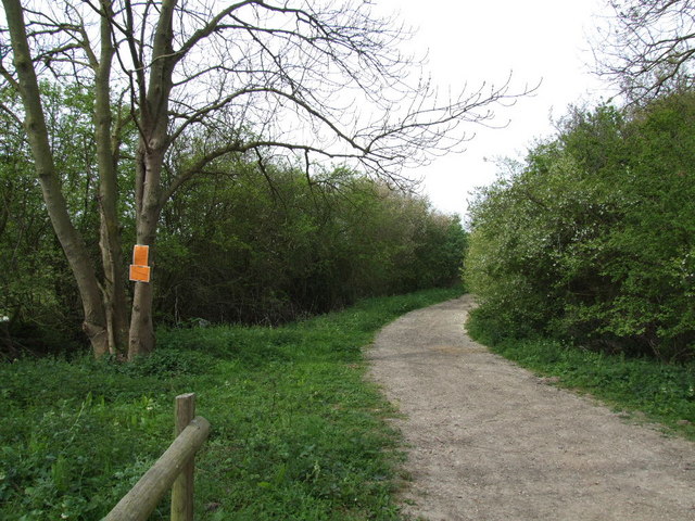
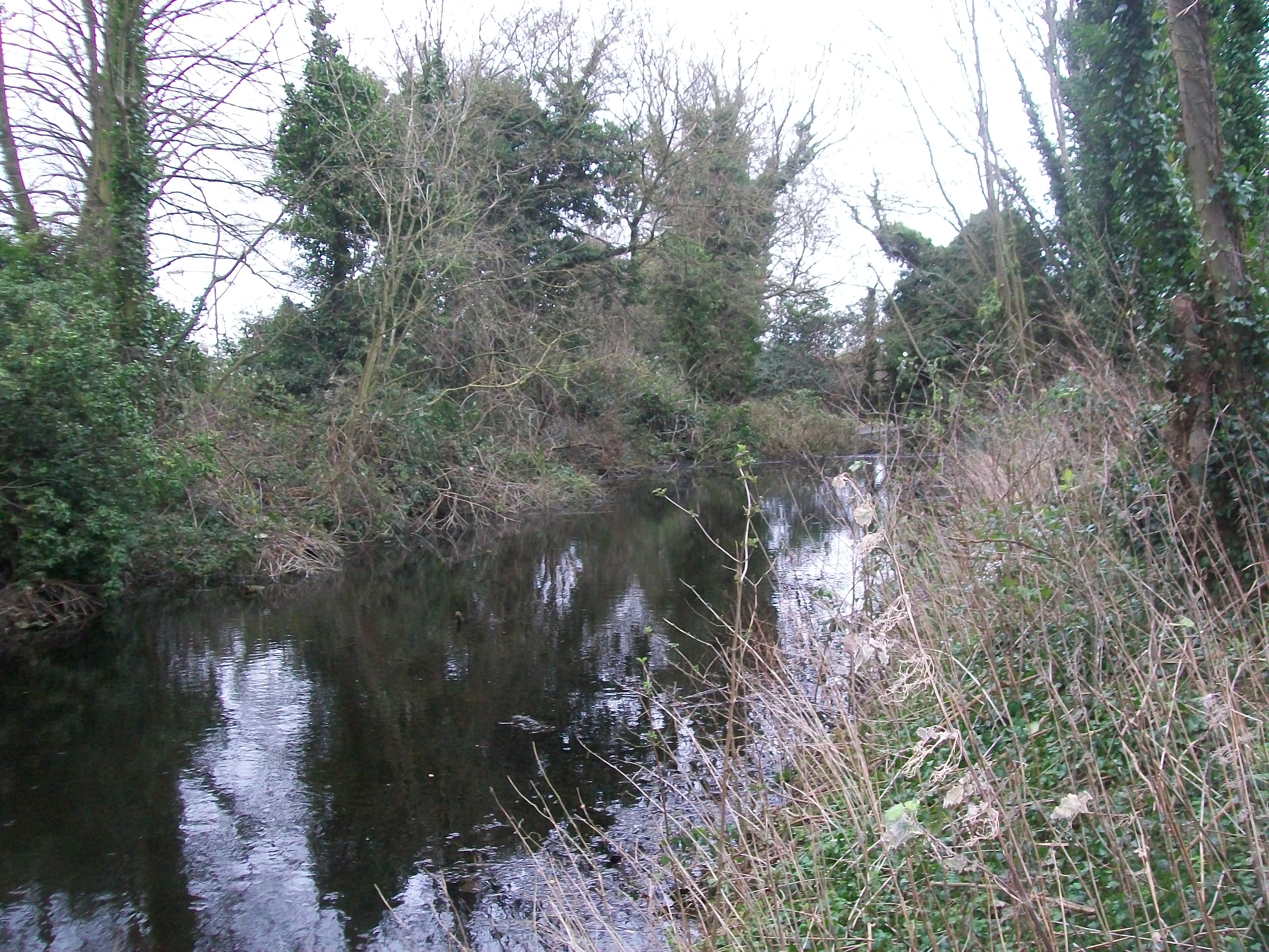
Dunton's countryside location makes it an ideal spot for outdoor activities, such as walking, cycling, and horse riding, with numerous footpaths and bridleways crisscrossing the area. Additionally, the parish is well-connected to surrounding towns and cities via road and public transport links, facilitating easy access to amenities and employment opportunities in the wider region.

If you have any feedback on the listing, please let us know in the comments section below.

Dunton Images

Images are sourced within 2km of 52.077528/-0.194474 or Grid Reference TL2343. Thanks to Geograph Open Source API. All images are credited.

Parish church, Dunton, Beds View from Chapel St from the south; dedicated to St Mary Magdalene, the stone building is in the Early English, Decorated and Perpendicular styles, consisting of chancel, nave of four bays, aisles, and an embattled western tower, containing 5 bells (hung in 1887 in commemoration of the jubilee of Queen Victoria), and south porch.
Parish church, Dunton, Beds
View from Chapel St from the south; dedicated to St Mary Magdalene, the stone building is in the Early English, Decorated and Perpendicular styles, consisting of chancel, nave of four bays, aisles, and an embattled western tower, containing 5 bells (hung in 1887 in commemoration of the jubilee of Queen Victoria), and south porch.
Village sign, Dunton, Beds
Pylons and farmland east of Biggleswade, Beds A square most notable, perhaps, by being crossed by pylons; view NW towards the Greensand ridge at Sandy Warren from Dunton Road, Biggleswade.
Pylons and farmland east of Biggleswade, Beds
A square most notable, perhaps, by being crossed by pylons; view NW towards the Greensand ridge at Sandy Warren from Dunton Road, Biggleswade.
Farmland and pylons east of Biggleswade, Beds View from the NE corner of the square across farmland with pylons.
Farmland and pylons east of Biggleswade, Beds
View from the NE corner of the square across farmland with pylons.
Farmland east of Biggleswade, Beds Cultivated land with a 2-metre buffer strip.
Farmland east of Biggleswade, Beds
Cultivated land with a 2-metre buffer strip.
Newton, Dunton, Beds View N from the Biggleswade Road, Dunton, towards Newton and Newton Grove.
Newton, Dunton, Beds
View N from the Biggleswade Road, Dunton, towards Newton and Newton Grove.
Dunton Water Works, Beds
Farmland, Millow, Dunton, Beds SW of Millow with long, gentle slopes around the Chalky Boulder Clay plateau
Farmland, Millow, Dunton, Beds
SW of Millow with long, gentle slopes around the Chalky Boulder Clay plateau
Fly-tipping, Dunton, Beds – beside the Sutton–Dunton road.
Fly-tipping, Dunton, Beds
– beside the Sutton–Dunton road.
Cyclists on a road near Eyeworth Lodge Farm
Cyclists and an impatient car driver depart.
Track near Eyeworth Lodge Farm
"Green Lane" a green lane
Lane closed ahead.
Lane closed ahead.
Approaching Dunton on the path from Millowbury Farm
Bridle road through the glade Bridle path from Millow Hall Farm to Dunton Lodge Farm.
Bridle road through the glade
Bridle path from Millow Hall Farm to Dunton Lodge Farm.
Ditch and Hedge south-east of Dunton The ditch runs northwards from the derelict barn on the path between Millow Hall and Dunton Lodge.
Ditch and Hedge south-east of Dunton
The ditch runs northwards from the derelict barn on the path between Millow Hall and Dunton Lodge.
Show me another place!

Dunton is located at Grid Ref: TL2343 (Lat: 52.077528, Lng: -0.194474)

Unitary Authority: Central Bedfordshire

Police Authority: Bedfordshire

What 3 Words

///iron.passion.upstarts. Near Edworth, Bedfordshire

Nearby Locations

Millow Dunton

Related Wikis

Dunton, Bedfordshire

Dunton is a village and civil parish in the Central Bedfordshire district of the county of Bedfordshire, England; about 12 miles (19 km) east south-east...
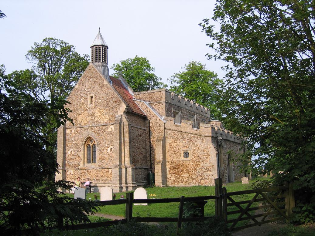
Eyeworth

Eyeworth (also Eyworth) is a small, rural village and civil parish in the Central Bedfordshire district of the county of Bedfordshire, England; about 12...

Stratton Park Moated Enclosure

Stratton Park Moated Enclosure (locally known as and sometimes informally referred to as Stratton Moat, also sometimes referred to as Stratton Park Moated...

Hinxworth

Hinxworth is a village and civil parish in North Hertfordshire, England. It sits just off the Great North Road between Baldock and Biggleswade. It has...

Nearby Amenities

Located within 500m of 52.077528,-0.194474
Power: pole
Lat/Long: 52.0778305/-0.1971632
Power: pole
Lat/Long: 52.0802047/-0.1987651
Power: pole
Lat/Long: 52.07864/-0.1993884
Power: pole
Lat/Long: 52.0782296/-0.1982608
Power: pole
Lat/Long: 52.0776878/-0.1960667
Power: pole
Lat/Long: 52.0794266/-0.1990702
Power: pole
Lat/Long: 52.0789003/-0.2004102
Power: pole
Lat/Long: 52.0756394/-0.1979797
Power: pole
Lat/Long: 52.0766827/-0.1969752
Direction: 120
Generator Method: photovoltaic
Generator Output Electricity: yes
Generator Solar Modules: 6
Generator Source: solar
Generator Type: solar_photovoltaic_panel
Location: roof
Power: generator
Lat/Long: 52.0812342/-0.196068
Direction: 205
Generator Method: photovoltaic
Generator Output Electricity: yes
Generator Solar Modules: 10
Generator Source: solar
Generator Type: solar_photovoltaic_panel
Location: roof
Power: generator
Lat/Long: 52.081237/-0.1959954
The data included in this document is from www.openstreetmap.org. The data is made available under ODbL.

Have you been to Dunton?

Leave your review of Dunton below (or comments, questions and feedback).