Dogdyke

Civil Parish in Lincolnshire North Kesteven

England

Dogdyke

The Packet Inn, Dogdyke Dogdyke was once a more important place than it is now. This was at the southern end of the Horncastle Canal where it joined the River Witham and there used to be a railway station on the now closed Boston to Lincoln line. There was also a ferry across the River Witham. Today the Packet Inn, built in 1924, survives.
The Packet Inn, Dogdyke Credit: Stephen McKay

Dogdyke is a small civil parish located in the county of Lincolnshire, in the East Midlands region of England. Situated approximately 5 miles east of the town of Coningsby, it is nestled in the rural countryside near the River Witham.

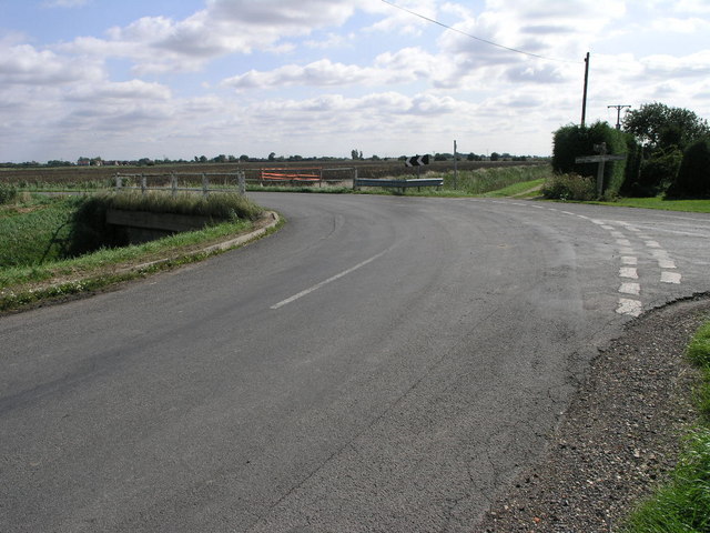
The parish covers an area of around 1.5 square miles and is home to a population of just over 100 residents. It is primarily an agricultural area, with vast stretches of farmland dominating the landscape. The fertile soil and favorable climate make it ideal for cultivation, and crops such as wheat, barley, and oilseed rape are commonly grown here.

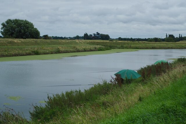
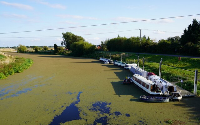
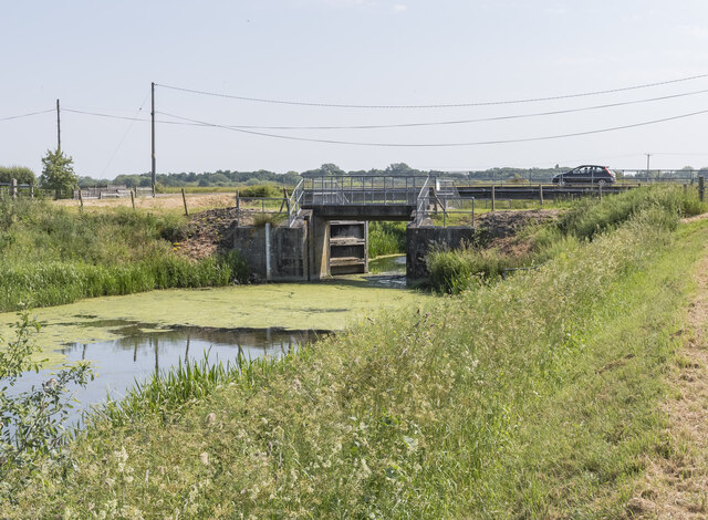
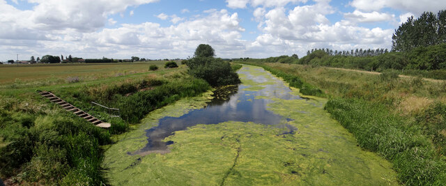
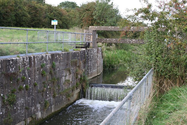
Despite its small size, Dogdyke is notable for its connection to the river. The River Witham flows through the parish, providing a picturesque setting for boating and fishing enthusiasts. The nearby Dogdyke Steam Drainage Station, a historic pumping station built in the early 19th century, is a popular attraction for visitors interested in the area's industrial heritage.

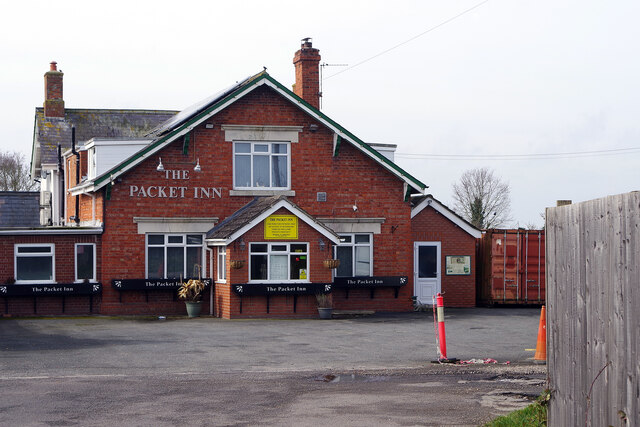
The parish is also home to a few scattered residential properties, some of which are historic buildings dating back to the 18th and 19th centuries. The village lacks significant amenities, such as shops or schools, with residents typically relying on nearby towns for their daily needs.

Overall, Dogdyke is a tranquil and rural community, offering a peaceful environment for those seeking a retreat from the hustle and bustle of city life. Its idyllic countryside setting and proximity to the River Witham make it an attractive location for nature lovers and outdoor enthusiasts.

If you have any feedback on the listing, please let us know in the comments section below.

Dogdyke Images

Images are sourced within 2km of 53.088183/-0.222799 or Grid Reference TF1956. Thanks to Geograph Open Source API. All images are credited.

The Packet Inn, Dogdyke Dogdyke was once a more important place than it is now. This was at the southern end of the Horncastle Canal where it joined the River Witham and there used to be a railway station on the now closed Boston to Lincoln line. There was also a ferry across the River Witham. Today the Packet Inn, built in 1924, survives.
The Packet Inn, Dogdyke
Dogdyke was once a more important place than it is now. This was at the southern end of the Horncastle Canal where it joined the River Witham and there used to be a railway station on the now closed Boston to Lincoln line. There was also a ferry across the River Witham. Today the Packet Inn, built in 1924, survives.
Under the new Tattashall Bridge Carrying the A153 over the River Witham.
Under the new Tattashall Bridge
Carrying the A153 over the River Witham.
The Water Rail Way Passes under the new Tattershall Bridge.  This cycle route forms part of the National Cycle Network Route 1.
The Water Rail Way
Passes under the new Tattershall Bridge. This cycle route forms part of the National Cycle Network Route 1.
Fishers on The River Witham
Choked The algae blooming on the surface of the River Witham at Tattershall Bridge makes the river look like a roadway rather than a waterway.
Choked
The algae blooming on the surface of the River Witham at Tattershall Bridge makes the river look like a roadway rather than a waterway.
Soilmarks on a field on Billinghay Hurn: aerial 2022 Trace of a rodden/former waterway.
Soilmarks on a field on Billinghay Hurn: aerial 2022
Trace of a rodden/former waterway.
Billinghay Skirth Pointing Doors Otherwise known as Tidal Doors.
Gates tend to remain in the position to which they were last pushed by the flow, and may remain open after water levels have equalised.
The gates will shut when the tide flows in.
Billinghay Skirth Pointing Doors
Otherwise known as Tidal Doors. Gates tend to remain in the position to which they were last pushed by the flow, and may remain open after water levels have equalised. The gates will shut when the tide flows in.
Billinghay Skirth The Skirth is navigable by small boats up to Billinghay.
Billinghay Skirth
The Skirth is navigable by small boats up to Billinghay.
Electricity poles and cables Here crossing Billinghay Skirth.
Electricity poles and cables
Here crossing Billinghay Skirth.
Billinghay Skirth choked View from the walkway above the pointing doors.  It's not just small drains that get weeded over, the main waterway 'behind', namely the River Witham, can also get choked <a href="https://www.geograph.org.uk/photo/6968649">TF1956 : Choked</a>.
Billinghay Skirth choked
View from the walkway above the pointing doors. It's not just small drains that get weeded over, the main waterway 'behind', namely the River Witham, can also get choked TF1956 : Choked.
Old Milestone by A153, Tattershall Bridge The Milestone is located by the road.  Parish of Tattershall (East Lindsey District). Carved stone post,  design, erected in the 19th Century. An earlier photograph can be found here: <a title="https://www.geograph.org.uk/photo/968516" href="https://www.geograph.org.uk/photo/968516">Link</a> 

Inscription reads:-  
SLEAFORD / 12  : : TATER / SHALL / 2  

Milestone Society National ID: LI_SFTS12
Old Milestone by A153, Tattershall Bridge
The Milestone is located by the road.  Parish of Tattershall (East Lindsey District). Carved stone post, design, erected in the 19th Century. An earlier photograph can be found here: Link  Inscription reads:- SLEAFORD / 12 : : TATER / SHALL / 2 Milestone Society National ID: LI_SFTS12
Tattershall Bridge Looking southeast
Tattershall Bridge
Looking southeast
Greenhouses and Shed These farm building stand at the junction of the A153 and the drain in the foreground, the road runs just beyond the second greenhouse.
Greenhouses and Shed
These farm building stand at the junction of the A153 and the drain in the foreground, the road runs just beyond the second greenhouse.
Deep and Narrow This land drain and the pylons are the only man-made things in this square.
Deep and Narrow
This land drain and the pylons are the only man-made things in this square.
Drain and Junction This road takes a sharp left turn to cross the drain over this bridge.
Drain and Junction
This road takes a sharp left turn to cross the drain over this bridge.
River Witham Looking south at Tattershall Bridge
River Witham
Looking south at Tattershall Bridge
Old Tattershall Bridge The main road now crosses the River Witham via a new bridge, the old bridge only carries pedestrians today.
Old Tattershall Bridge
The main road now crosses the River Witham via a new bridge, the old bridge only carries pedestrians today.
Walcott Dales Fenland adjacent to the River Witham. The village of Walcott is several miles distant.
Walcott Dales
Fenland adjacent to the River Witham. The village of Walcott is several miles distant.
Show me another place!

Dogdyke is located at Grid Ref: TF1956 (Lat: 53.088183, Lng: -0.222799)

Administrative County: Lincolnshire

District: North Kesteven

Police Authority: Lincolnshire

What 3 Words

///applauded.wanting.ramble. Near Coningsby, Lincolnshire

Nearby Locations

Dogdyke Tattershall Bridge

Related Wikis

Witham First District IDB

Witham First District IDB is an English internal drainage board which was set up under the terms of the Land Drainage Act 1930. The Board inherited the...

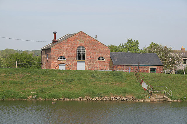
Dogdyke Pumping Station

The Dogdyke Engine is a drainage engine near Tattershall, Lincolnshire, in England. The drainage of 2,500 acres (1,012 ha) of land around Tattershall...

Tattershall railway station

Tattershall railway station was a station in Tattershall, Lincolnshire. It was closed in 1963. It is now an art gallery. == References == == External... ==

River Bain

The River Bain is a river in Lincolnshire, England, and a tributary of the River Witham.The Bain rises in the Lincolnshire Wolds at Ludford, a village...

Nearby Amenities

Located within 500m of 53.088183,-0.222799
Source: OS_OpenData _StreetView
Lat/Long: 53.0884423/-0.2188743
Source: OS_OpenData _StreetView
Lat/Long: 53.0891203/-0.2175993
Tattershall Bridge
Is In: Lincolnshire, England, UK
Place: hamlet
Source: Bing
Lat/Long: 53.0899385/-0.2160443
Bus Stop
Elizabeth Avenue
Naptan AtcoCode: 270000009246
Naptan Bearing: SW
Naptan CommonName: Elizabeth Avenue
Naptan Indicator: opp
Naptan Landmark: Elizabeth Avenue
Naptan NaptanCode: linjajmd
Naptan Street: A153
Naptan Verified: no
Source: OS_OpenData _StreetView
Lat/Long: 53.0879032/-0.2203513
Bus Stop
Elizabeth Avenue
Naptan AtcoCode: 270000009247
Naptan Bearing: NE
Naptan CommonName: Elizabeth Avenue
Naptan Indicator: adj
Naptan Landmark: Elizabeth Avenue
Naptan NaptanCode: linjajmg
Naptan Street: A153
Naptan Verified: no
Source: OS_OpenData _StreetView
Lat/Long: 53.0880537/-0.2201958
Bus Stop
Royal Oak Inn
Naptan AtcoCode: 2700LTBR6112
Naptan Bearing: SW
Naptan CommonName: Royal Oak Inn
Naptan Indicator: adj
Naptan Landmark: Royal Oak Inn
Naptan NaptanCode: lingamdp
Naptan Street: Old Sleaford Road
Naptan Verified: no
Source: OS_OpenData _StreetView
Lat/Long: 53.0891798/-0.2161471
Power: pole
Source: Bing
Lat/Long: 53.0882929/-0.2160814
Power: pole
Source: Bing
Lat/Long: 53.088/-0.2170925
Power: pole
Source: Bing
Lat/Long: 53.0873948/-0.2248295
Power: pole
Source: Bing
Lat/Long: 53.0866385/-0.2242153
Power: pole
Source: Bing
Lat/Long: 53.0890073/-0.2261579
Power: pole
Lat/Long: 53.0862019/-0.2235534
Power: pole
Source: Bing
Lat/Long: 53.0864267/-0.2213131
Power: pole
Source: Bing
Lat/Long: 53.0843863/-0.22411
Power: pole
Source: Bing
Lat/Long: 53.0857364/-0.2202376
Power: pole
Source: Bing
Lat/Long: 53.0861189/-0.2270752
Power: pole
Lat/Long: 53.0861858/-0.2233529
Power: pole
Source: Bing
Lat/Long: 53.0874633/-0.2189501
Power: pole
Lat/Long: 53.08522/-0.2263999
Power: pole
Source: Bing
Lat/Long: 53.0871894/-0.2198728
Power: pole
Source: Bing
Lat/Long: 53.0852224/-0.2239041
Power: pole
Lat/Long: 53.0852085/-0.2223935
Power: pole
Source: Bing
Lat/Long: 53.0842086/-0.220868
Power: pole
Source: Bing
Lat/Long: 53.0868834/-0.2208585
Power: pole
Source: Bing
Lat/Long: 53.086396/-0.2295227
Power: pole
Lat/Long: 53.0866119/-0.2216001
Power: pole
Source: Bing
Lat/Long: 53.0861528/-0.2238894
Power: pole
Lat/Long: 53.0861149/-0.2236869
Power: pole
Lat/Long: 53.0856566/-0.2251044
Power: pole
Source: Bing
Lat/Long: 53.0858032/-0.225032
Power: pole
Source: Bing
Lat/Long: 53.0866361/-0.2217785
Power: pole
Source: Bing
Lat/Long: 53.0877411/-0.2180026
Power: pole
Lat/Long: 53.0860811/-0.2237781
Power: pole
Source: Bing
Lat/Long: 53.0899255/-0.2269108
Power: pole
Source: Bing
Lat/Long: 53.0911223/-0.2278946
Power: pole
Source: Bing
Lat/Long: 53.0909894/-0.2174045
Power: pole
Source: Bing
Lat/Long: 53.0906721/-0.2184177
Power: pole
Source: Bing
Lat/Long: 53.0899883/-0.220542
Power: pole
Source: Bing
Lat/Long: 53.0903717/-0.2193263
Power: pole
Source: Bing
Lat/Long: 53.0895928/-0.2217544
Power: pole
Source: Bing
Lat/Long: 53.0885031/-0.223145
Power: pole
Source: Bing
Lat/Long: 53.0877871/-0.2234159
Power: pole
Source: Bing
Lat/Long: 53.0892222/-0.2228244
Power: pole
Lat/Long: 53.0870936/-0.2236707
Power: pole
Lat/Long: 53.0848083/-0.2277387
Power: pole
Source: Bing
Lat/Long: 53.0850001/-0.2191031
Power: pole
Lat/Long: 53.087564/-0.224173
Power: pole
Lat/Long: 53.0884534/-0.224896
Power: pole
Lat/Long: 53.0893425/-0.2256196
Power: pole
Lat/Long: 53.0902694/-0.2264251
Power: pole
Lat/Long: 53.0909762/-0.2270355
Power: pole
Lat/Long: 53.0917416/-0.2261299
Hope Cottage
Place: isolated_dwelling
Source: Bing
Lat/Long: 53.0864792/-0.2264605
Pub
The Royal Oak
Source: BIng
Lat/Long: 53.0892052/-0.2158806
Colour: red and white
Marker: aerial
Utility: gas
Lat/Long: 53.0855591/-0.2287444
The data included in this document is from www.openstreetmap.org. The data is made available under ODbL.

Have you been to Dogdyke?

Leave your review of Dogdyke below (or comments, questions and feedback).