Docking

Civil Parish in Norfolk King's Lynn and West Norfolk

England

Docking

The churchyard at Docking The lychgate <span class="nowrap"><a title="https://historicengland.org.uk/listing/the-list/list-entry/1152487?section=official-list-entry" rel="nofollow ugc noopener" href="https://historicengland.org.uk/listing/the-list/list-entry/1152487?section=official-list-entry">Link</a><img style="margin-left:2px;" alt="External link" title="External link - shift click to open in new window" src="https://s1.geograph.org.uk/img/external.png" width="10" height="10"/></span> dates from about 1875 and was probably designed by Frederick Preedy <span class="nowrap"><a title="https://en.wikipedia.org/wiki/Frederick_Preedy" rel="nofollow ugc noopener" href="https://en.wikipedia.org/wiki/Frederick_Preedy">Link</a><img style="margin-left:2px;" alt="External link" title="External link - shift click to open in new window" src="https://s1.geograph.org.uk/img/external.png" width="10" height="10"/></span>
The churchyard at Docking Credit: Jonathan Thacker

Docking is a civil parish located in the county of Norfolk, England. It is situated approximately 14 miles north of the town of King's Lynn and 30 miles northwest of the city of Norwich. The parish covers an area of around 11 square miles and has a population of around 1,200 people.

Docking is a rural village with a rich history dating back to the Anglo-Saxon period. It is mentioned in the Domesday Book of 1086, where it is referred to as "Dochinge." The village grew as an agricultural center, with farming being the primary occupation for many of its residents.

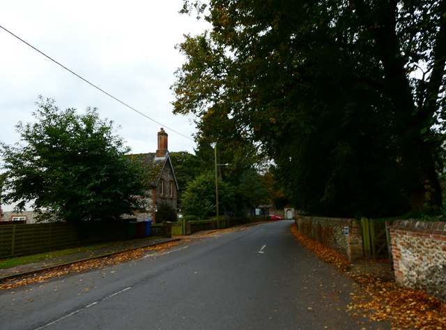
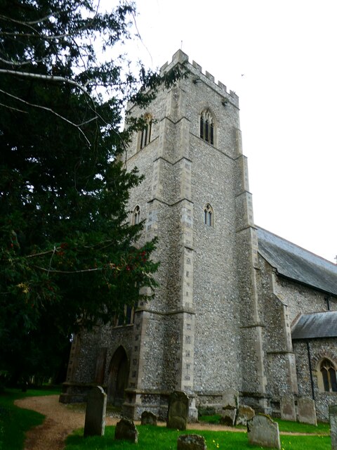
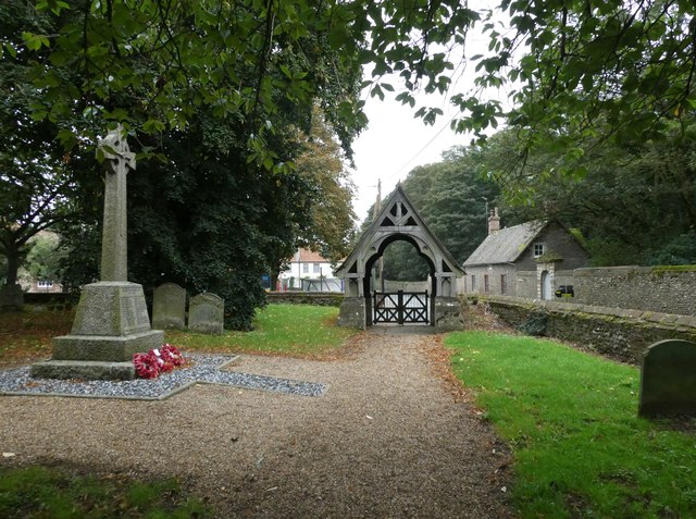
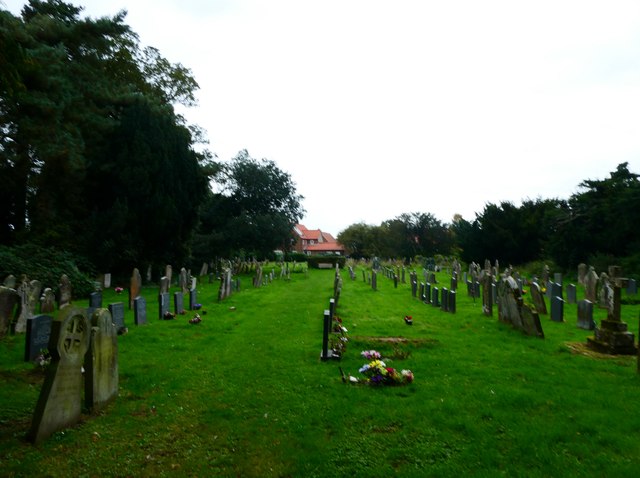
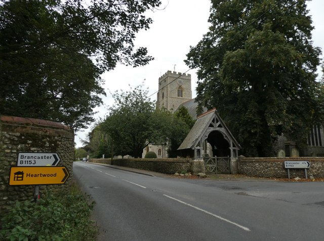
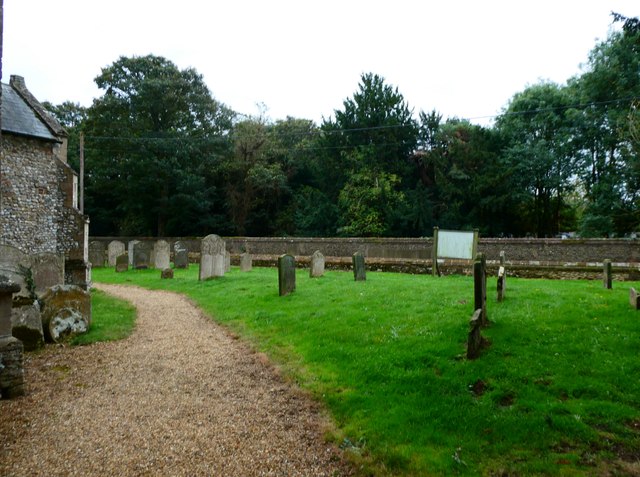
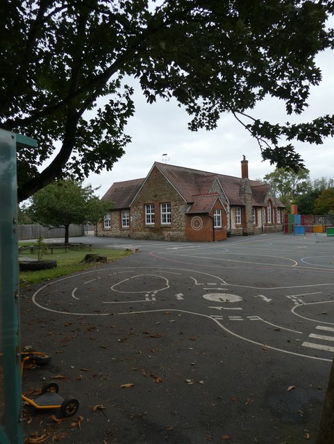
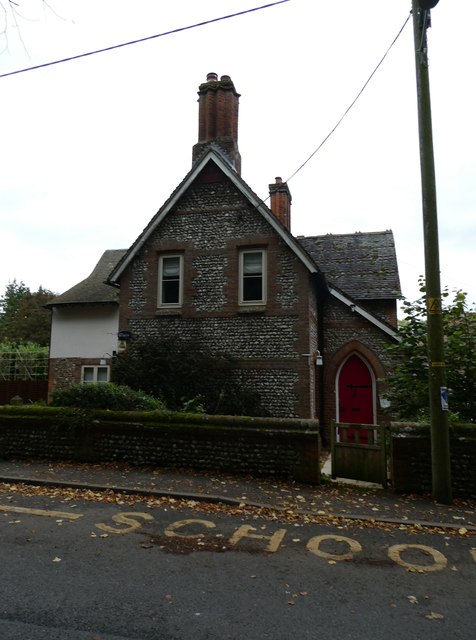
Today, Docking is a charming village that offers a range of amenities and services to its residents and visitors. It has a primary school, a village hall, and a church, St. Mary the Virgin, which dates back to the 14th century. The village also has a pub, a convenience store, and a post office, providing essential services to the local community.

The surrounding countryside of Docking offers picturesque landscapes and is popular among nature enthusiasts. The village is surrounded by fields and farmland, making it an ideal location for walking, cycling, and birdwatching. The nearby coastline, including the popular tourist destination of Brancaster Beach, is within easy reach.

Overall, Docking is a peaceful and attractive village with a strong sense of community. Its historical significance, beautiful surroundings, and range of amenities make it an appealing place to live or visit for those seeking a tranquil rural setting in Norfolk.

If you have any feedback on the listing, please let us know in the comments section below.
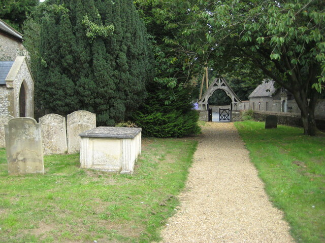
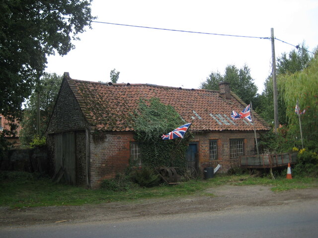
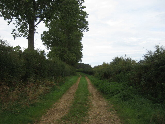
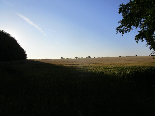
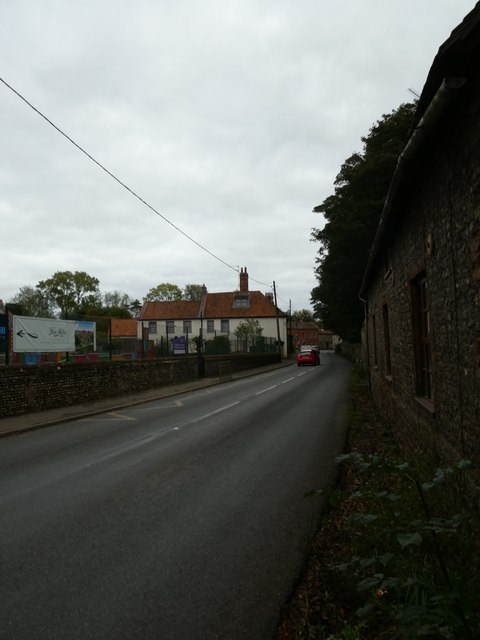
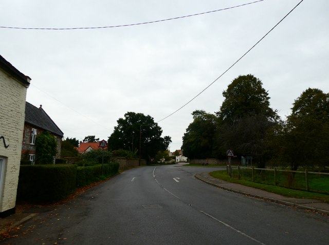
Docking Images

Images are sourced within 2km of 52.908358/0.630205 or Grid Reference TF7637. Thanks to Geograph Open Source API. All images are credited.

The churchyard at Docking The lychgate <span class="nowrap"><a title="https://historicengland.org.uk/listing/the-list/list-entry/1152487?section=official-list-entry" rel="nofollow ugc noopener" href="https://historicengland.org.uk/listing/the-list/list-entry/1152487?section=official-list-entry">Link</a><img style="margin-left:2px;" alt="External link" title="External link - shift click to open in new window" src="https://s1.geograph.org.uk/img/external.png" width="10" height="10"/></span> dates from about 1875 and was probably designed by Frederick Preedy <span class="nowrap"><a title="https://en.wikipedia.org/wiki/Frederick_Preedy" rel="nofollow ugc noopener" href="https://en.wikipedia.org/wiki/Frederick_Preedy">Link</a><img style="margin-left:2px;" alt="External link" title="External link - shift click to open in new window" src="https://s1.geograph.org.uk/img/external.png" width="10" height="10"/></span>
The churchyard at Docking
The lychgate LinkExternal link dates from about 1875 and was probably designed by Frederick Preedy LinkExternal link
Former smithy, Docking
Farm track, Docking
Farm track, Docking
Wheat field near Docking in early morning light
Looking southwards in Church Place towards Chequers Street
St Mary, Docking: tower
St Mary, Docking: path
St Mary, Docking: the churchyard at twilight
Looking eastwards along Chequers Street
Looking northwards along Church Place towards Well Street
St Mary's seen from Chequers Street
St Mary, Docking: churchyard
Docking C of E Primary School: early October 2023
The Old School House, Docking
Docking War Memorial: 1914-1918 names
Docking War Memorial: 1939-1945 names
St Mary, Docking: looking out of the south door
St Mary, Docking: stained glass window (1) Intricate and colourful windows in churches and cathedrals greatly add to the ambience, although many early examples in England were smashed by the Puritans and replaced with plain glass. There was a huge revival in the 19th Century with many elaborate new stained glass windows created. The 20th century saw the development of new techniques, including Gemmail, which overlaps pieces of stained glass without using lead. New windows are still being commissioned today, while the oldest known ones are still in place within the Ancestors of Christ window on the south side of Canterbury Cathedral.
St Mary, Docking: stained glass window (1)
Intricate and colourful windows in churches and cathedrals greatly add to the ambience, although many early examples in England were smashed by the Puritans and replaced with plain glass. There was a huge revival in the 19th Century with many elaborate new stained glass windows created. The 20th century saw the development of new techniques, including Gemmail, which overlaps pieces of stained glass without using lead. New windows are still being commissioned today, while the oldest known ones are still in place within the Ancestors of Christ window on the south side of Canterbury Cathedral.
Show me another place!

Docking is located at Grid Ref: TF7637 (Lat: 52.908358, Lng: 0.630205)

Administrative County: Norfolk

District: King's Lynn and West Norfolk

Police Authority: Norfolk

What 3 Words

///videos.tight.trams. Near Snettisham, Norfolk

Nearby Locations

Docking

Related Wikis

Docking railway station

Docking railway station was a station in Norfolk, serving the village of Docking. It closed to passengers in 1952. == References ==

Docking, Norfolk

Docking is a village and ancient civil parish in the north-west of the English county of Norfolk. It is near the North Norfolk Coast Site of Special Scientific...

RAF Docking

Royal Air Force Docking or more simply RAF Docking is a former Royal Air Force satellite station a few miles from Bircham Newton in Norfolk, England....

Stanhoe railway station

Stanhoe was a railway station which served the village of Stanhoe in Norfolk, England. Opened by the West Norfolk Junction Railway in 1866, it closed to...

Stanhoe

Stanhoe is a village and civil parish in the English county of Norfolk, 6.4 miles (10.2 km) from the North Sea. It covers an area of 6.06 km2 (2.34 sq...

RAF Bircham Newton

Royal Air Force Bircham Newton or more simply RAF Bircham Newton is a former Royal Air Force station located 2.1 miles (3.4 km) south east of Docking,...

Choseley

Choseley is a tiny hamlet and civil parish in the English county of Norfolk. It is situated between the villages of Titchwell and Docking and about 4 kilometres...

Bircham Newton

Bircham Newton is the smallest of the three villages that make up the civil parish of Bircham, in the west of the English county of Norfolk. The village...

Nearby Amenities

Located within 500m of 52.908358,0.630205
Docking
Historic Railway: station
Railway: site
Source: OS 1:25k
Wikidata: Q5287222
Wikipedia: en:Docking railway station
Lat/Long: 52.9084529/0.6252386
Railway Inn, opp
Naptan AtcoCode: 2900D102
Naptan Bearing: S
Naptan BusStopType: CUS
Naptan CommonName: Railway Inn
Naptan Indicator: opp
Naptan Locality: Docking
Naptan NaptanCode: nfoamjaw
Naptan Street: Brancaster Road
Naptan Verified: no
Source: naptan_import
Lat/Long: 52.9081993/0.6247088
Give Way
Lat/Long: 52.9072043/0.624769
Post Box
Operator: Royal Mail
Operator Wikidata: Q638098
Post Box Mounting: wooden_post
Post Box Type: lamp
Ref: PE31 41
Lat/Long: 52.908625/0.6247716
Give Way
Lat/Long: 52.9074074/0.6249896
Give Way
Lat/Long: 52.9074141/0.624779
Addr City: King's Lynn
Addr Housenumber: 3
Addr Postcode: PE31 8FT
Addr Street: Wagg Courtyard
Lat/Long: 52.9071176/0.6253684
Addr City: King's Lynn
Addr Housenumber: 4
Addr Postcode: PE31 8FT
Addr Street: Wagg Courtyard
Lat/Long: 52.9070464/0.6253496
Addr City: King's Lynn
Addr Housenumber: 5
Addr Postcode: PE31 8FT
Addr Street: Wagg Courtyard
Lat/Long: 52.907006/0.6251752
Addr City: King's Lynn
Addr Housenumber: 1
Addr Postcode: PE31 8FT
Addr Street: Wagg Courtyard
Lat/Long: 52.9072381/0.6249821
Addr City: King's Lynn
Addr Housenumber: 6
Addr Postcode: PE31 8FT
Addr Street: Wagg Courtyard
Lat/Long: 52.907213/0.6250747
Addr City: King's Lynn
Addr Housenumber: 2
Addr Postcode: PE31 8FT
Addr Street: Wagg Courtyard
Lat/Long: 52.9071871/0.6251833
Addr City: King's Lynn
Addr Housenumber: 8
Addr Postcode: PE31 8FS
Addr Street: Bennett Mews
Lat/Long: 52.9070829/0.6256739
Addr City: King's Lynn
Addr Housenumber: 7
Addr Postcode: PE31 8FS
Addr Street: Bennett Mews
Lat/Long: 52.9070705/0.6257547
Addr City: King's Lynn
Addr Housenumber: 4
Addr Postcode: PE31 8FS
Addr Street: Bennett Mews
Lat/Long: 52.9072714/0.6258127
Addr City: King's Lynn
Addr Housenumber: 5
Addr Postcode: PE31 8FS
Addr Street: Bennett Mews
Lat/Long: 52.9072102/0.6257741
Addr City: King's Lynn
Addr Housenumber: 6
Addr Postcode: PE31 8FS
Addr Street: Bennett Mews
Lat/Long: 52.9071637/0.6257366
Addr City: King's Lynn
Addr Housenumber: 1
Addr Postcode: PE31 8FS
Addr Street: Bennett Mews
Lat/Long: 52.9073762/0.6252961
Addr City: King's Lynn
Addr Housenumber: 2
Addr Postcode: PE31 8FS
Addr Street: Bennett Mews
Lat/Long: 52.907358/0.6254047
Addr City: King's Lynn
Addr Housenumber: 3
Addr Postcode: PE31 8FS
Addr Street: Bennett Mews
Lat/Long: 52.907334/0.6255085
Addr City: King's Lynn
Addr Housenumber: 9
Addr Postcode: PE31 8FS
Addr Street: Bennett Mews
Lat/Long: 52.9072597/0.6251911
Material: wood
Power: pole
Lat/Long: 52.9058699/0.6251363
Material: wood
Power: pole
Lat/Long: 52.9050347/0.6252104
The data included in this document is from www.openstreetmap.org. The data is made available under ODbL.

Have you been to Docking?

Leave your review of Docking below (or comments, questions and feedback).