Dinnington St. John's

Civil Parish in Yorkshire Rotherham

England

Dinnington St. John's

Rubble and Church Lane
Rubble and Church Lane Credit: Jonathan Thacker

Dinnington St. John's is a civil parish located in the county of Yorkshire, England. Situated in the Rotherham district, it is a small but vibrant community with a population of around 9,000 people. The parish covers an area of approximately 6 square miles and is surrounded by picturesque countryside.

The history of Dinnington St. John's dates back to the medieval period, and the village is known for its rich heritage. It was primarily an agricultural area, but with the advent of coal mining in the 19th century, the village underwent significant changes. The mining industry became a prominent source of employment, leading to a rise in population and the development of infrastructure.

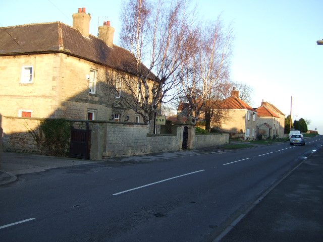
Today, Dinnington St. John's is a mix of residential, commercial, and industrial areas. The village center has a range of amenities, including shops, cafes, pubs, and community facilities. The local economy is diverse, with industries such as manufacturing, retail, and services contributing to employment opportunities.

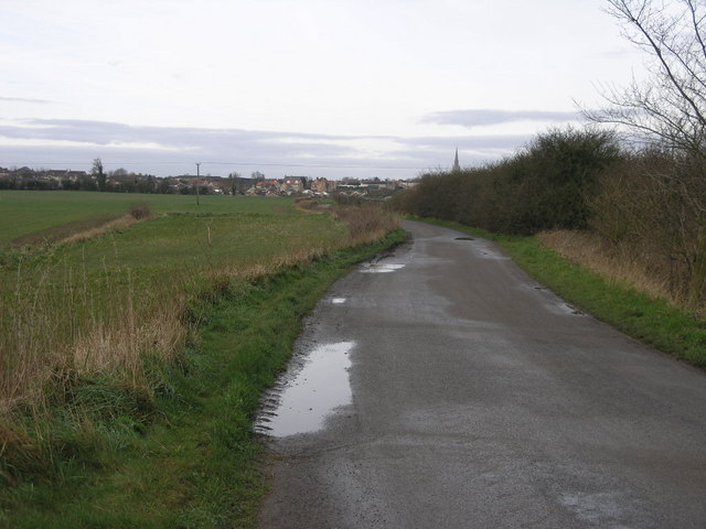
Nature lovers can enjoy the beautiful surrounding countryside, which offers scenic walks and outdoor activities. Dinnington St. John's is also home to several parks and green spaces, providing recreational areas for the residents.

The parish has a strong sense of community, with numerous local organizations, clubs, and events that bring people together. The village has a primary school and is well-connected to neighboring towns and cities through a reliable public transportation network.

Overall, Dinnington St. John's is a charming civil parish that combines history, natural beauty, and a close-knit community spirit.

If you have any feedback on the listing, please let us know in the comments section below.

Dinnington St. John's Images

Images are sourced within 2km of 53.37176/-1.200373 or Grid Reference SK5386. Thanks to Geograph Open Source API. All images are credited.

Rubble and Church Lane
Church Lane At this point does not follow the route marked on OS maps which would be in a curve to the left (north).
Church Lane
At this point does not follow the route marked on OS maps which would be in a curve to the left (north).
View towards the former colliery tip at Langold The colliery was always known as Firbeck Colliery,
View towards the former colliery tip at Langold
The colliery was always known as Firbeck Colliery,
Harrowed field and electricity line This area has been denuded of hedges and only a small area of scrub by a road junction remains.
Harrowed field and electricity line
This area has been denuded of hedges and only a small area of scrub by a road junction remains.
Footpath across a harrowed field
Bridleway to Firbeck Long Thwaite Wood in the background.
Bridleway to Firbeck
Long Thwaite Wood in the background.
Bridleway to Little Thwaite Wood Dropping down to the small valley of the Lamb Lane Dike.
Bridleway to Little Thwaite Wood
Dropping down to the small valley of the Lamb Lane Dike.
The Thwaite woods Little Thwaite Wood on the right, Long Thwaite Wood ahead.
The Thwaite woods
Little Thwaite Wood on the right, Long Thwaite Wood ahead.
Ordnance Survey Cut Mark This OS cut mark can be found on the west face of St John's Church. It marks a point 115.5741m above mean sea level.
Ordnance Survey Cut Mark
This OS cut mark can be found on the west face of St John's Church. It marks a point 115.5741m above mean sea level.
Woodsetts Road in North Anston
Bridleway and Crop Field Path running between a potato field on the left and the Butterfly House perimeter fence on the right.
Bridleway and Crop Field
Path running between a potato field on the left and the Butterfly House perimeter fence on the right.
Bridle Path and Crop Fields near Swinston  Hill Wood Pictured on a very warm afternoon in mid July. Swinston Hill Wood can be seen beyond the potato fields.
Bridle Path and Crop Fields near Swinston Hill Wood
Pictured on a very warm afternoon in mid July. Swinston Hill Wood can be seen beyond the potato fields.
Brand's Lane near Dinnington Pictured from a position close to White Walls Farm.
Brand's Lane near Dinnington
Pictured from a position close to White Walls Farm.
Farmland near White Walls Farm Looking towards Lodge Farm from Brand's Lane.
Farmland near White Walls Farm
Looking towards Lodge Farm from Brand's Lane.
Field of Oil Seed Rape off Brand's Lane Pictured from a bridleway junction. Stone Heads Plantation can be seen in the distance.
Field of Oil Seed Rape off Brand's Lane
Pictured from a bridleway junction. Stone Heads Plantation can be seen in the distance.
Bridleway, Wheat Field and Woodland This path points arrow-like towards the Red Quarry Plantation.
Bridleway, Wheat Field and Woodland
This path points arrow-like towards the Red Quarry Plantation.
Wheat Field Adjoining the Red Quarry Plantation
Wheat Field Between Letwell and Dinnington Looking towards Letwell on a very warm midweek afternoon in mid July.
Wheat Field Between Letwell and Dinnington
Looking towards Letwell on a very warm midweek afternoon in mid July.
Show me another place!

Dinnington St. John's is located at Grid Ref: SK5386 (Lat: 53.37176, Lng: -1.200373)

Division: West Riding

Administrative County: South Yorkshire

District: Rotherham

Police Authority: South Yorkshire

What 3 Words

///presumes.beakers.dunk. Near Dinnington, South Yorkshire

Related Wikis

Dinnington High School

Dinnington High School is a coeducational comprehensive school and Sixth Form in Dinnington, in the Metropolitan Borough of Rotherham, South Yorkshire...

Dinnington Town F.C.

Dinnington Town Football Club is a football club based in Dinnington, Rotherham, South Yorkshire, England. == History == The club was formed in 2000, joining...

Dinnington, South Yorkshire

Dinnington is a town and civil parish in the Metropolitan Borough of Rotherham in South Yorkshire, England. It is near to the towns of Worksop and Rotherham...

Dinnington Main Colliery

Dinnington Main Colliery was a coal mine situated in the village of Dinnington, near Rotherham, South Yorkshire, England. Until the coming of the colliery...

Throapham

Throapham is a hamlet in the Metropolitan Borough of Rotherham in South Yorkshire, England. Throapham was historically a township in the ancient parish...

Laughton en le Morthen

Laughton en le Morthen is a village and civil parish in the Metropolitan Borough of Rotherham lying to the south of Rotherham, South Yorkshire, England...

Macalloy

McCalls Special Products Ltd is a British manufacturer of steel bar and cable components for tensioned concrete, ground anchors, curtain walling, and steel...

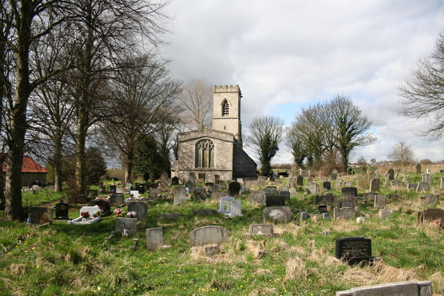
St John's Church, Throapham

St John's Church is a redundant Anglican church near the village of Throapham, on the road between Dinnington and Laughton-en-le-Morthen, South Yorkshire...

Nearby Amenities

Located within 500m of 53.37176,-1.200373
Dinnington
Place: town
Wikidata: Q2296611
Wikipedia: en:Dinnington, South Yorkshire
Lat/Long: 53.3692237/-1.2035179
Bus Stop
New Street/Addison Square
Bus: yes
Naptan AtcoCode: 370030099
Naptan Bearing: N
Naptan CommonName: New Street/Addison Square
Naptan Indicator: 30099
Naptan Landmark: 30099
Naptan PlusbusZoneRef: ROTHCEN
Naptan Street: New Street
Naptan Verified: no
Public Transport: platform
Source: naptan_import
Lat/Long: 53.3694505/-1.2055228
Bus Stop
Doe Quarry Lane/Dinnington Comp School
Alt Name: Doe Quarry Lane/Dinnington Comp School
Bus: yes
Naptan AltCommonName: Doe Quarry Lane/Dinnington Comp School
Naptan AtcoCode: 370030104
Naptan Bearing: NW
Naptan CommonName: Doe Quarry Lane/Dinnington Comp School
Naptan Indicator: 30104
Naptan Landmark: DINNINGTON COMPREHENSIVE SCHOO
Naptan PlusbusZoneRef: ROTHCEN
Naptan Street: Doe Quarry Lane
Naptan Verified: no
Public Transport: platform
Source: naptan_import
Lat/Long: 53.3728761/-1.2056394
Bus Stop
Silverdales/Byron Road
Bus: yes
Naptan AtcoCode: 370030071
Naptan Bearing: SE
Naptan CommonName: Silverdales/Byron Road
Naptan Indicator: 30071
Naptan Landmark: Streetlight No
Naptan PlusbusZoneRef: ROTHCEN
Naptan Street: Silverdales
Naptan Verified: no
Public Transport: platform
Source: naptan_import
Lat/Long: 53.3684419/-1.1998754
Bus Stop
Lordens Hill/Silverdales
Bus: yes
Naptan AtcoCode: 370030072
Naptan Bearing: N
Naptan CommonName: Lordens Hill/Silverdales
Naptan Indicator: 30072
Naptan Landmark: PARADE OF SHOPS
Naptan PlusbusZoneRef: ROTHCEN
Naptan Street: Lordens Hill
Naptan Verified: no
Public Transport: platform
Source: naptan_import
Lat/Long: 53.368883/-1.2040003
Bus Stop
Lordens Hill/The Crescent
Bus: yes
Naptan AtcoCode: 370030073
Naptan Bearing: SW
Naptan CommonName: Lordens Hill/The Crescent
Naptan Indicator: 30073
Naptan Landmark: 30073
Naptan PlusbusZoneRef: ROTHCEN
Naptan Street: Lordens Hill
Naptan Verified: no
Public Transport: platform
Source: naptan_import
Lat/Long: 53.3699672/-1.2007937
Bus Stop
Doe Quarry Lane/Leys Lane
Alt Name: Doe Quarry Lane/Leys Lane
Bus: yes
Naptan AltCommonName: Doe Quarry Lane/Leys Lane
Naptan AtcoCode: 370030074
Naptan Bearing: SE
Naptan CommonName: Doe Quarry Lane/Leys Lane
Naptan Indicator: 30074
Naptan Landmark: LORDENS HOTEL
Naptan PlusbusZoneRef: ROTHCEN
Naptan Street: Doe Quarry Lane
Naptan Verified: no
Public Transport: platform
Source: naptan_import
Lat/Long: 53.3715448/-1.1987802
Bus Stop
Doe Quarry Lane/Dinnington Comp School
Bus: yes
Naptan AtcoCode: 370030075
Naptan Bearing: SE
Naptan CommonName: Doe Quarry Lane/Dinnington Comp School
Naptan Indicator: 30075
Naptan Landmark: DINNINGTON COMPREHENSIVE SCH
Naptan PlusbusZoneRef: ROTHCEN
Naptan Street: Doe Quarry Lane
Naptan Verified: no
Public Transport: platform
Source: naptan_import
Lat/Long: 53.372714/-1.2042445
Bus Stop
Doe Quarry Lane/Lordens Hill
Alt Name: Doe Quarry Lane/Lordens Hill
Bus: yes
Departures Board: timetable
Naptan AltCommonName: Doe Quarry Lane/Lordens Hill
Naptan AtcoCode: 370035152
Naptan Bearing: NW
Naptan CommonName: Doe Quarry Lane/Lordens Hill
Naptan Indicator: 35152
Naptan Landmark: OPPOSITE LORDENS HOTEL
Naptan PlusbusZoneRef: ROTHCEN
Naptan Street: Doe Quarry Lane
Naptan Verified: no
Network: First, Stagecoach, TM
Public Transport: platform
Source: naptan_import
Lat/Long: 53.3712263/-1.1982
Bus Stop
Lordens Hill/Victoria Street
Alt Name: Lordens Hill/Victoria Street
Bus: yes
Naptan AltCommonName: Lordens Hill/Victoria Street
Naptan AtcoCode: 370035212
Naptan Bearing: NE
Naptan CommonName: Lordens Hill/Victoria Street
Naptan Indicator: 35212
Naptan Landmark: 35212
Naptan PlusbusZoneRef: ROTHCEN
Naptan Street: Lordens Hill
Naptan Verified: no
Public Transport: platform
Source: naptan_import
Lat/Long: 53.3696881/-1.2020615
Silverdales
Alt Name: Silverdales
Naptan AltCommonName: Silverdales
Naptan AtcoCode: 370035634
Naptan Bearing: NW
Naptan BusStopType: CUS
Naptan CommonName: Silverdales
Naptan Indicator: 35634
Naptan Landmark: OPPOSITE NO. 101/SPORTS FIELD
Naptan PlusbusZoneRef: ROTHCEN
Naptan Street: Silverdales
Naptan Verified: no
Source: naptan_import
Lat/Long: 53.3683613/-1.199922
Dinnington Comprehensive School Bus Park
Naptan AtcoCode: 370035722
Naptan Bearing: N
Naptan BusStopType: CUS
Naptan CommonName: Dinnington Comprehensive School Bus Park
Naptan Indicator: 35722
Naptan Landmark: 35722
Naptan PlusbusZoneRef: ROTHCEN
Naptan Street: Dinnington Comprehensive School Bus Park
Naptan Verified: no
Source: naptan_import
Lat/Long: 53.372559/-1.202579
Bus Stop
Doe Quarry Lane/Dinnington Junior School
Bus: yes
Naptan AtcoCode: 370035757
Naptan Bearing: N
Naptan CommonName: Doe Quarry Lane/Dinnington Junior School
Naptan Indicator: 35757
Naptan Landmark: 35757
Naptan PlusbusZoneRef: ROTHCEN
Naptan Street: Doe Quarry Lane
Naptan Verified: no
Public Transport: platform
Source: naptan_import
Lat/Long: 53.3734091/-1.2073881
Bus Stop
Doe Quarry Lane/Howard Street
Bus: yes
Naptan AtcoCode: 370035759
Naptan Bearing: N
Naptan CommonName: Doe Quarry Lane/Howard Street
Naptan Indicator: 35759
Naptan Landmark: 35759
Naptan PlusbusZoneRef: ROTHCEN
Naptan Street: Doe Quarry Lane
Naptan Verified: no
Public Transport: platform
Source: naptan_import
Lat/Long: 53.3721165/-1.2022716
Bus Stop
Lidgett Lane/New Street
Alt Name: Lidgett Lane/New Street
Bus: yes
Naptan AltCommonName: Lidgett Lane/New Street
Naptan AtcoCode: 370035793
Naptan Bearing: NE
Naptan CommonName: Lidgett Lane/New Street
Naptan Indicator: 35793
Naptan Landmark: 35793
Naptan PlusbusZoneRef: ROTHCEN
Naptan Street: Lidgett Lane
Naptan Verified: no
Public Transport: platform
Source: naptan_import
Lat/Long: 53.3686489/-1.2052972
Barrier: wall
Lat/Long: 53.3713371/-1.2038389
Restaurant
Four Seasons Cantonese Restaurant
Addr City: Sheffield
Addr Country: GB
Addr Housenumber: 39
Addr Postcode: S25 2QE
Addr Street: Lordens Hill
Addr Town: Dinnington
Cuisine: chinese
Delivery: no
Fhrs Id: 462190
Takeaway: yes
Lat/Long: 53.3692724/-1.2025152
Fast Food
China House Takeaway
Addr City: Sheffield
Addr Housenumber: 11
Addr Postcode: S25 2QE
Addr Street: Lordens Hill
Addr Suburb: Dinnington
Cuisine: chinese
Delivery: no
Drive Through: no
Takeaway: only
Website: https://take-a-way.co.uk/menu/3120/China%20House%20-%20Dinnington/
Lat/Long: 53.368798/-1.2041154
Post Box
Collection Times: Mo-Fr 09:00; Sa 07:00
Post Box Type: lamp
Ref: S25 580
Royal Cypher: EIIR
Royal Cypher Wikidata: Q33102113
Lat/Long: 53.3703482/-1.2006792
Defibrillator
Access: yes
Check Date: 2023-03-09
Defibrillator Location En: On outside wall.
Emergency: defibrillator
Indoor: no
Ref GB The Circuit: 42B09E14-EC34-4A7F-A880-AD6A00BEBC50
Lat/Long: 53.3693746/-1.2021063
Generator Method: photovoltaic
Generator Output Electricity: yes
Generator Source: solar
Generator Type: solar_photovoltaic_panel
Location: roof
Power: generator
Lat/Long: 53.3722961/-1.2046579
Generator Method: photovoltaic
Generator Output Electricity: yes
Generator Source: solar
Generator Type: solar_photovoltaic_panel
Location: roof
Power: generator
Lat/Long: 53.3722385/-1.2044218
Generator Method: photovoltaic
Generator Output Electricity: yes
Generator Source: solar
Generator Type: solar_photovoltaic_panel
Location: roof
Power: generator
Lat/Long: 53.3724834/-1.2014177
Generator Method: photovoltaic
Generator Output Electricity: yes
Generator Source: solar
Generator Type: solar_photovoltaic_panel
Location: roof
Power: generator
Lat/Long: 53.3723249/-1.2017691
Generator Method: photovoltaic
Generator Output Electricity: yes
Generator Source: solar
Generator Type: solar_photovoltaic_panel
Location: roof
Power: generator
Lat/Long: 53.3719121/-1.2002108
Generator Method: photovoltaic
Generator Output Electricity: yes
Generator Source: solar
Generator Type: solar_photovoltaic_panel
Location: roof
Power: generator
Lat/Long: 53.3706911/-1.1971101
Generator Method: photovoltaic
Generator Output Electricity: yes
Generator Source: solar
Generator Type: solar_photovoltaic_panel
Location: roof
Power: generator
Lat/Long: 53.3673223/-1.200656
Generator Method: photovoltaic
Generator Output Electricity: yes
Generator Source: solar
Generator Type: solar_photovoltaic_panel
Location: roof
Power: generator
Lat/Long: 53.3676552/-1.1989179
Generator Method: photovoltaic
Generator Output Electricity: yes
Generator Source: solar
Generator Type: solar_photovoltaic_panel
Location: roof
Power: generator
Lat/Long: 53.3676136/-1.1987329
Generator Method: photovoltaic
Generator Output Electricity: yes
Generator Source: solar
Generator Type: solar_photovoltaic_panel
Location: roof
Power: generator
Lat/Long: 53.3676024/-1.1985585
Generator Method: photovoltaic
Generator Output Electricity: yes
Generator Source: solar
Generator Type: solar_photovoltaic_panel
Location: roof
Power: generator
Lat/Long: 53.3675624/-1.1981481
Generator Method: photovoltaic
Generator Output Electricity: yes
Generator Source: solar
Generator Type: solar_photovoltaic_panel
Location: roof
Power: generator
Lat/Long: 53.3675336/-1.1979416
Barrier: motorcycle
Lat/Long: 53.3708539/-1.1966844
Barrier: bollard
Lat/Long: 53.3716079/-1.2011864
The data included in this document is from www.openstreetmap.org. The data is made available under ODbL.

Have you been to Dinnington St. John's?

Leave your review of Dinnington St. John's below (or comments, questions and feedback).