Denholme

Civil Parish in Yorkshire Bradford

England

Denholme

Ruins of Royd Hall, Denholme One of the abandoned farms in this desolate area, their fields overgrown by rushes.
Ruins of Royd Hall, Denholme Credit: Humphrey Bolton

Denholme is a civil parish located in the metropolitan borough of Bradford in West Yorkshire, England. It is situated in the foothills of the Pennines, approximately 8 miles northwest of the city of Bradford. The parish covers an area of around 5 square miles and is part of the Bronte Country, known for its association with the famous Bronte sisters.

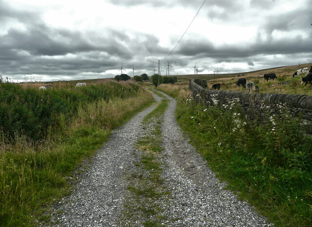
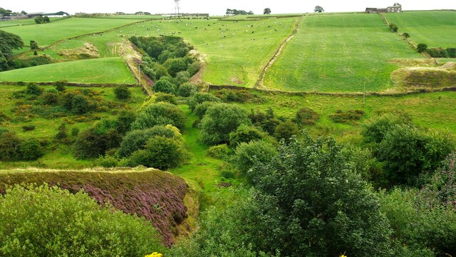
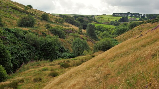
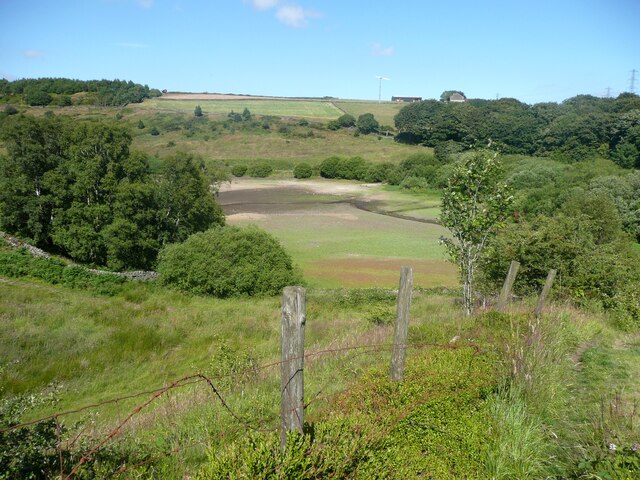
Denholme is a small, close-knit community with a population of around 5,000 people. The village itself is nestled in a picturesque valley and surrounded by rolling hills, offering stunning views of the countryside. The area is known for its natural beauty and attracts visitors who enjoy outdoor activities such as hiking, cycling, and birdwatching.

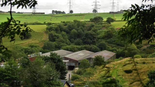
The village has a rich industrial heritage, with its roots in the textile industry. In the 19th century, Denholme was a thriving mill town, with numerous cotton mills and factories. Today, the remnants of these mills serve as a reminder of the village's past.

Denholme has a range of amenities for its residents, including shops, pubs, a primary school, and a library. The community is active and hosts various events throughout the year, such as the Denholme Gala and the Denholme Scarecrow Festival.

Overall, Denholme offers a peaceful and idyllic setting in the heart of Yorkshire's countryside, combined with a strong sense of community and a rich history.

If you have any feedback on the listing, please let us know in the comments section below.

Denholme Images

Images are sourced within 2km of 53.79833/-1.901358 or Grid Reference SE0633. Thanks to Geograph Open Source API. All images are credited.

Ruins of Royd Hall, Denholme One of the abandoned farms in this desolate area, their fields overgrown by rushes.
Ruins of Royd Hall, Denholme
One of the abandoned farms in this desolate area, their fields overgrown by rushes.
The two branches of Foreside Bottom Lane, Denholme The branch to the left has a surface of loose grit and is a public footpath, whilsy the branch to the right is covered in grass and is a public beirdleway.
The two branches of Foreside Bottom Lane, Denholme
The branch to the left has a surface of loose grit and is a public footpath, whilsy the branch to the right is covered in grass and is a public beirdleway.
Foreside Bottom Lane, Denholme This is a bridleway that comes to a halt after Allotments Farm. However there is a good bridleway to the left, passing the ruins of Royd Hall, to the Back Lane bridleway.
Foreside Bottom Lane, Denholme
This is a bridleway that comes to a halt after Allotments Farm. However there is a good bridleway to the left, passing the ruins of Royd Hall, to the Back Lane bridleway.
Stile on footpath at Foreside Bottom Lane, Denholme
Thornton Moor Reservoir View to the valve tower from the top of Hambleton Lane
Thornton Moor Reservoir
View to the valve tower from the top of Hambleton Lane
Doe Park Reservoir & Quarried Hill Top View to the site of Lowe Quarry above the reservoir
Doe Park Reservoir & Quarried Hill Top
View to the site of Lowe Quarry above the reservoir
Dam Wall of Doe Park Reservoir View North from Birk Hill
Dam Wall of Doe Park Reservoir
View North from Birk Hill
Old Railway Route to Thornton Wells Head Tunnel View from on top of Birk Hill Tunnel South of Denholme Station site. The cuttings leading into the tunnels are full of trees
Old Railway Route to Thornton Wells Head Tunnel
View from on top of Birk Hill Tunnel South of Denholme Station site. The cuttings leading into the tunnels are full of trees
Carperley Beck Valley View West from Station Sawmills. The level skyline in the centre is the dam of Thornton Moor Reservoir
Carperley Beck Valley
View West from Station Sawmills. The level skyline in the centre is the dam of Thornton Moor Reservoir
Station Sawmills Sawmills on the site of Denholme Railway Station Yard and the tree filled cutting leading to Birk Hill Tunnel beyond. The sawmills have in turn gone and this is now a housing estate.
Station Sawmills
Sawmills on the site of Denholme Railway Station Yard and the tree filled cutting leading to Birk Hill Tunnel beyond. The sawmills have in turn gone and this is now a housing estate.
View of the bed of Doe Park Reservoir, Denholme This was taken from Denholme Footpath 59. After a long period of mainly dry weather the bed is exposed in the upper parts of the reservoir.
View of the bed of Doe Park Reservoir, Denholme
This was taken from Denholme Footpath 59. After a long period of mainly dry weather the bed is exposed in the upper parts of the reservoir.
Denholme Footpath 59 Here the path is descending towards the footbridge over Denholme Beck.
Denholme Footpath 59
Here the path is descending towards the footbridge over Denholme Beck.
Denholme Footpath 57
Mural next to Emily's Eatery, Denholme Gate This cafe has very good reviews Unfortunately it closes at 2:30, but is said to be a good place for lunch. Their facebook page has lots of illustrations of women in a similar (American) style.
Mural next to Emily's Eatery, Denholme Gate
This cafe has very good reviews Unfortunately it closes at 2:30, but is said to be a good place for lunch. Their facebook page has lots of illustrations of women in a similar (American) style.
Gate on Denholme Footpath 57 From here the path goes down steeply into the valley. In some places stone paving has survived.
Gate on Denholme Footpath 57
From here the path goes down steeply into the valley. In some places stone paving has survived.
Denholme Footpath 59 This is a pleasant path that descends gently down a ridge.
Denholme Footpath 59
This is a pleasant path that descends gently down a ridge.
Denholme Footpath 59 passing the church At the far end of this field, in which a few sheep were grazing, the path goes through a housing estate before reaching the long descent along a ridge.
Denholme Footpath 59 passing the church
At the far end of this field, in which a few sheep were grazing, the path goes through a housing estate before reaching the long descent along a ridge.
Stile on Denholme Footpath 62 The path can be seen as a dark line across the field.
Stile on Denholme Footpath 62
The path can be seen as a dark line across the field.
Show me another place!

Denholme is located at Grid Ref: SE0633 (Lat: 53.79833, Lng: -1.901358)

Division: West Riding

Administrative County: West Yorkshire

District: Bradford

Police Authority: West Yorkshire

What 3 Words

///crystal.incursion.alpha. Near Denholme, West Yorkshire

Nearby Locations

Denholme Stubden Reservoir

Related Wikis

Denholme

Denholme is a town and civil parish in the Bradford Metropolitan Borough, West Yorkshire, England. It is 8 miles (13 km) west of Bradford, 7 miles (11...

Denholme railway station

Denholme railway station was a station on the Keighley-Queensbury section of the Queensbury Lines which ran between Keighley, Bradford and Halifax via...

Denholme Clough Fault

The Denholme Clough Fault is a small fault located in Denholme, England. The fault is approximately 500 metres (1,600 ft) long. The fault has produced...

RAF Manywells Height

Royal Air Force Manywells Height (also known as Royal Flying Corps Manywells Height, Royal Flying Corps Cullingworth and Royal Air Force Cullingworth)...
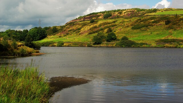
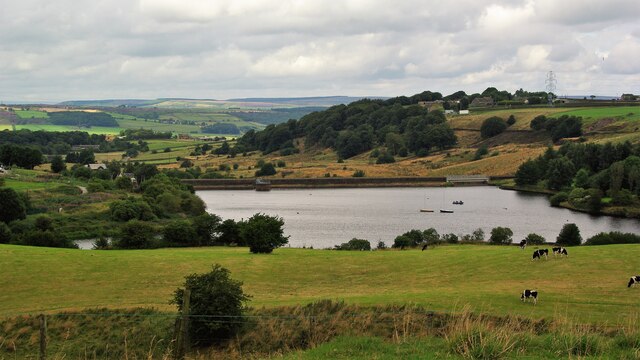
Hewenden Reservoir

Hewenden Reservoir is a fresh-water reservoir near to Cullingworth in West Yorkshire, England. The Bradford Corporation built the reservoir, which was...

Wilsden railway station

Wilsden railway station was a station on the Queensbury Lines which ran between Keighley, Bradford and Halifax. == History == The station was built by...

Harden Beck

Harden Beck is a stream that flows from Hewenden Reservoir, over Goit Stock Waterfall to the River Aire in Bingley, West Yorkshire. The route starts out...

Hewenden Viaduct

Hewenden Viaduct, situated near Cullingworth, West Yorkshire, England, originally served as a railway viaduct along the Queensbury Lines. Being one of...

Nearby Amenities

Located within 500m of 53.79833,-1.901358
Telephone
Booth: KX100
Covered: booth
Operator: BT
Lat/Long: 53.801218/-1.8961153
Bus Stop
Main Road / School Street
Bench: yes
Bus: yes
Local Ref: 45020099
Naptan AtcoCode: 450020099
Naptan Bearing: SW
Naptan CommonName: Main Road School Street
Naptan Crossing: South Street
Naptan Indicator: Stop 45020099
Naptan PlusbusZoneRef: LEEDS
Naptan ShortCommonName: South Street
Naptan Street: Main Road
Naptan Verified: no
Public Transport: platform
Ref: 45020099
Shelter: yes
Source: naptan_import; survey
Towards: Bradford, Halifax, Thornton
Lat/Long: 53.8011429/-1.8963268
Bus Stop
Denholme / School Street
Bus: yes
Local Ref: 45020100
Naptan AtcoCode: 450020100
Naptan Bearing: NW
Naptan CommonName: Main Street New Street
Naptan Crossing: New Street
Naptan Indicator: Stop 45020100
Naptan Landmark: The Royal PH
Naptan Notes: OSR taken place 040805
Naptan PlusbusZoneRef: LEEDS
Naptan ShortCommonName: New Street
Naptan Street: Main Road
Naptan Verified: no
Note: Corrected Name
Public Transport: platform
Shelter: yes
Source: naptan_import
Lat/Long: 53.8014552/-1.8959724
Bus Stop
Main Road / Denholme
Local Ref: 45021001
Naptan AtcoCode: 450021001
Naptan Bearing: NE
Naptan CommonName: Main Road Clock Lane
Naptan Indicator: Stop 45021001
Naptan Notes: OSR taken place 040805
Naptan PlusbusZoneRef: LEEDS
Naptan ShortCommonName: Clock Lane
Naptan Street: Main Road
Naptan Verified: no
Note: Corrected Name
Shelter: no
Source: naptan_import
Lat/Long: 53.8005081/-1.8990474
Bus Stop
Main Road / Clock Lane
Local Ref: 45021002
Naptan AtcoCode: 450021002
Naptan Bearing: SW
Naptan CommonName: Main Road Clock Lane
Naptan Crossing: Clock Lane
Naptan Indicator: Stop 45021002
Naptan Notes: OSR taken place 250805
Naptan PlusbusZoneRef: LEEDS
Naptan ShortCommonName: Clock Lane
Naptan Street: Main Road
Naptan Verified: no
Note: merged
Ref: 45021002
Shelter: no
Source: naptan_import; survey
Timetable: yes
Towards: Bradford, Halifax, Thornton
Lat/Long: 53.8002476/-1.8993062
Bus Stop
New Road Long / Causeway
Local Ref: 45021003
Naptan AtcoCode: 450021003
Naptan Bearing: SW
Naptan CommonName: New Road Long Causeway
Naptan Crossing: Long Causeway
Naptan Indicator: Stop 45021003
Naptan Notes: OSR taken place 040805
Naptan PlusbusZoneRef: LEEDS
Naptan ShortCommonName: Long Causeway
Naptan Street: New Road
Opposite: yes
Shelter: no
Source: naptan_import; survey
Timetable: yes
Lat/Long: 53.7985934/-1.8988091
Bus Stop
New Road / Long Causeway
Local Ref: 45051056
Naptan AtcoCode: 450051056
Naptan Bearing: N
Naptan BusStopType: CUS
Naptan CommonName: New Road Long Causeway
Naptan Indicator: Stop 45051056
Naptan PlusbusZoneRef: LEEDS
Naptan ShortCommonName: Hollin Hall Farm
Naptan Street: New Road
Physically Present: opposite
Source: naptan_import; survey
Lat/Long: 53.7990287/-1.8991344
R Hoyles
Shop: car
Lat/Long: 53.7995209/-1.9005262
Turning Circle
Lat/Long: 53.8018453/-1.900337
Turning Circle
Lat/Long: 53.801188/-1.8999373
Post Box
Operator: Royal Mail
Post Box Type: lamp
Royal Cypher: EIIR
Royal Cypher Wikidata: Q33102113
Lat/Long: 53.8003354/-1.8994342
Information: guidepost
Source: bing:local knowledge
Tourism: information
Lat/Long: 53.794043/-1.901772
Barrier: stile
Source: bing:local knowledge
Lat/Long: 53.7975443/-1.8991891
Barrier: stile
Lat/Long: 53.7977848/-1.8949796
MS
Heritage: 2
Heritage Operator: Historic England
Historic: milestone
Listed Status: Grade II
Source: Historic England
Lat/Long: 53.7974242/-1.8966656
Barrier: bollard
Lat/Long: 53.8012101/-1.8966571
Turning Circle
Lat/Long: 53.8010025/-1.8985803
Turning Circle
Longhouse Drive
Lat/Long: 53.8011435/-1.8975794
Turning Circle
Lat/Long: 53.8023157/-1.8999428
Turning Circle
Lat/Long: 53.8023284/-1.8990469
Power: pole
Lat/Long: 53.8023666/-1.9006833
Generator Method: photovoltaic
Generator Output Electricity: yes
Generator Source: solar
Generator Type: solar_photovoltaic_panel
Power: generator
Lat/Long: 53.8001304/-1.8946188
Crossing
Crossing: marked
Crossing Island: no
Crossing Ref: zebra
Tactile Paving: yes
Lat/Long: 53.8006171/-1.8985984
Material: wood
Power: pole
Lat/Long: 53.8000261/-1.8957343
Material: wood
Power: pole
Lat/Long: 53.7992746/-1.8960157
Material: wood
Power: pole
Lat/Long: 53.7986538/-1.8961325
Material: wood
Power: pole
Lat/Long: 53.7979765/-1.8962794
Power: pole
Lat/Long: 53.797385/-1.8962334
Power: pole
Lat/Long: 53.7968289/-1.8961697
Power: pole
Lat/Long: 53.7963272/-1.8961289
Power: pole
Lat/Long: 53.7957178/-1.8961006
Power: pole
Lat/Long: 53.7976286/-1.9000316
Power: pole
Lat/Long: 53.797776/-1.9002677
Power: pole
Lat/Long: 53.7973846/-1.9009499
Power: pole
Lat/Long: 53.7971955/-1.9016949
Power: pole
Lat/Long: 53.7969728/-1.902523
Line Management: transition
Power: pole
Lat/Long: 53.7967387/-1.9033972
Power: pole
Lat/Long: 53.797685/-1.9004809
Power: pole
Lat/Long: 53.7980359/-1.901122
Power: pole
Lat/Long: 53.7986537/-1.9014747
Power: pole
Lat/Long: 53.7989991/-1.901641
Power: pole
Lat/Long: 53.7970394/-1.8994213
Power: pole
Lat/Long: 53.7970945/-1.8991759
Power: pole
Lat/Long: 53.7967857/-1.8986802
Power: pole
Lat/Long: 53.7961732/-1.8976821
Power: pole
Lat/Long: 53.7958387/-1.897176
Power: pole
Lat/Long: 53.7962358/-1.898651
Power: pole
Lat/Long: 53.79544/-1.8968879
Power: pole
Lat/Long: 53.7950474/-1.8965698
The data included in this document is from www.openstreetmap.org. The data is made available under ODbL.

Have you been to Denholme?

Leave your review of Denholme below (or comments, questions and feedback).