Dean and Shelton

Civil Parish in Bedfordshire

England

Dean and Shelton

Upper Dean Ford This ford is found on Shay Lane in Upper Dean.
Upper Dean Ford Credit: John Walton

Dean and Shelton is a civil parish located in the county of Bedfordshire in England. It is situated approximately 4 miles east of the town of Bedford and covers an area of around 4 square miles. The parish is primarily rural, with picturesque countryside and a tranquil setting.

The population of Dean and Shelton is relatively small, with around 500 residents. The parish consists of several small hamlets, including Dean, Shelton, and Moor End. The area is known for its charming cottages and historic buildings, which add to the character of the parish.

The landscape of Dean and Shelton is predominantly agricultural, with vast fields and farmlands surrounding the settlements. The area is dotted with traditional farmhouses and barns, contributing to its rural charm. The River Great Ouse passes through the parish, providing a scenic backdrop and opportunities for recreational activities such as fishing and boating.

Although small in size, Dean and Shelton offers a close-knit community atmosphere. The parish has a village hall that serves as a hub for community events and gatherings. There are also a few local businesses, including a pub and a village store, providing essential services to residents.

The parish is surrounded by natural beauty, with several footpaths and bridleways crisscrossing the area, making it an ideal location for outdoor enthusiasts. The nearby Priory Country Park offers recreational facilities such as a lake, picnic areas, and nature trails, attracting visitors from both within and outside the parish.

Overall, Dean and Shelton is a charming rural parish with a close community, stunning countryside, and a range of outdoor activities, making it an appealing place to live or visit for those seeking a peaceful and idyllic setting.

If you have any feedback on the listing, please let us know in the comments section below.

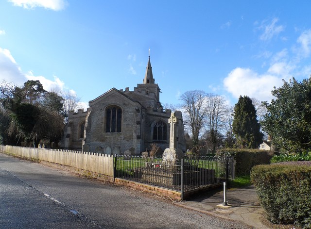
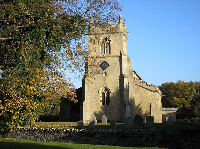
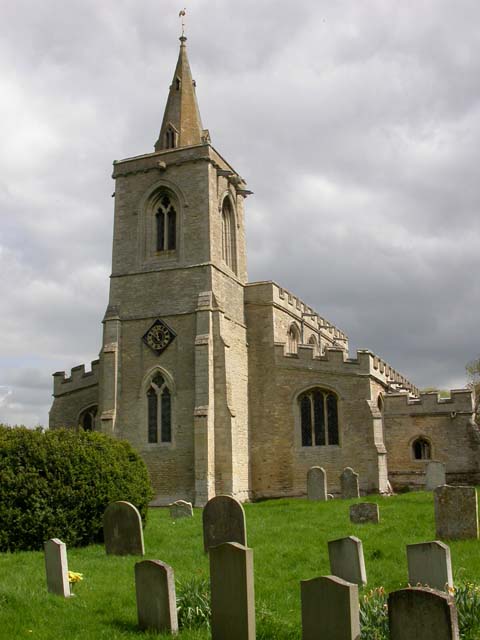
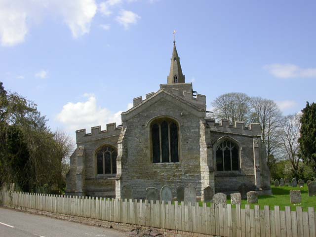
Dean and Shelton Images

Images are sourced within 2km of 52.306598/-0.469924 or Grid Reference TL0468. Thanks to Geograph Open Source API. All images are credited.

Upper Dean Ford This ford is found on Shay Lane in Upper Dean.
Upper Dean Ford
This ford is found on Shay Lane in Upper Dean.
Sweeping arable landscapes Open farmland above Upper Dean.
Sweeping arable landscapes
Open farmland above Upper Dean.
Arable landscape near Upper Dean
Non standard bridge on the Bridleway Crossing point over the River Til
Non standard bridge on the Bridleway
Crossing point over the River Til
Better than wet feet "Bridge" crossing over the River Til.
Better than wet feet
"Bridge" crossing over the River Til.
Windmill Tower at Upper Dean Recent history explained <span class="nowrap"><a title="http://www.windmillworld.com/millid/2260.htm" rel="nofollow ugc noopener" href="http://www.windmillworld.com/millid/2260.htm">Link</a><img style="margin-left:2px;" alt="External link" title="External link - shift click to open in new window" src="https://s1.geograph.org.uk/img/external.png" width="10" height="10"/></span>
Windmill Tower at Upper Dean
Recent history explained LinkExternal link
Cap details of Upper Dean Windmill Building description <span class="nowrap"><a title="http://www.windmillworld.com/millid/2260.htm" rel="nofollow ugc noopener" href="http://www.windmillworld.com/millid/2260.htm">Link</a><img style="margin-left:2px;" alt="External link" title="External link - shift click to open in new window" src="https://s1.geograph.org.uk/img/external.png" width="10" height="10"/></span>
Cap details of Upper Dean Windmill
Building description LinkExternal link
Windmill Tower at Upper Dean
The Three Compasses A pint of Thwaites "Good Elf" was taken here along with a fine pub lunch.
The Three Compasses
A pint of Thwaites "Good Elf" was taken here along with a fine pub lunch.
Trekking towards Upper Dean
Upper Dean windmill For recent history see: <span class="nowrap"><a title="http://www.windmillworld.com/millid/2260.htm" rel="nofollow ugc noopener" href="http://www.windmillworld.com/millid/2260.htm">Link</a><img style="margin-left:2px;" alt="External link" title="External link - shift click to open in new window" src="https://s1.geograph.org.uk/img/external.png" width="10" height="10"/></span>
Upper Dean windmill
For recent history see: LinkExternal link
The Three Compasses pub, Upper Dean
Small stream by the roadside, Upper Dean
Timber-framed house, Upper Dean The road is partially blocked by fallen branches-the weather had been very stormy the preceding few days.
Timber-framed house, Upper Dean
The road is partially blocked by fallen branches-the weather had been very stormy the preceding few days.
All Saints' church, Upper Dean See <span class="nowrap"><a title="http://www.britishlistedbuildings.co.uk/en-36266-church-of-all-saints-dean-and-shelton-" rel="nofollow ugc noopener" href="http://www.britishlistedbuildings.co.uk/en-36266-church-of-all-saints-dean-and-shelton-">Link</a><img style="margin-left:2px;" alt="External link" title="External link - shift click to open in new window" src="https://s1.geograph.org.uk/img/external.png" width="10" height="10"/></span> for entry as listed building. Mostly C14 with some C13.
All Saints' church, Upper Dean
See LinkExternal link for entry as listed building. Mostly C14 with some C13.
Barn at Nether Dean Nether Dean is not marked on the O.S. map-this location is marked "Lower Dean"
Barn at Nether Dean
Nether Dean is not marked on the O.S. map-this location is marked "Lower Dean"
Bridleway near Upper Dean
The Three Compasses pub, Upper Dean Built around 1700. See <span class="nowrap"><a title="http://www.britishlistedbuildings.co.uk/en-36264-the-three-compasses-public-house-dean-and#.VXQtLs9Viko" rel="nofollow ugc noopener" href="http://www.britishlistedbuildings.co.uk/en-36264-the-three-compasses-public-house-dean-and#.VXQtLs9Viko">Link</a><img style="margin-left:2px;" alt="External link" title="External link - shift click to open in new window" src="https://s1.geograph.org.uk/img/external.png" width="10" height="10"/></span> for entry in British Listed Buildings.
The Three Compasses pub, Upper Dean
Built around 1700. See LinkExternal link for entry in British Listed Buildings.
Show me another place!

Dean and Shelton is located at Grid Ref: TL0468 (Lat: 52.306598, Lng: -0.469924)

Unitary Authority: Bedford

Police Authority: Bedfordshire

What 3 Words

///bottle.corporate.shorthand. Near Swineshead, Bedfordshire

Related Wikis

Dean and Shelton

Dean and Shelton is a civil parish in the Bedford district, in the ceremonial county of Bedfordshire, England. The two parishes of Dean and Shelton were...

Dean, Bedfordshire

Dean or Over Dene is a former civil parish, now in the parish of Dean and Shelton, in the Bedford district, in the ceremonial county of Bedfordshire, England...

Upper Dean

Upper Dean is a village located in the Borough of Bedford in Bedfordshire, England. == Description == The village forms part of the Dean and Shelton civil...

Church of St Mary the Virgin, Shelton, North Bedfordshire

Church of St Mary the Virgin is a Grade I listed church in Shelton, Bedfordshire, England. == See also == Grade I listed buildings in Bedfordshire �...

Lower Dean

Lower Dean is a village located in the Borough of Bedford in Bedfordshire, England. The village forms part of the Dean and Shelton civil parish (where...

Church of All Saints, Upper Dean

The Church of All Saints is a Grade I listed church in Upper Dean, Bedfordshire, England. It became a listed building on 13 July 1964.The church escaped...

Shelton, North Bedfordshire

Shelton is a village and former civil parish, now in the parish of Dean and Shelton, in the Bedford district, in the ceremonial county of Bedfordshire...

Hargrave, Northamptonshire

Hargrave is a small village and civil parish situated in rural Northamptonshire, England, approximately 21 miles east of Northampton and adjacent to the...

Nearby Amenities

Located within 500m of 52.306598,-0.469924
Power: pole
Lat/Long: 52.3053646/-0.476955
Power: pole
Lat/Long: 52.3049352/-0.4761323
Power: pole
Lat/Long: 52.3048594/-0.4751994
Power: pole
Lat/Long: 52.3047878/-0.47427
Power: pole
Lat/Long: 52.3047121/-0.4733508
Power: pole
Lat/Long: 52.3046173/-0.4719876
Power: pole
Lat/Long: 52.3045058/-0.4706795
Power: pole
Lat/Long: 52.3043879/-0.4693679
Power: pole
Lat/Long: 52.3043395/-0.4680977
Power: pole
Lat/Long: 52.3042216/-0.4669066
Power: pole
Lat/Long: 52.3041143/-0.4657259
Power: pole
Lat/Long: 52.3040217/-0.4645107
The data included in this document is from www.openstreetmap.org. The data is made available under ODbL.

Have you been to Dean and Shelton?

Leave your review of Dean and Shelton below (or comments, questions and feedback).