Cutsdean

Civil Parish in Gloucestershire Cotswold

England

Cutsdean

Permissive footpath to Durhams Ture Maps do not tell us what Durhams Ture is, but label the wood ahead as The Durhams.
Permissive footpath to Durhams Ture Credit: Robin Webster

Cutsdean is a civil parish located in the county of Gloucestershire, England. Situated in the picturesque Cotswolds region, it is surrounded by rolling hills and scenic countryside. The parish is part of the administrative district of Tewkesbury and covers an area of approximately 5 square miles.

Cutsdean is a small and rural community, with a population of around 100 residents. The tranquil village is characterized by its traditional Cotswold stone houses and charming cottages, which add to its idyllic charm. The parish is known for its stunning views and peaceful atmosphere, making it a popular destination for tourists seeking a serene countryside experience.

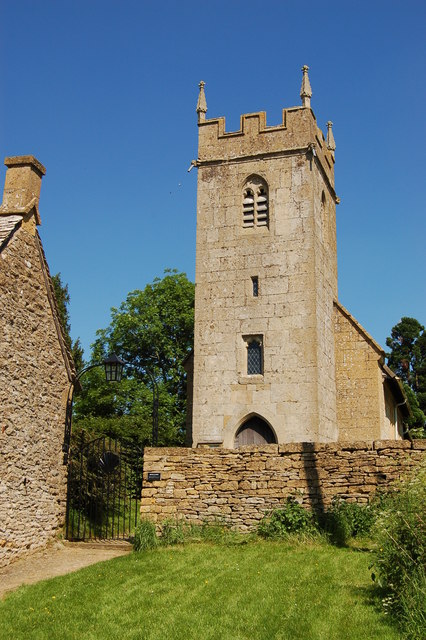
While Cutsdean may be small in size, it is rich in history and heritage. The village dates back to medieval times and has retained much of its historic character. Visitors can explore the village's ancient church, St. James' Church, which is a Grade II listed building. The church features beautiful stained glass windows and architectural elements that showcase its rich past.

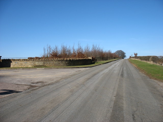
The parish is surrounded by scenic walking trails, offering visitors the opportunity to explore the stunning Cotswolds landscape. The nearby Cotswold Way National Trail passes through Cutsdean, providing hikers with breathtaking views and access to other nearby attractions.

Overall, Cutsdean is a charming and peaceful civil parish that offers visitors a glimpse into the beauty and tranquility of rural Gloucestershire.

If you have any feedback on the listing, please let us know in the comments section below.
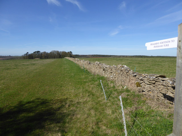
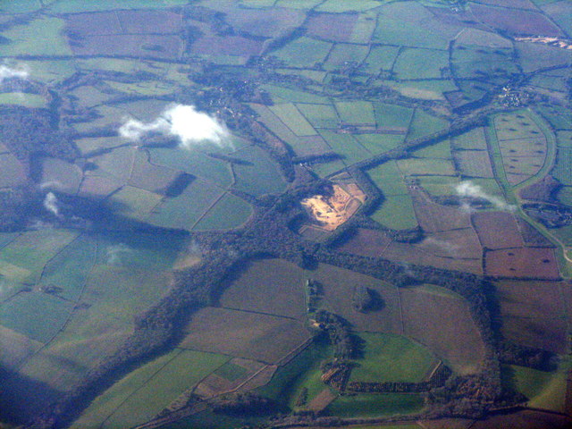
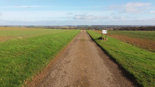
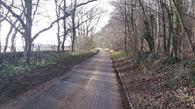
Cutsdean Images

Images are sourced within 2km of 51.979853/-1.840436 or Grid Reference SP1131. Thanks to Geograph Open Source API. All images are credited.

Permissive footpath to Durhams Ture Maps do not tell us what Durhams Ture is, but label the wood ahead as The Durhams.
Permissive footpath to Durhams Ture
Maps do not tell us what Durhams Ture is, but label the wood ahead as The Durhams.
Sheep farming No lambs to be seen.
Sheep farming
No lambs to be seen.
Lane through woodland Woods called Scarborough Pits to the right and Lower Slatepits to the left.
Lane through woodland
Woods called Scarborough Pits to the right and Lower Slatepits to the left.
Field east of Scarborough Pits wood
Lane east of Hornsleasow Farm
Cutsdean Trig Point An OS roadside triangulation pillar.
Cutsdean Trig Point
An OS roadside triangulation pillar.
Trafalgar Farm With a disused quarry near Temple Guiting standing out. The area at upper right with spaced trees is the Gallops between Ford and Jackdaws Castle.
Trafalgar Farm
With a disused quarry near Temple Guiting standing out. The area at upper right with spaced trees is the Gallops between Ford and Jackdaws Castle.
Diamond Way Diamond Way alongside a gallop by Jackdaw's Castle
Diamond Way
Diamond Way alongside a gallop by Jackdaw's Castle
Diamond Way Diamond Way heading down the drive to Ford Hill Farm
Diamond Way
Diamond Way heading down the drive to Ford Hill Farm
Diamond Way Diamond Way heading down to Cutsdean Lodge
Diamond Way
Diamond Way heading down to Cutsdean Lodge
Diamond Way Diamond Way bridleway heading out of the copse towards Cutsdean Lodge
Diamond Way
Diamond Way bridleway heading out of the copse towards Cutsdean Lodge
Path heading to Hornsleasow Farm Off the road the path heading to Hornsleasow Farm
Path heading to Hornsleasow Farm
Off the road the path heading to Hornsleasow Farm
Road by Home Ground Plantation Road by Home Ground Plantation heading to the turn to Hornsleasow Farm
Road by Home Ground Plantation
Road by Home Ground Plantation heading to the turn to Hornsleasow Farm
Lower Slatepits and Scarborough Pits Road passing through Lower Slatepits and Scarborough Pits
Lower Slatepits and Scarborough Pits
Road passing through Lower Slatepits and Scarborough Pits
Road heading to Buckle Street Road passing Ling Ground heading to Buckle Street
Road heading to Buckle Street
Road passing Ling Ground heading to Buckle Street
Fields above Snowshill A pastoral scene taken from Buckle Street.
Fields above Snowshill
A pastoral scene taken from Buckle Street.
Buckle Street
Buckle Street
Buckle Street on Cutsdean Hill This minor road links Bourton-on-the-Water with Broadway. Ahead is the summit of Cutsdean Hill which, at 305m, is one of few Cotswold Hills to exceed 1000ft high. In this case, by less than a foot !

The drive on the left is the entrance to Jackdaw's Castle.
Buckle Street on Cutsdean Hill
This minor road links Bourton-on-the-Water with Broadway. Ahead is the summit of Cutsdean Hill which, at 305m, is one of few Cotswold Hills to exceed 1000ft high. In this case, by less than a foot ! The drive on the left is the entrance to Jackdaw's Castle.
Show me another place!

Cutsdean is located at Grid Ref: SP1131 (Lat: 51.979853, Lng: -1.840436)

Administrative County: Gloucestershire

District: Cotswold

Police Authority: Gloucestershire

What 3 Words

///glee.slot.joints. Near Broadway, Worcestershire

Nearby Locations

Cutsdean

Related Wikis

Cutsdean Quarry

Cutsdean Quarry (grid reference SP105315) is a 0.83-hectare (2.1-acre) nature reserve in Gloucestershire, England. The site is listed in the 'Cotswold...

Hornsleasow Roughs

Hornsleasow Roughs (grid reference SP117323) is a 28.24-hectare (69.8-acre) biological Site of Special Scientific Interest in Gloucestershire, notified...

Hornsleasow Quarry

Hornsleasow Quarry (grid reference SP131322) is a 3.5-hectare (8.6-acre) geological Site of Special Scientific Interest in Gloucestershire, notified in...

Cutsdean

Cutsdean is a rural village in the Cotswolds and smaller than average sized parish, a few miles east north-east of Cheltenham, Gloucestershire and the...

Nearby Amenities

Located within 500m of 51.979853,-1.840436
Scarborough Farm Buildings
Power: pole
Transformer: distribution
Voltage Primary: 11000
Lat/Long: 51.9777492/-1.8377564
Power: pole
Lat/Long: 51.9771375/-1.8372421
Scarborough Farm
Power: pole
Transformer: distribution
Voltage Primary: 11000
Lat/Long: 51.9766906/-1.8369538
Power: pole
Lat/Long: 51.9760272/-1.8375264
The data included in this document is from www.openstreetmap.org. The data is made available under ODbL.

Have you been to Cutsdean?

Leave your review of Cutsdean below (or comments, questions and feedback).