Cruwys Morchard

Civil Parish in Devon Mid Devon

England

Cruwys Morchard

Cruwys Morchard: cattle in a field near Lythe-land Looking north towards Templeton
Cruwys Morchard: cattle in a field near Lythe-land Credit: Martin Bodman

Cruwys Morchard is a civil parish situated in the county of Devon, England. Located in the heart of the picturesque Mid Devon district, the parish covers an area of approximately 8 square kilometers. It is nestled between the larger towns of Tiverton and Crediton, and is surrounded by beautiful countryside.

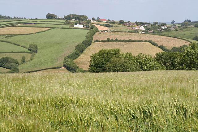
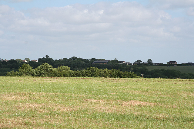
The village of Cruwys Morchard itself is small and quaint, with a population of around 500 residents. The parish is known for its charming rural character, with rolling hills, farmland, and pockets of woodland dotting the landscape. It is a popular destination for those seeking a peaceful and idyllic countryside retreat.

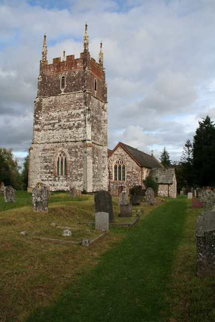
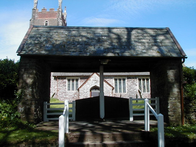
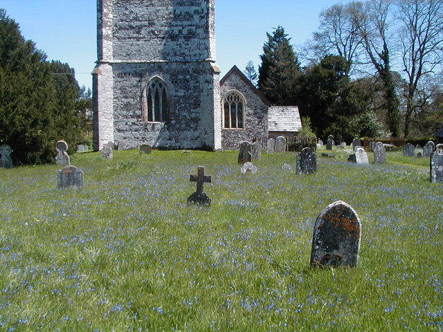
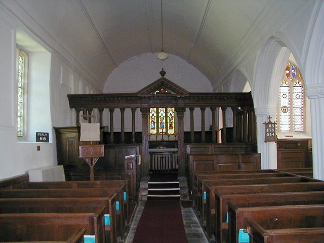
The history of Cruwys Morchard dates back many centuries, with evidence of settlement in the area as far back as the Bronze Age. The village features a number of historic buildings, including the Grade II listed St. Morchard's Church, which dates back to the 15th century. The church is a prominent landmark in the area and is renowned for its beautiful architecture.

Cruwys Morchard is a close-knit community with a strong sense of community spirit. The village has a primary school, which serves the local area, as well as a village hall that hosts various events and activities throughout the year. There are also a handful of local businesses, including a pub and a village shop, which provide essential services for residents and visitors alike.

In summary, Cruwys Morchard is a charming and historic civil parish in Devon, offering a peaceful and picturesque setting for its residents and visitors. With its rich history, beautiful countryside, and strong community spirit, it is a delightful place to live or explore.

If you have any feedback on the listing, please let us know in the comments section below.

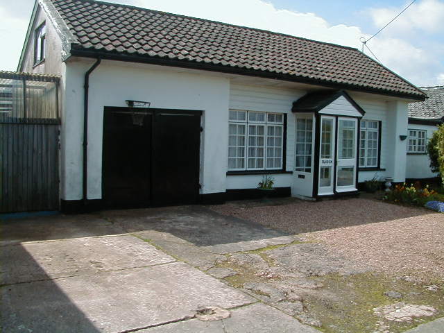
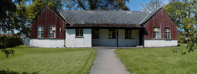
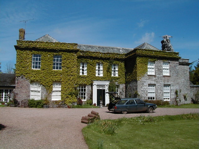
Cruwys Morchard Images

Images are sourced within 2km of 50.894674/-3.607074 or Grid Reference SS8711. Thanks to Geograph Open Source API. All images are credited.

Cruwys Morchard: cattle in a field near Lythe-land Looking north towards Templeton
Cruwys Morchard: cattle in a field near Lythe-land
Looking north towards Templeton
Cruwys Morchard: Windmill Farm Entrance to farmyard. In 1553 a windmill stood across the road to the east, probably near the trig point 253m up from sea level, where it would have worked in all winds
Cruwys Morchard: Windmill Farm
Entrance to farmyard. In 1553 a windmill stood across the road to the east, probably near the trig point 253m up from sea level, where it would have worked in all winds
Cruwys Morchard: church Church of the Holy Cross. Generations of the Cruwys family – lords of the manor – have lived in the parish since the time of King John (1199-1216). The church tower, which once carried a spire, suffered a lightning strike in 1689, and the consequent major fire – which melted the bells – necessitated the rebuilding of the top stage in brick
Cruwys Morchard: church
Church of the Holy Cross. Generations of the Cruwys family – lords of the manor – have lived in the parish since the time of King John (1199-1216). The church tower, which once carried a spire, suffered a lightning strike in 1689, and the consequent major fire – which melted the bells – necessitated the rebuilding of the top stage in brick
Cruwys Morchard: horse and cart at Pennymoor About to pass by the Cruwys Arms inn
Cruwys Morchard: horse and cart at Pennymoor
About to pass by the Cruwys Arms inn
Cruwys Morchard: the Cruwys Arms At Pennymoor crossroads, reputedly dating from the 16th century. The pub is shut on weekday lunchtimes but opens at 5:30 in the evenings
Cruwys Morchard: the Cruwys Arms
At Pennymoor crossroads, reputedly dating from the 16th century. The pub is shut on weekday lunchtimes but opens at 5:30 in the evenings
Cruwys Morchard: horse and cart at Pennymoor Passing the Cruwys Arms inn
Cruwys Morchard: horse and cart at Pennymoor
Passing the Cruwys Arms inn
Cruwys Morchard: towards Pennymoor Near Eastland, looking north-north-east
Cruwys Morchard: towards Pennymoor
Near Eastland, looking north-north-east
Cruwys Morchard: towards Withleigh Withleigh church tower is just visible almost on the horizon, part shrouded in a clump of trees. Looking east-north-east
Cruwys Morchard: towards Withleigh
Withleigh church tower is just visible almost on the horizon, part shrouded in a clump of trees. Looking east-north-east
Cruwys Morchard: Two Post Cross Looking east-north-east towards Peak Corner
Cruwys Morchard: Two Post Cross
Looking east-north-east towards Peak Corner
Cruwys Morchard: near Week Farm Looking south east towards Pennymoor
Cruwys Morchard: near Week Farm
Looking south east towards Pennymoor
Pennymoor Church looking west
Pennymoor Church
looking west
The Old Pennymoor Shop This was the Pennymoor shop in the 1960s & early 1970s run by Mrs Graves. It is now just a house.
The Old Pennymoor Shop
This was the Pennymoor shop in the 1960s & early 1970s run by Mrs Graves. It is now just a house.
The Old Pennymoor Shop, 1960s This is the old Pennymoor shop as it was in the 1960s.
The Old Pennymoor Shop, 1960s
This is the old Pennymoor shop as it was in the 1960s.
Community hall This is the Cruwys Morchard community hall which will hopefully soon be rebuilt if the required funds can be found by the local community.
Community hall
This is the Cruwys Morchard community hall which will hopefully soon be rebuilt if the required funds can be found by the local community.
Cruwys Morchard church gate
Cruwys Morchard house Photo taken from driveway leading up to the house.
Cruwys Morchard house
Photo taken from driveway leading up to the house.
Cruwys Morchard churchyard
Inside Cruwys Morchard church
Show me another place!

Cruwys Morchard is located at Grid Ref: SS8711 (Lat: 50.894674, Lng: -3.607074)

Administrative County: Devon

District: Mid Devon

Police Authority: Devon & Cornwall

What 3 Words

///chucked.tech.guarded. Near Witheridge, Devon

Related Wikis

Cruwys Morchard

Cruwys Morchard is an ecclesiastical and civil parish in the Mid Devon district of the county of Devon in England. It is located about four to five miles...

Templeton, Devon

Templeton is a hamlet, parish and former manor in Devon, England, situated 4 miles west of Tiverton. The parish church is dedicated to St Margaret. �...

Nomansland, Devon

Nomansland is a hamlet in Devon, England, with a population of about 150. It is eight miles west of Tiverton. It is so named because it was at one time...

Puddington, Devon

Puddington is a small village in Mid Devon within the Witheridge hundred. It is approximately nine miles from the town of Tiverton and 8 Miles from Crediton...

Poughill, Devon

Poughill (pronounced "po-il") is a village and civil parish in Devon, England. It lies 5 miles (8 km) north of Crediton. In 2011, the parish had a population...

Woolfardisworthy, Mid Devon

Woolfardisworthy (pronounced "Woolsery") is a village and civil parish in Mid Devon. It is situated about 5 miles (9 km) north of Crediton. According to...

Cheriton Fitzpaine

Cheriton Fitzpaine is a village in Devon, England, located 4 miles (7 km) north-east of Crediton. The population of the parish in the 2011 Census was 556...

Calverleigh

Calverleigh (anciently Calwoodleigh) is a village and former civil parish and manor, now in the parish of Loxbeare, in the Mid Devon district, in the county...

Have you been to Cruwys Morchard?

Leave your review of Cruwys Morchard below (or comments, questions and feedback).