Crowhurst

Civil Parish in Surrey Tandridge

England

Crowhurst

Grain Yard, Barrow Green Farm, near Lingfield, Surrey This should be the last 'first geograph' for the TQ44 hectad, of which I have contributed some 48.
Grain Yard, Barrow Green Farm, near Lingfield, Surrey Credit: Dr Neil Clifton

Crowhurst is a civil parish located in the Tandridge district of Surrey, England. It is situated approximately 2.5 miles southwest of the town of Lingfield. The parish covers an area of about 1.4 square miles and has a population of around 200 residents.

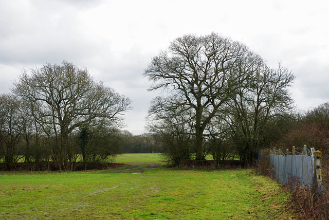
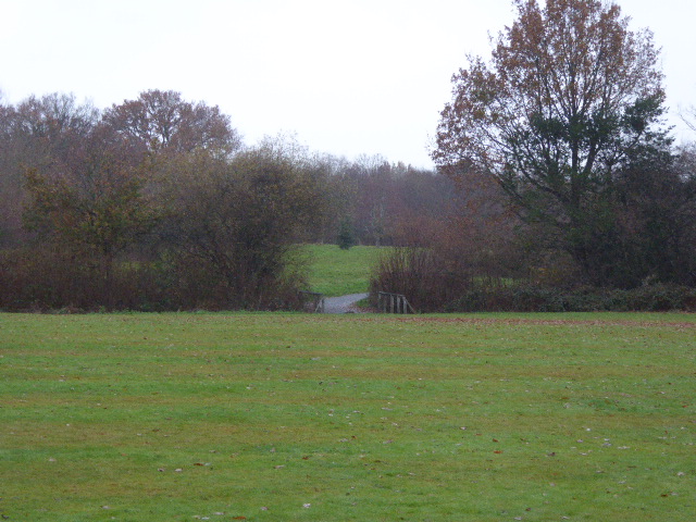
The village of Crowhurst is nestled in a picturesque rural setting, surrounded by beautiful countryside and farmland. It is known for its tranquil and peaceful atmosphere, making it an ideal place for those seeking a quiet and idyllic lifestyle.

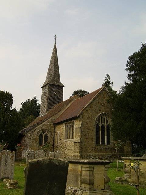
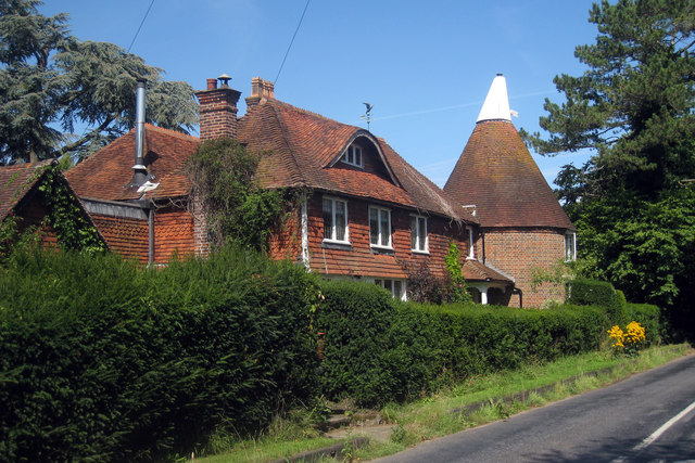
The village itself is small, with a scattering of residential properties and a few local amenities. These include a village hall, a church, and a primary school. The church, dedicated to St. George, is a historic building that dates back to the 13th century and is worth a visit for its architectural charm.

Crowhurst is well-connected to the surrounding areas, with good transport links. The A22 road runs nearby, providing easy access to the nearby towns of Lingfield, Oxted, and East Grinstead. The closest railway station is Lingfield, which offers regular services to London and other major cities.

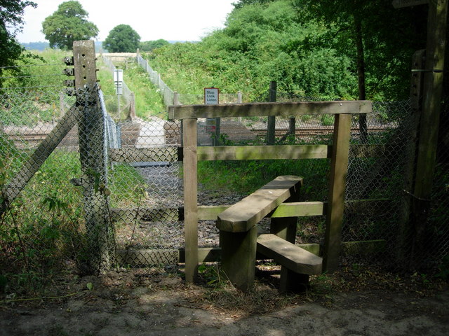
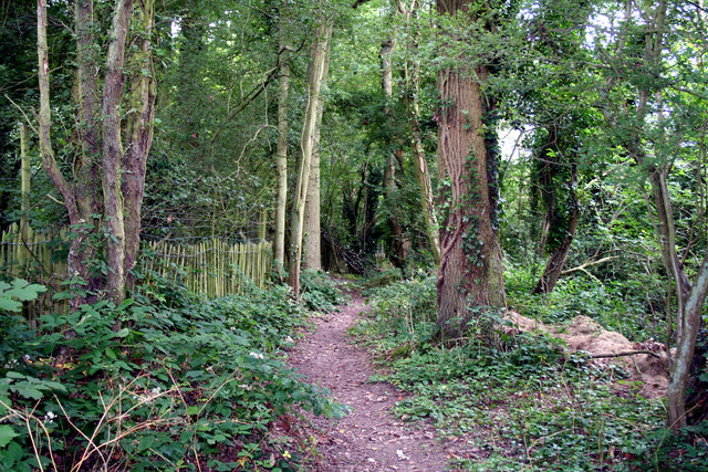
The surrounding countryside offers plenty of opportunities for outdoor activities, such as walking, cycling, and horse riding. There are also several nature reserves and parks in the vicinity, providing opportunities for wildlife spotting and peaceful nature walks.

Overall, Crowhurst is a charming and rural village, offering a peaceful retreat from the hustle and bustle of city life. It is a place that appeals to those who appreciate the beauty of the countryside and enjoy a close-knit community.

If you have any feedback on the listing, please let us know in the comments section below.
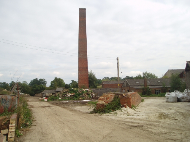
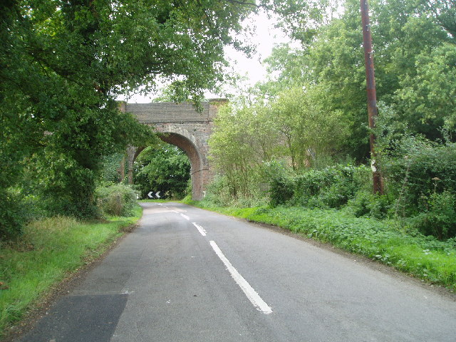
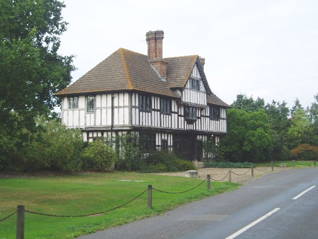
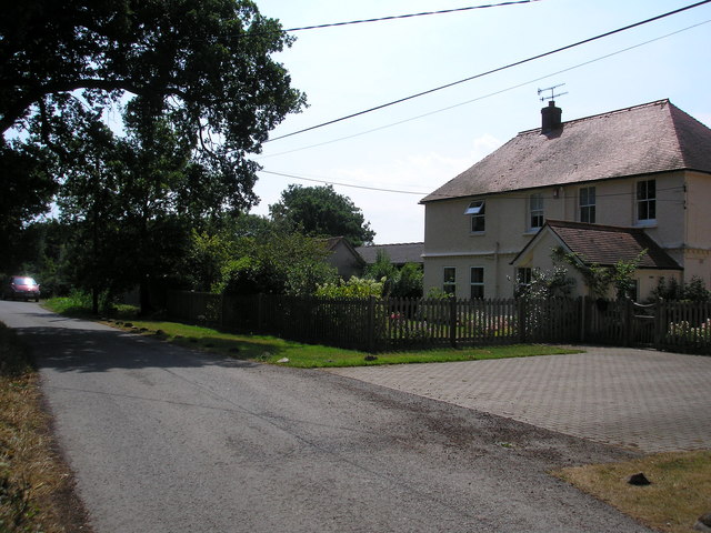
Crowhurst Images

Images are sourced within 2km of 51.204501/-0.00387 or Grid Reference TQ3946. Thanks to Geograph Open Source API. All images are credited.

Grain Yard, Barrow Green Farm, near Lingfield, Surrey This should be the last 'first geograph' for the TQ44 hectad, of which I have contributed some 48.
Grain Yard, Barrow Green Farm, near Lingfield, Surrey
This should be the last 'first geograph' for the TQ44 hectad, of which I have contributed some 48.
Crowhurst Brickworks - chimney The old brickworks site still retains its chimney, which is square.
Crowhurst Brickworks - chimney
The old brickworks site still retains its chimney, which is square.
Railway bridge On the railway line between Hurst Green and Lingfield on Caterfield Lane
Railway bridge
On the railway line between Hurst Green and Lingfield on Caterfield Lane
Crowhurst Manor - Gate House The present Crowhurst Manor house and farm date back to 15th century. This gate house is much more recent.
Crowhurst Manor - Gate House
The present Crowhurst Manor house and farm date back to 15th century. This gate house is much more recent.
Withycroft House, Bowerland Lane, near Lingfield, Surrey The house is on a minor lane just west of the East Grinstead railway line
Withycroft House, Bowerland Lane, near Lingfield, Surrey
The house is on a minor lane just west of the East Grinstead railway line
Footpath across railway line Footpath crossing the Tonbridge to Redhill railway line.
Footpath across railway line
Footpath crossing the Tonbridge to Redhill railway line.
Ponies near Crowhurst Lane, Surrey A sharp shower of rain had just begun as we reached these friendly ponies being groomed in a field not far south of Crowhurst Lane.
Ponies near Crowhurst Lane, Surrey
A sharp shower of rain had just begun as we reached these friendly ponies being groomed in a field not far south of Crowhurst Lane.
Meadow and woodland, near Crowhurst, Surrey No metalled road enters this gridsquare, which is thus a haven of peaceful English countryside.  The infant River Eden meanders just beyond the trees, and a large herd of Channel Islands cattle can also just be discerned.
Meadow and woodland, near Crowhurst, Surrey
No metalled road enters this gridsquare, which is thus a haven of peaceful English countryside. The infant River Eden meanders just beyond the trees, and a large herd of Channel Islands cattle can also just be discerned.
The Crowhurst Yew This ancient tree is estimated to be around 4,000 years old; maybe twice the age of the church in whose graveyard it now stands. The location of a church here may suggest an effort to put an obvious Christian stamp on a site that was already of religious or spiritual significance to a pre-Christian population, thus easing the transition of religion.
The Crowhurst Yew
This ancient tree is estimated to be around 4,000 years old; maybe twice the age of the church in whose graveyard it now stands. The location of a church here may suggest an effort to put an obvious Christian stamp on a site that was already of religious or spiritual significance to a pre-Christian population, thus easing the transition of religion.
St. George's Church at Crowhurst The small disperesed village of Crowhurst lies about two miles north of Lingfield and is centred in the west of this grid-square around the small mediaeval church of St. George, seen here from the village street. 
<a href="https://www.geograph.org.uk/photo/691472">TQ3947 : The Crowhurst Yew</a> stands in the churchyard and its foliage can be seen to the right of the picture.
St. George's Church at Crowhurst
The small disperesed village of Crowhurst lies about two miles north of Lingfield and is centred in the west of this grid-square around the small mediaeval church of St. George, seen here from the village street. TQ3947 : The Crowhurst Yew stands in the churchyard and its foliage can be seen to the right of the picture.
Footpath near Lingfield, Surrey This footpath leads about 1.5 miles westwards from the end of Bowerlands Lane to Blindley Heath
Footpath near Lingfield, Surrey
This footpath leads about 1.5 miles westwards from the end of Bowerlands Lane to Blindley Heath
The Oast House, Pikes Lane, Crowhurst, Surrey Single round kiln oast house. The offset kiln suggests there may have been more kilns originally.
The Oast House, Pikes Lane, Crowhurst, Surrey
Single round kiln oast house. The offset kiln suggests there may have been more kilns originally.
Railway bridge over Bowerland Lane The declared headroom is 13' 0" - the rest of the world except America need calculators to work out what that is!
Railway bridge over Bowerland Lane
The declared headroom is 13' 0" - the rest of the world except America need calculators to work out what that is!
Field and wood Old Furzefield Wood is on the left.
Field and wood
Old Furzefield Wood is on the left.
Postbox on Crowhurst Road This rather remote location seems to be sited on the centroid of several scattered dwellings.
Postbox on Crowhurst Road
This rather remote location seems to be sited on the centroid of several scattered dwellings.
View from bridge HGG1 856 Looking in the Up direction towards Hurst Green on the East Grinstead line.
View from bridge HGG1 856
Looking in the Up direction towards Hurst Green on the East Grinstead line.
Way between fields The railway is behind the fence on the right.
Way between fields
The railway is behind the fence on the right.
Old excavations In the belt of woodland by Gibbs Brook Lane.
Old excavations
In the belt of woodland by Gibbs Brook Lane.
Show me another place!

Crowhurst is located at Grid Ref: TQ3946 (Lat: 51.204501, Lng: -0.00387)

Administrative County: Surrey

District: Tandridge

Police Authority: Surrey

What 3 Words

///sunk.apply.plates. Near Lingfield, Surrey

Nearby Locations

Crowhurst

Related Wikis

Crowhurst, Surrey

Crowhurst is a village and civil parish in the Tandridge district of Surrey, England. The nearest town is Oxted, 3 miles (5 km) to the north. Rated two...
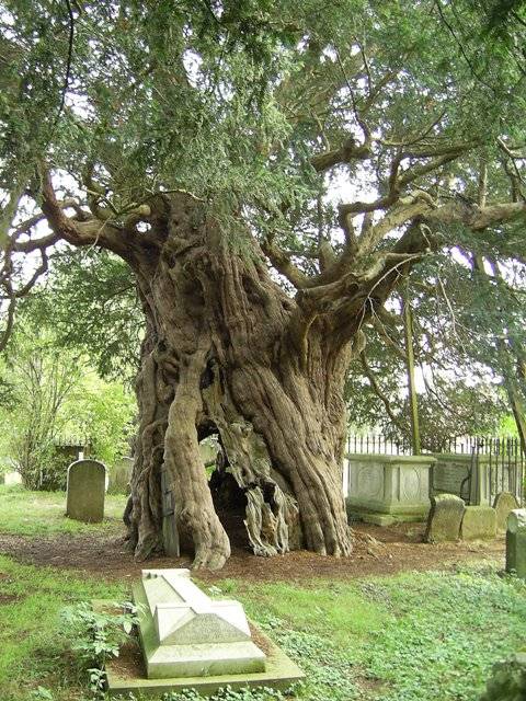
Crowhurst Yew

The Crowhurst Yew is a yew tree in the churchyard of St George's Church in Crowhurst, Surrey, England. It is thought to be about 4,000 years old. Its girth...

Crowhurst Place

Crowhurst Place, Crowhurst, Surrey, England is a medieval hall house dating from the early 15th century. In the 20th century, the house was reconstructed...

Staffhurst Wood

Staffhurst Wood is a 51-hectare (130-acre) biological Site of Special Scientific Interest south of Oxted in Surrey. It is a Nature Conservation Review...

Haxted Watermill

Haxted Watermill is a much-restored Grade II listed watermill in Surrey, England, close to the border with Kent, and is powered by the River Eden. ��2...

Lingfield Wildlife Area

Lingfield Wildlife Area is a 6.3-hectare (16-acre) Local Nature Reserve in Lingfield in Surrey. It is owned by Tandridge District Council and managed...

Centenary Fields

Centenary Fields is a 4.2-hectare (10-acre) Local Nature Reserve in Lingfield in Surrey. It is owned by Lingfield Parish Council and managed by Lingfield...

Lingfield railway station

Lingfield railway station is on the East Grinstead branch of the Oxted line in southern England and serves Lingfield in Surrey. It is 26 miles 23 chains...

Nearby Amenities

Located within 500m of 51.204501,-0.00387
Source: Landsat photo
Lat/Long: 51.2061715/-0.0014265
Chellows Farm
Landuse: farm
Note Retag: CS #48756035
Source: npe
Lat/Long: 51.2021367/0.0014993
Post Box
Ref: RH7 99
Lat/Long: 51.201445/-0.0061831
Material: wood
Power: pole
Lat/Long: 51.2079866/-0.0066532
Power: pole
Lat/Long: 51.2072203/-0.0080332
Material: wood
Power: pole
Lat/Long: 51.2088427/-0.0051257
Barrier: stile
Lat/Long: 51.2017946/0.0002937
Source: Landsat photo
Lat/Long: 51.2061593/-0.001365
Material: wood
Power: pole
Lat/Long: 51.2077975/0.0008583
Power: pole
Lat/Long: 51.2064616/-0.0093636
Power: pole
Lat/Long: 51.2000956/-0.0040582
Power: pole
Lat/Long: 51.2009612/-0.003621
Power: pole
Lat/Long: 51.2018183/-0.0031838
Power: pole
Lat/Long: 51.2027174/-0.0027519
Power: pole
Lat/Long: 51.2032502/-0.0024891
Power: pole
Lat/Long: 51.2040333/-0.0020841
Power: pole
Lat/Long: 51.2046719/-0.001325
Power: pole
Lat/Long: 51.2052466/-0.0006196
Power: pole
Lat/Long: 51.2058482/0.0001207
Material: wood
Power: pole
Lat/Long: 51.2069254/0.0005391
Barrier: stile
Lat/Long: 51.2019865/0.0001533
Barrier: stile
Lat/Long: 51.2038291/0.002933
The data included in this document is from www.openstreetmap.org. The data is made available under ODbL.

Have you been to Crowhurst?

Leave your review of Crowhurst below (or comments, questions and feedback).