Covehithe

Civil Parish in Suffolk East Suffolk

England

Covehithe

Field south-east of Wrentham
Field south-east of Wrentham Credit: Christopher Hilton

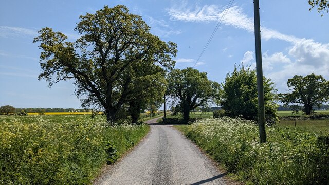
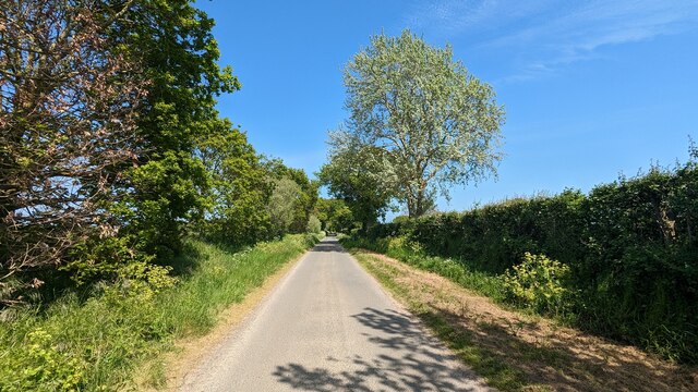
Covehithe is a small civil parish located in the county of Suffolk, England. It is situated on the east coast, approximately 4 miles north of the town of Southwold. The parish is known for its picturesque and unspoiled coastline, which attracts visitors seeking tranquility and natural beauty.

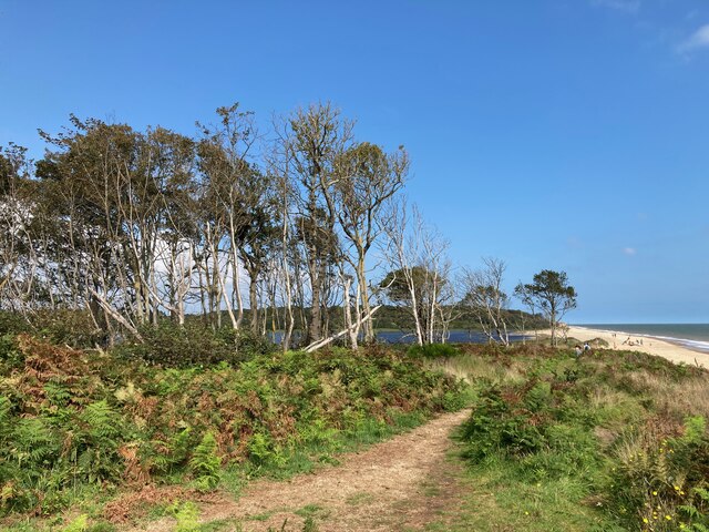
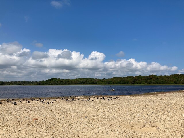
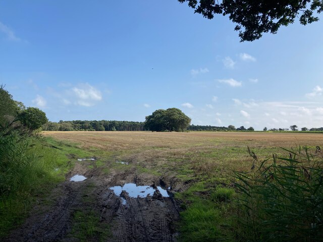
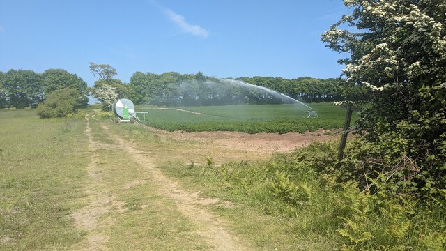
Covehithe is a sparsely populated area with a population of just over 20 people according to the latest census data. The parish is characterized by its rural charm, with a landscape dominated by farmlands and woodland areas. It is a haven for wildlife, and visitors may spot various species of birds and other animals in the area.

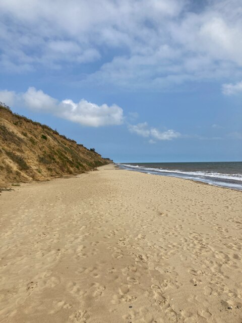
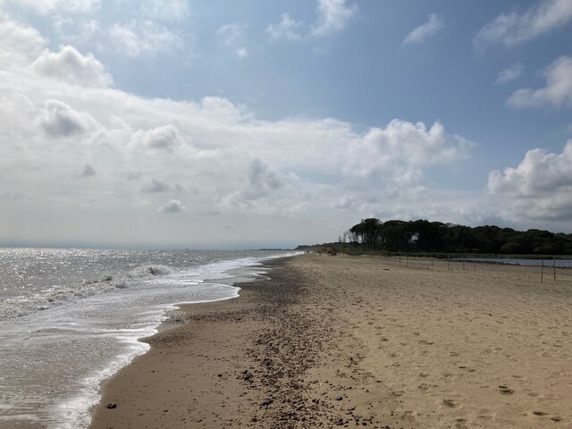
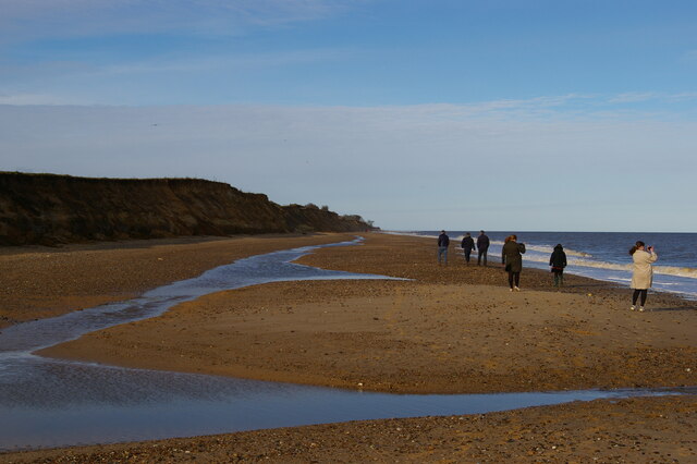
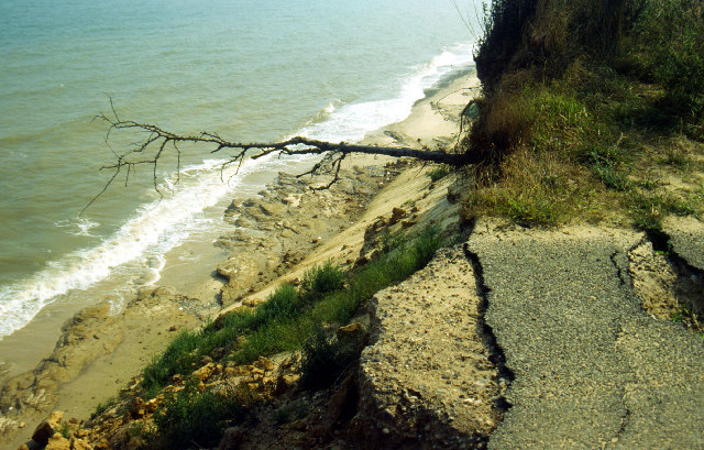
One of the main features of Covehithe is its stunning beach. The coastline is largely undeveloped and offers a peaceful retreat for those looking to escape the crowds. The beach is known for its golden sand and beautiful dunes, creating a serene environment for beachcombing, walking, and enjoying the natural surroundings.

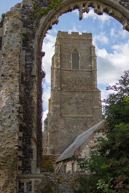
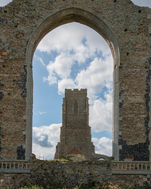
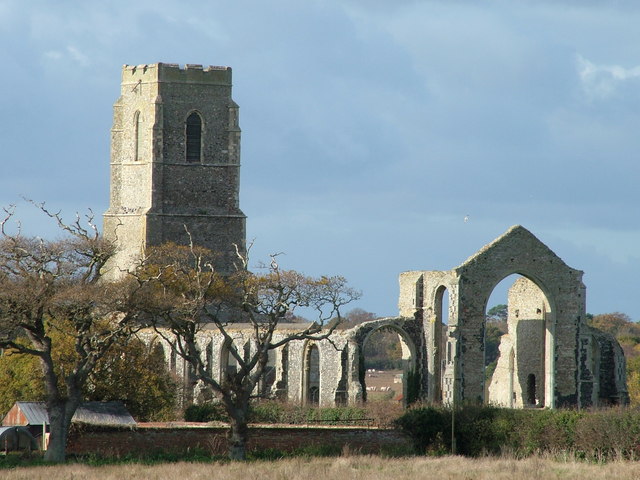
The parish also boasts a historic church, St. Andrew's Church, which is a Grade I listed building. The church dates back to the 17th century and features a distinctive thatched roof, adding to its charm. It is a popular attraction for visitors interested in exploring the local history and architecture.

Overall, Covehithe is a hidden gem in Suffolk, offering a tranquil and untouched coastal experience. Its unspoiled beauty, rural landscape, and historic church make it an appealing destination for nature lovers and those seeking a peaceful retreat.

If you have any feedback on the listing, please let us know in the comments section below.

Covehithe Images

Images are sourced within 2km of 52.372174/1.696228 or Grid Reference TM5181. Thanks to Geograph Open Source API. All images are credited.

Field south-east of Wrentham
St. Andrew's Church, Covehithe A view of the tower from one of the ruined windows.

See also: <span class="nowrap"><a title="http://www.suffolkchurches.co.uk/covehithe.htm" rel="nofollow ugc noopener" href="http://www.suffolkchurches.co.uk/covehithe.htm">Link</a><img style="margin-left:2px;" alt="External link" title="External link - shift click to open in new window" src="https://s1.geograph.org.uk/img/external.png" width="10" height="10"/></span> (Suffolk Churches Website)
St. Andrew's Church, Covehithe
A view of the tower from one of the ruined windows. See also: LinkExternal link (Suffolk Churches Website)
Covehithe Beach
Covehithe Beach
Long Covert and Benacre Broad
Benacre Broad
Benacre Broad
Beach at Benacre
Beach at Benacre
Looking towards North Common Wood
Beach below Covehithe Cliffs
Sandbar at Benacre Broad
Church of St. Andrew, Covehithe <span class="nowrap"><a title="https://historicengland.org.uk/listing/the-list/list-entry/1032168?section=official-list-entry" rel="nofollow ugc noopener" href="https://historicengland.org.uk/listing/the-list/list-entry/1032168?section=official-list-entry">Link</a><img style="margin-left:2px;" alt="External link" title="External link - shift click to open in new window" src="https://s1.geograph.org.uk/img/external.png" width="10" height="10"/></span>
Church of St. Andrew, Covehithe
Anchor House, Covehithe <span class="nowrap"><a title="https://historicengland.org.uk/listing/the-list/list-entry/1352545?section=official-list-entry" rel="nofollow ugc noopener" href="https://historicengland.org.uk/listing/the-list/list-entry/1352545?section=official-list-entry">Link</a><img style="margin-left:2px;" alt="External link" title="External link - shift click to open in new window" src="https://s1.geograph.org.uk/img/external.png" width="10" height="10"/></span>
Anchor House, Covehithe
Church of St. Andrew, Covehithe A church within a church. <span class="nowrap"><a title="https://historicengland.org.uk/listing/the-list/list-entry/1032168?section=official-list-entry" rel="nofollow ugc noopener" href="https://historicengland.org.uk/listing/the-list/list-entry/1032168?section=official-list-entry">Link</a><img style="margin-left:2px;" alt="External link" title="External link - shift click to open in new window" src="https://s1.geograph.org.uk/img/external.png" width="10" height="10"/></span>
Church of St. Andrew, Covehithe
A church within a church. LinkExternal link
Font in Church of St. Andrew, Covehithe <span class="nowrap"><a title="https://historicengland.org.uk/listing/the-list/list-entry/1032168?section=official-list-entry" rel="nofollow ugc noopener" href="https://historicengland.org.uk/listing/the-list/list-entry/1032168?section=official-list-entry">Link</a><img style="margin-left:2px;" alt="External link" title="External link - shift click to open in new window" src="https://s1.geograph.org.uk/img/external.png" width="10" height="10"/></span>
Font in Church of St. Andrew, Covehithe
Whitehouse Farmhouse, Covehithe <span class="nowrap"><a title="https://historicengland.org.uk/listing/the-list/list-entry/1032169?section=official-list-entry" rel="nofollow ugc noopener" href="https://historicengland.org.uk/listing/the-list/list-entry/1032169?section=official-list-entry">Link</a><img style="margin-left:2px;" alt="External link" title="External link - shift click to open in new window" src="https://s1.geograph.org.uk/img/external.png" width="10" height="10"/></span>
Whitehouse Farmhouse, Covehithe
Watering the potatoes
Road leading to Middle Buildings
Suffolk Coast Path Coastal erosion means that the path is often inland and here follows the main road into Covehithe.
Suffolk Coast Path
Coastal erosion means that the path is often inland and here follows the main road into Covehithe.
Show me another place!

Covehithe is located at Grid Ref: TM5181 (Lat: 52.372174, Lng: 1.696228)

Administrative County: Suffolk

District: East Suffolk

Police Authority: Suffolk

What 3 Words

///placidly.motoring.cloak. Near Southwold, Suffolk

Nearby Locations

Covehithe

Related Wikis

Benacre National Nature Reserve

Benacre National Nature Reserve is a national nature reserve in the English county of Suffolk. It is located on the North Sea coast in the parishes of...

Covehithe

Covehithe is a village and civil parish in the East Suffolk district of the English county of Suffolk. It lies on the North Sea coast around 4 miles (6...

St Andrew's Church, Covehithe

St Andrew's Church is a partly redundant Anglican church in the hamlet of Covehithe in the English county of Suffolk. It is recorded in the National Heritage...

Pakefield to Easton Bavents

Pakefield to Easton Bavents is a 735.4-hectare (1,817-acre) biological and geological Site of Special Scientific Interest which stretches along the Suffolk...

Have you been to Covehithe?

Leave your review of Covehithe below (or comments, questions and feedback).