Broadbridge Heath

Settlement in Sussex Horsham

England

Broadbridge Heath

Streets of Horsham Junction of Curzon Avenue and Vale Drive.
Streets of Horsham Credit: James Emmans

Broadbridge Heath is a small village located in the district of Horsham, in the county of Sussex, England. Situated approximately 1.5 miles west of Horsham town center, Broadbridge Heath is known for its picturesque landscape and rural charm.

The village is home to a population of around 5,000 residents and offers a range of amenities and services to cater to their needs. It boasts a number of local shops, including a supermarket, pharmacy, and a few small independent businesses. There are also several pubs and restaurants in the village, providing locals and visitors with dining options.

Broadbridge Heath is surrounded by beautiful countryside, making it an ideal location for outdoor enthusiasts. The village is close to St Leonard's Forest, which offers scenic walking trails, cycling routes, and opportunities for wildlife spotting. The nearby Warnham Nature Reserve is also a popular attraction, known for its diverse birdlife and tranquil surroundings.

Education in Broadbridge Heath is well-served, with a primary school located in the village. For secondary education, students typically attend schools in nearby Horsham.

The village is conveniently located for commuting, with easy access to major road networks. The A24 and A264 roads are both within close proximity, providing connections to London, Brighton, and other surrounding areas. Horsham train station, located nearby, offers regular services to London and other major cities.

Overall, Broadbridge Heath offers a peaceful and idyllic setting, with a strong sense of community and a range of amenities to cater to the needs of its residents.

If you have any feedback on the listing, please let us know in the comments section below.

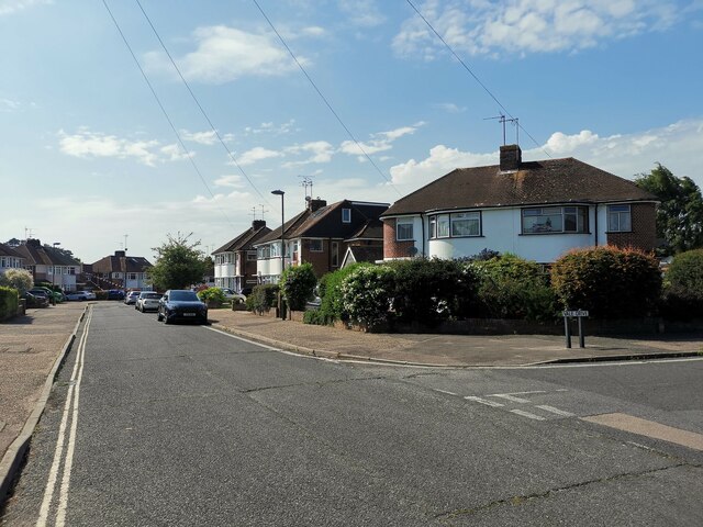
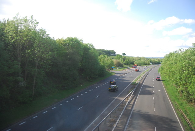
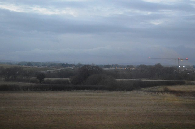
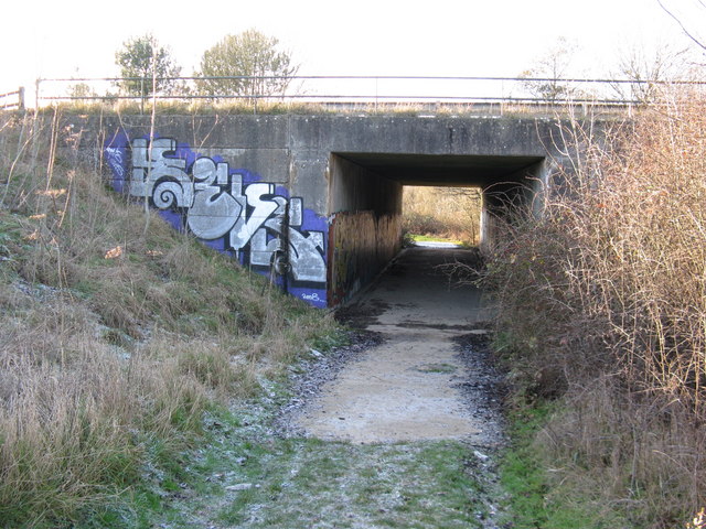
Broadbridge Heath Images

Images are sourced within 2km of 51.07141/-0.363239 or Grid Reference TQ1431. Thanks to Geograph Open Source API. All images are credited.

Streets of Horsham Junction of Curzon Avenue and Vale Drive.
Streets of Horsham
Junction of Curzon Avenue and Vale Drive.
A24 The A24 is a main road that runs from Clapham, in Greater London to Worthing in West Sussex. It passes through or by Sutton, Dorking and Horsham. The road is 55 miles long.
<span class="nowrap"><a title="http://www.sabre-roads.org.uk/wiki/index.php?title=A24" rel="nofollow ugc noopener" href="http://www.sabre-roads.org.uk/wiki/index.php?title=A24">Link</a><img style="margin-left:2px;" alt="External link" title="External link - shift click to open in new window" src="https://s1.geograph.org.uk/img/external.png" width="10" height="10"/></span>
A24
The A24 is a main road that runs from Clapham, in Greater London to Worthing in West Sussex. It passes through or by Sutton, Dorking and Horsham. The road is 55 miles long. LinkExternal link
Farmland by the railway line
A24 The A24 is a main road that runs from Clapham, in Greater London to Worthing in West Sussex. It passes through or by Sutton, Dorking and Horsham. The road is 55 miles long.
<span class="nowrap"><a title="http://www.sabre-roads.org.uk/wiki/index.php?title=A24" rel="nofollow ugc noopener" href="http://www.sabre-roads.org.uk/wiki/index.php?title=A24">Link</a><img style="margin-left:2px;" alt="External link" title="External link - shift click to open in new window" src="https://s1.geograph.org.uk/img/external.png" width="10" height="10"/></span>
A24
The A24 is a main road that runs from Clapham, in Greater London to Worthing in West Sussex. It passes through or by Sutton, Dorking and Horsham. The road is 55 miles long. LinkExternal link
Stile and Fingerpost On Public Footpath FP1628/1
Stile and Fingerpost
On Public Footpath FP1628/1
Do Not loiter on Footpath! Active airfield
Do Not loiter on Footpath!
Active airfield
Farmland near Horsham
Dilapidated farm buildings, Parthings, near Horsham Taken from the bridleway looking south west.
Dilapidated farm buildings, Parthings, near Horsham
Taken from the bridleway looking south west.
Footbridge on footpath 1628/1
Burnet moth on Knapweed Found this Five-Spot Burnet moth (Zygaena trifolii) on a Knapweed flower next to the A24. This was on a huge detour because the repairs to the <a href="https://www.geograph.org.uk/photo/237542">TQ1530 : New footbridge on footpath 1634</a> had not been completed.
Burnet moth on Knapweed
Found this Five-Spot Burnet moth (Zygaena trifolii) on a Knapweed flower next to the A24. This was on a huge detour because the repairs to the TQ1530 : New footbridge on footpath 1634 had not been completed.
Baystone Farm land-fill site This field was a land-fill site from the 1960s to 1981. Landscaping was completed in 1986 with the only evidence left being an unusually high fence and the inspection tubes/methane vents(?), one of which can be seen just to the right of centre. In the distance the towers of <a href="https://www.geograph.org.uk/photo/48570">TQ1428 : Christ's Hospital School</a> can be seen.
Baystone Farm land-fill site
This field was a land-fill site from the 1960s to 1981. Landscaping was completed in 1986 with the only evidence left being an unusually high fence and the inspection tubes/methane vents(?), one of which can be seen just to the right of centre. In the distance the towers of TQ1428 : Christ's Hospital School can be seen.
Pill box in High Woods This type 24 pill box was built to cover the bridge at Floodgates, see <a href="https://www.geograph.org.uk/photo/237542">TQ1530 : New footbridge on footpath 1634</a>.
Pill box in High Woods
This type 24 pill box was built to cover the bridge at Floodgates, see TQ1530 : New footbridge on footpath 1634.
Anti-tank road block cube on Floodgates bridge The farm bridge that this cube blocked fell into disrepair and was replaced by a footbridge.
Anti-tank road block cube on Floodgates bridge
The farm bridge that this cube blocked fell into disrepair and was replaced by a footbridge.
Old farm buildings at Parthings
Train crossing bridge over footpath near Parthings
Bridge carrying the Arundel to Horsham line
Embankment of the Arundel to Horsham line
Graffiti or art? It's always a matter for debate. In this case it brightens up the dull concrete. The inside walls of the bridge are also painted <a href="https://www.geograph.org.uk/photo/1648773">TQ1529 : Graffiti on bridge walls</a>
Graffiti or art?
It's always a matter for debate. In this case it brightens up the dull concrete. The inside walls of the bridge are also painted TQ1529 : Graffiti on bridge walls
Show me another place!

Broadbridge Heath is located at Grid Ref: TQ1431 (Lat: 51.07141, Lng: -0.363239)

Administrative County: West Sussex

District: Horsham

Police Authority: Sussex

What 3 Words

///proven.many.undulation. Near Warnham, West Sussex

Nearby Locations

Broadbridge Heath

Related Wikis

Broadbridge Heath

Broadbridge Heath is a village and civil parish in the Horsham district of West Sussex, England. It is about two miles (3 km) west from the historic centre...

Field Place, Warnham

Field Place is a Grade I listed house in Warnham, West Sussex, England. It is the birthplace of the poet Percy Bysshe Shelley, born there in 1792. The...

Broadbridge Heath F.C.

Broadbridge Heath Football Club is a football club based in Broadbridge Heath, near Horsham, in West Sussex, England. They are currently members of the...

Tanbridge House School

Tanbridge House School is a coeducational secondary school located in Horsham, West Sussex, England. Its current head master is Mr Sheridan who started...

Nearby Amenities

Located within 500m of 51.07141,-0.363239
Crossing
Crossing: zebra
Kerb: lowered
Tactile Paving: yes
Lat/Long: 51.0716312/-0.3598036
Post Box
Operator: Royal Mail
Operator Wikidata: Q638098
Ref: RH12 170
Lat/Long: 51.0702322/-0.3673869
Post Office
Broadbridge Heath Post Office
Addr City: Broadbridge Heath
Addr Housenumber: 48-50
Addr Postcode: RH12 3LW
Addr Street: Billingshurst Road
Brand: Post Office
Brand Wikidata: Q1783168
Operator: One Stop Stores Ltd
Ref Pol Id: 1026
Website: https://www.postoffice.co.uk/branch-finder/0909122/broadbridge-heath
Lat/Long: 51.0715655/-0.36276
Crossing
Crossing: uncontrolled
Crossing Ref: zebra
Kerb: lowered
Tactile Paving: yes
Lat/Long: 51.0713557/-0.3595014
Mini Roundabout
Lat/Long: 51.0692319/-0.368798
Charrington Way
Bench: yes
Bin: yes
Lit: yes
Naptan AtcoCode: 4400HO0045
Naptan Bearing: SW
Naptan CommonName: Charrington Way
Naptan Indicator: opp Charrington Way
Naptan Landmark: Charrington Way
Naptan NaptanCode: wsxapmwj
Naptan Street: Billinghurst Road
Naptan Verified: no
Shelter: no
Source: naptan_import
Tactile Paving: no
Lat/Long: 51.0697704/-0.3682867
Kingsmead Road
Bench: yes
Bin: yes
Lit: yes
Naptan AtcoCode: 4400HO0046
Naptan Bearing: NE
Naptan CommonName: Kingsmead Road
Naptan Indicator: opp. Kingsmead Road
Naptan Landmark: Kingsmead Road
Naptan NaptanCode: wsxapmwm
Naptan Street: Billinghurst Road
Naptan Verified: no
Shelter: yes
Source: naptan_import
Tactile Paving: no
Lat/Long: 51.0702192/-0.3676207
Warnham Road
Naptan AtcoCode: 4400HO0047
Naptan Bearing: E
Naptan CommonName: Warnham Road
Naptan Indicator: adj Warnham Road
Naptan Landmark: Warnham Road
Naptan NaptanCode: wsxapmwp
Naptan Street: Billinghurst Road
Naptan Verified: no
Source: naptan_import
Lat/Long: 51.0714346/-0.3641646
Warnham Road
Naptan AtcoCode: 4400HO0048
Naptan Bearing: W
Naptan CommonName: Warnham Road
Naptan Indicator: opp. Warnham Road
Naptan Landmark: Warnham Road
Naptan NaptanCode: wsxapmwt
Naptan Street: Billinghurst Road
Naptan Verified: no
Source: naptan_import
Lat/Long: 51.0714502/-0.3636615
Bus Stop
Church Road
Bus: yes
Naptan AtcoCode: 4400HO0049
Naptan Bearing: E
Naptan CommonName: Church Road
Naptan Indicator: opp. Church Road
Naptan Landmark: Church Road
Naptan NaptanCode: wsxaptad
Naptan Street: Billinghurst Road
Naptan Verified: no
Public Transport: platform
Source: naptan_import
Lat/Long: 51.0715321/-0.3609777
Bus Stop
Church Road
Bus: yes
Naptan AtcoCode: 4400HO0050
Naptan Bearing: W
Naptan CommonName: Church Road
Naptan Indicator: opp. Guildford Road
Naptan Landmark: Church Road
Naptan NaptanCode: wsxaptag
Naptan Street: Billinghurst Road
Naptan Verified: no
Public Transport: platform
Source: naptan_import
Lat/Long: 51.0713973/-0.3604212
Shelley Arms
Bus: yes
Public Transport: stop_position
Lat/Long: 51.0712601/-0.3581339
Shelley Arms
Bus: yes
Public Transport: stop_position
Lat/Long: 51.0711902/-0.3572031
Broadbridge Heath
Is In: West Sussex, England, UK
Place: village
Wikidata: Q2267976
Lat/Long: 51.070514/-0.3611287
Station Garage Škoda
Addr Street: Billingshurst Road
Shop: car
Lat/Long: 51.0716347/-0.3648316
Barrier: kissing_gate
Foot: yes
Lat/Long: 51.0724098/-0.3685166
Forge Close
Bus: yes
Public Transport: stop_position
Lat/Long: 51.0722124/-0.3617277
Post Box
Collection Plate: CP1
Collection Times: Mo-Fr 17:00; Sa 11:30
Operator: Royal Mail
Operator Wikidata: Q638098
Post Box Type: pillar
Ref: RH12 238
Royal Cypher: EIIR
Royal Cypher Wikidata: Q33102113
Lat/Long: 51.071549/-0.3629493
Post Box
Collection Plate: CP7D
Collection Times: Mo-Fr 09:00; Sa 07:00
Operator: Royal Mail
Operator Wikidata: Q638098
Post Box Type: lamp
Ref: RH12 212D
Royal Cypher: EIIR
Royal Cypher Wikidata: Q33102113
Lat/Long: 51.0691032/-0.3598936
Nichola R. Lloyd
Shop: hairdresser
Lat/Long: 51.0712046/-0.3588816
Barnetts
Shop: hairdresser
Lat/Long: 51.0712105/-0.3587716
The Ironing Shop
Shop: laundry
Lat/Long: 51.0714812/-0.3600163
Old Post Cottages
Addr Housename: Old Post Cottages
Building: residential
Wikidata: Q26278027
Lat/Long: 51.0710206/-0.3595249
War Memorial
Historic: memorial
Lat/Long: 51.0713739/-0.3608439
One Stop
Addr City: Broadbridge Heath
Addr Housenumber: 48 - 50
Addr Postcode: RH12 3LW
Addr Street: Billingshurst Road
Brand: One Stop
Brand Wikidata: Q65954217
Contact Website: https://www.onestop.co.uk/store?store=06902361-23be-498f-8b0f-86e939a72260
Fhrs Id: 338411
Opening Hours: 06:00-22:00
Phone: +44 1403 265054
Shop: convenience
Source Addr: FHRS Open Data
Lat/Long: 51.0715631/-0.3628488
Bus: yes
Public Transport: stop_position
Lat/Long: 51.0714397/-0.3604042
Bus: yes
Public Transport: stop_position
Lat/Long: 51.0714891/-0.3609756
Bus Stop
Shelley Arms
Bus: yes
Naptan AtcoCode: 4400HO0052
Naptan Bearing: W
Naptan CommonName: Shelley Arms PH
Naptan Indicator: opp. Shelley Arms
Naptan Landmark: Wickhurst Lane
Naptan NaptanCode: wsxaptam
Naptan Street: Old Guildford Road
Naptan Verified: no
Public Transport: platform
Shelter: yes
Lat/Long: 51.0711417/-0.3572108
Bus Stop
Shelley Arms
Bus: yes
Naptan AtcoCode: 4400HO0051
Naptan Bearing: E
Naptan CommonName: Shelley Arms PH
Naptan Indicator: adj Shelley Arms
Naptan Landmark: Wickhurst Lane
Naptan NaptanCode: wsxaptaj
Naptan Street: Old Guildford Road
Naptan Verified: no
Public Transport: platform
Shelter: yes
Lat/Long: 51.0713149/-0.3581292
Bus Stop
Forge Close
Addr District: Broadbridge Heath
Addr Street: Old Guildford Road
Bearing: W
Bus: yes
Naptan AtcoCode: 4400HO0337
Naptan NaptanCode: wsxgmjpa
Public Transport: platform
Lat/Long: 51.0721716/-0.3617849
Bus Stop
Forge Close
Addr District: Broadbridge Heath
Addr Street: Old Guildford Road
Bearing: E
Bus: yes
Naptan AtcoCode: 4400HO0338
Naptan NaptanCode: wsxgmjpd
Public Transport: platform
Lat/Long: 51.0722606/-0.3616755
Post Box
Collection Plate: CP1D
Collection Times: Mo-Fr 09:00; Sa 07:00
Description: This postbox is very discreet and is not easily visible when walking along Old Guildford Road. This postbox is in the wall on the left hand side of the sheltered walkway into house number 38 before the resident's private door.
Operator: Royal Mail
Operator Wikidata: Q638098
Post Box Type: wall
Ref: RH12 123D
Royal Cypher: EIIR
Royal Cypher Wikidata: Q33102113
Lat/Long: 51.0714981/-0.3592038
Washout Hydrant
Fire Hydrant
Emergency: fire_hydrant
Fire Hydrant Type: underground
Survey Date: 2018-11-11
Water Source: main
Lat/Long: 51.072722/-0.3639496
Washout Hydrant
Fire Hydrant
Emergency: fire_hydrant
Fire Hydrant Type: underground
Survey Date: 2018-11-11
Water Source: main
Lat/Long: 51.070316/-0.356498
Washout Hydrant
Fire Hydrant
Emergency: fire_hydrant
Fire Hydrant Type: underground
Survey Date: 2018-11-11
Water Source: main
Lat/Long: 51.068856/-0.3678113
Washout Hydrant
Fire Hydrant
Emergency: fire_hydrant
Fire Hydrant Type: underground
Survey Date: 2018-11-11
Water Source: main
Lat/Long: 51.070221/-0.3593561
Washout Hydrant
Fire Hydrant
Emergency: fire_hydrant
Fire Hydrant Type: underground
Survey Date: 2018-11-11
Water Source: main
Lat/Long: 51.070284/-0.3593824
Barrier: bollard
Bicycle: yes
Foot: yes
Lat/Long: 51.0676209/-0.3594934
Crossing
Bicycle: yes
Crossing: unmarked
Crossing Island: no
Crossing Markings: no
Kerb: flush
Tactile Paving: yes
Lat/Long: 51.0691935/-0.368714
Artwork Type: sculpture
Tourism: artwork
Lat/Long: 51.0723659/-0.3569744
Bus Stop
Bus: yes
Public Transport: platform
Shelter: yes
Lat/Long: 51.0669671/-0.3638645
Bus Stop
Bus: yes
Naptan AtcoCode: 4400HO1585
Naptan NaptanCode: wsxgtawp
Public Transport: platform
Shelter: yes
Lat/Long: 51.0670337/-0.3636485
Waste Basket
Waste: dog_excrement
Lat/Long: 51.0724959/-0.3621713
Waste Basket
Waste: dog_excrement
Lat/Long: 51.0721958/-0.3613989
Bench
Lat/Long: 51.0739136/-0.3602606
Bench
Lat/Long: 51.0734299/-0.3603038
Bus Stop
Warnham Road
Bus: yes
Naptan AtcoCode: 4400HO0048
Naptan Bearing: W
Naptan CommonName: Warnham Road
Naptan Indicator: opp. Warnham Road
Naptan Landmark: Warnham Road
Naptan NaptanCode: wsxapmwt
Naptan Street: Billinghurst Road
Naptan Verified: no
Public Transport: platform
Source: naptan_import
Lat/Long: 51.0714049/-0.3635614
Bus Stop
Warnham Road
Bus: yes
Naptan AtcoCode: 4400HO0047
Naptan Bearing: E
Naptan CommonName: Warnham Road
Naptan Indicator: adj Warnham Road
Naptan Landmark: Warnham Road
Naptan NaptanCode: wsxapmwp
Naptan Street: Billinghurst Road
Naptan Verified: no
Public Transport: platform
Source: naptan_import
Lat/Long: 51.0714824/-0.3642359
Bus Stop
Charrington Way
Bench: yes
Bin: yes
Bus: yes
Lit: yes
Naptan AtcoCode: 4400HO0045
Naptan Bearing: SW
Naptan CommonName: Charrington Way
Naptan Indicator: opp Charrington Way
Naptan Landmark: Charrington Way
Naptan NaptanCode: wsxapmwj
Naptan Street: Billinghurst Road
Naptan Verified: no
Public Transport: platform
Shelter: no
Source: naptan_import
Tactile Paving: no
Lat/Long: 51.0696715/-0.3683169
Bus Stop
Charrington Way
Bench: yes
Bin: yes
Bus: yes
Lit: yes
Naptan AtcoCode: 4400HO0046
Naptan Bearing: NE
Naptan CommonName: Charrington Way
Naptan Indicator: opp. Kingsmead Road
Naptan Landmark: Kingsmead Road
Naptan NaptanCode: wsxapmwm
Naptan Street: Billinghurst Road
Naptan Verified: no
Public Transport: platform
Shelter: yes
Source: naptan_import
Tactile Paving: no
Lat/Long: 51.0701998/-0.3677858
Defibrillator
Emergency: defibrillator
Lat/Long: 51.0675971/-0.3606579
The data included in this document is from www.openstreetmap.org. The data is made available under ODbL.

Have you been to Broadbridge Heath?

Leave your review of Broadbridge Heath below (or comments, questions and feedback).