Coppenhall

Civil Parish in Staffordshire South Staffordshire

England

Coppenhall

Track and Barns, Leese Farm
Track and Barns, Leese Farm Credit: Mick Malpass

Coppenhall is a civil parish located in Staffordshire, England. Situated approximately 4 miles south of Stafford, the parish covers an area of around 7.5 square kilometers and is home to a population of about 500 residents.

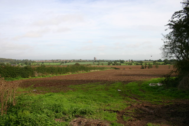
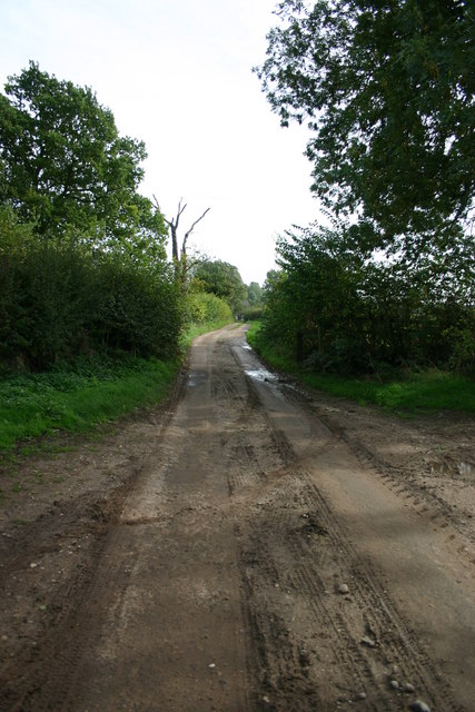
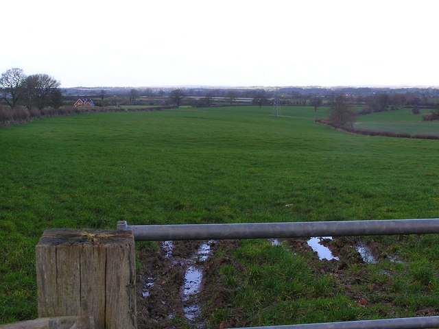
The village of Coppenhall is predominantly rural, with a scattering of residential properties, farmland, and open countryside. The area is known for its picturesque landscapes, including rolling green hills and fields. The nearby River Sow adds to the natural beauty of the surroundings.

Despite its small size, Coppenhall benefits from a strong sense of community. The village has a village hall, which serves as a focal point for social events and gatherings. Additionally, there is a parish church, St. Lawrence's Church, which holds regular services and plays a significant role in the community.

In terms of amenities, Coppenhall is relatively limited. There are no shops or schools within the village itself, with residents typically accessing these services in nearby Stafford. However, the village does have a public house, The Chetwynd Arms, which offers a place for locals and visitors to socialize and enjoy a meal or drink.

Overall, Coppenhall is a charming rural parish that offers residents a peaceful and picturesque environment. Its small size and close-knit community contribute to a sense of belonging and a relaxed way of life.

If you have any feedback on the listing, please let us know in the comments section below.

Coppenhall Images

Images are sourced within 2km of 52.771432/-2.137654 or Grid Reference SJ9019. Thanks to Geograph Open Source API. All images are credited.

Track and Barns, Leese Farm
Gateway and Field Taken from Leese Farm, looking towards Stafford Castle, which can be seen above the trees in the centre of the picture.
Gateway and Field
Taken from Leese Farm, looking towards Stafford Castle, which can be seen above the trees in the centre of the picture.
Lowland in central Staffordshire
Fields off Billington Bank, Stafford A view of fields from an unnamed lane off the brow of Billington bank near Stafford. On the horizon in the distance is 'The Keep', a block of flats on the Highfields Estate in Stafford. There used to be a second block but that was brought down and new housing built.
Fields off Billington Bank, Stafford
A view of fields from an unnamed lane off the brow of Billington bank near Stafford. On the horizon in the distance is 'The Keep', a block of flats on the Highfields Estate in Stafford. There used to be a second block but that was brought down and new housing built.
Unnamed Lane to Leese Farm At the end of this unnamed lane is a public footpath and Leese Farm which can just be seen (the two white features are the windows!).
Unnamed Lane to Leese Farm
At the end of this unnamed lane is a public footpath and Leese Farm which can just be seen (the two white features are the windows!).
Leese Farm from Thorneyfields Lane
Coppenhall Church St Lawrence's, described by Pevsner as 'the perfect 13C village church, small but with great dignity.'  The bell-turret is a Victorian addition.
Coppenhall Church
St Lawrence's, described by Pevsner as 'the perfect 13C village church, small but with great dignity.' The bell-turret is a Victorian addition.
Argos Home Delivery at  Acton Gate Home delivery Regional Distribution Centre, the smallest of three!
Argos Home Delivery at Acton Gate
Home delivery Regional Distribution Centre, the smallest of three!
Gateway near Dunston Heath Farm The farm can be seen at the other side of the field
Gateway near Dunston Heath Farm
The farm can be seen at the other side of the field
Lane to Valley Farm, Dunston A no through road - you can tell by the grass in the middle!
Lane to Valley Farm, Dunston
A no through road - you can tell by the grass in the middle!
Ploughed field and the view to the mill at Butter Hill House Looking from the lane from The Toft to Coppenhall. The mill among the trees is at <a href="https://www.geograph.org.uk/gridref/SJ898181">SJ898181</a>
Ploughed field and the view to the mill at Butter Hill House
Looking from the lane from The Toft to Coppenhall. The mill among the trees is at SJ898181
View across fields to Coppenhall
A new hedge
A new hedge
Track to The Wheats
Track to The Wheats
Believe me, there is a pond here. Looking down at the pond, which lies below the level of the surrounding field, and is hidden by various trees and bushes, including a crab-apple.

See <a href="https://www.geograph.org.uk/photo/250688">SJ9119 : Crab-apples</a>
Believe me, there is a pond here.
Looking down at the pond, which lies below the level of the surrounding field, and is hidden by various trees and bushes, including a crab-apple. See SJ9119 : Crab-apples
Crab-apples Wild apples, growing by a pond. 

See <a href="https://www.geograph.org.uk/photo/250687">SJ9119 : Believe me, there is a pond here.</a>
Crab-apples
Wild apples, growing by a pond. See SJ9119 : Believe me, there is a pond here.
Field where maize has been recently harvested. The trees on the left hide a pond - see <a href="https://www.geograph.org.uk/photo/250687">SJ9119 : Believe me, there is a pond here.</a>
Field where maize has been recently harvested.
The trees on the left hide a pond - see SJ9119 : Believe me, there is a pond here.
Chase View Lane This is a very narrow lane from Coppenhall to Ash Flats. It has 2 right angled bends, this is the view from the northern bend looking towards Coppenhall.
Chase View Lane
This is a very narrow lane from Coppenhall to Ash Flats. It has 2 right angled bends, this is the view from the northern bend looking towards Coppenhall.
Show me another place!

Coppenhall is located at Grid Ref: SJ9019 (Lat: 52.771432, Lng: -2.137654)

Administrative County: Staffordshire

District: South Staffordshire

Police Authority: Staffordshire

What 3 Words

///fruity.warblers.meals. Near Stafford, Staffordshire

Nearby Locations

Coppenhall Coppenhall

Related Wikis

St Lawrence's Church, Coppenhall

St Lawrence's Church, Coppenhall is a Grade II* listed parish church in the Church of England in Coppenhall, Staffordshire. == History == The small ancient...

Hyde Lea

Hyde Lea is a village and parish in Staffordshire, England, just west of Stafford itself. Hyde Lea borders the southern boundary of Castle Church parish...

Coppenhall

Coppenhall is a small settlement in Staffordshire, England. Coppenhall lies 2 kilometres (1 mi) southwest of Stafford and 4 miles (6.4 km) NNW of Penkridge...

Stafford Grammar School

Stafford Grammar School is a mixed independent day school at Burton Manor, located on the outskirts of Stafford, the county town of Staffordshire. Founded...

Nearby Amenities

Located within 500m of 52.771432,-2.137654
Bus Stop
Firtree Close
Bus: yes
Naptan AtcoCode: 3800C649101
Naptan Bearing: NE
Naptan CommonName: Firtree Close
Naptan Indicator: Opp
Naptan Landmark: Firtree Close
Naptan Street: Hyde Bank
Naptan Verified: no
Public Transport: platform
Source: naptan_import
Lat/Long: 52.7726096/-2.1355272
Bus Stop
Firtree Close
Bus: yes
Naptan AtcoCode: 3800C649102
Naptan Bearing: SW
Naptan CommonName: Firtree Close
Naptan Indicator: Adj
Naptan Landmark: Firtree Close
Naptan Street: Hyde Bank
Naptan Verified: no
Public Transport: platform
Source: naptan_import
Lat/Long: 52.7725828/-2.1354233
Coppenhall
Place: village
Lat/Long: 52.7724699/-2.136081
Barrier: stile
Lat/Long: 52.7720596/-2.1341133
Barrier: stile
Lat/Long: 52.7715831/-2.1341188
Generator Method: photovoltaic
Generator Output Electricity: yes
Generator Source: solar
Generator Type: solar_photovoltaic_panel
Location: roof
Power: generator
Lat/Long: 52.7716521/-2.1387318
Generator Method: photovoltaic
Generator Output Electricity: yes
Generator Source: solar
Generator Type: solar_photovoltaic_panel
Location: roof
Power: generator
Lat/Long: 52.7717429/-2.1375489
Generator Method: photovoltaic
Generator Output Electricity: yes
Generator Source: solar
Generator Type: solar_photovoltaic_panel
Location: roof
Power: generator
Lat/Long: 52.7716764/-2.1374819
The data included in this document is from www.openstreetmap.org. The data is made available under ODbL.

Have you been to Coppenhall?

Leave your review of Coppenhall below (or comments, questions and feedback).