Conisbrough Parks
Civil Parish in Yorkshire Doncaster
England
Conisbrough Parks

Conisbrough Parks is a civil parish located in the Metropolitan Borough of Doncaster, South Yorkshire, England. It is situated approximately 5 miles southwest of Doncaster town center. The parish covers an area of approximately 4.7 square miles and is home to a population of around 2,000 residents.
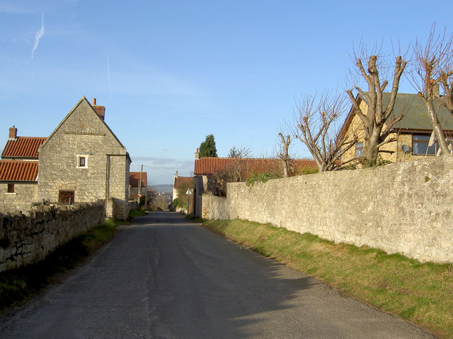
The area is known for its picturesque landscapes and open green spaces. Conisbrough Parks is surrounded by the stunning countryside of South Yorkshire, offering residents and visitors a peaceful and tranquil environment. The parish is characterized by its rolling hills, meandering streams, and woodlands, making it an ideal location for outdoor activities such as walking, hiking, and cycling.
One of the prominent features of Conisbrough Parks is the historic Conisbrough Castle, a 12th-century medieval fortress. The castle is a popular tourist attraction and a significant historical site, offering visitors a glimpse into the region's rich heritage.
The parish also boasts several local amenities and facilities, including a primary school, a community center, and a local pub. Additionally, there are various shops, restaurants, and cafes in the nearby town of Conisbrough, providing residents with easy access to essential services and leisure activities.
Overall, Conisbrough Parks offers a delightful blend of natural beauty, historical significance, and community spirit, making it an appealing place to live or visit for those seeking a peaceful and idyllic setting in the heart of Yorkshire.
If you have any feedback on the listing, please let us know in the comments section below.
Conisbrough Parks Images
Images are sourced within 2km of 53.465513/-1.225982 or Grid Reference SK5196. Thanks to Geograph Open Source API. All images are credited.


Conisbrough Parks is located at Grid Ref: SK5196 (Lat: 53.465513, Lng: -1.225982)
Division: West Riding
Administrative County: South Yorkshire
District: Doncaster
Police Authority: South Yorkshire
What 3 Words
///unicorns.supplier.mimics. Near Conisbrough, South Yorkshire
Nearby Locations
Related Wikis
Clifton, Doncaster
Clifton is a small village to the south-west of Doncaster, within the boundary of the civil parish of Conisbrough Parks, which had a population of 385...

Conisbrough Parks
Conisbrough Parks is a civil parish in the Metropolitan Borough of Doncaster and ceremonial county of South Yorkshire in England. It had a population...
Ashfield Brick Pits
Ashfield Brick Pits (grid reference SK515981) is a 0.6 hectare (1.4 acre) geological site of Special Scientific Interest south of Conisbrough in South...

Conisbrough
Conisbrough () is a town within the City of Doncaster, in South Yorkshire, England. It is roughly midway between Doncaster and Rotherham, and is built...

A630 road
The A630 is an A road in the United Kingdom. It runs between Sheffield city centre (53.3762°N 1.3998°W / 53.3762; -1.3998 (A630 road (southwestern end...

St Peter's Church, Conisbrough
St Peter's Church is a parish church in Conisbrough, in South Yorkshire, in England. The core of the church is believed to be 8th-century, based on similarities...
Cudworth Urban District
Cudworth was an urban district in the West Riding of Yorkshire, England between 1900 and 1974. It encompassed the towns of Cudworth and Upper Cudworth...
Conisbrough Urban District
Conisbrough was an urban district in the West Riding of Yorkshire, England between 1921 and 1974. It encompassed the towns of Conisbrough and Denaby Main...
Nearby Amenities
Located within 500m of 53.465513,-1.225982Have you been to Conisbrough Parks?
Leave your review of Conisbrough Parks below (or comments, questions and feedback).