Clyst St. Lawrence

Civil Parish in Devon East Devon

England

Clyst St. Lawrence

Long Country Lane A country lane running between Three Elms Cross and Summer Bridge near Clyst St Lawrence in Devon.
Long Country Lane Credit: John P Reeves

Clyst St. Lawrence is a civil parish located in the county of Devon, England. Situated approximately 10 miles east of the city of Exeter, it is part of the East Devon district. The parish covers an area of around 3 square miles and is home to a population of about 500 residents.

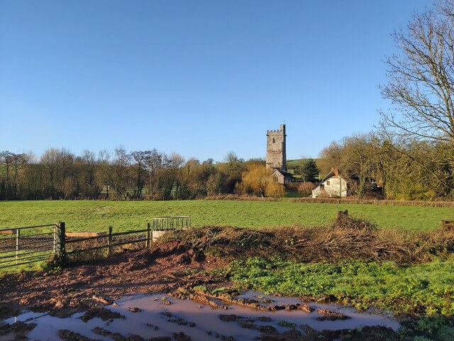
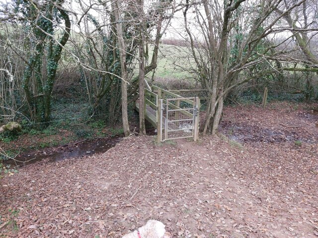
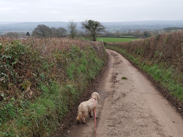
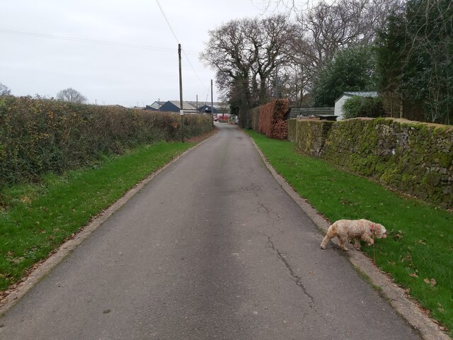
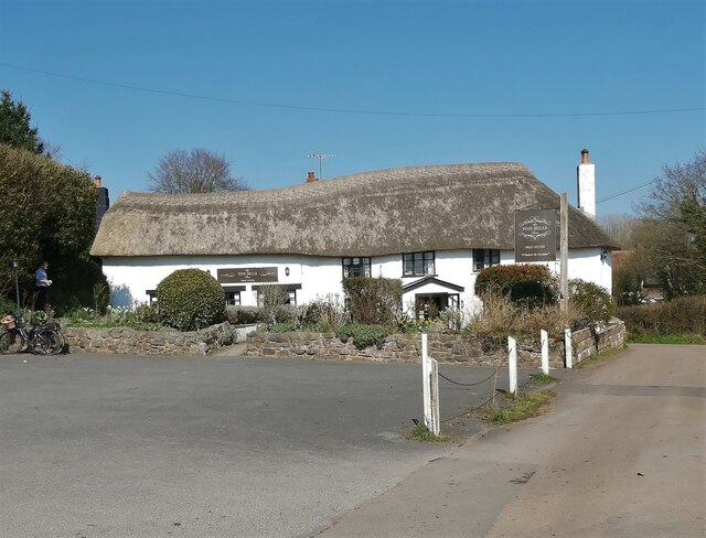
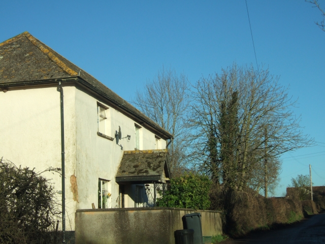
The village of Clyst St. Lawrence is nestled in the picturesque countryside of the Clyst Valley. It is known for its charming thatched cottages and beautiful surrounding landscapes. The parish is predominantly rural, with a mix of farmland and woodland, providing a tranquil and idyllic setting.

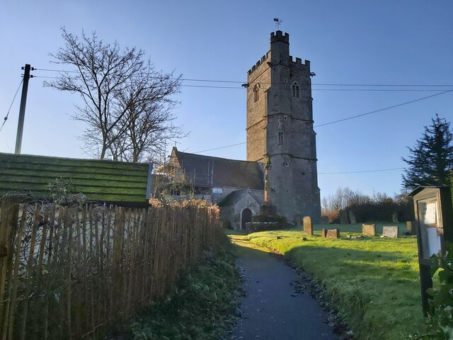
The parish church of St. Lawrence, dating back to the 12th century, is a prominent landmark in the village. It is a Grade I listed building and features a stunning medieval tower and a Norman font. The church has a rich history and is well-preserved, attracting visitors interested in historical and architectural heritage.

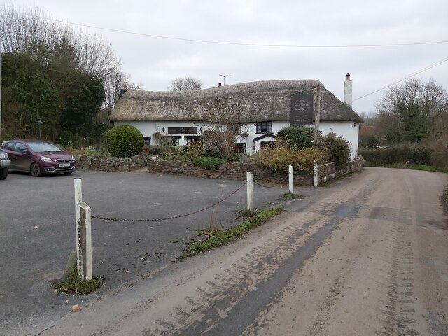
Clyst St. Lawrence is also home to a primary school, providing education for children in the local area. The village has a strong sense of community, with various social activities and events organized throughout the year. Additionally, there are several local businesses, including a village shop and a pub, serving the needs of the residents.

The parish is well-connected to nearby towns and cities via road links, making it accessible for commuters and visitors alike. With its rural charm and convenient location, Clyst St. Lawrence offers a peaceful and picturesque setting for residents and visitors to enjoy.

If you have any feedback on the listing, please let us know in the comments section below.

Clyst St. Lawrence Images

Images are sourced within 2km of 50.792709/-3.382341 or Grid Reference ST0200. Thanks to Geograph Open Source API. All images are credited.

Long Country Lane A country lane running between Three Elms Cross and Summer Bridge near Clyst St Lawrence in Devon.
Long Country Lane
A country lane running between Three Elms Cross and Summer Bridge near Clyst St Lawrence in Devon.
Road Junction A country lane road junction just north of Hitt's Farm between the villages of Clyst St Lawrence and Whimple in Devon.
Road Junction
A country lane road junction just north of Hitt's Farm between the villages of Clyst St Lawrence and Whimple in Devon.
Footpath on the Edge of a Field A public footpath running alongside a hedge on the edge of a field just north of Hitt's Farm between the villages of Clyst St Lawrence and Whimple in Devon.
Footpath on the Edge of a Field
A public footpath running alongside a hedge on the edge of a field just north of Hitt's Farm between the villages of Clyst St Lawrence and Whimple in Devon.
St Lawrence Church in Devon A view of the front of St Lawrence Church in Clyst St Lawrence in Devon as viewed from the entrance path from the country lane that runs through the village.
St Lawrence Church in Devon
A view of the front of St Lawrence Church in Clyst St Lawrence in Devon as viewed from the entrance path from the country lane that runs through the village.
St Lawrence Church in Devon A distant view of St Lawrence Church in Clyst St Lawrence in Devon as viewed from a nearby public footpath.
St Lawrence Church in Devon
A distant view of St Lawrence Church in Clyst St Lawrence in Devon as viewed from a nearby public footpath.
Road Bridge over the River View of the road bridge crossing the River Clyst in the village of Cyst Hydon in Devon.
Road Bridge over the River
View of the road bridge crossing the River Clyst in the village of Cyst Hydon in Devon.
St Andrew Church in Clyst Hydon A front view of St Andrew Church in Clyst Hydon, Devon as seen from the public footpath running through the adjoining farmers field.
St Andrew Church in Clyst Hydon
A front view of St Andrew Church in Clyst Hydon, Devon as seen from the public footpath running through the adjoining farmers field.
St Andrew Church in Clyst Hydon A side view of St Andrew Church in Clyst Hydon, Devon as seen from the public footpath running through the adjoining farmers field.
St Andrew Church in Clyst Hydon
A side view of St Andrew Church in Clyst Hydon, Devon as seen from the public footpath running through the adjoining farmers field.
The Five Bells Inn near Clyst Hydon A view of the Five Bells Inn near Clyst Hydon in Devon as viewed from the country road that runs from One Fir to Woodhayes.
The Five Bells Inn near Clyst Hydon
A view of the Five Bells Inn near Clyst Hydon in Devon as viewed from the country road that runs from One Fir to Woodhayes.
Footbridge over a Stream A gated footbridge over a stream near the River Clyst in Devon. The foot bridge is part of a public footpath in the Clyst St Lawrence Country Park running from Clyst St Lawrence to Clyst Hydon.
Footbridge over a Stream
A gated footbridge over a stream near the River Clyst in Devon. The foot bridge is part of a public footpath in the Clyst St Lawrence Country Park running from Clyst St Lawrence to Clyst Hydon.
Country Lane near Hoop-Cross A country road between Sherways Farm and Hoop-Cross in the Clyst St Lawrence Country Park in Devon.
Country Lane near Hoop-Cross
A country road between Sherways Farm and Hoop-Cross in the Clyst St Lawrence Country Park in Devon.
Lane to Twynhayes Farm A view down the small lane to Twynhayes Farm running from Clyst Hydon village in East Devon.
Lane to Twynhayes Farm
A view down the small lane to Twynhayes Farm running from Clyst Hydon village in East Devon.
Five Bells Pub in Clyst Hydon A view of the Five Bells Pub in Clyst Hydon which lies east of the M5 near Ashclyst Forest in Devon.
Five Bells Pub in Clyst Hydon
A view of the Five Bells Pub in Clyst Hydon which lies east of the M5 near Ashclyst Forest in Devon.
Country Lane A view down the country lane running between Courtney's Farm and the village of Aunk in Devon.
Country Lane
A view down the country lane running between Courtney's Farm and the village of Aunk in Devon.
Farm Entrance The entrance to Courtney's Farm as viewed from the country lane running between the farm and the village of Aunk in Devon.
Farm Entrance
The entrance to Courtney's Farm as viewed from the country lane running between the farm and the village of Aunk in Devon.
Country Lane A view down the country lane running between Courtney's Farm and the village of Aunk in Devon near the area of Broad Oak.
Country Lane
A view down the country lane running between Courtney's Farm and the village of Aunk in Devon near the area of Broad Oak.
Path through the Maize This public footpath passes through the farmer's maize crop between Broad Oak and Little Silver in Devon.
Path through the Maize
This public footpath passes through the farmer's maize crop between Broad Oak and Little Silver in Devon.
Path between High Hedges Running between farmland and Little Silver in Devon, this public footpath passes between high hedges as it approaches Little Silver.
Path between High Hedges
Running between farmland and Little Silver in Devon, this public footpath passes between high hedges as it approaches Little Silver.
Show me another place!

Clyst St. Lawrence is located at Grid Ref: ST0200 (Lat: 50.792709, Lng: -3.382341)

Administrative County: Devon

District: East Devon

Police Authority: Devon & Cornwall

What 3 Words

///bespoke.digress.typed. Near Whimple, Devon

Nearby Locations

Clyst St. Lawrence

Related Wikis

Clyst St Lawrence

Clyst St Lawrence is a village and civil parish about 8 miles north-east of the city of Exeter in the county of Devon, England. Historically it formed...

Devon Redlands

The Devon Redlands is a natural region in southwest Britain that has been designated as National Character Area (NCA) 148 by Natural England. == Extent... ==

Aunk

Aunk (anciently Anke) is a small hamlet and former manor in the parish of Clyst Hydon in East Devon, England. The place-name is of Celtic origin along...

Clyst Hydon

Clyst Hydon is a village and civil parish in the county of Devon, England. It was in the Cliston Hundred and has a church dedicated to St Andrew. The parish...

Nearby Amenities

Located within 500m of 50.792709,-3.382341
Upton Cross
Junction: yes
Lat/Long: 50.7920917/-3.388207
Brand: National Grid
Brand Wikidata: Q1465461
Material: wood
Operator: National Grid Electricity Distribution Plc
Operator Old: Western Power Distribution
Operator Wikidata: Q7988183
Owner: National Grid Electricity Distribution (South West) Plc
Owner Wikidata: Q114397866
Power: pole
Lat/Long: 50.7930186/-3.3804591
Brand: National Grid
Brand Wikidata: Q1465461
Devices: 1
Material: wood
Operator: National Grid Electricity Distribution Plc
Operator Old: Western Power Distribution
Operator Wikidata: Q7988183
Owner: National Grid Electricity Distribution (South West) Plc
Owner Wikidata: Q114397866
Power: pole
Transformer: distribution
Lat/Long: 50.7917656/-3.380852
Brand: National Grid
Brand Wikidata: Q1465461
Line Management: split
Material: wood
Operator: National Grid Electricity Distribution Plc
Operator Old: Western Power Distribution
Operator Wikidata: Q7988183
Owner: National Grid Electricity Distribution (South West) Plc
Owner Wikidata: Q114397866
Power: pole
Lat/Long: 50.792927/-3.3817694
Brand: National Grid
Brand Wikidata: Q1465461
Material: wood
Operator: National Grid Electricity Distribution Plc
Operator Old: Western Power Distribution
Operator Wikidata: Q7988183
Owner: National Grid Electricity Distribution (South West) Plc
Owner Wikidata: Q114397866
Power: pole
Lat/Long: 50.7927456/-3.3843067
Brand: National Grid
Brand Wikidata: Q1465461
Devices: 1
Frequency: 50
Material: wood
Operator: National Grid Electricity Distribution Plc
Operator Old: Western Power Distribution
Operator Wikidata: Q7988183
Owner: National Grid Electricity Distribution (South West) Plc
Owner Wikidata: Q114397866
Phases: 1
Power: pole
Transformer: distribution
Lat/Long: 50.7928219/-3.3830863
Brand: National Grid
Brand Wikidata: Q1465461
Material: wood
Operator: National Grid Electricity Distribution Plc
Operator Old: Western Power Distribution
Operator Wikidata: Q7988183
Owner: National Grid Electricity Distribution (South West) Plc
Owner Wikidata: Q114397866
Power: pole
Lat/Long: 50.7945174/-3.3875737
Brand: National Grid
Brand Wikidata: Q1465461
Material: wood
Operator: National Grid Electricity Distribution Plc
Operator Old: Western Power Distribution
Operator Wikidata: Q7988183
Owner: National Grid Electricity Distribution (South West) Plc
Owner Wikidata: Q114397866
Power: pole
Lat/Long: 50.7940969/-3.386769
Brand: National Grid
Brand Wikidata: Q1465461
Material: wood
Operator: National Grid Electricity Distribution Plc
Operator Old: Western Power Distribution
Operator Wikidata: Q7988183
Owner: National Grid Electricity Distribution (South West) Plc
Owner Wikidata: Q114397866
Power: pole
Lat/Long: 50.7932424/-3.3861119
Brand: National Grid
Brand Wikidata: Q1465461
Line Management: split
Material: wood
Operator: National Grid Electricity Distribution Plc
Operator Old: Western Power Distribution
Operator Wikidata: Q7988183
Owner: National Grid Electricity Distribution (South West) Plc
Owner Wikidata: Q114397866
Power: pole
Lat/Long: 50.7926473/-3.385613
Brand: National Grid
Brand Wikidata: Q1465461
Material: wood
Operator: National Grid Electricity Distribution Plc
Operator Old: Western Power Distribution
Operator Wikidata: Q7988183
Owner: National Grid Electricity Distribution (South West) Plc
Owner Wikidata: Q114397866
Power: pole
Lat/Long: 50.7921285/-3.3861306
Brand: National Grid
Brand Wikidata: Q1465461
Material: wood
Operator: National Grid Electricity Distribution Plc
Operator Old: Western Power Distribution
Operator Wikidata: Q7988183
Owner: National Grid Electricity Distribution (South West) Plc
Owner Wikidata: Q114397866
Power: pole
Lat/Long: 50.7906448/-3.3883649
Give Way
Direction: backward
Lat/Long: 50.7921149/-3.3882053
Brand: National Grid
Brand Wikidata: Q1465461
Material: wood
Operator: National Grid Electricity Distribution Plc
Operator Old: Western Power Distribution
Operator Wikidata: Q7988183
Owner: National Grid Electricity Distribution (South West) Plc
Owner Wikidata: Q114397866
Power: pole
Lat/Long: 50.7917253/-3.3865061
Brand: National Grid
Brand Wikidata: Q1465461
Material: wood
Operator: National Grid Electricity Distribution Plc
Operator Old: Western Power Distribution
Operator Wikidata: Q7988183
Owner: National Grid Electricity Distribution (South West) Plc
Owner Wikidata: Q114397866
Power: pole
Lat/Long: 50.7912926/-3.3872223
Brand: National Grid
Brand Wikidata: Q1465461
Devices: 1
Frequency: 50
Material: wood
Operator: National Grid Electricity Distribution Plc
Operator Old: Western Power Distribution
Operator Wikidata: Q7988183
Owner: National Grid Electricity Distribution (South West) Plc
Owner Wikidata: Q114397866
Power: pole
Transformer: distribution
Lat/Long: 50.7925354/-3.3891776
Addr City: Cullompton
Lat/Long: 50.7923868/-3.3888358
Addr City: Cullompton
Lat/Long: 50.7923555/-3.388833
Addr City: Cullompton
Lat/Long: 50.7923575/-3.3887767
Addr City: Cullompton
Lat/Long: 50.7923699/-3.3887779
Addr City: Cullompton
Lat/Long: 50.7923735/-3.3886749
Addr City: Cullompton
Lat/Long: 50.7922936/-3.3886678
Addr City: Cullompton
Lat/Long: 50.7922881/-3.3888235
Addr City: Cullompton
Lat/Long: 50.7922613/-3.3888211
Addr City: Cullompton
Lat/Long: 50.7922575/-3.3889285
Addr City: Cullompton
Lat/Long: 50.7923831/-3.3889397
Access: private
Door: overhead
Entrance: yes
Motorcar: private
Lat/Long: 50.7923135/-3.3890046
Watering Place
Access: private
Lat/Long: 50.79095/-3.3864833
Watering Place
Access: private
Lat/Long: 50.7909814/-3.3862674
Clyst St. Lawrence
Colour: white
Direction: forward
Material: metal
Traffic Sign: city_limit
Lat/Long: 50.7917591/-3.3841028
Upton Cross
Colour: white
Ele: 69
Foot: yes
Horse: yes
Information: guidepost
Material: wood
Operator: East Devon District Council
Tourism: information
Vehicle: yes
Lat/Long: 50.7920742/-3.3882831
Addr City: Cullompton
Lat/Long: 50.7913199/-3.3820476
Addr City: Cullompton
Lat/Long: 50.7912481/-3.3820577
Addr City: Cullompton
Lat/Long: 50.7912437/-3.3819799
Addr City: Cullompton
Lat/Long: 50.7912183/-3.3819835
Addr City: Cullompton
Lat/Long: 50.7912102/-3.3818385
Addr City: Cullompton
Lat/Long: 50.7913074/-3.3818248
Clyst St. Lawrence
Place: village
Population: 100
Wikidata: Q2619784
Wikipedia: en:Clyst St Lawrence
Lat/Long: 50.7925355/-3.3825855
The data included in this document is from www.openstreetmap.org. The data is made available under ODbL.

Have you been to Clyst St. Lawrence?

Leave your review of Clyst St. Lawrence below (or comments, questions and feedback).