Clothall

Civil Parish in Hertfordshire North Hertfordshire

England

Clothall

Barnacks Hill Wood Taken looking west from the bridleway
Barnacks Hill Wood Credit: Paul Dixon

Clothall is a civil parish located in Hertfordshire, England. It is situated within the North Hertfordshire district and covers an area of approximately 10 square kilometers. The parish consists of several small settlements, including the villages of Clothall and Clothall Common, as well as the hamlets of Luffenhall and Briary Lane.

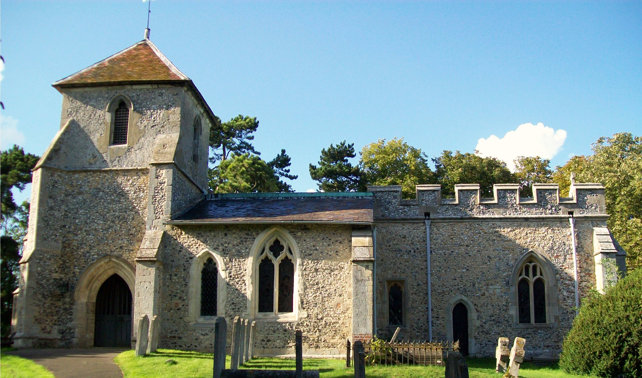
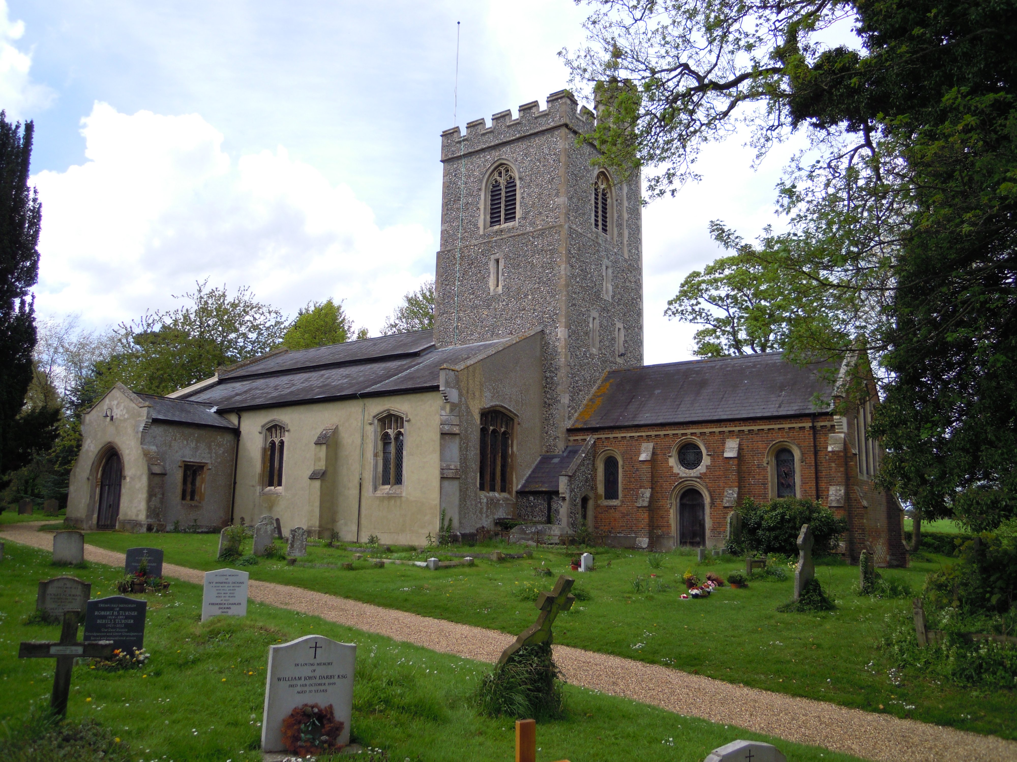
The village of Clothall is known for its picturesque countryside and traditional English charm. It features a mix of historic buildings, such as the 12th-century St. Mary's Church and the Grade II listed Clothall Bury, which dates back to the 17th century. The village also has a small primary school, a village hall, and a pub, providing essential amenities for the local community.

Clothall Common is a smaller settlement located to the west of Clothall village. It is predominantly residential, with a mix of modern and older properties. The common itself provides open green space for recreational activities and a children's playground.

Luffenhall and Briary Lane are both hamlets within the parish, characterized by their rural setting and a handful of houses. They offer a peaceful retreat from the busier village life.

Clothall is well-connected to nearby towns and cities, with good transport links via the A1(M) and the nearby train station in Baldock. This makes it an attractive location for commuters and those seeking a quieter rural lifestyle within easy reach of urban amenities.

If you have any feedback on the listing, please let us know in the comments section below.
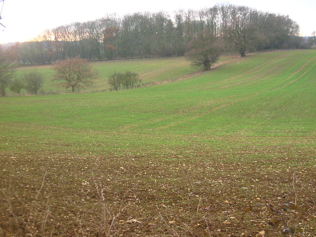
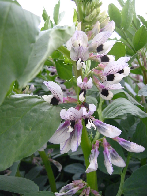
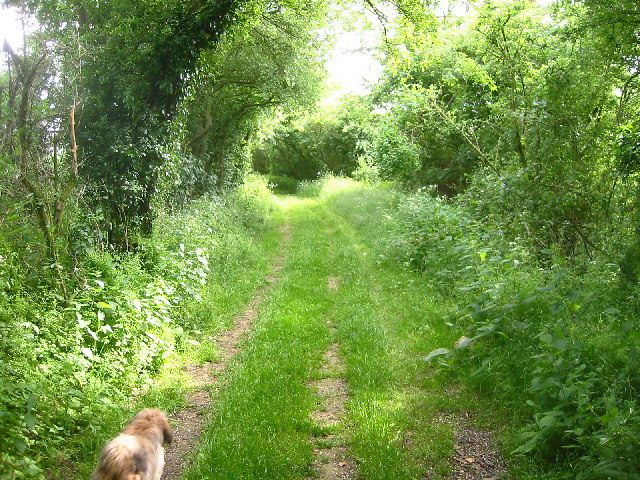
Clothall Images

Images are sourced within 2km of 51.969634/-0.138441 or Grid Reference TL2731. Thanks to Geograph Open Source API. All images are credited.

Barnacks Hill Wood Taken looking west from the bridleway
Barnacks Hill Wood
Taken looking west from the bridleway
Clothall from Quickswood Farm Taken from halfway up the bridleway from Clothall Road to Quickswood farm, the tiny village of Clothall can be seen top right.
Clothall from Quickswood Farm
Taken from halfway up the bridleway from Clothall Road to Quickswood farm, the tiny village of Clothall can be seen top right.
Weston Hills from Quickswood Farm Looking west we see construction work on the Baldock bypass as it cuts into the Weston Hills
Weston Hills from Quickswood Farm
Looking west we see construction work on the Baldock bypass as it cuts into the Weston Hills
Flint near Quickswood A lot of the land in this area contains flint. This was taken just outside the south end of the wooded area.
Flint near Quickswood
A lot of the land in this area contains flint. This was taken just outside the south end of the wooded area.
Barn in Quickswood Taken on the Icknield Way path at TL276333, looking south west towards the wood. Can sometimes see deer running around here, but never when you have a camera!
Barn in Quickswood
Taken on the Icknield Way path at TL276333, looking south west towards the wood. Can sometimes see deer running around here, but never when you have a camera!
Rape crop near Wallington Taken at TL279334 - you can see this dip on the contours of the grid square.
Rape crop near Wallington
Taken at TL279334 - you can see this dip on the contours of the grid square.
Barley field near Wallington Barley and Wheat are a popular crops around here.
Barley field near Wallington
Barley and Wheat are a popular crops around here.
Broad beans near Wallington Half the field was wheat, the other half was broad beans. Pretty!
Broad beans near Wallington
Half the field was wheat, the other half was broad beans. Pretty!
Wallington from the Icknield Way Path Looking east towards Wallington from TL 284 337
Wallington from the Icknield Way Path
Looking east towards Wallington from TL 284 337
Bury Farm, Wallington Taken from the bridleway to the west of the farm (TL 291 334)
Bury Farm, Wallington
Taken from the bridleway to the west of the farm (TL 291 334)
Bridleway south of Wallington A green and pleasant route from Wallington to Clothall
Bridleway south of Wallington
A green and pleasant route from Wallington to Clothall
Hertfordshire way near Wallington Taken from TL291329 looking east. A bridleway from Wallington to Clothall runs left to right across the picture.
Hertfordshire way near Wallington
Taken from TL291329 looking east. A bridleway from Wallington to Clothall runs left to right across the picture.
Fallen tree in woods near Wallington These woods on the Hertfordshire way near Wallington appear to be nameless (TL284327) but there is very pleasant and well waymarked path leading through them.
Fallen tree in woods near Wallington
These woods on the Hertfordshire way near Wallington appear to be nameless (TL284327) but there is very pleasant and well waymarked path leading through them.
Quickswood Rape Crop Taken from Icknield Way path towards Wallington.
Quickswood Rape Crop
Taken from Icknield Way path towards Wallington.
Farm track to Rydals Wood The track runs between Rydals Wood and Coldash Wood
Farm track to Rydals Wood
The track runs between Rydals Wood and Coldash Wood
Coldash Wood Looking east across freshly cultivated fields to Coldash Wood
Coldash Wood
Looking east across freshly cultivated fields to Coldash Wood
Footpath to Church End, Weston Start of a footpath running south west to Church End, Weston
Footpath to Church End, Weston
Start of a footpath running south west to Church End, Weston
Farm track near Clothall Farm track running north east from the bridleway
Farm track near Clothall
Farm track running north east from the bridleway
Show me another place!

Clothall is located at Grid Ref: TL2731 (Lat: 51.969634, Lng: -0.138441)

Administrative County: Hertfordshire

District: North Hertfordshire

Police Authority: Hertfordshire

What 3 Words

///breaches.emporium.learning. Near Baldock, Hertfordshire

Nearby Locations

Clothall

Related Wikis

Clothall

Clothall is a village and civil parish in the county of Hertfordshire, England, with a population of 358. It is situated 2.25 miles (3.62 km) south-east...

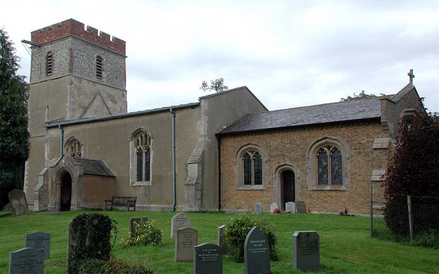
Holy Trinity Church, Weston

Holy Trinity Church is the parish church for the village of Weston in Hertfordshire. The church building stands to the south-east of the village on high...

Rushden, Hertfordshire

Rushden is a small village and civil parish which forms part of the grouped parish council of Rushden and Wallington in the North Hertfordshire district...

Wallington, Hertfordshire

Wallington is a small village and civil parish in the North Hertfordshire district, in the county of Hertfordshire, England, near the town of Baldock....

Weston, Hertfordshire

Weston is a village and civil parish in the North Hertfordshire district of Hertfordshire, England. It is located around 4 miles north of Stevenage, 2...

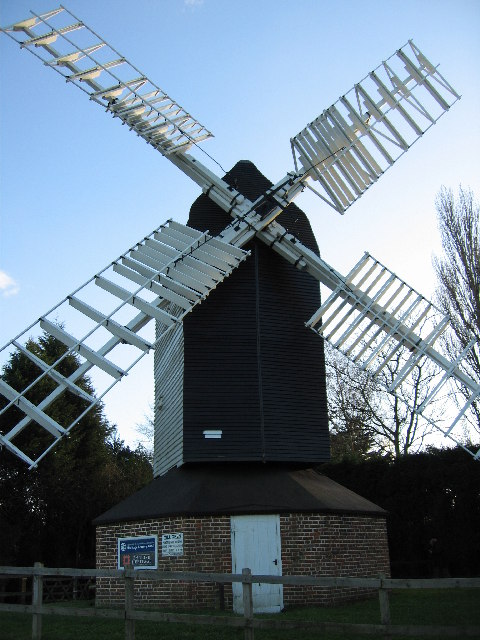
Lannock Mill, Weston

Lannock Mill is a Grade II listed tower mill at Weston, Hertfordshire, England which is derelict. == History == Lannock Mill was built in 1860. A windmill...
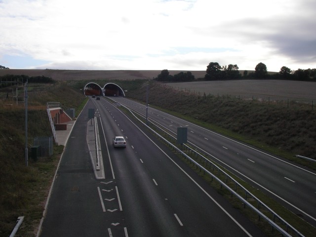
Weston Hills Tunnel

The Weston Hills Tunnel is a 230m twin road tunnel under the Weston Hills near Baldock in Hertfordshire. It was constructed as part of the A505 Baldock...

Cromer, Hertfordshire

Cromer is a hamlet in the civil parish of Ardeley, Hertfordshire, England. It is a small hamlet; however, it is noteworthy for possessing Hertfordshire...

Nearby Amenities

Located within 500m of 51.969634,-0.138441
Power: pole
Lat/Long: 51.971817/-0.1398062
Power: pole
Lat/Long: 51.9708644/-0.1440159
Power: pole
Lat/Long: 51.9693446/-0.1399589
Power: pole
Lat/Long: 51.968796/-0.139385
Power: pole
Lat/Long: 51.9712014/-0.1405224
Power: pole
Lat/Long: 51.9707156/-0.1426359
Power: pole
Lat/Long: 51.9705634/-0.1412653
Power: pole
Lat/Long: 51.9699982/-0.1406427
Power: pole
Lat/Long: 51.9710194/-0.1453904
Barrier: kissing_gate
Foot: yes
Source: GPS
Lat/Long: 51.9685067/-0.1444794
Clothall Bury
Place: isolated_dwelling
Lat/Long: 51.972068/-0.1391715
The data included in this document is from www.openstreetmap.org. The data is made available under ODbL.

Have you been to Clothall?

Leave your review of Clothall below (or comments, questions and feedback).