Clifford

Civil Parish in Herefordshire

England

Clifford

Old Milestone, B4352, Pen-y-Park The milestone is located at the top of East Hill, east of cottages, on the verge immediately to the west of the boundary marker HF_HYHF03pb <a title="https://www.geograph.org.uk/photo/6049297" href="https://www.geograph.org.uk/photo/6049297">Link</a> on the south side of the road.  Parish of Clifford (Hererfordshire District). Carved stone post, erected by the Whitney & Brewardine turnpike trust in the 19th century. 

Inscription reads:-   : TO / HAY / 3 MILES :


Milestone Society National ID: HF_HYHF03
Old Milestone, B4352, Pen-y-Park Credit: Mike Faherty

Clifford is a civil parish located in the county of Herefordshire, England. It is situated in the western part of the county, near the border with Wales. The parish covers an area of approximately 12 square kilometers and is home to a population of around 500 residents.

The village of Clifford itself is a small and picturesque settlement, characterized by traditional English countryside charm. It is nestled within the stunning landscape of the Golden Valley, surrounded by rolling hills and green fields. The parish is known for its natural beauty, with the River Wye flowing through its southern part, providing opportunities for scenic walks and outdoor activities.

Historically, Clifford has been an agricultural community, with farming being a significant part of its economy. The fertile land in the area has supported various farming practices, including livestock rearing and crop cultivation. Today, agriculture still plays a vital role, although the village has evolved to incorporate other industries such as tourism and small businesses.

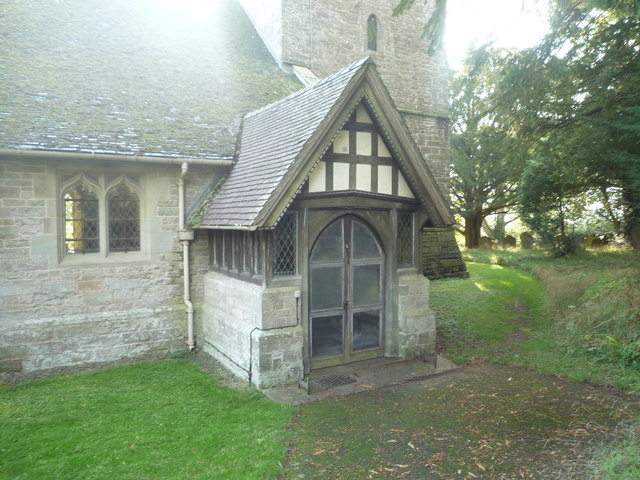
The village boasts a Norman church, St. Mary's, which stands as a testament to its rich history. The church is believed to date back to the 12th century and is known for its architectural beauty. It serves as a focal point for the local community and is a popular destination for visitors interested in historical and cultural heritage.

Clifford offers a range of amenities to its residents, including a primary school, village hall, and a few local shops and pubs. There are also several accommodation options available for tourists seeking a peaceful rural retreat.

Overall, Clifford, Herefordshire, is a charming and idyllic village that showcases the natural beauty and historical heritage of the region.

If you have any feedback on the listing, please let us know in the comments section below.
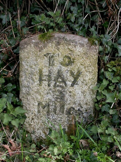
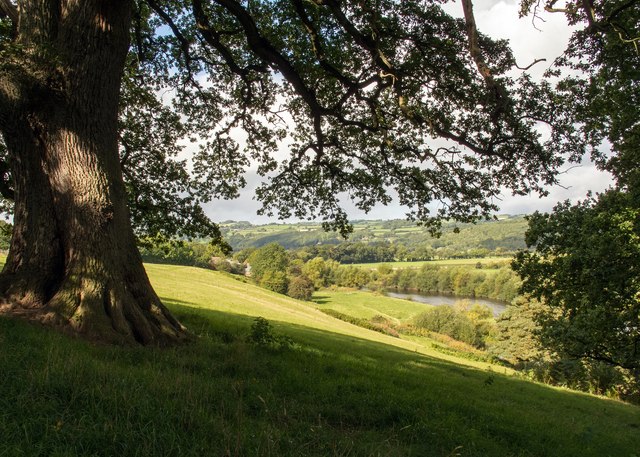
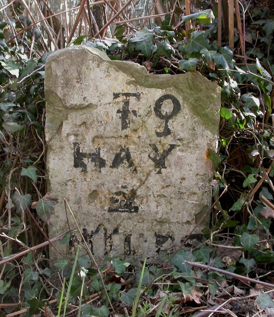
Clifford Images

Images are sourced within 2km of 52.094648/-3.072834 or Grid Reference SO2644. Thanks to Geograph Open Source API. All images are credited.

Old Milestone, B4352, Pen-y-Park The milestone is located at the top of East Hill, east of cottages, on the verge immediately to the west of the boundary marker HF_HYHF03pb <a title="https://www.geograph.org.uk/photo/6049297" href="https://www.geograph.org.uk/photo/6049297">Link</a> on the south side of the road.  Parish of Clifford (Hererfordshire District). Carved stone post, erected by the Whitney & Brewardine turnpike trust in the 19th century. 

Inscription reads:-   : TO / HAY / 3 MILES :


Milestone Society National ID: HF_HYHF03
Old Milestone, B4352, Pen-y-Park
The milestone is located at the top of East Hill, east of cottages, on the verge immediately to the west of the boundary marker HF_HYHF03pb Link on the south side of the road. Parish of Clifford (Hererfordshire District). Carved stone post, erected by the Whitney & Brewardine turnpike trust in the 19th century. Inscription reads:- : TO / HAY / 3 MILES : Milestone Society National ID: HF_HYHF03
Oak tree near Locksters Pool There is a majestic Oak tree at the fork of the Herefordshire Trail and Wye Valley Walk footpaths. On a warm and sunny day it is a shady spot to enjoy the view of the Wye valley.
Oak tree near Locksters Pool
There is a majestic Oak tree at the fork of the Herefordshire Trail and Wye Valley Walk footpaths. On a warm and sunny day it is a shady spot to enjoy the view of the Wye valley.
Ordnance Survey 1GL Bolt This OS Bolt can be found on the west face of St Mary's Church. It marks a point 159.871m above mean sea level.
Ordnance Survey 1GL Bolt
This OS Bolt can be found on the west face of St Mary's Church. It marks a point 159.871m above mean sea level.
Ordnance Survey Cut Mark This OS cut mark can be found on the Parish Rooms. It marks a point 165.848m above mean sea level.
Ordnance Survey Cut Mark
This OS cut mark can be found on the Parish Rooms. It marks a point 165.848m above mean sea level.
Old Boundary Marker on the B4352 in Clifford parish Parish Boundary Marker on the south side of the B4352 at Pen-y-Park, east of the hill top and cottages and east of milestone HF_HYHF03. Clifford parish. Inscribed but illegible.

Herefordshire SMR. SMR Number: 56797 <span class="nowrap"><a title="https://www.heritagegateway.org.uk/Gateway/Results_Single.aspx?uid=MHE28552&resourceID=101" rel="nofollow ugc noopener" href="https://www.heritagegateway.org.uk/Gateway/Results_Single.aspx?uid=MHE28552&resourceID=101">Link</a><img style="margin-left:2px;" alt="External link" title="External link - shift click to open in new window" src="https://s1.geograph.org.uk/img/external.png" width="10" height="10"/></span>

Milestone Society National ID: HF_HYHF03pb
Old Boundary Marker on the B4352 in Clifford parish
Parish Boundary Marker on the south side of the B4352 at Pen-y-Park, east of the hill top and cottages and east of milestone HF_HYHF03. Clifford parish. Inscribed but illegible. Herefordshire SMR. SMR Number: 56797 LinkExternal link Milestone Society National ID: HF_HYHF03pb
Old Milestone, B4348, Rock Coppice The milestone is located 150m east of the junction with Priory Lane against the hedgerow, 15m from B stone, on the south side of the road.  Parish of Clifford (Hererfordshire District). Carved stone post, erected by the Whitney & Brewardine turnpike trust in the 19th century. 

Inscription reads:-
TO
HAY
2
MILES

Milestone Society National ID: HF_HYHF02
Old Milestone, B4348, Rock Coppice
The milestone is located 150m east of the junction with Priory Lane against the hedgerow, 15m from B stone, on the south side of the road. Parish of Clifford (Hererfordshire District). Carved stone post, erected by the Whitney & Brewardine turnpike trust in the 19th century. Inscription reads:- TO HAY 2 MILES Milestone Society National ID: HF_HYHF02
The Old Vicarage (Clifford) Splendid stone building that faces the village church.
The Old Vicarage (Clifford)
Splendid stone building that faces the village church.
The Black Mountains (Viewed from St. Mary's Church at Clifford) Excellent view of these memorable hills from a church that is placed in a forest-like churchyard.
The Black Mountains (Viewed from St. Mary's Church at Clifford)
Excellent view of these memorable hills from a church that is placed in a forest-like churchyard.
Former Methodist Chapel (Clifford) Sadly couldn't get closer, but the building really has changed a lot since Philip Halling's photo from 2013: <a href="https://www.geograph.org.uk/photo/3572634">SO2545 : Former Calvinistic Methodist chapel</a> . The building is now whitewashed, and the entrance gates have two pumpkins on top!
Former Methodist Chapel (Clifford)
Sadly couldn't get closer, but the building really has changed a lot since Philip Halling's photo from 2013: SO2545 : Former Calvinistic Methodist chapel . The building is now whitewashed, and the entrance gates have two pumpkins on top!
Lane at Clifford Taken at the lay-by car park for St. Mary's church.
Lane at Clifford
Taken at the lay-by car park for St. Mary's church.
Lychgate at St. Mary's Church (Clifford) Nice Welsh-styled lychgate at the entrance to this church.
Lychgate at St. Mary's Church (Clifford)
Nice Welsh-styled lychgate at the entrance to this church.
Lamp at St. Mary's Church (Clifford) Nice vintage lamp by the path leading to the church.
Lamp at St. Mary's Church (Clifford)
Nice vintage lamp by the path leading to the church.
St. Mary's Church (Bell Tower & Porch | Clifford) Two great features at this church, from stone to timber.
St. Mary's Church (Bell Tower & Porch | Clifford)
Two great features at this church, from stone to timber.
St. Mary's Church (Porch | Clifford) The nice timber-framed porch at the entrance to this church.
St. Mary's Church (Porch | Clifford)
The nice timber-framed porch at the entrance to this church.
St. Mary's Church (Clifford) Much of the interior of this church is late Victorian, as it was done by Ewan Christian from 1887 to 1888. There are a few old features that survived this rebuild.
St. Mary's Church (Clifford)
Much of the interior of this church is late Victorian, as it was done by Ewan Christian from 1887 to 1888. There are a few old features that survived this rebuild.
St. Mary's Church (Font | Clifford) Plain font inside the nave of this church.
St. Mary's Church (Font | Clifford)
Plain font inside the nave of this church.
St. Mary's Church (North Aisle | Clifford) This aisle was added to the church during the restoration by Ewan Christian in 1888.
St. Mary's Church (North Aisle | Clifford)
This aisle was added to the church during the restoration by Ewan Christian in 1888.
Window inside St. Mary's Church (Nave | Clifford) Plain window inside the nave that has a view to the large churchyard.
Window inside St. Mary's Church (Nave | Clifford)
Plain window inside the nave that has a view to the large churchyard.
Show me another place!

Clifford is located at Grid Ref: SO2644 (Lat: 52.094648, Lng: -3.072834)

Unitary Authority: County of Herefordshire

Police Authority: West Mercia

What 3 Words

///strutting.hears.bikes. Near Clifford, Herefordshire

Nearby Locations

Clifford

Related Wikis

Greens Siding railway station

Greens Siding railway station was a station to the east of Clifford, Herefordshire, England. The station was opened in 1903, closed to passengers in 1941...

Clifford Priory

Clifford Priory was a priory in Herefordshire, England at grid reference SO2531944576. == References ==

Westbrook railway station (England)

Westbrook railway station was a station to the northwest of Dorstone, Herefordshire, England. The station was opened in 1881, closed to passengers in 1941...

Clifford railway station

Clifford railway station was a station in Clifford, Herefordshire, England. The station was opened in 1881, closed to passengers in 1941 and closed completely...

Nearby Amenities

Located within 500m of 52.094648,-3.072834
Power: pole
Source: Bing
Lat/Long: 52.0930669/-3.0773308
Power: pole
Source: Bing
Lat/Long: 52.0969426/-3.0712663
Power: pole
Source: Bing
Lat/Long: 52.0957859/-3.0734094
Power: pole
Source: Bing
Lat/Long: 52.0959094/-3.0713843
Power: pole
Source: Bing
Lat/Long: 52.0955255/-3.0704266
Power: pole
Source: Bing
Lat/Long: 52.0945895/-3.0751528
Power: pole
Source: Bing
Lat/Long: 52.0964598/-3.0739834
Power: pole
Source: Bing
Lat/Long: 52.0925395/-3.0780925
Power: pole
Source: Bing
Lat/Long: 52.0974533/-3.0700511
Power: pole
Source: Bing
Lat/Long: 52.0979823/-3.0752628
Power: pole
Source: Bing
Lat/Long: 52.0952125/-3.074265
Power: pole
Source: Bing
Lat/Long: 52.0935498/-3.0766414
Power: pole
Source: Bing
Lat/Long: 52.0950789/-3.0692304
Power: pole
Source: Bing
Lat/Long: 52.0940804/-3.0758851
Power: pole
Source: Bing
Lat/Long: 52.0964383/-3.0724894
Direction: 215
Generator Method: photovoltaic
Generator Output Electricity: yes
Generator Solar Modules: 18
Generator Source: solar
Generator Type: solar_photovoltaic_panel
Location: roof
Power: generator
Lat/Long: 52.0920378/-3.0715746
Direction: 215
Generator Method: photovoltaic
Generator Output Electricity: yes
Generator Solar Modules: 38
Generator Source: solar
Generator Type: solar_photovoltaic_panel
Location: roof
Power: generator
Lat/Long: 52.0941072/-3.070497
Power: pole
Source: bing
Lat/Long: 52.0970135/-3.0748388
Power: pole
Source: bing
Lat/Long: 52.0981175/-3.0772421
Power: pole
Source: bing
Lat/Long: 52.0987914/-3.0754209
The data included in this document is from www.openstreetmap.org. The data is made available under ODbL.

Have you been to Clifford?

Leave your review of Clifford below (or comments, questions and feedback).