Clanfield

Civil Parish in Oxfordshire West Oxfordshire

England

Clanfield

St Stephen's Church, Clanfield
St Stephen's Church, Clanfield Credit: AJD

Clanfield is a civil parish located in Oxfordshire, England. Situated approximately 5 miles west of the market town of Witney, Clanfield is nestled in the beautiful countryside of the Upper Thames Valley. The parish covers an area of about 5.5 square miles and has a population of around 900 people.

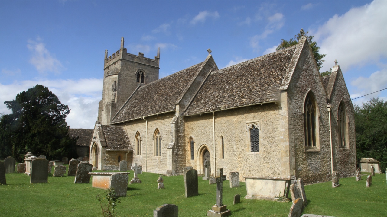
With its origins dating back to the medieval period, Clanfield is steeped in history. The village is adorned with quaint thatched cottages, charming stone houses, and a picturesque church, St. Stephen's. The church, which dates back to the 12th century, is a prominent feature of the village and is known for its impressive medieval wall paintings.

The village offers a range of amenities for its residents and visitors. There is a village shop, a post office, and a primary school, providing essential services for the local community. The village pub, The Clanfield Tavern, is a focal point for socializing and enjoying traditional English cuisine.

Clanfield is surrounded by rolling countryside, making it an ideal location for outdoor enthusiasts. There are numerous walking and cycling routes that allow visitors to explore the stunning landscape and enjoy the tranquility of the area. The village is also within close proximity to the Cotswolds, a designated Area of Outstanding Natural Beauty.

Overall, Clanfield is a charming and historic village that offers a peaceful and idyllic setting for its residents. With its rich heritage, beautiful countryside, and range of amenities, Clanfield is a hidden gem in Oxfordshire.

If you have any feedback on the listing, please let us know in the comments section below.
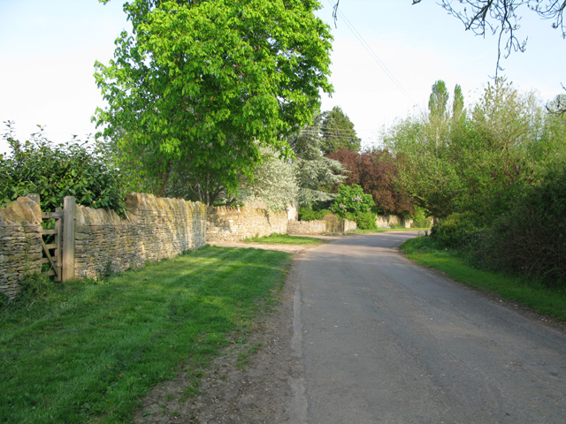
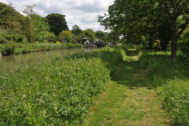
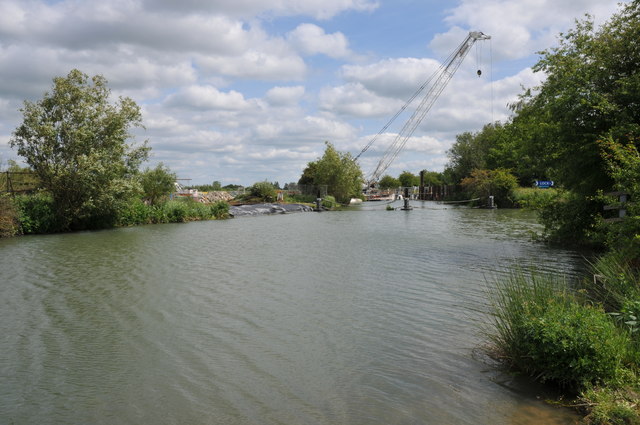
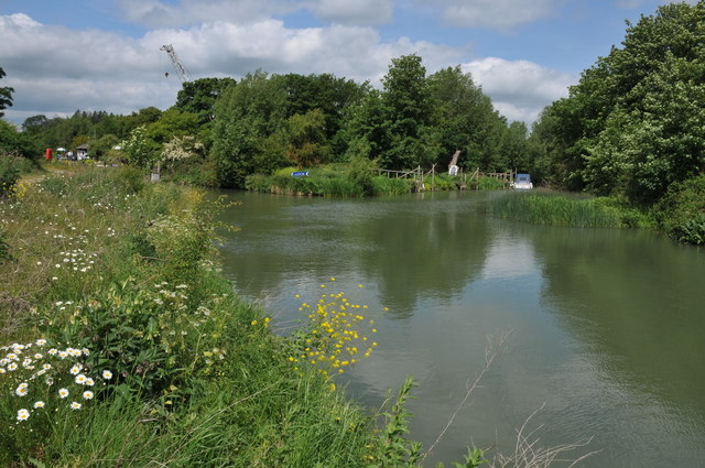
Clanfield Images

Images are sourced within 2km of 51.709814/-1.588977 or Grid Reference SP2801. Thanks to Geograph Open Source API. All images are credited.

St Stephen's Church, Clanfield
Entering Grafton from the north west
Road through the village of Grafton
Manor Farm, Grafton
Manor Farm, Grafton
Entering Clanfield from the south on the A4095
Radcot Lock, River Thames The upper lock gate has just been opened and the narrowboat is about to move upstream.
Radcot Lock, River Thames
The upper lock gate has just been opened and the narrowboat is about to move upstream.
River Thames near Radcot Lock The River Thames pictured between Radcot Bridge and Radcot Lock.
River Thames near Radcot Lock
The River Thames pictured between Radcot Bridge and Radcot Lock.
Canada geese on the Thames A pair Canada geese (Branta canadensis) with seven young goslings on the River Thames near Radcot Lock.
Canada geese on the Thames
A pair Canada geese (Branta canadensis) with seven young goslings on the River Thames near Radcot Lock.
Radcot Lock Radcot Lock on the River Thames is set off by a well maintained garden.
Radcot Lock
Radcot Lock on the River Thames is set off by a well maintained garden.
Thames Path at Radcot Lock The Thames Path approaching Radcot Lock from the west.
Thames Path at Radcot Lock
The Thames Path approaching Radcot Lock from the west.
Maintenance work on Radcot Weir A crane on the site of Radcot Weir on the River Thames.
Maintenance work on Radcot Weir
A crane on the site of Radcot Weir on the River Thames.
River Thames at Radcot River Thames approaching the weir and lock at Radcot .
River Thames at Radcot
River Thames approaching the weir and lock at Radcot .
Old Man's Bridge, River Thames One of a number of such footbridges on the upper Thames.
Old Man's Bridge, River Thames
One of a number of such footbridges on the upper Thames.
St Stephen's church, Clanfield A small 13th century church, standing behind its churchyard on the north-west edge of the village, next to Chestlion Farm which may have been the manor house. <span class="nowrap"><a title="http://www.oxfordshirecotswolds.org/site/attractions/clanfield-st-stephen-s-church-p521151" rel="nofollow ugc noopener" href="http://www.oxfordshirecotswolds.org/site/attractions/clanfield-st-stephen-s-church-p521151">Link</a><img style="margin-left:2px;" alt="External link" title="External link - shift click to open in new window" src="https://s1.geograph.org.uk/img/external.png" width="10" height="10"/></span>
St Stephen's church, Clanfield
A small 13th century church, standing behind its churchyard on the north-west edge of the village, next to Chestlion Farm which may have been the manor house. LinkExternal link
The tower of St Stephen's church, Clanfield The western tower, with four pinnacles and a squat figure of Saint Stephen on its south-east corner, houses a ring of eight bells. <span class="nowrap"><a title="http://www.oxfordshirecotswolds.org/site/attractions/clanfield-st-stephen-s-church-p521151" rel="nofollow ugc noopener" href="http://www.oxfordshirecotswolds.org/site/attractions/clanfield-st-stephen-s-church-p521151">Link</a><img style="margin-left:2px;" alt="External link" title="External link - shift click to open in new window" src="https://s1.geograph.org.uk/img/external.png" width="10" height="10"/></span>
The tower of St Stephen's church, Clanfield
The western tower, with four pinnacles and a squat figure of Saint Stephen on its south-east corner, houses a ring of eight bells. LinkExternal link
St Stephen's church from the eastern end
Interior view of St Stephen's church
Inside St Stephen's church
Show me another place!

Clanfield is located at Grid Ref: SP2801 (Lat: 51.709814, Lng: -1.588977)

Administrative County: Oxfordshire

District: West Oxfordshire

Police Authority: Thames Valley

What 3 Words

///opinion.nuzzling.carpeted. Near Bampton, Oxfordshire

Nearby Locations

Clanfield

Related Wikis

Clanfield, Oxfordshire

Clanfield is a village and civil parish about three miles (5 km) south of Carterton, Oxfordshire. The parish includes the hamlet of Little Clanfield one...

Grafton and Radcot

Grafton and Radcot is a civil parish in West Oxfordshire. The parish includes the hamlets of Radcot on the River Thames and Grafton.

Radcot Lock

Radcot Lock is a lock on the River Thames in England just downstream of Radcot, Oxfordshire, on the southern bank. The lock was built by the Thames Conservancy...

Grafton, Oxfordshire

Grafton is a hamlet and former civil parish, now in the parish of Grafton and Radcot, in the West Oxfordshire district, in the county of Oxfordshire, England...

Old Man's Bridge

Old Man's Bridge is a wooden footbridge across the River Thames in Oxfordshire, England. It is situated on the reach above Rushey Lock, a short way downstream...

Battle of Radcot Bridge

The Battle of Radcot Bridge was fought on 19 December 1387 in medieval England between troops loyal to Richard II, led by court favourite Robert de Vere...
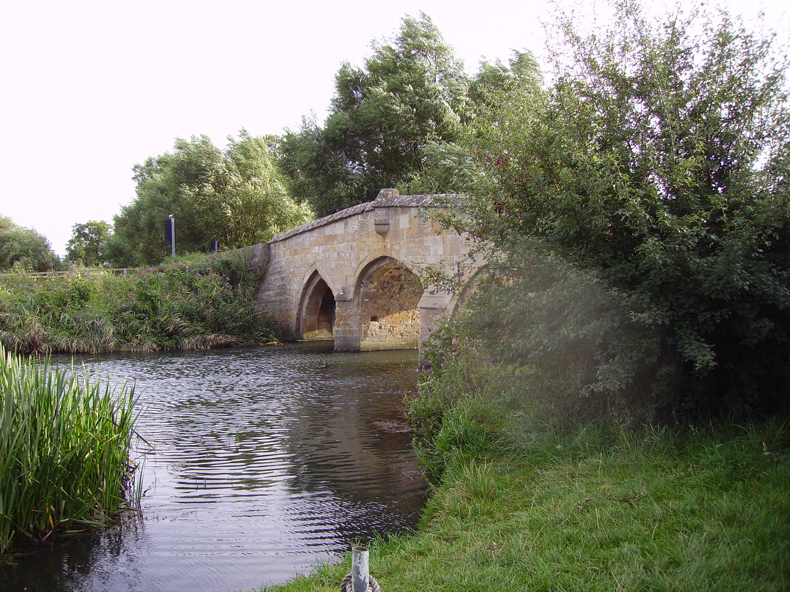
Radcot Bridge

Radcot Bridge is a crossing of the Thames in England, south of Radcot, Oxfordshire, and north of Faringdon, Oxfordshire which is in the district of that...

Grafton Lock

Grafton Lock is a lock on the River Thames in Oxfordshire, England. It is on the northern bank between Kelmscott and Radcot, about 1 mile (1.6 km) south...

Related Videos

Place to Eat in the Cotswolds

The Double Red Duke #cotswold #placestovisit #placestoeat #england #travel.

Thames Path - Source to London - Cricklade to Radcot Bridge - Day 2 of 12

Day 2 of 12 of an epic walking adventure through some of England's most beautiful countryside and incredible history. A walk that ...

Adventure Plus Gap Year 2024

The Adventure Plus Gap training year is designed to equip you to lead adventure activities with young people and adults in the ...

Hunter Cottage - Clanfield, Oxfordshire - Exclusive Videos

View this luxurious holiday rental. Hunter Cottage is a stylishly furnished and cosy one bedroom en-suite cottage. It sits in the ...

Nearby Amenities

Located within 500m of 51.709814,-1.588977
Bus Stop
Carter Institute
Bus: yes
Naptan AtcoCode: 340000211CI
Naptan Bearing: N
Naptan CommonName: Carter Institute
Naptan Indicator: Opposite
Naptan Landmark: Bus Shelter
Naptan NaptanCode: oxfajtwa
Naptan Street: A4095
Naptan Verified: no
Public Transport: platform
Source: naptan_import
Lat/Long: 51.7121968/-1.5895201
Maxspeed: 30 mph
Traffic Sign: maxspeed
Lat/Long: 51.7085064/-1.5911737
Townhall
Carter House
Lat/Long: 51.7121059/-1.5892169
Addr Housename: High House
Addr Street: Main Street
Lat/Long: 51.7118676/-1.5896959
Addr Housename: Friar's Court Cottages
Addr Housenumber: 2
Addr Street: Main Street
Lat/Long: 51.7093373/-1.590993
Addr Housename: Elm Tree Cottages
Addr Housenumber: 1
Lat/Long: 51.7103835/-1.592083
Addr Housename: Elm Tree Cottages
Addr Housenumber: 2
Lat/Long: 51.7104883/-1.5920344
Addr Housename: Windmill House
Addr Street: Main Street
Lat/Long: 51.7104548/-1.5905992
Bench
Backrest: yes
Material: metal
Lat/Long: 51.7117302/-1.5896895
Addr Housename: Bumblebee Cottage
Addr Street: Main Street
Lat/Long: 51.713928/-1.5893948
Addr Housename: Bushey Farm
Addr Street: Main Street
Lat/Long: 51.710678/-1.5903964
Addr Housename: Homestead
Addr Street: Main Street
Lat/Long: 51.7124527/-1.5896103
Addr Housename: Sunny View
Addr Street: Main Street
Lat/Long: 51.7125415/-1.5895918
Addr Housename: Friar's Court Cottages
Addr Housenumber: 1
Addr Street: Main Street
Lat/Long: 51.7093919/-1.5909638
Addr Housename: Windmill Cottage
Addr Street: Main Street
Lat/Long: 51.7100161/-1.5907211
Adventure Plus
Addr Place: Clanfield
Addr Postcode: OX18 2SN
Addr Street: Main Street
Phone: +44 1993 703 308
Website: https://www.adventureplus.org.uk/
Lat/Long: 51.7103062/-1.5914231
Power: pole
Source: Bing
Lat/Long: 51.7109011/-1.5947939
Power: pole
Source: Bing
Lat/Long: 51.710818/-1.5934903
Power: pole
Source: Bing
Lat/Long: 51.7096613/-1.5959821
Generator Method: photovoltaic
Generator Output Electricity: yes
Generator Source: solar
Generator Type: solar_photovoltaic_panel
Location: roof
Power: generator
Lat/Long: 51.7130637/-1.5938196
Generator Method: photovoltaic
Generator Output Electricity: yes
Generator Source: solar
Generator Type: solar_photovoltaic_panel
Location: roof
Power: generator
Lat/Long: 51.7129258/-1.593841
Generator Method: photovoltaic
Generator Output Electricity: yes
Generator Source: solar
Generator Type: solar_photovoltaic_panel
Location: roof
Power: generator
Lat/Long: 51.7127031/-1.5929183
Generator Method: photovoltaic
Generator Output Electricity: yes
Generator Source: solar
Generator Type: solar_photovoltaic_panel
Location: roof
Power: generator
Lat/Long: 51.7127795/-1.5938705
Generator Method: photovoltaic
Generator Output Electricity: yes
Generator Source: solar
Generator Type: solar_photovoltaic_panel
Location: roof
Power: generator
Lat/Long: 51.7124954/-1.5947664
Generator Method: photovoltaic
Generator Output Electricity: yes
Generator Source: solar
Generator Type: solar_photovoltaic_panel
Location: roof
Power: generator
Lat/Long: 51.712492/-1.5946645
Generator Method: photovoltaic
Generator Output Electricity: yes
Generator Source: solar
Generator Type: solar_photovoltaic_panel
Location: roof
Power: generator
Lat/Long: 51.7125003/-1.5943506
Generator Method: photovoltaic
Generator Output Electricity: yes
Generator Source: solar
Generator Type: solar_photovoltaic_panel
Location: roof
Power: generator
Lat/Long: 51.7124937/-1.594246
Generator Method: photovoltaic
Generator Output Electricity: yes
Generator Source: solar
Generator Type: solar_photovoltaic_panel
Location: roof
Power: generator
Lat/Long: 51.7124854/-1.594128
Generator Method: photovoltaic
Generator Output Electricity: yes
Generator Source: solar
Generator Type: solar_photovoltaic_panel
Location: roof
Power: generator
Lat/Long: 51.7124322/-1.5938973
Generator Method: photovoltaic
Generator Output Electricity: yes
Generator Source: solar
Generator Type: solar_photovoltaic_panel
Location: roof
Power: generator
Lat/Long: 51.712384/-1.5935755
Generator Method: photovoltaic
Generator Output Electricity: yes
Generator Source: solar
Generator Type: solar_photovoltaic_panel
Location: roof
Power: generator
Lat/Long: 51.71144/-1.5881574
Defibrillator
Access: yes
Booth: KX100
Covered: booth
Defibrillator Location: inside old phone box, near Clanfield Primary School
Disused Amenity: telephone
Emergency: defibrillator
Man Made: telephone_box
Lat/Long: 51.7131253/-1.5892056
The data included in this document is from www.openstreetmap.org. The data is made available under ODbL.

Have you been to Clanfield?

Leave your review of Clanfield below (or comments, questions and feedback).