Churchstanton

Civil Parish in Devon Somerset West and Taunton

England

Churchstanton

Churchstanton : St Peter & St Paul's Church The Anglican Church of St Peter & St Paul in dates from the 14th century and has been designated as a Grade I listed building.
Churchstanton : St Peter & St Paul's Church Credit: Lewis Clarke

Churchstanton is a small civil parish located in the county of Devon, in the southwest of England. Situated approximately 8 miles to the northeast of the town of Wellington, the parish covers an area of around 6 square miles.

The village itself is nestled in the Blackdown Hills Area of Outstanding Natural Beauty, providing residents and visitors with breathtaking views of the surrounding countryside. Churchstanton is predominantly a rural community, with a population of around 400 residents.

The parish is home to the Grade II listed Church of St. Peter and St. Paul, a historic place of worship that dates back to the 13th century. The church's impressive architecture and beautiful stained glass windows make it a popular destination for history enthusiasts and those seeking a moment of tranquility.

Despite its small size, Churchstanton boasts a vibrant community spirit, with various local events and activities taking place throughout the year. The village hall serves as a hub for social gatherings, hosting regular clubs, classes, and community meetings.

The surrounding countryside offers ample opportunities for outdoor activities, such as hiking, cycling, and birdwatching. The nearby Blackdown Hills also provide a wealth of wildlife and nature reserves, making Churchstanton an ideal location for nature lovers.

Overall, Churchstanton, Devon, offers a peaceful and picturesque setting, perfect for those seeking a tranquil rural lifestyle or a peaceful retreat in the heart of the English countryside.

If you have any feedback on the listing, please let us know in the comments section below.

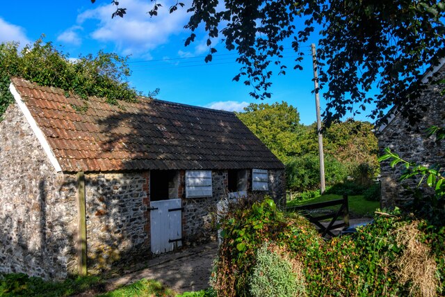
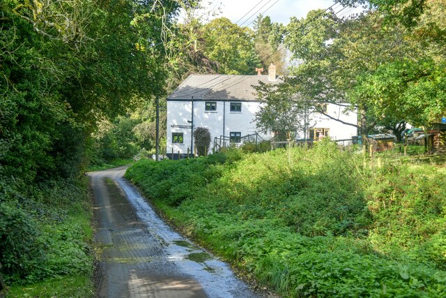
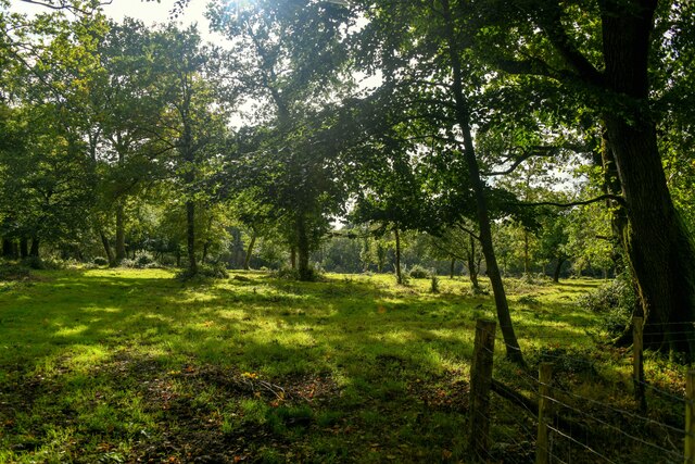
Churchstanton Images

Images are sourced within 2km of 50.917829/-3.144021 or Grid Reference ST1913. Thanks to Geograph Open Source API. All images are credited.

Churchstanton : St Peter & St Paul's Church The Anglican Church of St Peter & St Paul in dates from the 14th century and has been designated as a Grade I listed building.
Churchstanton : St Peter & St Paul's Church
The Anglican Church of St Peter & St Paul in dates from the 14th century and has been designated as a Grade I listed building.
Churchstanton : St Peter & St Paul's Church The church consists of a four-bay nave and a chancel which is at an angle to the nave and has a waggon roof.
Churchstanton : St Peter & St Paul's Church
The church consists of a four-bay nave and a chancel which is at an angle to the nave and has a waggon roof.
Churchstanton : Church Road Looking along a small country lane.
Churchstanton : Church Road
Looking along a small country lane.
Churchstanton : Road A road passing the house.
Churchstanton : Road
A road passing the house.
Churchstanton : Church Road Looking along Church Road.
Churchstanton : Church Road
Looking along Church Road.
Churchstanton : Newtons Buildings at Newtons off Church Road.
Churchstanton : Newtons
Buildings at Newtons off Church Road.
Churchstanton : Grassy Field A grassy field off Church Road.
Churchstanton : Grassy Field
A grassy field off Church Road.
Churchstanton : Church Road Looking along Church Road passing Newtons Cottages.
Churchstanton : Church Road
Looking along Church Road passing Newtons Cottages.
Churchstanton : Church Road Looking along Church Road.
Churchstanton : Church Road
Looking along Church Road.
Churchstanton : Trickey Warren Lane Looking along a small track and right of way.
Churchstanton : Trickey Warren Lane
Looking along a small track and right of way.
Churchstanton : Woodland Woods off Trickey Warren Lane.
Churchstanton : Woodland
Woods off Trickey Warren Lane.
Churchstanton : Trickey Warren Lane Looking along Trickey Warren Lane.
Churchstanton : Trickey Warren Lane
Looking along Trickey Warren Lane.
Churchstanton : Grassy Field & Cattle Cows in the field.
Churchstanton : Grassy Field & Cattle
Cows in the field.
Churchstanton : Trickey Warren Lane A small track through the countryside.
Churchstanton : Trickey Warren Lane
A small track through the countryside.
Churchstanton : Trickey Warren Lane Looking along the track.
Churchstanton : Trickey Warren Lane
Looking along the track.
Churchstanton : Trickey Warren Lane Looking along a lane.
Churchstanton : Trickey Warren Lane
Looking along a lane.
Churchstanton : Country Lane Looking along the road by Kedget Barton.
Churchstanton : Country Lane
Looking along the road by Kedget Barton.
Churchstanton : Country Lane Looking along a small lane.
Churchstanton : Country Lane
Looking along a small lane.
Show me another place!

Churchstanton is located at Grid Ref: ST1913 (Lat: 50.917829, Lng: -3.144021)

Administrative County: Somerset

District: Somerset West and Taunton

Police Authority: Avon and Somerset

What 3 Words

///curiosity.cooking.patching. Near Hemyock, Devon

Related Wikis

Churchstanton

Churchstanton is a village and civil parish in Somerset, England, situated within the Blackdown Hills Area of Outstanding Natural Beauty, on the River...

RAF Culmhead

Royal Air Force Culmhead or more simply RAF Culmhead is a former Royal Air Force station, situated at Churchstanton on the Blackdown Hills in Somerset...

Ringdown SSSI, Somerset

Ringdown (grid reference ST178155) is a 4.0 hectare (9.9 acre) biological Site of Special Scientific Interest west of Burnworthy in the Blackdown Hills...

Church of St Leonard, Otterford

The Anglican Church of St Leonard in Otterford, Somerset, England was built in the 14th century. It is a Grade II* listed building. == History == The church...

Nearby Amenities

Located within 500m of 50.917829,-3.144021
Power: pole
Source: bing
Transformer: distribution
Lat/Long: 50.9156531/-3.1433921
Power: pole
Source: bing
Lat/Long: 50.9176036/-3.1510189
Power: pole
Source: bing
Lat/Long: 50.9172688/-3.1492031
Power: pole
Source: bing
Lat/Long: 50.9170371/-3.1479558
Power: pole
Source: bing
Lat/Long: 50.9170278/-3.1477144
Power: pole
Source: bing
Lat/Long: 50.9170177/-3.1474891
Power: pole
Source: bing
Lat/Long: 50.916923/-3.1452468
Power: pole
Source: bing
Lat/Long: 50.9167421/-3.1412074
Power: pole
Source: bing
Lat/Long: 50.9168283/-3.1431145
Power: pole
Source: bing
Transformer: distribution
Lat/Long: 50.9166499/-3.139181
Power: pole
Source: bing
Lat/Long: 50.9168731/-3.1374885
The data included in this document is from www.openstreetmap.org. The data is made available under ODbL.

Have you been to Churchstanton?

Leave your review of Churchstanton below (or comments, questions and feedback).