Broad Oak
Settlement in Herefordshire
England
Broad Oak

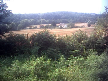
Broad Oak is a small village located in the county of Herefordshire, in the West Midlands region of England. Situated approximately 5 miles east of Hereford, the village is nestled amidst picturesque countryside and offers residents and visitors a peaceful and tranquil setting.
The village is characterized by its charming rural atmosphere and is home to a close-knit community of around 300 inhabitants. The landscape surrounding Broad Oak is predominantly agricultural, with rolling hills, fields, and meadows dominating the scenery. The village itself is made up of a collection of traditional stone cottages, giving it a quintessentially English feel.
Despite its small size, Broad Oak boasts a range of amenities that cater to the needs of its residents. These include a village hall, a primary school, and a local pub, which serves as a gathering place for both locals and visitors alike.
Broad Oak is also conveniently located in terms of transportation links. The village is easily accessible by road, with the A438 passing nearby, connecting it to neighboring towns and cities. Public transportation options are available, with regular bus services connecting Broad Oak to Hereford and other nearby areas.
For those seeking outdoor activities, Broad Oak offers plenty of opportunities for exploring the surrounding countryside. The village is close to the stunning Wye Valley, an Area of Outstanding Natural Beauty, which provides ample opportunities for hiking, cycling, and wildlife spotting.
In conclusion, Broad Oak is a charming village in Herefordshire, offering a quiet and idyllic lifestyle amidst beautiful rural surroundings.
If you have any feedback on the listing, please let us know in the comments section below.
Broad Oak Images
Images are sourced within 2km of 51.88807/-2.7569657 or Grid Reference SO4821. Thanks to Geograph Open Source API. All images are credited.


Broad Oak is located at Grid Ref: SO4821 (Lat: 51.88807, Lng: -2.7569657)
Unitary Authority: County of Herefordshire
Police Authority: West Mercia
What 3 Words
///connected.growth.tablet. Near Llanrothal, Herefordshire
Nearby Locations
Related Wikis
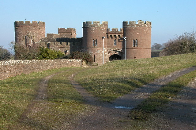
Pembridge Castle
Pembridge Castle, originally called Newland Castle, is a late 12th century to early 13th century Grade I listed former border castle located approximately...

Skenfrith
Skenfrith (Welsh: Ynysgynwraidd) is a small village in Monmouthshire, south-east Wales. It is located on the River Monnow, close to the border between...
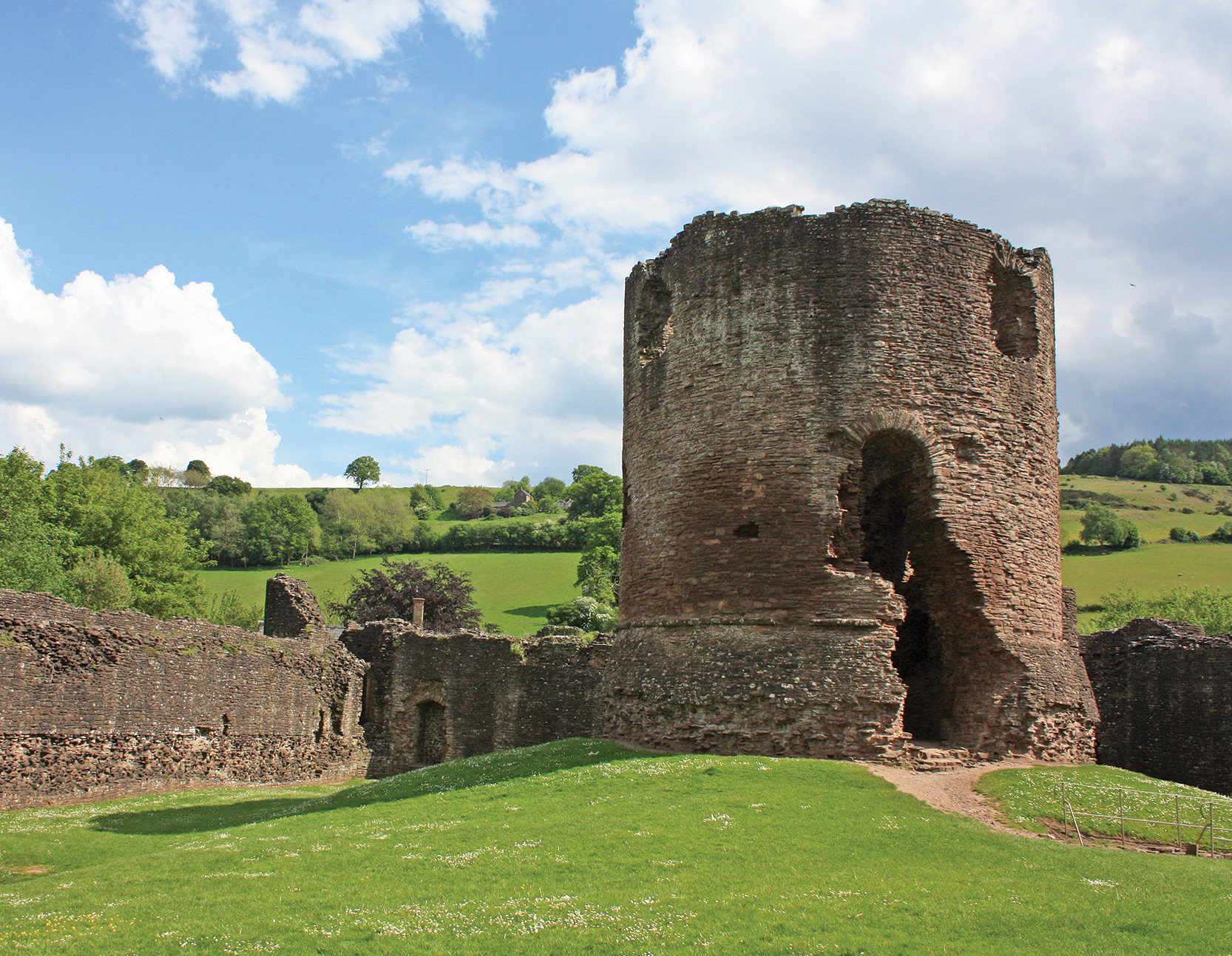
Skenfrith Castle
Skenfrith Castle (Welsh: Castell Ynysgynwraidd) is a ruined castle in the village of Skenfrith in Monmouthshire, Wales. The fortification was established...

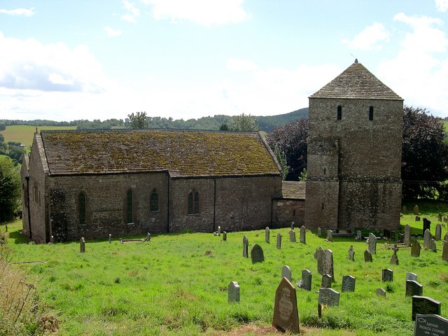
St Bridget's Church, Skenfrith
The Church of St Bridget (or St Bride) lies at the north end of the village of Skenfrith, Monmouthshire, Wales. It is an active parish church and a Grade...
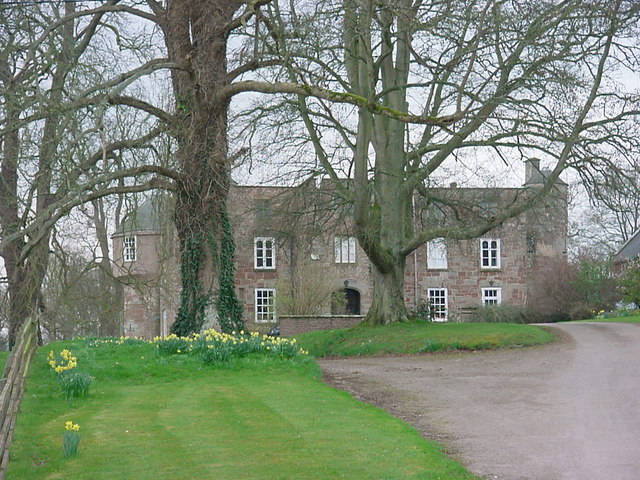
Treago Castle
Treago Castle is a fortified manor house in the parish of St Weonards, Herefordshire, England (grid reference SO48922396). Built c. 1500, it was recorded...
Garway
Garway is a civil parish in south-west Herefordshire, England. The population of the civil parish was 430 at the 2011 census. It is set on a hillside...
Llanrothal
Llanrothal is a small village and historical parish in Herefordshire, England in the Monnow Valley, on the border with Monmouthshire, Wales. The River...

St John the Baptist's Church, Llanrothal
St John the Baptist's Church is a redundant Anglican church in Llanrothal, Herefordshire, England. It is recorded in the National Heritage List for England...
Nearby Amenities
Located within 500m of 51.88807,-2.7569657Have you been to Broad Oak?
Leave your review of Broad Oak below (or comments, questions and feedback).