Cheswick Green

Civil Parish in Warwickshire Solihull

England

Cheswick Green

Stratford-upon-Avon Canal towards bridge #21
Stratford-upon-Avon Canal towards bridge #21 Credit: Ian S

Cheswick Green is a civil parish located in the county of Warwickshire, England. Situated approximately 11 miles southeast of Birmingham, it falls within the district of Solihull. The village is nestled amidst picturesque countryside, offering a peaceful and idyllic setting for its residents.

Cheswick Green is a relatively small parish, covering an area of around 1.5 square miles. It is home to a close-knit community of approximately 2,000 residents. The village boasts a range of amenities, including a primary school, a community hall, a local shop, and a pub, catering to the needs of its inhabitants.

The area is known for its beautiful natural surroundings, with plenty of green spaces and parks, providing opportunities for outdoor activities and leisurely walks. Cheswick Green is also well-connected, with good transportation links to nearby towns and cities, making it an attractive location for commuters.

The village has a rich history, with evidence of human habitation dating back to the Bronze Age. The name "Cheswick" is believed to have originated from Old English, meaning "a dairy farm." Over the years, the village has seen development and expansion, but it has managed to maintain its rural charm and character.

Cheswick Green offers a peaceful and close-knit community, combined with easy access to urban amenities and natural beauty. It is a desirable place to live for those seeking a balance between rural tranquility and modern conveniences.

If you have any feedback on the listing, please let us know in the comments section below.

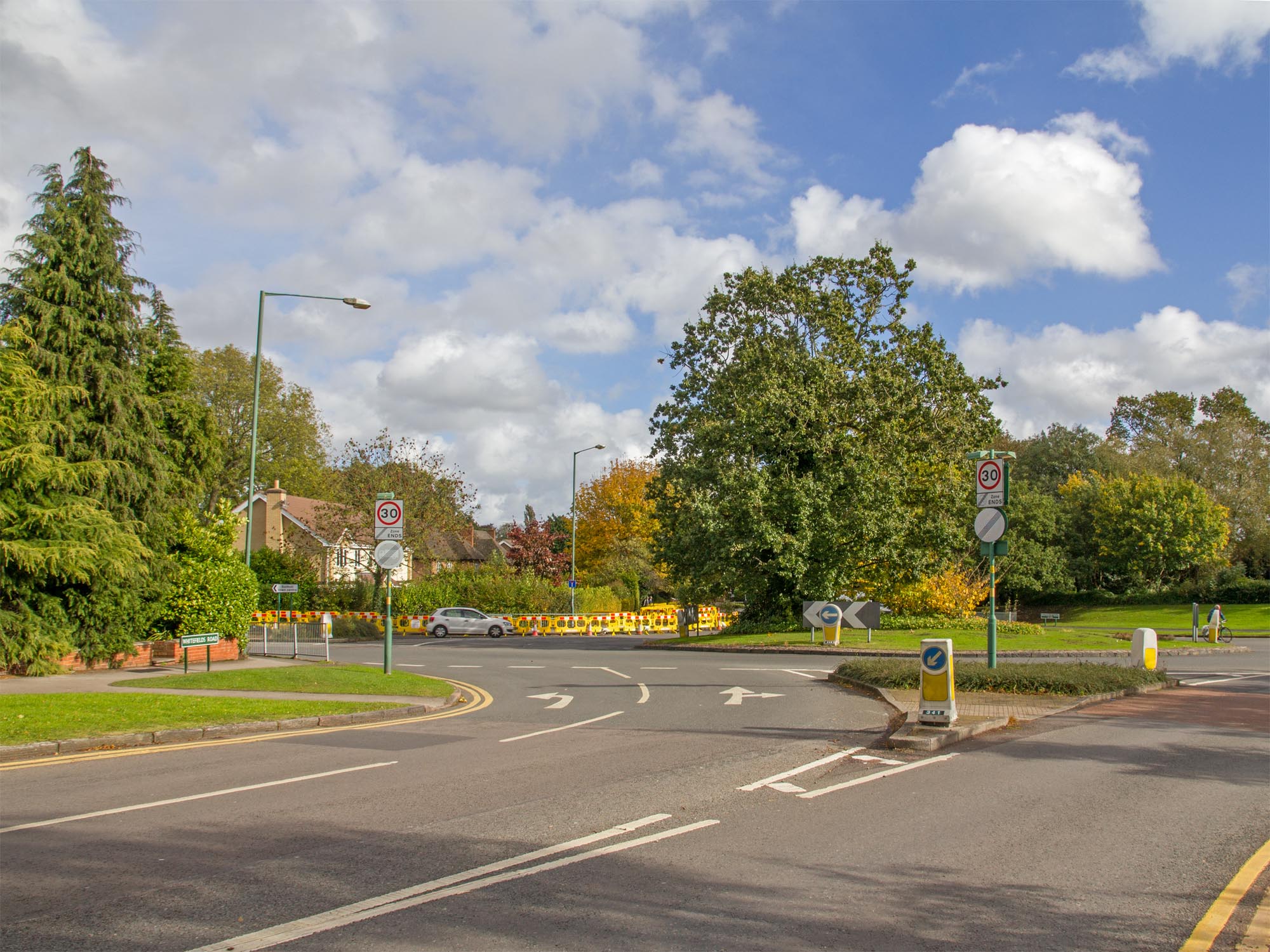
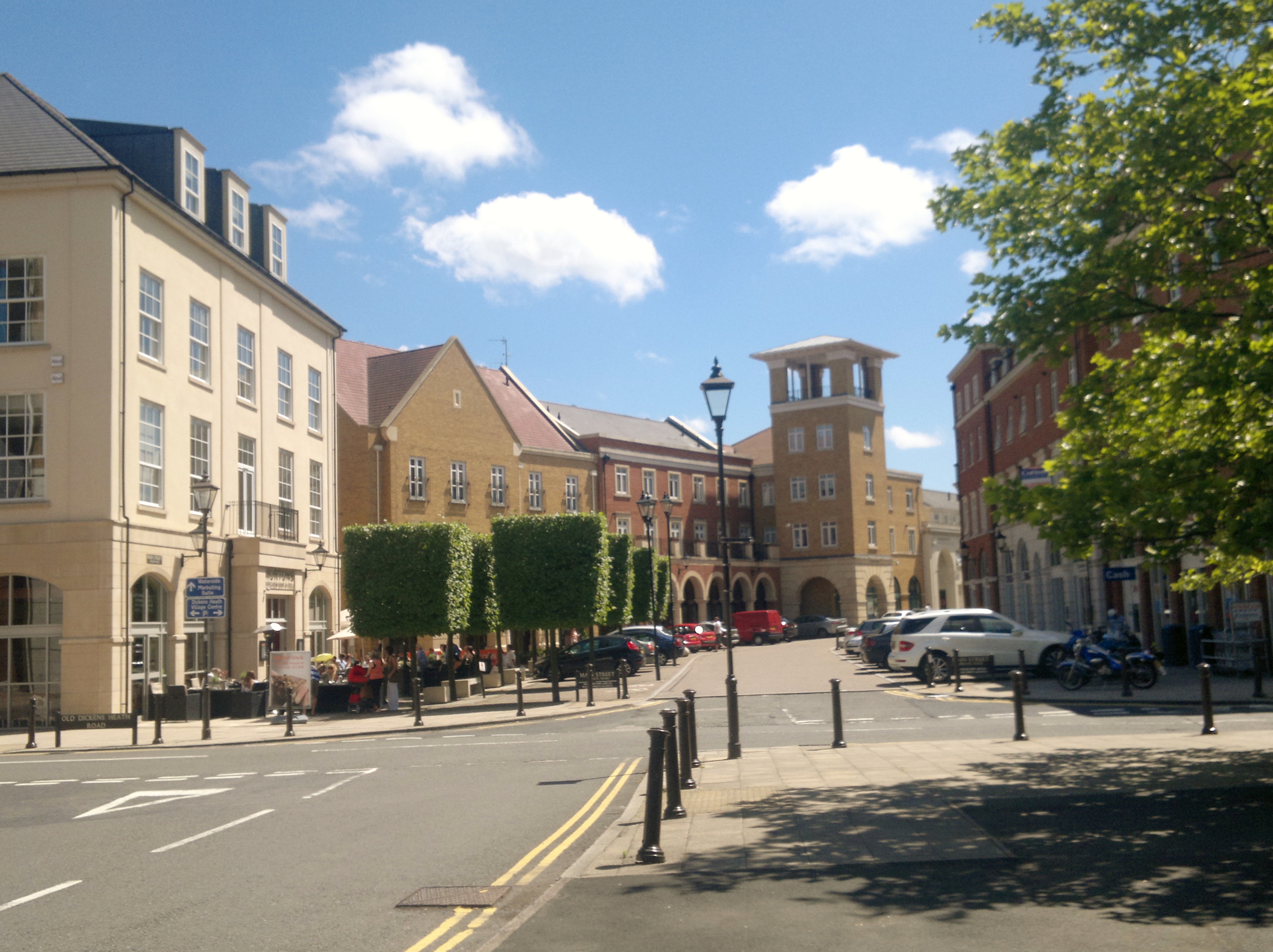
Cheswick Green Images

Images are sourced within 2km of 52.378242/-1.808036 or Grid Reference SP1375. Thanks to Geograph Open Source API. All images are credited.

Stratford-upon-Avon Canal towards bridge #21
Stratford-upon-Avon Canal at Tinkers Lane Bridge, bridge #21
Stratford-upon-Avon Canal towards bridge #20A
Stratford-upon-Avon Canal at M42 Bridge, bridge #20A
Stratford-upon-Avon Canal towards bridge #20
Stratford-upon-Avon Canal at Dyers Lane Bridge, bridge #20
Canal boat Lavinia Mary, Stratford-upon-Avon Canal
Stratford-upon-Avon Canal towards bridge #19
Beer garden at the Blue Bell Cider House Next to Blue Bell Bridge, Stratford-upon-Avon Canal.
Beer garden at the Blue Bell Cider House
Next to Blue Bell Bridge, Stratford-upon-Avon Canal.
Blue Bell Cider House next bridge #19 Stratford-upon-Avon canal
Stratford-upon-Avon Canal from the Blue Bell Cider House
Stratford-upon-Avon Canal towards bridge #18
Canal boat Dabchick, Stratford-upon-Avon Canal
Canal boat Speckled Hen, Stratford-upon-Avon Canal
Show me another place!

Cheswick Green is located at Grid Ref: SP1375 (Lat: 52.378242, Lng: -1.808036)

Administrative County: West Midlands

District: Solihull

Police Authority: West Midlands

What 3 Words

///shield.asset.policy. Near Cheswick Green, West Midlands

Related Wikis

Cheswick Green

Cheswick Green is a village and civil parish within the Metropolitan Borough of Solihull in the English county of West Midlands, incorporating the nearby...

Monkspath Hall

Monkspath Hall was a two-storey Georgian country house in Monkspath, historically in Tanworth-in-Arden, Warwickshire (since 1974 part of Solihull, in the...

Monkspath Meadow

Monkspath Meadow is a 1.2 ha (3.0 acres) ancient hay-meadow and a biological site of Special Scientific Interest in the West Midlands. The site was notified...

Monkspath

Monkspath is a large residential community and light-industrial area of Solihull, West Midlands, England, southeast of the town's Shirley district (and...

Shelly Green

Shelly Green is a settlement in the West Midlands conurbation, although it was not considered as such until the late 1990s. As of 2001 it had a population...

Dickens Heath

Dickens Heath is a large modern village and civil parish within the Metropolitan Borough of Solihull in the English county of West Midlands incorporating...

Hillfield Park

Hillfield Park, Solihull, West Midlands is a community open space and play park in Monkspath, Solihull. It covers an area of over 2 acres (0.81 ha) and...

RAF Hockley Heath

RAF Hockley Heath is a former Royal Air Force station located 4 miles (6.4 km) south of Solihull, Warwickshire, England, 7.7 miles (12.4 km) north-east...

Nearby Amenities

Located within 500m of 52.378242,-1.808036
Cheswick Green
Place: village
Wikidata: Q5094040
Wikipedia: en:Cheswick Green
Lat/Long: 52.3793198/-1.8125166
Bus Stop
Cheswick Way / Cheswick Green School
Bus: yes
Naptan AtcoCode: 43000122201
Naptan Bearing: SE
Naptan BusStopType: MKD
Naptan CommonName: Cheswick Green School
Naptan Indicator: adj
Naptan NaptanCode: nwmgawgt
Naptan PlusbusZoneRef: BHAMNWS
Naptan Status: ACT
Naptan StopType: BCT
Naptan Street: CHESWICK WAY
Naptan Towards: Shirley
Naptan Verified: no
Public Transport: platform
Route Ref: S2
Source: WMCA
Lat/Long: 52.3808808/-1.8091864
Bus Stop
Cheswick Way / Cheswick Green School
Bus: yes
Naptan AtcoCode: 43000122202
Naptan Bearing: NW
Naptan BusStopType: MKD
Naptan CommonName: Cheswick Green School
Naptan Indicator: opp
Naptan NaptanCode: nwmgawgw
Naptan PlusbusZoneRef: BHAMNWS
Naptan Status: ACT
Naptan StopType: BCT
Naptan Street: CHESWICK WAY
Naptan Towards: Earlswood
Naptan Verified: no
Public Transport: platform
Source: WMCA
Lat/Long: 52.3810076/-1.8097736
Bus Stop
Cheswick Way / Willow Drive
Bus: yes
Naptan AtcoCode: 43000122302
Naptan Bearing: SW
Naptan BusStopType: MKD
Naptan CommonName: Willow Drive
Naptan Indicator: opp
Naptan NaptanCode: nwmgawjd
Naptan PlusbusZoneRef: BHAMNWS
Naptan Status: ACT
Naptan StopType: BCT
Naptan Street: CHESWICK WAY
Naptan Towards: Earlswood
Naptan Verified: no
Public Transport: platform
Source: WMCA
Lat/Long: 52.3809416/-1.8134467
Bus Stop
Cheswick Way / The Saxon
NaPTANAreaCode: 43000122401
Bus: yes
Layby: yes
Naptan AtcoCode: 43000122401
Naptan Bearing: S
Naptan BusStopType: MKD
Naptan CommonName: The Saxon
Naptan Indicator: opp
Naptan NaptanCode: nwmgawjg
Naptan PlusbusZoneRef: BHAMNWS
Naptan Status: ACT
Naptan StopType: BCT
Naptan Street: CHESWICK WAY
Naptan Towards: Earlswood
Naptan Verified: no
Public Transport: platform
Route Ref: s4;s14
Shelter: yes
Shelter Ref: 812429
Source: WMCA
Lat/Long: 52.3782657/-1.8148684
Bus Stop
Cheswick Way / The Saxon
NaPTANAreaCode: 43000122402
Bus: yes
Naptan AtcoCode: 43000122402
Naptan Bearing: N
Naptan BusStopType: MKD
Naptan CommonName: The Saxon
Naptan Indicator: adj
Naptan NaptanCode: nwmgawjm
Naptan PlusbusZoneRef: BHAMNWS
Naptan Status: ACT
Naptan StopType: BCT
Naptan Street: CHESWICK WAY
Naptan Towards: Shirley
Naptan Verified: no
Public Transport: platform
Route Ref: S2
Shelter: yes
Shelter Ref: 812425
Source: WMCA
Lat/Long: 52.3780609/-1.8151205
Crossing
Crossing: zebra
Crossing Island: no
Tactile Paving: yes
Traffic Calming: table
Lat/Long: 52.3811852/-1.8101345
Post Box
Collection Times: Mo-Fr 17:00; Sa 11:30
Operator: Royal Mail
Post Box Type: pillar
Ref: B90 412
Royal Cypher: EIIR
Royal Cypher Wikidata: Q33102113
Source: survey
Lat/Long: 52.3781151/-1.8153689
Telephone
Booth: KX100
Covered: booth
Operator: BT
Phone: +44 1564 703081
Source: survey
Lat/Long: 52.3781229/-1.8153856
Give Way
Source: Warwickshire CC Aerial Imagery 2013
Lat/Long: 52.3765617/-1.8139305
Bus Stop
Creynolds Lane / Creynolds Close
Bus: yes
Naptan AtcoCode: 43000129601
Naptan Bearing: SW
Naptan BusStopType: CUS
Naptan CommonName: Creynolds Close
Naptan NaptanCode: nwmtpatj
Naptan Status: ACT
Naptan StopType: BCT
Naptan Street: CREYNOLDS LANE
Naptan Towards: Earlswood
Public Transport: platform
Route Ref: S2
Source: WMCA
Lat/Long: 52.377221/-1.8123069
Bus Stop
Creynolds Lane / Himley Rise
Bus: yes
Naptan AtcoCode: 43001358001
Naptan Bearing: SW
Naptan BusStopType: MKD
Naptan CommonName: Himley Rise
Naptan Indicator: opposite
Naptan NaptanCode: nwmwjadt
Naptan Status: ACT
Naptan StopType: BCT
Naptan Street: CREYNOLDS LANE
Naptan Towards: Solihull
Public Transport: platform
Route Ref: S2
Source: WMCA
Lat/Long: 52.3791047/-1.8096253
Arden Kitchens
Shop: kitchen
Source: survey
Lat/Long: 52.3783836/-1.8153043
Olivia's Hair & Beauty
Shop: hairdresser
Lat/Long: 52.3784204/-1.8152815
Post Box
Collection Times: Mo-Fr 17:30; Sa 11:30
Operator: Royal Mail
Operator Wikidata: Q638098
Post Box Type: pillar
Ref: B90 1272
Royal Cypher: EIIR
Royal Cypher Wikidata: Q33102113
Source: survey
Lat/Long: 52.3821093/-1.8117774
Post Box
Collection Times: Mo-Fr 09:00; Sa 07:00
Operator: Royal Mail
Operator Wikidata: Q638098
Post Box Type: lamp
Ref: B90 65D
Royal Cypher: EIIR
Royal Cypher Wikidata: Q33102113
Source: survey
Lat/Long: 52.3779538/-1.8109471
Generator Method: photovoltaic
Generator Output Electricity: yes
Generator Source: solar
Generator Type: solar_photovoltaic_panel
Location: roof
Power: generator
Lat/Long: 52.3796107/-1.8107727
Generator Method: photovoltaic
Generator Output Electricity: yes
Generator Source: solar
Generator Type: solar_photovoltaic_panel
Location: roof
Power: generator
Lat/Long: 52.3794896/-1.810813
Generator Method: photovoltaic
Generator Output Electricity: yes
Generator Source: solar
Generator Type: solar_photovoltaic_panel
Location: roof
Power: generator
Lat/Long: 52.3797368/-1.8119234
Generator Method: photovoltaic
Generator Output Electricity: yes
Generator Source: solar
Generator Type: solar_photovoltaic_panel
Location: roof
Power: generator
Lat/Long: 52.3809189/-1.8099922
Generator Method: photovoltaic
Generator Output Electricity: yes
Generator Source: solar
Generator Type: solar_photovoltaic_panel
Location: roof
Power: generator
Lat/Long: 52.3807847/-1.8096676
Generator Method: photovoltaic
Generator Output Electricity: yes
Generator Source: solar
Generator Type: solar_photovoltaic_panel
Location: roof
Power: generator
Lat/Long: 52.3808665/-1.8098044
Generator Method: photovoltaic
Generator Output Electricity: yes
Generator Source: solar
Generator Type: solar_photovoltaic_panel
Location: roof
Power: generator
Lat/Long: 52.3818816/-1.8119663
Generator Method: photovoltaic
Generator Output Electricity: yes
Generator Source: solar
Generator Type: solar_photovoltaic_panel
Location: roof
Power: generator
Lat/Long: 52.3820699/-1.8113279
Generator Method: photovoltaic
Generator Output Electricity: yes
Generator Source: solar
Generator Type: solar_photovoltaic_panel
Location: roof
Power: generator
Lat/Long: 52.3766258/-1.8145117
Generator Method: photovoltaic
Generator Output Electricity: yes
Generator Source: solar
Generator Type: solar_photovoltaic_panel
Location: roof
Power: generator
Lat/Long: 52.3792325/-1.8142945
Generator Method: photovoltaic
Generator Output Electricity: yes
Generator Source: solar
Generator Type: solar_photovoltaic_panel
Location: roof
Power: generator
Lat/Long: 52.3793078/-1.81445
Generator Method: photovoltaic
Generator Output Electricity: yes
Generator Source: solar
Generator Type: solar_photovoltaic_panel
Location: roof
Power: generator
Lat/Long: 52.3808927/-1.8139914
Generator Method: photovoltaic
Generator Output Electricity: yes
Generator Source: solar
Generator Type: solar_photovoltaic_panel
Location: roof
Power: generator
Lat/Long: 52.3798047/-1.8129131
The Oaks
Addr City: Solihull
Addr Housenumber: 92
Addr Postcode: B90 4HG
Addr Street: Cheswick Way
Fhrs Id: 523936
Tourism: guest_house
Lat/Long: 52.3810646/-1.8091419
The data included in this document is from www.openstreetmap.org. The data is made available under ODbL.

Have you been to Cheswick Green?

Leave your review of Cheswick Green below (or comments, questions and feedback).