Broad Oak

Settlement in Cumberland Copeland

England

Broad Oak

Derelict farm building
Derelict farm building Credit: P Gaskell

Broad Oak is a small village located in the county of Cumberland, England. Situated in the beautiful countryside, it is nestled amidst rolling hills and picturesque landscapes. The village is part of the Eden district and lies approximately 5 miles southeast of the town of Penrith.

Broad Oak is known for its tranquil and idyllic setting, making it a popular destination for those seeking a peaceful retreat or a base to explore the surrounding area. The village is characterized by its charming stone cottages and traditional architecture, giving it a quintessentially English feel.

Although small in size, Broad Oak has a close-knit community that is proud of its heritage and maintains a strong sense of local identity. The village is home to a village hall, which serves as a hub for community activities and events. It also has a local pub, where residents and visitors can enjoy a pint of ale or a hearty meal.

The countryside surrounding Broad Oak offers ample opportunities for outdoor activities. The village is within close proximity to the Lake District National Park, famous for its stunning lakes, mountains, and hiking trails. Outdoor enthusiasts can enjoy a range of activities such as walking, cycling, and birdwatching in this scenic area.

Overall, Broad Oak is a charming village that offers a peaceful and picturesque setting, making it an ideal destination for those seeking a tranquil retreat or an opportunity to explore the natural beauty of Cumberland.

If you have any feedback on the listing, please let us know in the comments section below.
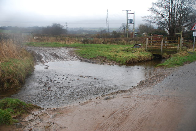
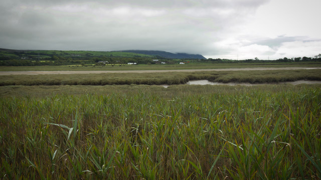
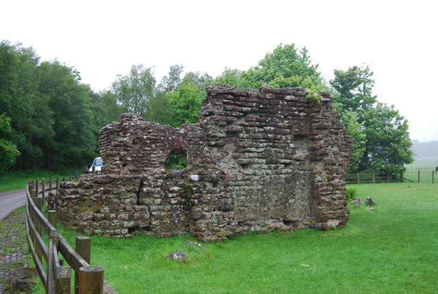
Broad Oak Images

Images are sourced within 2km of 54.340398/-3.365402 or Grid Reference SD1194. Thanks to Geograph Open Source API. All images are credited.

Derelict farm building
Ford at Waberthwaite This farm ford on the Whitrow Beck is found at Waberthwaite near Newbiggin.
Ford at Waberthwaite
This farm ford on the Whitrow Beck is found at Waberthwaite near Newbiggin.
On Muncaster Castle Hill
The Esk estuary at Hall Waberthwaite A ford crosses here but it is high tide and to attempt anything would be extremely inadvisable.
The Esk estuary at Hall Waberthwaite
A ford crosses here but it is high tide and to attempt anything would be extremely inadvisable.
High tide below Beacon Plantation This is about as far as the high tide would allow me to go without wading. At low tide it's possible to follow the bridleway onwards but I had to follow a higher alternative route north towards Ravenglass.
High tide below Beacon Plantation
This is about as far as the high tide would allow me to go without wading. At low tide it's possible to follow the bridleway onwards but I had to follow a higher alternative route north towards Ravenglass.
Newbiggin from across the Esk estuary
Hall Waberthwaite from across the River Esk
River Esk
River Esk
Creek of the Esk estuary A water channel on the north side of the River Esk, to the south of Beacon Plantation.
Creek of the Esk estuary
A water channel on the north side of the River Esk, to the south of Beacon Plantation.
Hall Waberthwaite Tidal Ford This tidal ford in the mouth of the River Esk is found at Hall Waberthwaite.
Hall Waberthwaite Tidal Ford
This tidal ford in the mouth of the River Esk is found at Hall Waberthwaite.
Ford on the River Esk The channel here splits into three. This is the easiest crossing, and it's low tide!
Ford on the River Esk
The channel here splits into three. This is the easiest crossing, and it's low tide!
River Esk and Salt Marsh The Esk Railway Viaduct is in the distance.
River Esk and Salt Marsh
The Esk Railway Viaduct is in the distance.
River Esk The River Esk rises on the Scafell range near Esk Hause, flows south then west to its mouth at Ravenglass.
River Esk
The River Esk rises on the Scafell range near Esk Hause, flows south then west to its mouth at Ravenglass.
Lambs at play
Lambs at play
Public Footpath through Muncaster Castle Estate
Muncaster castle A view of Muncaster castle looking in a NE direction
Muncaster castle
A view of Muncaster castle looking in a NE direction
River Esk Looking west
River Esk
Looking west
Show me another place!

Broad Oak is located at Grid Ref: SD1194 (Lat: 54.340398, Lng: -3.365402)

Administrative County: Cumbria

District: Copeland

Police Authority: Cumbria

What 3 Words

///equipping.stress.whistling. Near Seascale, Cumbria

Related Wikis

Broad Oak, Cumbria

Broad Oak is a hamlet in Cumbria, England. It is located along the A595 road, 14.4 miles (23.2 km) by road south of Egremont. == See also == List of places...

Waberthwaite

Waberthwaite is a small, former rural civil parish (about 4 square miles in area) on the south bank of the estuary of the River Esk, in Copeland, Cumbria...

St John's Church, Waberthwaite

St John's Church is situated on the south bank of the River Esk in the hamlet of Hall Waberthwaite in the former civil parish of Waberthwaite (now part...

Muncaster Castle

Muncaster Castle is a privately owned castle overlooking the River Esk, about a mile east of the west-coastal town of Ravenglass in Cumbria, England. It...

Muncaster

Muncaster is a civil parish in Cumbria, North West England. The parish is 41 miles (66 km) south west of the city of Carlisle, in the Copeland district...

St Michael's Church, Muncaster

St Michael's Church is in the grounds of Muncaster Castle, near Ravenglass, Cumbria, England. It is an active Anglican parish church in the deanery of...

Eskmeals railway station

Eskmeals is a former railway station in the Eskmeals area of the Cumbrian coast, England. It was located on the Cumbrian Coast Line, south of Ravenglass...

Glannoventa

Glannoventa is a Roman fort associated with the Roman naval base at Ravenglass in Cumbria, England. Its name is derived from the Latin place-name Clanoventa...

Nearby Amenities

Located within 500m of 54.340398,-3.365402
Broad Oak Farm (N bound)
Naptan AtcoCode: 090050271684
Naptan Bearing: N
Naptan BusStopType: CUS
Naptan CommonName: Broad Oak Farm (N bound)
Naptan Indicator: near
Naptan Landmark: Broad Oak Bridge
Naptan NaptanCode: cumawgpd
Naptan Street: A595(T)
Naptan Verified: no
Source: naptan_import
Lat/Long: 54.3397338/-3.3646086
Broad Oak Farm (S bound)
Naptan AtcoCode: 090050273531
Naptan Bearing: SE
Naptan BusStopType: CUS
Naptan CommonName: Broad Oak Farm (S bound)
Naptan Indicator: near
Naptan Landmark: Broad Oak Bridge
Naptan NaptanCode: cumawgpm
Naptan Street: A595(T)
Naptan Verified: no
Source: naptan_import
Lat/Long: 54.3398437/-3.3644277
Telephone
Booth: K6
Covered: booth
Lat/Long: 54.3397483/-3.3648043
Barrier: cattle_grid
Lat/Long: 54.3403678/-3.3644664
Post Box
Post Box Type: lamp
Ref: CA18 101
Royal Cypher: EIIR
Source: survey
Lat/Long: 54.3383698/-3.3634753
Broad Oak
Place: hamlet
Wikidata: Q4971904
Wikipedia: en:Broad Oak, Cumbria
Lat/Long: 54.3389403/-3.3637373
Power: pole
Lat/Long: 54.3378118/-3.362645
Power: pole
Lat/Long: 54.338737/-3.362695
Power: pole
Lat/Long: 54.339899/-3.3634104
Power: pole
Lat/Long: 54.3400902/-3.3628512
Barrier: cattle_grid
Lat/Long: 54.3440682/-3.3653275
Power: pole
Lat/Long: 54.3436757/-3.3603782
Information: guidepost
Tourism: information
Lat/Long: 54.3441309/-3.3653928
Power: pole
Lat/Long: 54.3372496/-3.3692052
Power: pole
Lat/Long: 54.3375716/-3.3676448
Power: pole
Lat/Long: 54.3381265/-3.365138
Power: pole
Lat/Long: 54.338387/-3.3639506
Power: pole
Lat/Long: 54.3396094/-3.3621281
Power: pole
Lat/Long: 54.3405099/-3.361581
Power: pole
Lat/Long: 54.3414144/-3.3609618
Power: pole
Lat/Long: 54.3423599/-3.3603039
Power: pole
Lat/Long: 54.34285/-3.3600013
Power: pole
Lat/Long: 54.3416861/-3.3622249
Power: pole
Lat/Long: 54.3418523/-3.362976
The data included in this document is from www.openstreetmap.org. The data is made available under ODbL.

Have you been to Broad Oak?

Leave your review of Broad Oak below (or comments, questions and feedback).