Chandler's Ford

Civil Parish in Hampshire Eastleigh

England

Chandler's Ford

Chandler's Ford railway station, Hampshire Opened in 1847 on the London & South Western Railway's line from Eastleigh to Romsey, this station closed in 1969. It was rebuilt and reopened in 2003.
View north west towards Romsey. The original station's main building was to the right of the line, rather than the left. The disused eastbound platform can also be seen on the right.
Chandler's Ford railway station, Hampshire Credit: Nigel Thompson

Chandler's Ford is a civil parish located in the county of Hampshire, England. Situated approximately 7 miles east of the city of Southampton and 5 miles north of the town of Eastleigh, it is a suburban area that forms part of the wider Eastleigh borough.

Chandler's Ford is primarily a residential area, known for its quiet and family-friendly atmosphere. The parish is home to a population of around 21,000 residents. It is characterized by a mix of housing types, including detached and semi-detached houses, as well as a number of apartment complexes and retirement homes.

The area boasts a range of amenities and facilities to cater to the needs of its residents. There are several shopping centers and supermarkets, along with a variety of local shops, cafes, and restaurants. Chandler's Ford is also well-served by schools, with a number of primary and secondary schools located within its boundaries.

In terms of recreational opportunities, the parish offers numerous green spaces, parks, and playing fields. There are also several sports clubs and leisure centers, providing opportunities for various activities such as football, cricket, tennis, and swimming.

Chandler's Ford benefits from excellent transport links, with easy access to major roads including the M3 and M27 motorways. The area is served by regular bus services, providing connections to nearby towns and cities. Additionally, Chandler's Ford railway station offers direct train services to Southampton, Winchester, and London.

Overall, Chandler's Ford is a peaceful and well-connected residential area, offering a high quality of life for its residents.

If you have any feedback on the listing, please let us know in the comments section below.

Chandler's Ford Images

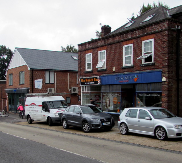
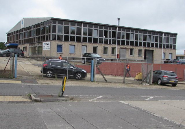
Images are sourced within 2km of 50.969169/-1.385113 or Grid Reference SU4319. Thanks to Geograph Open Source API. All images are credited.

Chandler's Ford railway station, Hampshire Opened in 1847 on the London & South Western Railway's line from Eastleigh to Romsey, this station closed in 1969. It was rebuilt and reopened in 2003.
View north west towards Romsey. The original station's main building was to the right of the line, rather than the left. The disused eastbound platform can also be seen on the right.
Chandler's Ford railway station, Hampshire
Opened in 1847 on the London & South Western Railway's line from Eastleigh to Romsey, this station closed in 1969. It was rebuilt and reopened in 2003. View north west towards Romsey. The original station's main building was to the right of the line, rather than the left. The disused eastbound platform can also be seen on the right.
Midhurst Court, Chandler's Ford A little infilling development.
Midhurst Court, Chandler's Ford
A little infilling development.
Kingsway in Chandlers Ford Looking southward.
Kingsway in Chandlers Ford
Looking southward.
Ordnance Survey Flush Bracket G5239 This bracket can be found on the wall of Chandlers Ford Infant School.
For more detail see : <span class="nowrap"><a title="http://www.bench-marks.org.uk/bm12939" rel="nofollow ugc noopener" href="http://www.bench-marks.org.uk/bm12939">Link</a><img style="margin-left:2px;" alt="External link" title="External link - shift click to open in new window" src="https://s1.geograph.org.uk/img/external.png" width="10" height="10"/></span>
Ordnance Survey Flush Bracket G5239
This bracket can be found on the wall of Chandlers Ford Infant School. For more detail see : LinkExternal link
Ordnance Survey Flush Bracket 2790 This can be found on the wall of a house -private flats - in Winchester Road, Chandlers Ford.
For more detail see : <span class="nowrap"><a title="http://www.bench-marks.org.uk/bm10491" rel="nofollow ugc noopener" href="http://www.bench-marks.org.uk/bm10491">Link</a><img style="margin-left:2px;" alt="External link" title="External link - shift click to open in new window" src="https://s1.geograph.org.uk/img/external.png" width="10" height="10"/></span>
Ordnance Survey Flush Bracket 2790
This can be found on the wall of a house -private flats - in Winchester Road, Chandlers Ford. For more detail see : LinkExternal link
Nail Look, Chandler's Ford Nail salon at 1 Bournemouth Road.
Nail Look, Chandler's Ford
Nail salon at 1 Bournemouth Road.
Single track line towards Chandler's Ford railway station From Bournemouth Road bridge. <a title="https://www.geograph.org.uk/photo/5478025" href="https://www.geograph.org.uk/photo/5478025">Link</a>
Single track line towards Chandler's Ford railway station
From Bournemouth Road bridge. Link
Maya Fine Indian Dining, Chandler's Ford Indian cuisine restaurant and takeaway at 5 Bournemouth Road.
Maya Fine Indian Dining, Chandler's Ford
Indian cuisine restaurant and takeaway at 5 Bournemouth Road.
King George VI pillarbox, Bournemouth Road, Chandler's Ford  On the west side of the B3043 Bournemouth Road, near a row of shops.
King George VI pillarbox, Bournemouth Road, Chandler's Ford
On the west side of the B3043 Bournemouth Road, near a row of shops.
Footpath and cycleway to Chandler's Ford railway station Descending from Bournemouth Road past Chandler's Ford Chinese Medical Centre.
Footpath and cycleway to Chandler's Ford railway station
Descending from Bournemouth Road past Chandler's Ford Chinese Medical Centre.
Knight Goodhead office in Chandler's Ford Chartered accountants at 7 Bournemouth Road.
Knight Goodhead office in Chandler's Ford
Chartered accountants at 7 Bournemouth Road.
GoPhysio in Chandler's Ford  Physiotherapy, Pilates and injury treatment clinic at 11 Bournemouth Road.
GoPhysio in Chandler's Ford
Physiotherapy, Pilates and injury treatment clinic at 11 Bournemouth Road.
Art Deco Café, Chandler's Ford Viewed across Bournemouth Road in late July 2017.
An October 2016 Google Earth Street View shows Firecare & Security Ltd here.
Art Deco Café, Chandler's Ford
Viewed across Bournemouth Road in late July 2017. An October 2016 Google Earth Street View shows Firecare & Security Ltd here.
His & Kids, Bournemouth Road, Chandler's Ford The barber shop for men and children is next door to The Munch Box (sandwiches and baguettes).
His & Kids, Bournemouth Road, Chandler's Ford
The barber shop for men and children is next door to The Munch Box (sandwiches and baguettes).
Fishy Co in Chandler's Ford The fishmonger at 15 Bournemouth Road is next door to Art Deco Café.
Fishy Co in Chandler's Ford
The fishmonger at 15 Bournemouth Road is next door to Art Deco Café.
Directions sign facing Bournemouth Road, Chandler's Ford Facing northbound traffic on the B3043 Bournemouth Road on the approach 
to the roundabout at the B3043 Hursley Road junction.
Directions sign facing Bournemouth Road, Chandler's Ford
Facing northbound traffic on the B3043 Bournemouth Road on the approach to the roundabout at the B3043 Hursley Road junction.
Selwood Plant & Pumps, Chandler's Ford Business at 32-36 Bournemouth Road view across School Lane.
Selwood Plant & Pumps, Chandler's Ford
Business at 32-36 Bournemouth Road view across School Lane.
Ashbourne Motor Company, Chandler's Ford At 1 School Lane, viewed across Station Lane.
Ashbourne Motor Company, Chandler's Ford
At 1 School Lane, viewed across Station Lane.
Show me another place!

Chandler's Ford is located at Grid Ref: SU4319 (Lat: 50.969169, Lng: -1.385113)

Administrative County: Hampshire

District: Eastleigh

Police Authority: Hampshire

What 3 Words

///chains.dated.rather. Near Eastleigh, Hampshire

Related Wikis

Infinity F.C.

Infinity Football Club is a football club currently based in Sidlesham, West Sussex. The club compete in Hampshire Premier League Senior Division. ��2...

Toynbee School

Toynbee School is an 11-16 (no sixth form) secondary school in Chandler's Ford, Hampshire. The head teacher is Matthew Longden. == History == Toynbee School...

Chandler's Ford railway station

Chandler's Ford railway station serves the Chandler's Ford area of Eastleigh in Hampshire, England. It is on the Eastleigh to Romsey Line, 75 miles 25...

Chandler's Ford shooting

The Chandler's Ford shooting (codenamed Operation Hurlock by the police) was the shooting of armed robbers in the town of Chandler's Ford, Hampshire, in...

Related Videos

【修咸頓生活】Southampton Walking Tour SO50 Lakeside Country Park

公園雖然較細,但係環境優美,沿住個湖泊行,陽光藍天白雲倒映喺水中,非常悠閒。

#17 Rob's Hampshire Pub Walks: Middle , Eastleigh The Village That Time Forgot Walk 4 miles approx.

One of my Hampshire walks of discovery through North Stoneham Park and the village that even the locals have never heard of.

Nearby Amenities

Located within 500m of 50.969169,-1.385113
Crossing
Bicycle: yes
Crossing: traffic_signals
Crossing Ref: toucan
Segregated: no
Lat/Long: 50.9663947/-1.3873182
Motorway Junction
Leigh Road
Ref: 13
Lat/Long: 50.9697179/-1.3786681
Crossing
Bicycle: yes
Crossing: traffic_signals
Crossing Ref: toucan
Segregated: no
Lat/Long: 50.9703336/-1.3899872
Turning Circle
Lat/Long: 50.9665454/-1.3809432
Place Of Worship
Velmore Church
Addr City: Chandlers Ford , SO53 3GY
Addr Street: Falkland Road
Religion: christian
Toilets Wheelchair: yes
Website: https://www.facebook.com/VelmoreChurch/?locale=en_GB
Wheelchair: yes
Wheelchair Description: Used to be Velmore Chapel, was redeveloped as part of the redevelopment programme for the whole of Velmore between approx 2005 - 2012. Is now a thriving community centre with many activities, groups, cafe etc. Tel: 02380 261139 Email: info@velmorecentr
Lat/Long: 50.9716669/-1.383132
Turning Circle
Lat/Long: 50.9713666/-1.3903916
Power: tower
Ref: 4YC 27
Source Ref: extrapolation
Lat/Long: 50.9701985/-1.387459
Power: tower
Ref: 4YC 28
Source Ref: extrapolation
Lat/Long: 50.9698877/-1.3826339
Post Office
Velmore Sub Post Office
Addr City: Eastleigh
Addr Housenumber: 5
Addr Postcode: SO53 3GA
Addr Street: Falkland Court
Addr Suburb: Chandler's Ford
Phone: +44 845 722 3344
Ref Pol Id: 11107
Toilets Wheelchair: no
Website: https://www.postoffice.co.uk/
Wheelchair: yes
Wheelchair Description: This Post Office is a small counter inside the back of the Co Op shop.
Lat/Long: 50.9720397/-1.3827402
Bus Stop
Velmore Estate Shops
Bus: yes
Naptan AtcoCode: 1900HA030116
Naptan Bearing: N
Naptan CommonName: Velmore Estate Shops
Naptan Crossing: Devon Drive
Naptan NaptanCode: hamawjwm
Naptan Street: Falkland Road
Naptan Verified: no
Public Transport: platform
Source: naptan_import
Lat/Long: 50.9724249/-1.3831735
Bus Stop
Velmore Estate Shops
Bus: yes
Naptan AtcoCode: 1900HA030117
Naptan Bearing: S
Naptan CommonName: Velmore Estate Shops
Naptan Crossing: Devon Drive
Naptan NaptanCode: hamawjwt
Naptan Street: Falkland Road
Naptan Verified: no
Public Transport: platform
Source: naptan_import
Lat/Long: 50.9724155/-1.3830882
Bus Stop
Cambridge Drive
Bus: yes
Naptan AtcoCode: 1900HA030118
Naptan Bearing: S
Naptan CommonName: Cambridge Drive
Naptan Crossing: Cambridge Drive
Naptan NaptanCode: hamawjwj
Naptan Street: Falkland Road
Naptan Verified: no
Public Transport: platform
Source: naptan_import
Lat/Long: 50.9694038/-1.3832563
Bus Stop
Suffolk Drive
Bus: yes
Naptan AtcoCode: 1900HA030119
Naptan Bearing: N
Naptan CommonName: Suffolk Drive
Naptan Crossing: Suffolk Drive
Naptan NaptanCode: hamawjmt
Naptan Street: Falkland Road
Naptan Verified: no
Public Transport: platform
Source: naptan_import
Lat/Long: 50.9672432/-1.3845096
Bus Stop
Falkland Road
Bus: yes
Naptan AtcoCode: 1900HA030120
Naptan NaptanCode: hamawjgm
Public Transport: platform
Lat/Long: 50.9654372/-1.3859345
Bus Stop
Falkland Road
Bus: yes
Naptan AtcoCode: 1900HA030121
Naptan NaptanCode: hamawjga
Public Transport: platform
Lat/Long: 50.9653739/-1.3861749
Shelter
Lat/Long: 50.9673003/-1.3906795
Bus Stop
Somerset Crescent
Bus: yes
Naptan AtcoCode: 1900HA030557
Naptan Bearing: E
Naptan CommonName: Somerset Crescent
Naptan Crossing: Falkland Road
Naptan NaptanCode: hamawmaj
Naptan Street: Belmont Road
Naptan Verified: no
Public Transport: platform
Source: naptan_import
Lat/Long: 50.9703823/-1.38293
Bus Stop
Belmont Road
Bus: yes
Naptan AtcoCode: 1900HA030558
Naptan Bearing: N
Naptan CommonName: Belmont Road
Naptan Crossing: Belmont Road
Naptan NaptanCode: hamawmwt
Naptan Street: Wiltshire Road
Naptan Verified: no
Public Transport: platform
Source: naptan_import
Lat/Long: 50.9712782/-1.3789017
Bus Stop
Kent Road
Bus: yes
Naptan AtcoCode: 1900HA030560
Naptan Bearing: W
Naptan CommonName: Kent Road
Naptan Crossing: Kent Road
Naptan NaptanCode: hamawmga
Naptan Street: Cox Row
Naptan Verified: no
Public Transport: platform
Source: naptan_import
Lat/Long: 50.9726347/-1.3814597
Bus Stop
Chandlers Ford Asda
Bench: yes
Bin: yes
Bus: yes
Lit: yes
Public Transport: platform
Shelter: yes
Tactile Paving: no
Lat/Long: 50.9676598/-1.3912059
Bus Stop
Chandlers Ford Asda
Bench: yes
Bin: yes
Bus: yes
Lit: yes
Naptan AtcoCode: 1900HA030002
Naptan NaptanCode: hamawgam
Public Transport: platform
Shelter: yes
Tactile Paving: no
Lat/Long: 50.9681042/-1.3912561
Bus Stop
Chestnut Avenue, Asda
Bench: yes
Bin: yes
Bus: yes
Public Transport: platform
Shelter: yes
Tactile Paving: no
Lat/Long: 50.9681997/-1.388209
Bus Stop
Chestnut Avenue, Asda
Bench: no
Bin: no
Bus: yes
Naptan AtcoCode: 1900HAA91312
Naptan NaptanCode: hamjpwdg
Public Transport: platform
Shelter: no
Tactile Paving: no
Wheelchair: yes
Lat/Long: 50.9692297/-1.3889843
Barmer
Note: (Tyres only)
Shop: car_repair
Lat/Long: 50.9669188/-1.390596
Post Box
Collection Plate: CP1
Collection Times: Mo-Fr 17:15; Sa 11:45
Operator: Royal Mail
Operator Wikidata: Q638098
Post Box Type: pillar
Ref: SO53 565
Royal Cypher: GR
Royal Cypher Wikidata: Q33102273
Lat/Long: 50.9720225/-1.3828405
Dreams
Brand: Dreams
Brand Wikidata: Q5306688
Note: bed specialist
Shop: bed
Lat/Long: 50.9670483/-1.3865893
Crossing
Lat/Long: 50.9695045/-1.3889179
American Golf
Note: (Golf specialist)
Shop: sports
Lat/Long: 50.9668335/-1.3864441
Crossing
Crossing: unmarked
Crossing Island: no
Crossing Markings: no
Tactile Paving: yes
Lat/Long: 50.9684849/-1.3882813
Atm
Operator: NatWest Bank
Lat/Long: 50.9669924/-1.3905346
Atm
Operator: Asda Finance
Lat/Long: 50.9669679/-1.3905534
Atm
Lat/Long: 50.9669451/-1.3905735
Crossing
Crossing: traffic_signals
Crossing Island: no
Tactile Paving: yes
Lat/Long: 50.9697109/-1.391409
Entrance: main
Level: 0
Lat/Long: 50.9689041/-1.3920767
Crossing
Crossing: uncontrolled
Crossing Markings: yes
Lat/Long: 50.9690605/-1.3922249
Crossing: unmarked
Traffic Calming: hump
Lat/Long: 50.9695866/-1.3919098
Barrier: lift_gate
Lat/Long: 50.9654616/-1.3876983
Barrier: lift_gate
Lat/Long: 50.9655002/-1.3873892
Crossing
Crossing: traffic_signals
Crossing Island: no
Crossing Markings: dots
Tactile Paving: yes
Lat/Long: 50.967918/-1.3912183
Crossing
Button Operated: yes
Crossing: traffic_signals
Crossing Island: no
Tactile Paving: yes
Traffic Signals Sound: yes
Traffic Signals Vibration: yes
Lat/Long: 50.9689808/-1.3886351
Post Box
Collection Times: Mo-Fr 17:00; Sa 11:30
Operator: Royal Mail
Operator Wikidata: Q638098
Post Box Type: pillar
Ref: SO53 579
Royal Cypher: EIIR
Royal Cypher Wikidata: Q33102113
Lat/Long: 50.9674367/-1.3904069
Crossing
Crossing: uncontrolled
Lat/Long: 50.9657175/-1.3866646
Information: board
Tourism: information
Lat/Long: 50.9698766/-1.3854634
Tourism: picnic_site
Lat/Long: 50.9699037/-1.3855586
Crossing
Lat/Long: 50.967398/-1.3880659
Crossing
Lat/Long: 50.9674613/-1.387935
Crossing
Lat/Long: 50.9702812/-1.3897516
Barrier: cycle_barrier
Lat/Long: 50.9663061/-1.3873695
Telephone
Addr City: Eastleigh
Addr Country: GB
Addr Housename: Shopping Precinct Falkland Court
Addr Street: Falkland Road
Addr Suburb: Chandler's Ford
Booth: KX100
Covered: booth
Operator: BT
Operator Wikidata: Q593786
Payment Coins: no
Phone: +44 2380 262384
Lat/Long: 50.97203/-1.3828224
Post Box
Collection Plate: CP1D
Collection Times: Mo-Fr 09:00; Sa 07:00
Operator: Royal Mail
Operator Wikidata: Q638098
Post Box Type: pillar
Ref: SO53 390D
Royal Cypher: EIIR
Royal Cypher Wikidata: Q33102113
Lat/Long: 50.9672385/-1.3854301
KPMG
Office: accountant
Website: kpmg.co.uk
Lat/Long: 50.967135/-1.3826865
Carers Together
Addr City: Eastleigh
Addr Housename: Falkland Court
Addr Street: Falkland Road
Shop: charity
Lat/Long: 50.9721378/-1.3824591
ALDI
Brand: ALDI
Brand Wikidata: Q41171672
Brand Wikipedia: en:Aldi
Contact Website: https://stores.aldi.co.uk/eastleigh/1b-chestnut-ave-retail-park
Shop: supermarket
Lat/Long: 50.9673813/-1.3867049
Poundstretcher
Addr City: Eastleigh
Addr Housename: Chestnut Retail Park
Addr Postcode: SO53 3TF
Addr Street: Chestnut Avenue
Brand: Poundstretcher
Brand Wikidata: Q7235675
Brand Wikipedia: en:Poundstretcher
Phone: +44 2380 615210
Shop: variety_store
Website: https://www.poundstretcher.co.uk/eastleigh-748
Lat/Long: 50.9676921/-1.3869087
Turning Circle
Lat/Long: 50.9711945/-1.3885539
Fast Food
McDonald's
Addr City: Eastleigh
Addr Street: Bournemouth Road
Brand: McDonald's
Brand Wikidata: Q38076
Brand Wikipedia: en:McDonald's
Check Date: 2024-04-03
Contact Website: https://www.mcdonalds.com/gb/en-gb/location/eastleigh/eastleigh---asda/bournemouth-road/8261522.html
Cuisine: burger
Description: This branch is inside the Asda superstore.
Drive Through: no
Start Date: 2019-09-04
Takeaway: yes
Lat/Long: 50.9676497/-1.3899232
Waste Basket
Bin
Survey Date: 2020-01-23
Lat/Long: 50.9679803/-1.3792039
Crossing
Crossing: uncontrolled
Crossing Island: no
Crossing Markings: zebra
Tactile Paving: yes
Lat/Long: 50.9678135/-1.3910502
Crossing
Crossing: uncontrolled
Crossing Island: no
Crossing Markings: zebra
Tactile Paving: yes
Lat/Long: 50.9676499/-1.39051
Entrance: yes
Lat/Long: 50.967465/-1.3904484
Crossing
Lat/Long: 50.965472/-1.3861577
Crossing
Crossing: uncontrolled
Lat/Long: 50.9654898/-1.3860499
Asda Opticians
Brand: Asda
Brand Wikidata: Q297410
Brand Wikipedia: en:Asda
Check Date: 2024-04-03
Contact Phone: +44 23 8027 7382
Contact Website: https://storelocator.asda.com/south-east/eastleigh/bournemouth-road/opticians
Fixme: Location not accurate
Operator: Asda Stores Ltd
Shop: optician
Lat/Long: 50.9671031/-1.3896471
Pharmacy
Asda
Brand: Asda
Brand Wikidata: Q297410
Brand Wikipedia: en:Asda
Check Date: 2024-04-03
Contact Phone: +44 23 8027 7390
Contact Website: https://storelocator.asda.com/south-east/eastleigh/bournemouth-road/pharmacy
Fixme: Location not accurate
Healthcare: pharmacy
Operator: Asda Stores Ltd
Lat/Long: 50.9672044/-1.389572
Traffic Signals
Traffic Signals: pedestrian_crossing
Traffic Signals Direction: forward
Lat/Long: 50.9697021/-1.3913439
Bicycle Parking
Access: yes
Bicycle Parking: stands
Capacity: 6
Check Date Capacity: 2023-05-13
Covered: no
Fee: no
Lat/Long: 50.9682241/-1.3912126
Bicycle Parking
Bicycle Parking: stands
Lat/Long: 50.9677179/-1.3902651
Bicycle Parking
Bicycle Parking: stands
Lat/Long: 50.967656/-1.3901719
Crossing
Crossing: uncontrolled
Lat/Long: 50.9723844/-1.3831361
Traffic Signals
Traffic Signals: pedestrian_crossing
Traffic Signals Direction: backward
Lat/Long: 50.9678891/-1.3912312
Traffic Signals
Traffic Signals: pedestrian_crossing
Traffic Signals Direction: forward
Lat/Long: 50.9679461/-1.3912066
Chandlers Ford Asda
Bus: yes
Public Transport: stop_position
Lat/Long: 50.9681229/-1.3911332
Chandlers Ford Asda
Bus: yes
Public Transport: stop_position
Lat/Long: 50.9676867/-1.3913214
Traffic Signals
Traffic Signals: pedestrian_crossing
Traffic Signals Direction: backward
Lat/Long: 50.9697204/-1.3914806
Traffic Signals
Traffic Signals: pedestrian_crossing
Traffic Signals Direction: backward
Lat/Long: 50.968937/-1.3886137
Traffic Signals
Traffic Signals: pedestrian_crossing
Traffic Signals Direction: forward
Lat/Long: 50.9690217/-1.388664
Bus Stop
B&Q House
Bus: yes
Public Transport: platform
Shelter: yes
Lat/Long: 50.9666863/-1.387667
Crossing
Crossing: uncontrolled
Crossing Markings: zebra
Lat/Long: 50.9674325/-1.3874505
Crossing
Crossing: uncontrolled
Crossing Markings: zebra
Lat/Long: 50.9674891/-1.387238
Traffic Signals
Traffic Signals: pedestrian_crossing
Traffic Signals Direction: forward
Lat/Long: 50.9702784/-1.390029
Traffic Signals
Traffic Signals: pedestrian_crossing
Traffic Signals Direction: forward
Lat/Long: 50.9703916/-1.3899701
Traffic Calming: island
Lat/Long: 50.9701325/-1.3892146
Addr Housenumber: 2-12
Entrance: main
Lat/Long: 50.9725928/-1.3832521
Addr Housenumber: 14-24
Entrance: main
Lat/Long: 50.9724201/-1.3833454
Entrance: yes
Level: 1
Lat/Long: 50.9684122/-1.3916212
Entrance: emergency
Level: 2
Lat/Long: 50.968801/-1.3914983
Man Made: charge_point
Lat/Long: 50.9691771/-1.3921664
Man Made: charge_point
Lat/Long: 50.969198/-1.3921081
Man Made: charge_point
Lat/Long: 50.9692194/-1.3920473
Man Made: charge_point
Lat/Long: 50.9692407/-1.3919884
Man Made: charge_point
Lat/Long: 50.9692624/-1.3919283
Man Made: charge_point
Lat/Long: 50.9692837/-1.3918699
NatWest
Addr City: Chandler's Ford
Addr Housename: Hampshire House
Addr Postcode: SO53 3RY
Addr Street: Templars Way
Level: 1
Office: company
Lat/Long: 50.9688926/-1.3917863
Lloyds Register
Addr City: Chandler's Ford
Addr Housename: Hampshire House
Addr Postcode: SO53 3RY
Addr Street: Templars Way
Level: 2
Office: company
Lat/Long: 50.9685244/-1.3917192
Clinic
Complete Fertility Centre
Addr City: Chandler's Ford
Addr Housename: Hampshire House
Addr Postcode: SO53 3RY
Addr Street: Templars Way
Healthcare: clinic
Healthcare Speciality: fertility
Phone: +44 2380 010 570
Website: https://www.completefertility.co.uk/
Lat/Long: 50.9684499/-1.3919542
Milestone
Description: 70 miles from London 7 miles from Winton 5 miles to Southampton
Lat/Long: 50.9715859/-1.3894907
The data included in this document is from www.openstreetmap.org. The data is made available under ODbL.

Have you been to Chandler's Ford?

Leave your review of Chandler's Ford below (or comments, questions and feedback).