Chadshunt

Civil Parish in Warwickshire Stratford-on-Avon

England

Chadshunt

Kineton-Southam Road Looking towards Chadshunt.
Kineton-Southam Road Credit: Ian Rob

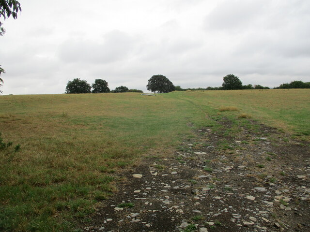
Chadshunt is a civil parish located in the county of Warwickshire, England. It is situated approximately 8 miles south of the town of Warwick and covers an area of around 3 square kilometers. The parish is predominantly rural, with beautiful countryside surrounding it.

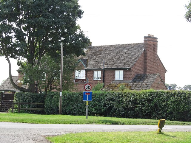
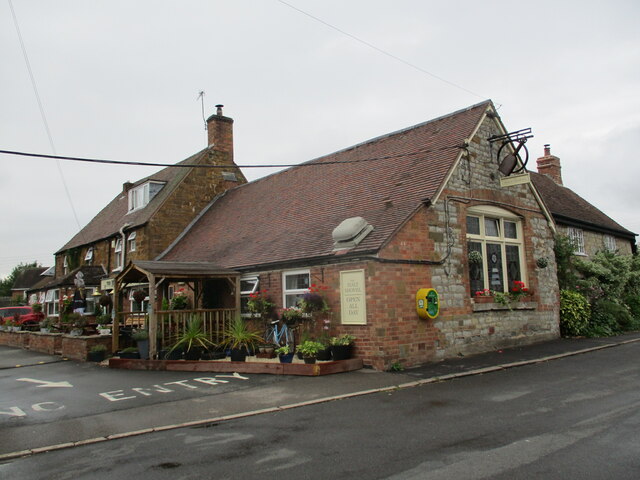
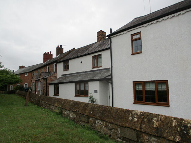
The village of Chadshunt itself is small, with a population of around 100 residents. It is known for its picturesque charm and tranquility, offering a peaceful retreat for those seeking a break from the hustle and bustle of urban life. The architecture in Chadshunt primarily consists of traditional cottages and farmhouses, giving it a timeless feel.

The parish is rich in history, with evidence of human settlement dating back to the Roman period. The nearby Fosse Way, one of the country's oldest and most significant Roman roads, passes through the area, further highlighting its historical importance.

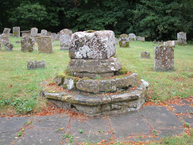
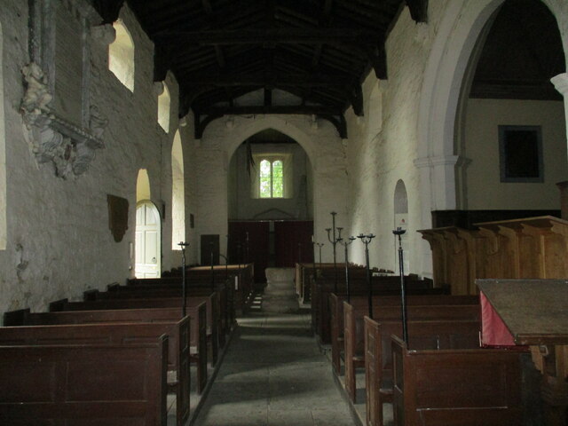
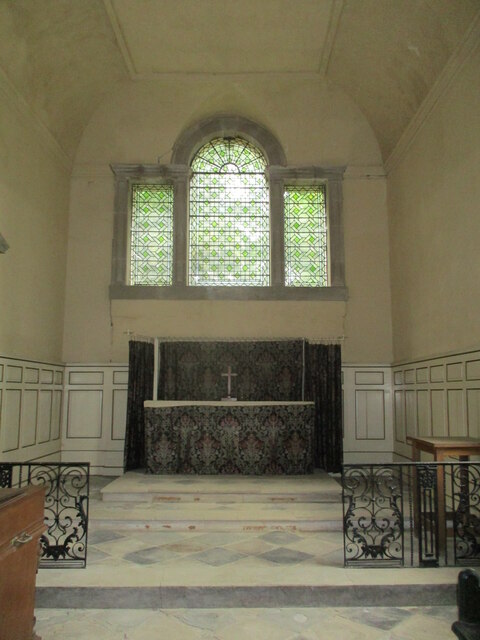
The village lacks many amenities, with no shops or schools within its boundaries. However, residents have easy access to nearby towns and villages for their daily needs. The parish church of St. Mary the Virgin serves as a place of worship and community gathering.

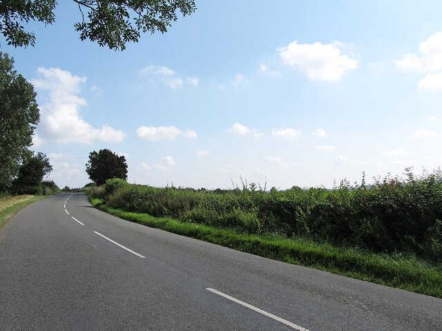
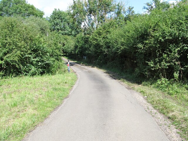
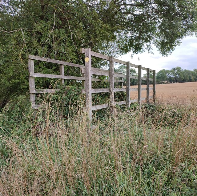
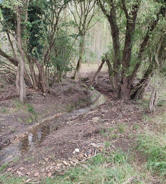
Chadshunt is a haven for nature enthusiasts, with several walking and cycling paths offering breathtaking views of the Warwickshire countryside. The surrounding fields and farmland are home to a variety of flora and fauna, making it an ideal destination for outdoor activities and wildlife spotting.

In conclusion, Chadshunt is a small, idyllic village in Warwickshire, offering a peaceful and rural lifestyle to its residents. Its rich history, charming architecture, and natural beauty make it a hidden gem within the county.

If you have any feedback on the listing, please let us know in the comments section below.

Chadshunt Images

Images are sourced within 2km of 52.171683/-1.490039 or Grid Reference SP3452. Thanks to Geograph Open Source API. All images are credited.

Kineton-Southam Road Looking towards Chadshunt.
Kineton-Southam Road
Looking towards Chadshunt.
Chadshunt Cottages On Watery Lane.
Chadshunt Cottages
On Watery Lane.
Chadshunt-Boundary Farm The Gateway at the end of Watery Lane.
Chadshunt-Boundary Farm
The Gateway at the end of Watery Lane.
Chadshunt Farmland Off Watery Lane.
Chadshunt Farmland
Off Watery Lane.
Chadshunt-Watery Lane The road close to the entrance to Boundary Farm.
Chadshunt-Watery Lane
The road close to the entrance to Boundary Farm.
Ditch along the edge of the churchyard, Chadshunt The churchyard is raised above the level of the neighbouring field and separated from it by a ditch.
Ditch along the edge of the churchyard, Chadshunt
The churchyard is raised above the level of the neighbouring field and separated from it by a ditch.
Track across a grass field, Chadshunt
Remains of a medieval cross, Chadshunt Was once a substantial structure <span class="nowrap"><a title="https://historicengland.org.uk/listing/the-list/list-entry/1019662?section=official-list-entry" rel="nofollow ugc noopener" href="https://historicengland.org.uk/listing/the-list/list-entry/1019662?section=official-list-entry">Link</a><img style="margin-left:2px;" alt="External link" title="External link - shift click to open in new window" src="https://s1.geograph.org.uk/img/external.png" width="10" height="10"/></span>
Remains of a medieval cross, Chadshunt
Was once a substantial structure LinkExternal link
Old driveway to Chadshunt House
The Malt Shovel, Gaydon
Cottages, Church Walk, Gaydon
Bridleway Bridge
Bridleway Bridge
Stream runs alongside plantation near Bishop's Gorse Farm
Old railway bridge This old bridge is on Southam Road, Kineton.  It was built for the Stratford & Midland Junction Railway, which was closed in 1965.
Old railway bridge
This old bridge is on Southam Road, Kineton. It was built for the Stratford & Midland Junction Railway, which was closed in 1965.
Railway bridge sign This restored sign is adjacent to the old railway bridge in Lighthorne Road, Kineton.  It was originally erected sometime after 1909 when the railway line became the Stratford & Midland Junction Railway.
Railway bridge sign
This restored sign is adjacent to the old railway bridge in Lighthorne Road, Kineton. It was originally erected sometime after 1909 when the railway line became the Stratford & Midland Junction Railway.
Church of All Saints, Chadshunt. Interior looking west The nave is the accumulated work of the twelfth, fourteenth and fifteenth centuries <span class="nowrap"><a title="https://historicengland.org.uk/listing/the-list/list-entry/1035627?section=official-list-entry" rel="nofollow ugc noopener" href="https://historicengland.org.uk/listing/the-list/list-entry/1035627?section=official-list-entry">Link</a><img style="margin-left:2px;" alt="External link" title="External link - shift click to open in new window" src="https://s1.geograph.org.uk/img/external.png" width="10" height="10"/></span>
Church of All Saints, Chadshunt. Interior looking west
The nave is the accumulated work of the twelfth, fourteenth and fifteenth centuries LinkExternal link
Church of All Saints, Chadshunt. Chancel interior Built about 1730 <span class="nowrap"><a title="https://historicengland.org.uk/listing/the-list/list-entry/1035627?section=official-list-entry" rel="nofollow ugc noopener" href="https://historicengland.org.uk/listing/the-list/list-entry/1035627?section=official-list-entry">Link</a><img style="margin-left:2px;" alt="External link" title="External link - shift click to open in new window" src="https://s1.geograph.org.uk/img/external.png" width="10" height="10"/></span>
Church of All Saints, Chadshunt. Chancel interior
Built about 1730 LinkExternal link
Churchyard path, Chadshunt
Show me another place!

Chadshunt is located at Grid Ref: SP3452 (Lat: 52.171683, Lng: -1.490039)

Administrative County: Warwickshire

District: Stratford-on-Avon

Police Authority: Warwickshire

What 3 Words

///overhaul.spaceship.update. Near Gaydon, Warwickshire

Nearby Locations

Chadshunt Chadshunt

Related Wikis

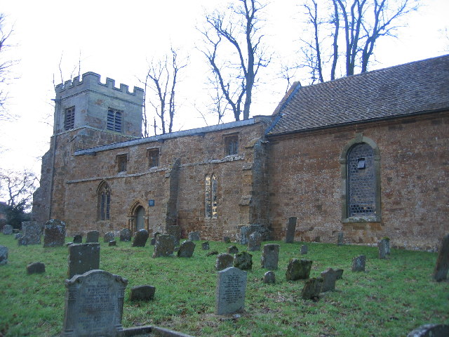
All Saints Church, Chadshunt

All Saints Church is a redundant Anglican church in the parish of Chadshunt, Warwickshire, England. It is recorded in the National Heritage List for England...

Chadshunt

Chadshunt is a small village and civil parish in the Stratford-on-Avon district, in the county of Warwickshire, England. Chadshunt is located in between...

RAF Gaydon

Royal Air Force Gaydon or more simply RAF Gaydon is a former Royal Air Force station located 5.2 miles (8.4 km) east of Wellesbourne, Warwickshire and...

Kineton High School

Kineton High School is a mixed secondary school located in South Warwickshire, England within the village of Kineton. It is a non-selective academy school...

Nearby Amenities

Located within 500m of 52.171683,-1.490039
Bus Stop
Watery Lane
Bus: yes
Naptan AtcoCode: 4200F161801
Naptan Bearing: SW
Naptan BusStopType: CUS
Naptan CommonName: Watery Lane
Naptan Indicator: Adj
Naptan NaptanCode: waragmwj
Naptan Street: Southam Road
Naptan Verified: no
Public Transport: platform
Source: naptan_import
Lat/Long: 52.1729081/-1.4935397
Bus Stop
Watery Lane
Bus: yes
Naptan AtcoCode: 4200F161802
Naptan Bearing: E
Naptan BusStopType: CUS
Naptan CommonName: Watery Lane
Naptan Indicator: Opp
Naptan NaptanCode: wardjdwp
Naptan Street: Southam Road
Naptan Verified: no
Public Transport: platform
Source: naptan_import
Lat/Long: 52.1729683/-1.4936208
Post Box
Collection Times: Mo-Fr 16:00; Sa 10:15
Operator: Royal Mail
Operator Wikidata: Q638098
Post Box Type: lamp
Ref: CV35 109
Royal Cypher: GVIR
Royal Cypher Wikidata: Q33102169
Source: survey
Lat/Long: 52.1730334/-1.4932499
Chadshunt
Place: hamlet
Lat/Long: 52.1735289/-1.4918731
The data included in this document is from www.openstreetmap.org. The data is made available under ODbL.

Have you been to Chadshunt?

Leave your review of Chadshunt below (or comments, questions and feedback).