Cassington

Civil Parish in Oxfordshire West Oxfordshire

England

Cassington

Thames meadow
Thames meadow Credit: N Chadwick

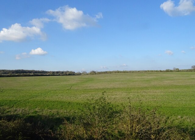
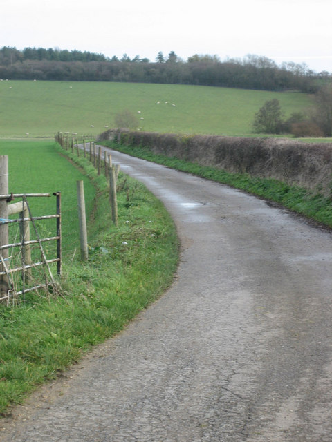
Cassington is a civil parish located in the district of West Oxfordshire, Oxfordshire, England. Situated about five miles northwest of the city of Oxford, it covers an area of approximately 5.5 square miles. The parish is bordered by the River Thames to the east and the A40 road to the south.

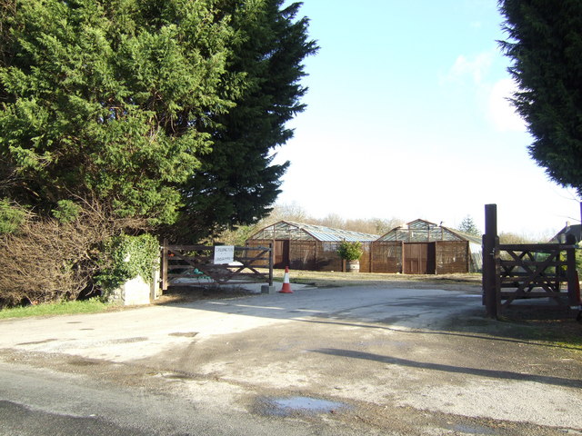
The village of Cassington itself is home to a population of around 900 residents. It retains a traditional English countryside charm with its picturesque thatched-roof cottages and historic buildings. The local economy is primarily based on agriculture and a few small businesses.

Cassington is known for its rich history, dating back to Roman times. The remains of a Roman villa were discovered in the village, indicating a long-standing settlement. St. Peter's Church, a Grade II listed building, stands as a testament to the area's medieval heritage.

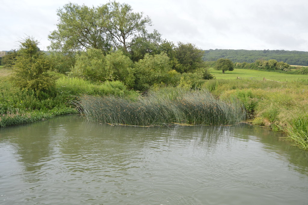
Residents and visitors can enjoy the tranquil surroundings of Cassington Nature Reserve, a protected area designated for its diverse wildlife and natural beauty. The reserve encompasses wetlands, woodlands, and meadows, offering opportunities for walking, birdwatching, and nature exploration.

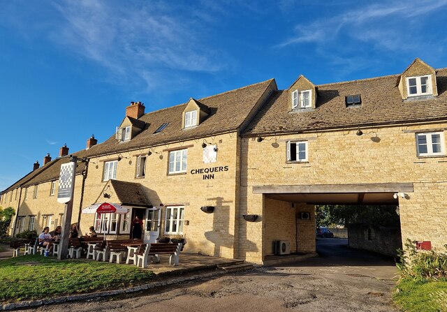
Cassington benefits from good transport links, with easy access to the A40 and regular bus services connecting the village to Oxford and nearby towns. The village also boasts a primary school, a village hall, and a local pub, providing essential amenities for its residents.

Overall, Cassington offers a peaceful and idyllic setting with a strong sense of community, making it an attractive place to live or visit for those seeking a rural retreat within close proximity to Oxford.

If you have any feedback on the listing, please let us know in the comments section below.

Cassington Images

Images are sourced within 2km of 51.800142/-1.345262 or Grid Reference SP4511. Thanks to Geograph Open Source API. All images are credited.

Thames meadow
Thames meadow
Thames Path This National Trail is 184 miles (294 km) long, following the River Thames from its source in the Cotswolds almost to the sea, finishing at the Thames Barrier in Greenwich.
The trail keeps to the banks of the river most of the route.
Website: <span class="nowrap"><a title="http://www.nationaltrail.co.uk/ThamesPath/" rel="nofollow ugc noopener" href="http://www.nationaltrail.co.uk/ThamesPath/">Link</a><img style="margin-left:2px;" alt="External link" title="External link - shift click to open in new window" src="https://s1.geograph.org.uk/img/external.png" width="10" height="10"/></span>
Thames Path
This National Trail is 184 miles (294 km) long, following the River Thames from its source in the Cotswolds almost to the sea, finishing at the Thames Barrier in Greenwich. The trail keeps to the banks of the river most of the route. Website: LinkExternal link
Confluence of River Evenlode and River Thames The River Evenlode is a tributary of the Thames in Oxfordshire. It rises near Moreton-in-Marsh, Gloucestershire in the Cotswold Hills and flows south-east passing near Stow-on-the-Wold, Charlbury, Bladon, and Cassington, and its valley provides the route of the southern part of the Cotswold Line.
Confluence of River Evenlode and River Thames
The River Evenlode is a tributary of the Thames in Oxfordshire. It rises near Moreton-in-Marsh, Gloucestershire in the Cotswold Hills and flows south-east passing near Stow-on-the-Wold, Charlbury, Bladon, and Cassington, and its valley provides the route of the southern part of the Cotswold Line.
River Thames The River Thames rises at Thames Head in Gloucestershire on the slopes of the Cotswolds and flows generally eastward to its mouth near Southend in Essex. At 215 miles long it is one of the longest rivers in Britain, and the longest entirely within England. It is one of the most important rivers in Britain. <span class="nowrap"><a title="http://en.wikipedia.org/wiki/River_Thames" rel="nofollow ugc noopener" href="http://en.wikipedia.org/wiki/River_Thames">Link</a><img style="margin-left:2px;" alt="External link" title="External link - shift click to open in new window" src="https://s1.geograph.org.uk/img/external.png" width="10" height="10"/></span>
River Thames
The River Thames rises at Thames Head in Gloucestershire on the slopes of the Cotswolds and flows generally eastward to its mouth near Southend in Essex. At 215 miles long it is one of the longest rivers in Britain, and the longest entirely within England. It is one of the most important rivers in Britain. LinkExternal link
Thames Path This National Trail is 184 miles (294 km) long, following the River Thames from its source in the Cotswolds almost to the sea, finishing at the Thames Barrier in Greenwich.
The trail keeps to the banks of the river most of the route.
Website: <span class="nowrap"><a title="http://www.nationaltrail.co.uk/ThamesPath/" rel="nofollow ugc noopener" href="http://www.nationaltrail.co.uk/ThamesPath/">Link</a><img style="margin-left:2px;" alt="External link" title="External link - shift click to open in new window" src="https://s1.geograph.org.uk/img/external.png" width="10" height="10"/></span>
Thames Path
This National Trail is 184 miles (294 km) long, following the River Thames from its source in the Cotswolds almost to the sea, finishing at the Thames Barrier in Greenwich. The trail keeps to the banks of the river most of the route. Website: LinkExternal link
Grazing west of Yarnton
Eynsham Road, Cassington
Cassington - St Peter's Church The church of St Peter in Cassington was built in the early C12th for Geoffrey de Clinton. In 1318 Lady Montacute (Not as EH says, Lady Mantaate), paid for the addition of the upper stage to the tower and the fine broach spire above it.
The church is EH Grade I listed: <span class="nowrap"><a title="https://historicengland.org.uk/listing/the-list/list-entry/1367949?section=official-list-entry" rel="nofollow ugc noopener" href="https://historicengland.org.uk/listing/the-list/list-entry/1367949?section=official-list-entry">Link</a><img style="margin-left:2px;" alt="External link" title="External link - shift click to open in new window" src="https://s1.geograph.org.uk/img/external.png" width="10" height="10"/></span>
The church's own history website: <span class="nowrap"><a title="https://stpeterschurchcassington.org/our-history" rel="nofollow ugc noopener" href="https://stpeterschurchcassington.org/our-history">Link</a><img style="margin-left:2px;" alt="External link" title="External link - shift click to open in new window" src="https://s1.geograph.org.uk/img/external.png" width="10" height="10"/></span>
Cassington - St Peter's Church
The church of St Peter in Cassington was built in the early C12th for Geoffrey de Clinton. In 1318 Lady Montacute (Not as EH says, Lady Mantaate), paid for the addition of the upper stage to the tower and the fine broach spire above it. The church is EH Grade I listed: LinkExternal link The church's own history website: LinkExternal link
Cassington - Church Lane Church Lane, not too surprisingly, leads to <a href="https://www.geograph.org.uk/photo/7586579">SP4510 : Cassington - St Peter's Church</a>
Cassington - Church Lane
Church Lane, not too surprisingly, leads to SP4510 : Cassington - St Peter's Church
Cassington - The Chequers Inn The Chequers Inn in Cassington is a pub which seems to specialise in Indian food. It also has rooms.
Their website: <span class="nowrap"><a title="https://www.thechequersinn-cassington.com" rel="nofollow ugc noopener" href="https://www.thechequersinn-cassington.com">Link</a><img style="margin-left:2px;" alt="External link" title="External link - shift click to open in new window" src="https://s1.geograph.org.uk/img/external.png" width="10" height="10"/></span>
Cassington - The Chequers Inn
The Chequers Inn in Cassington is a pub which seems to specialise in Indian food. It also has rooms. Their website: LinkExternal link
St. Peter's Church, Cassington
The Chequer's Inn
The Chequer's Inn
Farm Lane This lane just south of New Barn Farm crosses the River Evenlode before reaching Purwell Farm
Farm Lane
This lane just south of New Barn Farm crosses the River Evenlode before reaching Purwell Farm
Footpath north from Cassington Lane The A40 is just beyond the far hedge.
Footpath north from Cassington Lane
The A40 is just beyond the far hedge.
Cassington Nurseries Retail and trade plant nursery.
Cassington Nurseries
Retail and trade plant nursery.
Road to Worton
Road to Worton
Railway line south to Oxford
Show me another place!

Cassington is located at Grid Ref: SP4511 (Lat: 51.800142, Lng: -1.345262)

Administrative County: Oxfordshire

District: West Oxfordshire

Police Authority: Thames Valley

What 3 Words

///slept.graphic.thud. Near Yarnton, Oxfordshire

Nearby Locations

Cassington

Related Wikis

Worton (hamlet), Oxfordshire

Worton is a hamlet in Cassington civil parish, 4.5 miles (7.2 km) northwest of Oxford. == History == The Domesday Book records that in 1086 William FitzOsbern...

Cassington

Cassington is a village and civil parish in Oxfordshire about 5 miles (8 km) northwest of Oxford. The village lies on gravel strata about 1⁄2 mile (800...

Cassington Halt railway station

Cassington Halt was a single platform halt opened by the Great Western Railway on 9 March 1936 on the Oxford, Witney and Fairford Railway to serve the...

Cassington Canal

The Cassington Canal (also known as the Cassington Cut or the Evenlode Cut) was an early 19th-century canal near Eynsham, Oxfordshire. The canal was built...

River Evenlode

The River Evenlode is a tributary of the Thames in Oxfordshire. It rises near Moreton-in-Marsh, Gloucestershire, in the Cotswold Hills and flows south...

Wytham Ditches and Flushes

Wytham Ditches and Flushes is a 2.7-hectare (6.7-acre) biological Site of Special Scientific Interest north of Oxford in Oxfordshire.These ditches have...

Yarnton railway station

Yarnton Junction was a three-platform station serving the village of Yarnton, Oxfordshire. It was built in 1861 at the junction of the Oxford, Worcester...

Church Hanborough

Church Hanborough is a village in Hanborough civil parish about 5 miles (8 km) northeast of Witney in Oxfordshire. == Manor == The Domesday Book of 1086...

Nearby Amenities

Located within 500m of 51.800142,-1.345262
Power: pole
Source: Bing
Lat/Long: 51.8016787/-1.3450435
Power: pole
Source: Bing
Lat/Long: 51.8020176/-1.3431075
Power: pole
Source: Bing
Lat/Long: 51.802286/-1.3414824
Power: pole
Source: Bing
Lat/Long: 51.8026003/-1.3396131
Power: pole
Source: Bing
Lat/Long: 51.8005143/-1.3508174
Power: pole
Source: Bing
Lat/Long: 51.8008012/-1.3496077
Power: pole
Source: Bing
Lat/Long: 51.8013309/-1.347065
Power: pole
Source: Bing
Lat/Long: 51.8002141/-1.3520458
Power: pole
Source: Bing
Lat/Long: 51.8011026/-1.3484128
Power: pole
Source: Bing
Lat/Long: 51.799184/-1.3398288
Power: pole
Source: Bing
Lat/Long: 51.7979333/-1.3424118
Power: pole
Source: Bing
Lat/Long: 51.7984393/-1.341296
Power: pole
Source: Bing
Lat/Long: 51.7977177/-1.3427203
Power: pole
Source: Bing
Lat/Long: 51.7990098/-1.3392683
Turning Loop
Lat/Long: 51.7959324/-1.3428345
The data included in this document is from www.openstreetmap.org. The data is made available under ODbL.

Have you been to Cassington?

Leave your review of Cassington below (or comments, questions and feedback).