Carsington
Civil Parish in Derbyshire Derbyshire Dales
England
Carsington

Carsington is a civil parish located in the county of Derbyshire, England. Situated in the Derbyshire Dales district, it covers an area of approximately 17 square kilometers. The parish is named after Carsington, a small village within its boundaries.
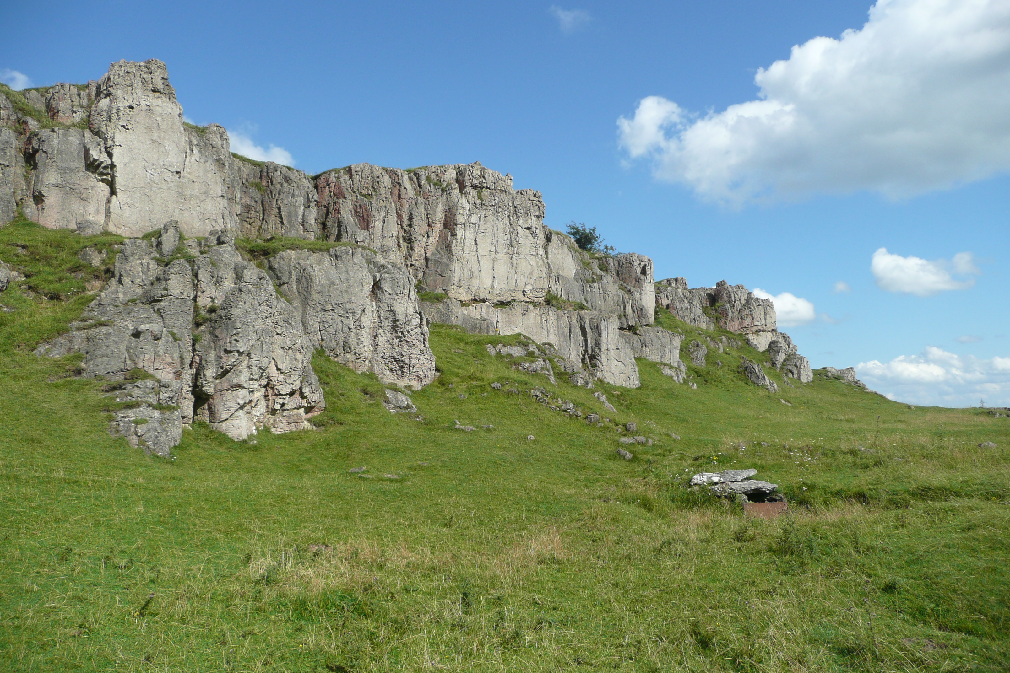
Carsington is known for its picturesque surroundings, with rolling hills, lush green fields, and charming countryside. It is located near the eastern edge of the Peak District National Park, offering residents and visitors easy access to the stunning natural beauty of the area. The parish is also bordered by the scenic Carsington Water, a large reservoir that attracts tourists and outdoor enthusiasts alike.
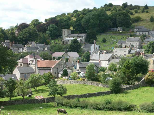
The village of Carsington itself is small, with a population of around 300 people. It has a rich history, dating back to the Domesday Book, which mentions the settlement. Today, the village retains much of its traditional charm, with stone-built houses and a peaceful, rural atmosphere.
The parish is primarily residential, with a mix of historic and modern houses. There are also a few local businesses, such as a pub and a village shop, catering to the needs of the community. The area is popular with walkers, cyclists, and nature lovers, who can explore the numerous footpaths and trails that crisscross the countryside.
Overall, Carsington is a tranquil and scenic civil parish in Derbyshire, offering a peaceful retreat for those seeking a rural lifestyle surrounded by natural beauty.
If you have any feedback on the listing, please let us know in the comments section below.
Carsington Images
Images are sourced within 2km of 53.075149/-1.635742 or Grid Reference SK2453. Thanks to Geograph Open Source API. All images are credited.


Carsington is located at Grid Ref: SK2453 (Lat: 53.075149, Lng: -1.635742)
Administrative County: Derbyshire
District: Derbyshire Dales
Police Authority: Derbyshire
What 3 Words
///careless.dummy.secretly. Near Wirksworth, Derbyshire
Nearby Locations
Related Wikis

Carsington
Carsington is a village in the middle of the Derbyshire Dales, England; it adjoins the hamlet of Hopton, and is close to the historic town of Wirksworth...

St Margaret's Church, Carsington
St Margaret's Church, Carsington, is a Grade II* listed parish church in the Church of England: 122 in Carsington, Derbyshire. == History == The church...
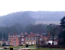
Hopton Hall
Hopton Hall is an 18th-century country house at Hopton, near Wirksworth, Derbyshire. It is a Grade II listed building. The Manor of Hopton, anciently the...
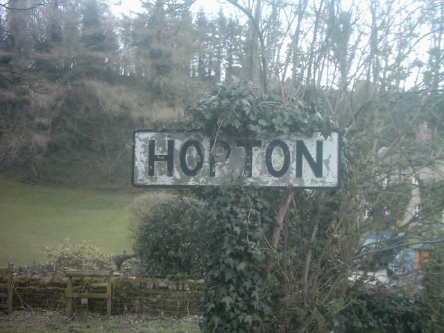
Hopton, Derbyshire
Hopton is a small village adjacent to the village of Carsington and two miles from the market town of Wirksworth in the Peak District. Evidence of humans...
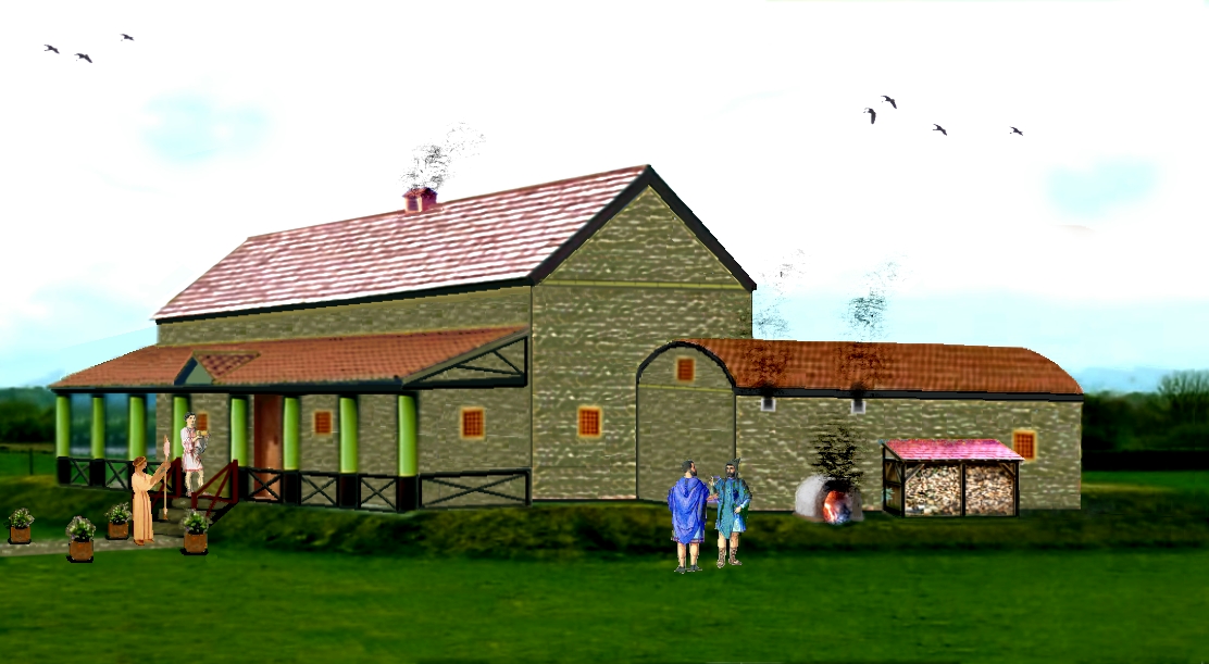
Carsington Roman Villa
The Carsington Roman Villa is a Roman villa at Scow Brook, Carsington near Wirksworth, Derbyshire, England. The site of the villa is currently submerged...
Brassington
Brassington is a village and civil parish in the Derbyshire Dales district of Derbyshire, 16 miles north west of Derby. The parish had a population of...

Carsington Water
Carsington Water is a reservoir, operated by Severn Trent Water, between Wirksworth and Kniveton in Derbyshire, England. The reservoir takes water from...
Harboro' Rocks
Harboro' Rocks (or Harborough Rocks) is a dolomitic limestone hill near the village of Brassington in the Derbyshire Peak District. The summit is 379 metres...
Nearby Amenities
Located within 500m of 53.075149,-1.635742Have you been to Carsington?
Leave your review of Carsington below (or comments, questions and feedback).