Carlton Scroop

Civil Parish in Lincolnshire South Kesteven

England

Carlton Scroop

Post Office repeater station and mast View from the public footpath in the direction of Carlton Scroop.
Post Office repeater station and mast Credit: Ian Paterson

Carlton Scroop is a civil parish located in the district of South Kesteven in Lincolnshire, England. It covers an area of approximately 4 square miles and is situated about 7 miles north of Grantham. The village itself is small and has a population of around 200 residents.

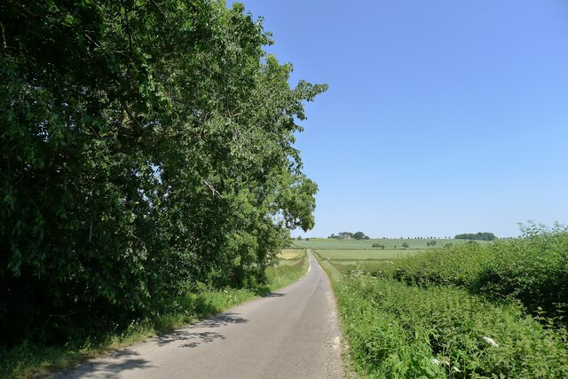
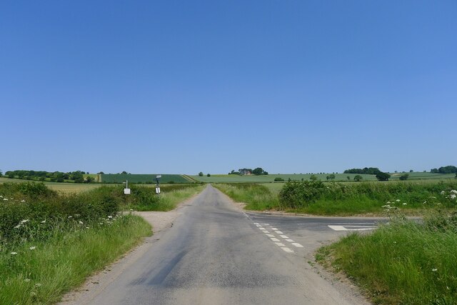
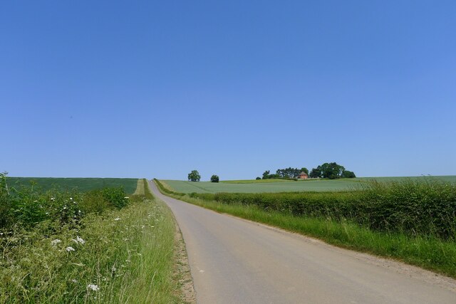
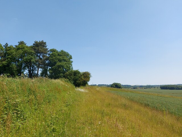
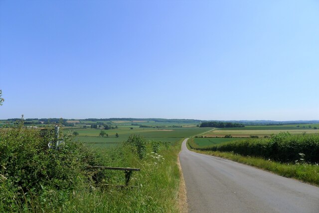
The parish is primarily rural and characterized by its picturesque countryside, with rolling hills and meandering streams. It is surrounded by agricultural land and farmland, which contributes to the local economy. The village is known for its charming and well-preserved traditional stone cottages, giving it a quintessential English village feel.

In terms of amenities, Carlton Scroop has a small primary school that serves the local community. There is also a village hall which hosts various community events and gatherings. However, for more extensive facilities and services, residents often rely on nearby towns such as Grantham.

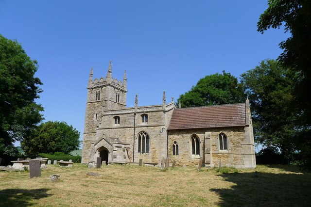
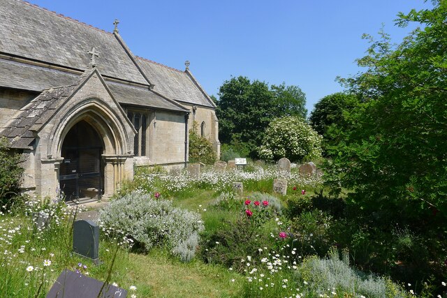
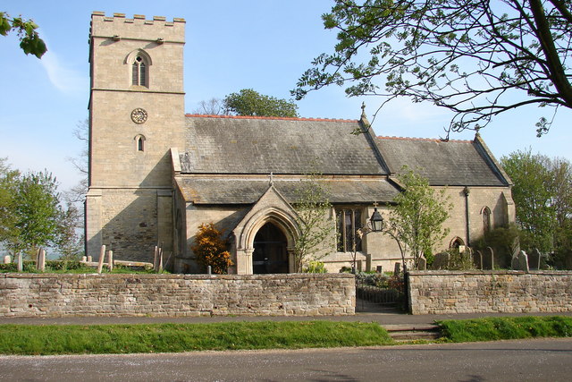
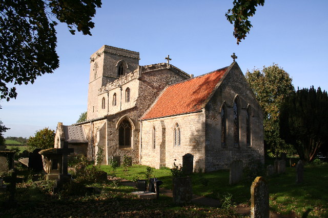
The parish is steeped in history, with notable landmarks including the St. Nicholas Church, which dates back to the 12th century and features beautiful stained glass windows. The church serves as a focal point for the community and holds regular services and events.

Overall, Carlton Scroop offers a peaceful and idyllic countryside setting, making it an attractive place for those seeking a tranquil rural lifestyle. Its rich history, natural beauty, and close-knit community contribute to its charm and appeal.

If you have any feedback on the listing, please let us know in the comments section below.

Carlton Scroop Images

Images are sourced within 2km of 52.993637/-0.59938 or Grid Reference SK9444. Thanks to Geograph Open Source API. All images are credited.

Post Office repeater station and mast View from the public footpath in the direction of Carlton Scroop.
Post Office repeater station and mast
View from the public footpath in the direction of Carlton Scroop.
Hough Road from the north side of Grove Plantations
Church of St Wilfred, Honington Listed Grade I, from the 11th century.
Church of St Wilfred, Honington
Listed Grade I, from the 11th century.
Main Street leaving the south side of Honington
Frinkley Lane crossing Hough Road The Viking Way comes down Hough Road from the north (ahead), and turns left along Frinkley Lane
Frinkley Lane crossing Hough Road
The Viking Way comes down Hough Road from the north (ahead), and turns left along Frinkley Lane
Hough Road rising up to the Red House ridge Rising from Jurassic mudstones in the valley of Honington Beck to a ridge of harder sandstones and ironstones <span class="nowrap"><a title="https://geologyviewer.bgs.ac.uk/" rel="nofollow ugc noopener" href="https://geologyviewer.bgs.ac.uk/">Link</a><img style="margin-left:2px;" alt="External link" title="External link - shift click to open in new window" src="https://s1.geograph.org.uk/img/external.png" width="10" height="10"/></span>
Hough Road rising up to the Red House ridge
Rising from Jurassic mudstones in the valley of Honington Beck to a ridge of harder sandstones and ironstones LinkExternal link
Footpath running along the ridge below The Red House The footpath runs to Carlton Scroop. It is probably little used as Howdale Lane immediately to the north offers an easier traffic-free route
Footpath running along the ridge below The Red House
The footpath runs to Carlton Scroop. It is probably little used as Howdale Lane immediately to the north offers an easier traffic-free route
Howdale Lane east of Belle Vue Farm Taking the Viking Way east to Carlton Scroop
Howdale Lane east of Belle Vue Farm
Taking the Viking Way east to Carlton Scroop
Howdale Lane Taking the Viking Way west to Hough Road
Howdale Lane
Taking the Viking Way west to Hough Road
Grantham Road (A607) entering Carlton Scroop 'Carlton' means the settlement of freemen or peasants ('karl' + 'ton'). Scroop derives from the Scrope family who held the manor
Grantham Road (A607) entering Carlton Scroop
'Carlton' means the settlement of freemen or peasants ('karl' + 'ton'). Scroop derives from the Scrope family who held the manor
Church of St Nicholas, Carlton Scroop Listed Grade I. With a flower rich 'God's Acre' <a href="https://www.geograph.org.uk/photo/7524836">SK9444 : God's Acre, Church of St Nicholas, Carlton Scroop</a>
Church of St Nicholas, Carlton Scroop
Listed Grade I. With a flower rich 'God's Acre' SK9444 : God's Acre, Church of St Nicholas, Carlton Scroop
God's Acre, Church of St Nicholas, Carlton Scroop "This churchyard has been managed for its botanical diversity since 1996.  The different habitats within the churchyard attract many different species of wildlife between 2015 and 2018 over 200 species of plants, invertebrates, mammals and birds have been recorded here." <span class="nowrap"><a title="https://www.caringforgodsacre.org.uk/churchyard/carlton-scroop-st-nicholas/" rel="nofollow ugc noopener" href="https://www.caringforgodsacre.org.uk/churchyard/carlton-scroop-st-nicholas/">Link</a><img style="margin-left:2px;" alt="External link" title="External link - shift click to open in new window" src="https://s1.geograph.org.uk/img/external.png" width="10" height="10"/></span>
God's Acre, Church of St Nicholas, Carlton Scroop
"This churchyard has been managed for its botanical diversity since 1996. The different habitats within the churchyard attract many different species of wildlife between 2015 and 2018 over 200 species of plants, invertebrates, mammals and birds have been recorded here." LinkExternal link
The A607 running north from Carlton Scroop The road runs along the foot of the limestone escarpment of 'Lincoln Cliff'
The A607 running north from Carlton Scroop
The road runs along the foot of the limestone escarpment of 'Lincoln Cliff'
Track off Sudbrook Road We are located in the 'Ancaster Gap'. The higher ground on the horizon forms the northern edge of the Gap.
Track off Sudbrook Road
We are located in the 'Ancaster Gap'. The higher ground on the horizon forms the northern edge of the Gap.
Hough Road, looking south from Carlton Ashes The road carries the Viking Way. The footpath to the left goes to Carlton Scroop
Hough Road, looking south from Carlton Ashes
The road carries the Viking Way. The footpath to the left goes to Carlton Scroop
Virgin and Child At St Nicholas' Church, Normanton-on-Cliffe.
Virgin and Child
At St Nicholas' Church, Normanton-on-Cliffe.
Public Right of Way Near St Nicholas Church, Normanton.
Public Right of Way
Near St Nicholas Church, Normanton.
St.Nicholas' church, Normanton, Lincs. With splendid views over the Lincolnshire countryside, St.Nicholas' has good Transitional and Early English arcades with an interesting range of capitals, a Perpendicular clerestory and a Victorian chancel in the Early English style. A delightful church, now un-used, but well preserved and lovingly cared for by the Redundant Churches Fund.
St.Nicholas' church, Normanton, Lincs.
With splendid views over the Lincolnshire countryside, St.Nicholas' has good Transitional and Early English arcades with an interesting range of capitals, a Perpendicular clerestory and a Victorian chancel in the Early English style. A delightful church, now un-used, but well preserved and lovingly cared for by the Redundant Churches Fund.
Show me another place!

Carlton Scroop is located at Grid Ref: SK9444 (Lat: 52.993637, Lng: -0.59938)

Administrative County: Lincolnshire

District: South Kesteven

Police Authority: Lincolnshire

What 3 Words

///roofed.waltz.ramble. Near Caythorpe, Lincolnshire

Related Wikis

Carlton Scroop

Carlton Scroop is a small village and civil parish in the South Kesteven district of Lincolnshire, England. The population of the civil parish (including...

Honington railway station

Honington railway station was a station in the village of Honington, Lincolnshire. It was located on junction with the line Grantham and Lincoln railway...

St Nicholas Church, Normanton

St Nicholas Church is a redundant Anglican church in Normanton-on-Cliffe, Lincolnshire, England. It is recorded in the National Heritage List for England...

Normanton-on-Cliffe

Normanton-on-Cliffe, sometimes known as Normanton, is a village and civil parish in the South Kesteven district of Lincolnshire, England. It lies on the...

Honington, Lincolnshire

Honington is an English village and civil parish in the South Kesteven district of Lincolnshire. It lies just north of the junction between the A153 and...

Hough-on-the-Hill

Hough-on-the-Hill is a village and civil parish in the South Kesteven district of Lincolnshire, England. The population of the civil parish including Brandon...

Frieston

Frieston is a village in the South Kesteven district of Lincolnshire, England. It is situated just west of the A607 road, and 7 miles (11 km) north from...

Gelston, Lincolnshire

Gelston is a village in the South Kesteven district of Lincolnshire, England. It is 2 miles (3 km) west from the A607 road, 5 miles (8 km) north from Grantham...

Related Videos

Stunning sun starting to set across English countryside. Honington, England.

sun setting in Honington England, United Kingdom. February 2022. green belt land.

Camp site toor

Best day of my life.

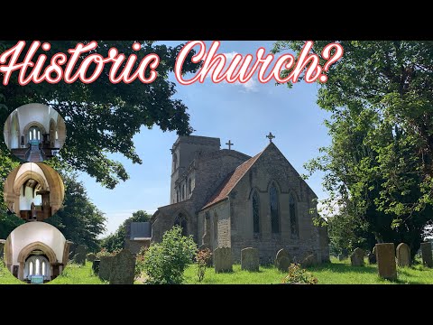
St. Nicholas Church || Pinkybelle’s Adventures

St Nicholas Church is a redundant Anglican church in Normanton-on-Cliffe, Lincolnshire, England. It is recorded in the National ...

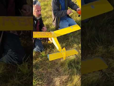
Bardney Flyers Free flight 2018.1

Gang of members on Saturday evening free flight fun.

Nearby Amenities

Located within 500m of 52.993637,-0.59938
Bus Stop
Council Houses
Naptan AtcoCode: 270002701474
Naptan Bearing: SW
Naptan CommonName: Council Houses
Naptan Indicator: opp
Naptan Landmark: Council Houses
Naptan NaptanCode: linadtmg
Naptan Street: Main Street
Naptan Verified: no
Public Transport: platform
Source: naptan_import
Lat/Long: 52.991109/-0.5939417
Bus Stop
Council Houses
Naptan AtcoCode: 270002701476
Naptan Bearing: NE
Naptan CommonName: Council Houses
Naptan Indicator: adj
Naptan Landmark: Council Houses
Naptan NaptanCode: linadtmj
Naptan Street: Main Street
Naptan Verified: no
Source: naptan_import
Lat/Long: 52.9912177/-0.5940126
Highfield Farm
Place: farm
Source: Bing
Lat/Long: 52.9959753/-0.5978696
Lodge Farm
Place: farm
Source: Bing
Lat/Long: 52.9912938/-0.596564
The data included in this document is from www.openstreetmap.org. The data is made available under ODbL.

Have you been to Carlton Scroop?

Leave your review of Carlton Scroop below (or comments, questions and feedback).