Carlby

Civil Parish in Lincolnshire South Kesteven

England

Carlby

Saponaria officinalis Common Soapwort growing in a verge.  There is an extensive patch of it - see <a href="https://www.geograph.org.uk/photo/6946317">TF0513 : A flowering verge</a>.

The plant has a list of common names as long as my arm - have a look at <span class="nowrap"><a title="https://www.rhs.org.uk/plants/16441/Saponaria-officinalis/Details" rel="nofollow ugc noopener" href="https://www.rhs.org.uk/plants/16441/Saponaria-officinalis/Details">Link</a><img style="margin-left:2px;" alt="External link" title="External link - shift click to open in new window" src="https://s1.geograph.org.uk/img/external.png" width="10" height="10"/></span> .  The only other name I recognise on there is "Jill-run-by-the-street".
Saponaria officinalis Credit: Bob Harvey

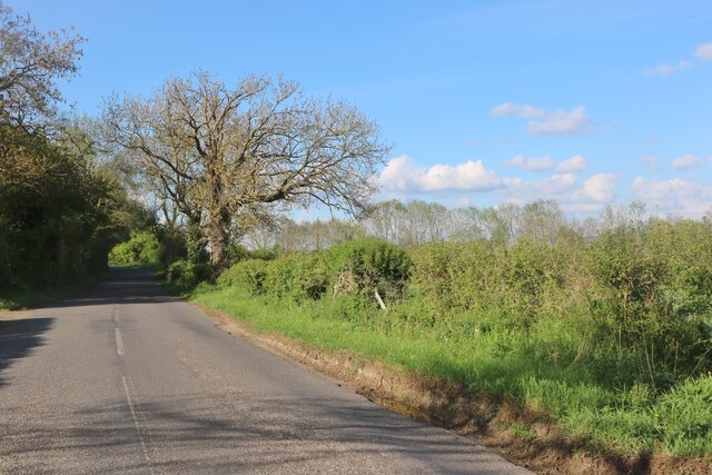
Carlby is a civil parish located in the South Kesteven district of Lincolnshire, England. Situated approximately 8 miles east of the town of Stamford, Carlby is a small and picturesque village with a population of around 300 residents.

The village is primarily residential, consisting of a mix of charming cottages and more modern houses. The surrounding countryside is characterized by rolling hills and scenic landscapes, offering residents and visitors a tranquil and idyllic setting. The parish is home to a number of farms, contributing to the agricultural heritage of the area.

Carlby does not have its own primary school or post office, but these amenities can be found in nearby villages. However, the village does have a village hall, which serves as a community hub and hosts various social events throughout the year.

The village is well-connected to other parts of Lincolnshire, with good road links to nearby towns and cities. The A1 road is easily accessible, providing convenient access to Peterborough and Grantham. The nearest railway station is located in Stamford, offering regular services to major cities such as London and Peterborough.

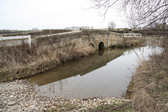
The parish is surrounded by several natural attractions, including the Deeping Lakes Nature Reserve and the picturesque River Welland, which provide opportunities for outdoor activities such as walking, cycling, and fishing.

Overall, Carlby offers a peaceful and rural lifestyle, with its scenic surroundings and close proximity to larger towns and cities making it an attractive place to live for those seeking a quieter, countryside setting.

If you have any feedback on the listing, please let us know in the comments section below.
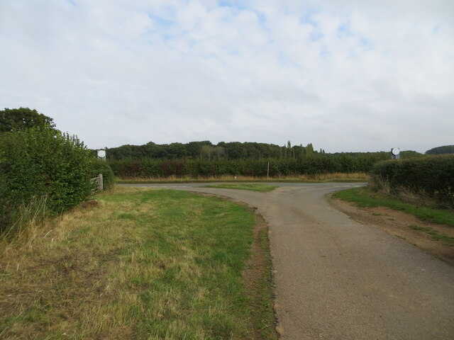
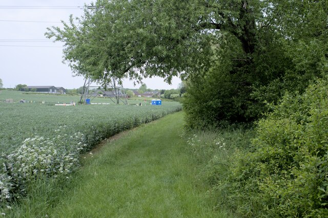
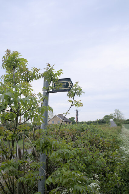
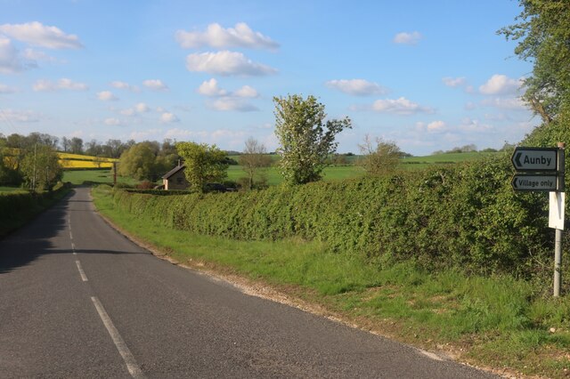
Carlby Images

Images are sourced within 2km of 52.717639/-0.456348 or Grid Reference TF0414. Thanks to Geograph Open Source API. All images are credited.

Saponaria officinalis Common Soapwort growing in a verge.  There is an extensive patch of it - see <a href="https://www.geograph.org.uk/photo/6946317">TF0513 : A flowering verge</a>.

The plant has a list of common names as long as my arm - have a look at <span class="nowrap"><a title="https://www.rhs.org.uk/plants/16441/Saponaria-officinalis/Details" rel="nofollow ugc noopener" href="https://www.rhs.org.uk/plants/16441/Saponaria-officinalis/Details">Link</a><img style="margin-left:2px;" alt="External link" title="External link - shift click to open in new window" src="https://s1.geograph.org.uk/img/external.png" width="10" height="10"/></span> .  The only other name I recognise on there is "Jill-run-by-the-street".
Saponaria officinalis
Common Soapwort growing in a verge. There is an extensive patch of it - see TF0513 : A flowering verge. The plant has a list of common names as long as my arm - have a look at LinkExternal link . The only other name I recognise on there is "Jill-run-by-the-street".
A flowering verge A patch of Common Soapwort in the grass verge beside Carlby Road.  See <a href="https://www.geograph.org.uk/photo/6946315">TF0513 : Saponaria officinalis</a>.
A flowering verge
A patch of Common Soapwort in the grass verge beside Carlby Road. See TF0513 : Saponaria officinalis.
East Lodge This field is known as East Lodge, after a building that once stood there.  The crop is of field beans, drying rapidly but not yet ready for harvest.  Diagonally across the left the row of trees is the trackbed of the former railway from Bourne to Essendine.
East Lodge
This field is known as East Lodge, after a building that once stood there. The crop is of field beans, drying rapidly but not yet ready for harvest. Diagonally across the left the row of trees is the trackbed of the former railway from Bourne to Essendine.
Carlby Road A simple lane between Carlby and Greatford, here looking toward Greatford.  The trees have mostly been planted since I got married, historically this was an open heathland landscape.  The wide verges might hint at an ancient route - it does head toward one of the places called Stowe - but it is likely to be an enclosure-era adoption of an earlier track on high ground that granted the width.
Carlby Road
A simple lane between Carlby and Greatford, here looking toward Greatford. The trees have mostly been planted since I got married, historically this was an open heathland landscape. The wide verges might hint at an ancient route - it does head toward one of the places called Stowe - but it is likely to be an enclosure-era adoption of an earlier track on high ground that granted the width.
The Drift at its junction with the B1176 road Looking north-eastward.
The Drift at its junction with the B1176 road
Looking north-eastward.
A flag for Ukraine There is a lot of solidarity in the UK with the people of the Ukraine, beset with evil invaders.
A flag for Ukraine
There is a lot of solidarity in the UK with the people of the Ukraine, beset with evil invaders.
Restricted Byway Sections 47-50 of the 2000 Act introduce a new category of highway called 
the “restricted byway”. A restricted byway is defined as a highway over which 
the public have restricted byway rights, with or without the right to drive 
animals of any description.  This replaced the concept of a "road used as a public path".

This track is a restricted byway.  See <a href="https://www.geograph.org.uk/photo/7175487">TF0214 : Restricted Byway sign</a>.

A little further on is the camp for one of the wire-pulling bases used to re-string the 400kV line through Lincolnshire
Restricted Byway
Sections 47-50 of the 2000 Act introduce a new category of highway called the “restricted byway”. A restricted byway is defined as a highway over which the public have restricted byway rights, with or without the right to drive animals of any description. This replaced the concept of a "road used as a public path". This track is a restricted byway. See TF0214 : Restricted Byway sign. A little further on is the camp for one of the wire-pulling bases used to re-string the 400kV line through Lincolnshire
Criss-Cross Patterns against the sky of the wires and structure of a pylon, including (on the right) a pulling platform used for changing the wires.
Criss-Cross
Patterns against the sky of the wires and structure of a pylon, including (on the right) a pulling platform used for changing the wires.
Restricted Byway sign Sections 47-50 of the 2000 Act introduced a new category of highway called 
the “restricted byway”. A restricted byway is defined as a highway over which 
the public have restricted byway rights, with or without the right to drive 
animals of any description.  No motorised vehicles are permitted.
Restricted Byway sign
Sections 47-50 of the 2000 Act introduced a new category of highway called the “restricted byway”. A restricted byway is defined as a highway over which the public have restricted byway rights, with or without the right to drive animals of any description. No motorised vehicles are permitted.
Village Green at Essendine
The West Glen River at Essendine Looking downstream.
The West Glen River at Essendine
Looking downstream.
Stamford Road, Aunby
Stamford Road south of Careby
Essendine Church St Mary's Church was originally the chapel for the nearby castle (of which only earthworks survive). The chancel is unusual in being taller than the nave, due to it having been rebuilt in the early 19C.  The south doorway has a Norman arch with a carved tympanum showing a demi-figure of Christ and two angels, a motif more usual in France than in England.
Essendine Church
St Mary's Church was originally the chapel for the nearby castle (of which only earthworks survive). The chancel is unusual in being taller than the nave, due to it having been rebuilt in the early 19C. The south doorway has a Norman arch with a carved tympanum showing a demi-figure of Christ and two angels, a motif more usual in France than in England.
Bridge and ford on B1176
Church of St Stephen, Carlby
Carlby, with Church of St Stephen
Old in new, near Essendine A curiously anachronistic window in the gable end of this cottage: perhaps a homage to an earlier building?
Old in new, near Essendine
A curiously anachronistic window in the gable end of this cottage: perhaps a homage to an earlier building?
Show me another place!

Carlby is located at Grid Ref: TF0414 (Lat: 52.717639, Lng: -0.456348)

Administrative County: Lincolnshire

District: South Kesteven

Police Authority: Lincolnshire

What 3 Words

///sentences.bins.tastier. Near Essendine, Rutland

Nearby Locations

Carlby Monk's Wood

Related Wikis

Carlby

Carlby is a small village and civil parish in the district of South Kesteven in Lincolnshire, England. The population of the civil parish at the 2011 census...

Church of St Mary Magdalene, Essendine

The Church of St Mary Magdalene is a church in Essendine, Rutland. It is a Grade II* listed building. == History == The small church is built within the...

Essendine

Essendine is a village and civil parish at the eastern end of the county of Rutland in the East Midlands of England, located 5 miles (7 km) north of Stamford...

Essendine railway station

Essendine railway station was a station in Essendine, Rutland. It was situated on the East Coast Main Line of the Great Northern Railway. == Overview... ==

Aunby

Aunby is a village in the civil parish of Careby Aunby and Holywell, in the South Kesteven district of Lincolnshire, England. It is situated north from...

Witham on the Hill

Witham on the Hill is a village and civil parish in the South Kesteven district of Lincolnshire, England. The population of the civil parish was 260 at...

Witham Hall

Witham Hall is an independent boarding and day school situated in Witham on the Hill, Lincolnshire, England. == The hall == The house is described by Sir...

Ryhall Pasture and Little Warren Verges

Ryhall Pasture and Little Warren Verges is a 6.2-hectare (15-acre) biological Site of Special Scientific Interest north of the village of Ryhall. Little...

Nearby Amenities

Located within 500m of 52.717639,-0.456348
Ford: yes
Lat/Long: 52.7206043/-0.4555021
Building: yes
Lat/Long: 52.7162464/-0.4609837
The data included in this document is from www.openstreetmap.org. The data is made available under ODbL.

Have you been to Carlby?

Leave your review of Carlby below (or comments, questions and feedback).