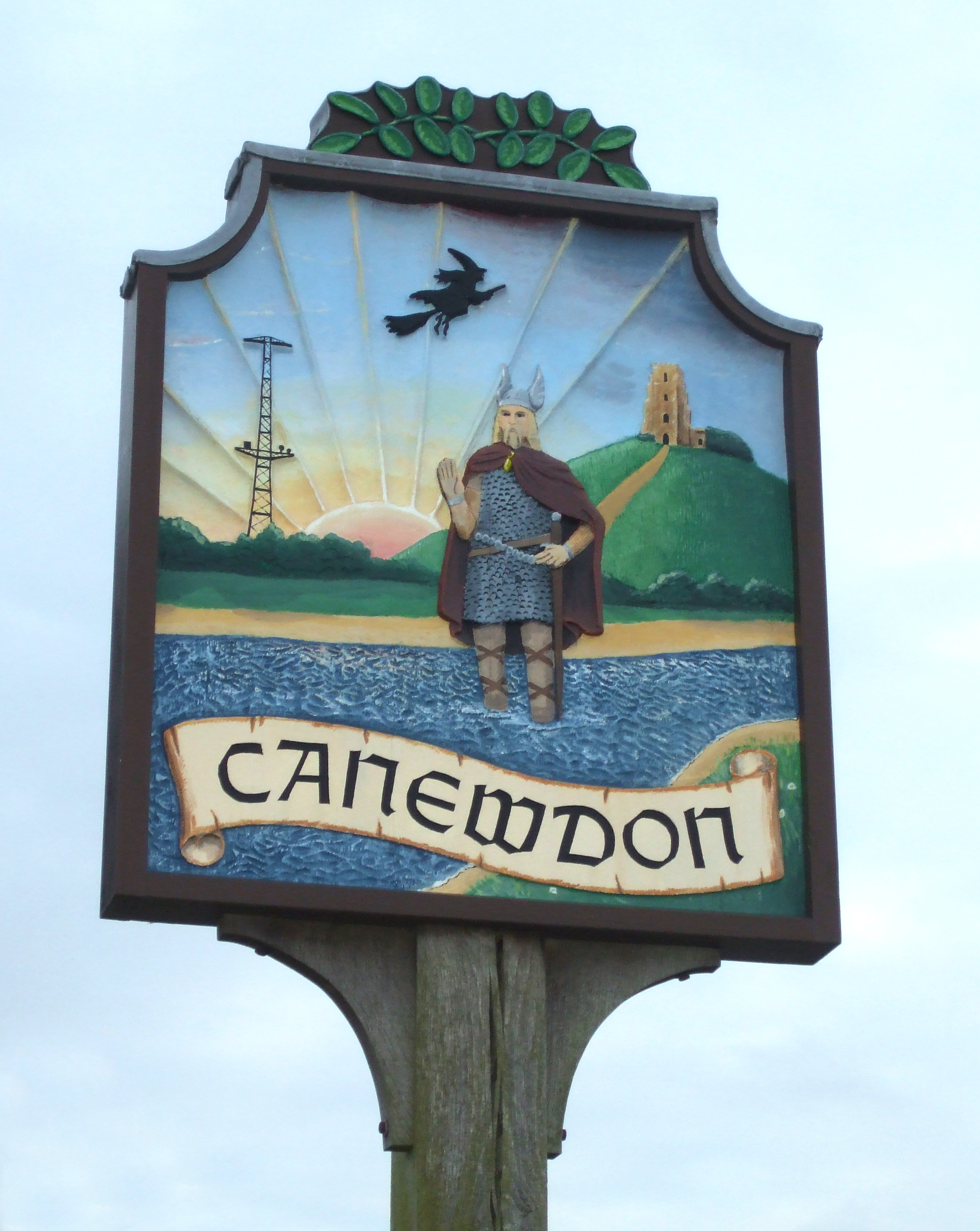
Canewdon

Civil Parish in Essex Rochford

England

Canewdon

Near Raymonds Farm A view across farmland just north of Raymonds Farm. A section of farm track can be seen ahead.
Near Raymonds Farm Credit: Trevor Harris

Canewdon is a civil parish located in the county of Essex, England. Situated about 45 miles east of London, it lies in the District of Rochford and is part of the Southend-on-Sea unitary authority area. With a population of around 1,250 residents, Canewdon is a small and close-knit community.

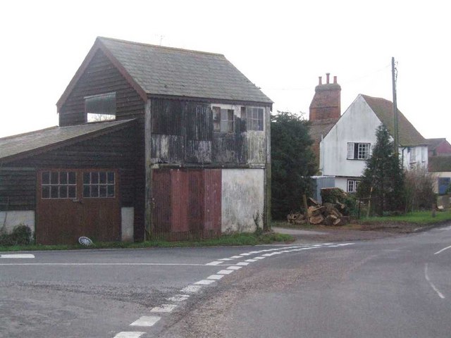
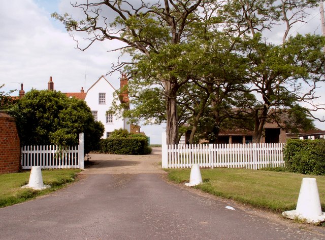
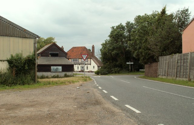
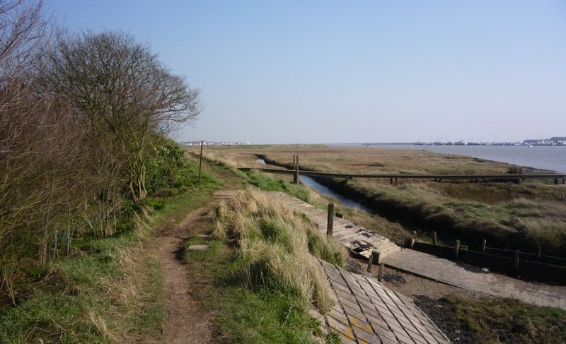
The village is known for its picturesque countryside, surrounded by fields and farmland. It boasts a rich history, with evidence of human activity dating back to the Neolithic period. The name "Canewdon" is derived from the Old English words "cane" and "dun," meaning "hill with a boundary marker."

One of the notable landmarks in Canewdon is the 11th-century St. Nicholas Church, which stands on the highest hill in the area. This church is renowned for its architectural beauty and historical significance. It is believed to have been built on the site of an earlier Anglo-Saxon church and contains a rare Norman font.

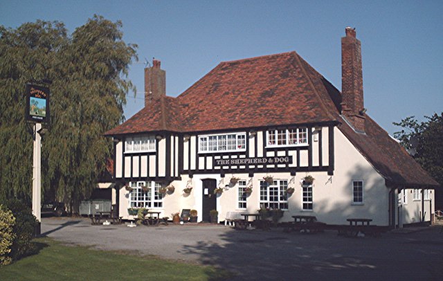
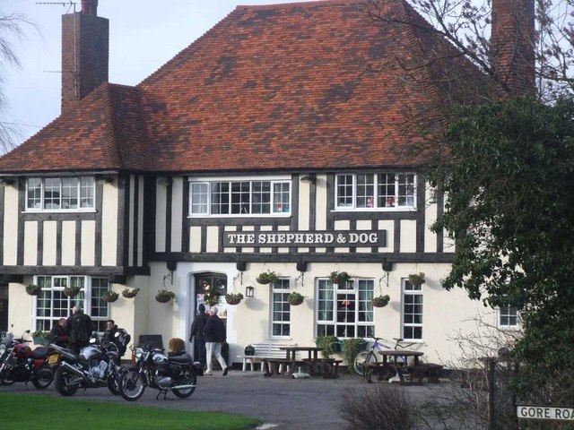
The village also has a primary school, providing education for local children. Canewdon is well-connected to neighboring towns and cities through road networks, with easy access to the A127 and A130. The proximity to the coast adds to its appeal, with the popular seaside town of Southend-on-Sea just a short drive away.

Canewdon offers a peaceful and idyllic setting, attracting residents who appreciate the tranquility of rural life while still being within reach of urban amenities. The community is known for its strong sense of community spirit, with various events and activities organized throughout the year.

In summary, Canewdon is a charming civil parish in Essex, England, known for its scenic landscapes, historic church, and strong community ties.

If you have any feedback on the listing, please let us know in the comments section below.

Canewdon Images

Images are sourced within 2km of 51.616789/0.743231 or Grid Reference TQ9094. Thanks to Geograph Open Source API. All images are credited.

Near Raymonds Farm A view across farmland just north of Raymonds Farm. A section of farm track can be seen ahead.
Near Raymonds Farm
A view across farmland just north of Raymonds Farm. A section of farm track can be seen ahead.
Footbridge & Stile This footbridge and Stile are on the footpath that runs between Canewdon Village and Upper Raypits Farm. The yellow sign warns of an electric fence.
Footbridge & Stile
This footbridge and Stile are on the footpath that runs between Canewdon Village and Upper Raypits Farm. The yellow sign warns of an electric fence.
Lambourne Hall Farm This is a picture of Lambourne Hall farm near Canewdon looking west from the footpath that runs by the farm.
Lambourne Hall Farm
This is a picture of Lambourne Hall farm near Canewdon looking west from the footpath that runs by the farm.
Rosewood Bunker This is the guardhouse to RAF Canewdon in Gardener’s Lane it is now a private property called “Rosewood”. The site was part of the chain home radar system from WW2 that was used for many years after. However this site closed not long after the end of the war. The aerial masts were sited to the north.  One of the masts was bought by Marconi and still exists.  See <a href="https://www.geograph.org.uk/gridref/TL7203">TL7203</a>
A second mast was also reused somewhere on the Welsh coast although in cut down form. There are some that think the site was used into the Cold War.
Rosewood Bunker
This is the guardhouse to RAF Canewdon in Gardener’s Lane it is now a private property called “Rosewood”. The site was part of the chain home radar system from WW2 that was used for many years after. However this site closed not long after the end of the war. The aerial masts were sited to the north. One of the masts was bought by Marconi and still exists. See TL7203 A second mast was also reused somewhere on the Welsh coast although in cut down form. There are some that think the site was used into the Cold War.
Footpath through Ballards Gore Golf Club Footpath  through golf course north towards Canewdon. When I was a lad, this area was an abandoned gravel working with spoil tips, old machinery, rough scrub and flooded pits with tench the size of nuclear submarines. It's gone sadly downhill over the last 40 years.
Footpath through Ballards Gore Golf Club
Footpath through golf course north towards Canewdon. When I was a lad, this area was an abandoned gravel working with spoil tips, old machinery, rough scrub and flooded pits with tench the size of nuclear submarines. It's gone sadly downhill over the last 40 years.
Stile west of Loftmans Farm The footpath runs south from here to West Hall. But it's been over-sown with wheat and wheat's about all there is in this square. The blue thing on top of the stile is a length of plastic water pipe in which the electric fence wire runs, a gesture by a considerate farmer to prevent electrocution of ramblers. Shame about the over-sowing though.
Stile west of Loftmans Farm
The footpath runs south from here to West Hall. But it's been over-sown with wheat and wheat's about all there is in this square. The blue thing on top of the stile is a length of plastic water pipe in which the electric fence wire runs, a gesture by a considerate farmer to prevent electrocution of ramblers. Shame about the over-sowing though.
Remote countryside north-east of Canewdon Access to this gridsquare has become somewhat hardgoing since the Roach Valley Way footpath was diverted away from it. Taken from the end of Lion Creek.
Remote countryside north-east of Canewdon
Access to this gridsquare has become somewhat hardgoing since the Roach Valley Way footpath was diverted away from it. Taken from the end of Lion Creek.
The Anchor, Canewdon The other pub in the village, also on the Roach Valley Way.
The Anchor, Canewdon
The other pub in the village, also on the Roach Valley Way.
The Shepherd and Dog, Ballards Gore Typical country inn.
The Shepherd and Dog, Ballards Gore
Typical country inn.
Ballards Gore These farm sheds are on a three way junction leading to Paglesham, Creeksea Ferry or Stambridge.
Ballards Gore
These farm sheds are on a three way junction leading to Paglesham, Creeksea Ferry or Stambridge.
Shepherd and Dog On Gore Road.  This is a great little pub.  I went there on a bikers' day.

Here is another picture <a href="https://www.geograph.org.uk/photo/236577">TQ9092 : The Shepherd and Dog, Ballards Gore</a>
Shepherd and Dog
On Gore Road. This is a great little pub. I went there on a bikers' day. Here is another picture TQ9092 : The Shepherd and Dog, Ballards Gore
Red Brick Lodge On Creeksea Ferry Road.
Red Brick Lodge
On Creeksea Ferry Road.
Part of Canewdon's High Street
Lambourne Hall Road as you leave Canewdon
The entrance to Lambourne Hall
The road junction at Ballards Gore This is where Gore Road, Creeksea Ferry Road and Paglesham Road all meet. The 'Shepherd & Dog' inn can be seen at the centre of the photo.
The road junction at Ballards Gore
This is where Gore Road, Creeksea Ferry Road and Paglesham Road all meet. The 'Shepherd & Dog' inn can be seen at the centre of the photo.
FW3/22 Anti-aircraft pillbox Unusual type of pillbox situated at Gardiners Lane, Canewdon, with a Vickers quick-firing anti-aircraft gun emplacement on top.  It would have formed part of the defences around Canewdon radar station during the war.  This type of pillbox is extremely rare.
FW3/22 Anti-aircraft pillbox
Unusual type of pillbox situated at Gardiners Lane, Canewdon, with a Vickers quick-firing anti-aircraft gun emplacement on top. It would have formed part of the defences around Canewdon radar station during the war. This type of pillbox is extremely rare.
Rare anti-aircraft pillbox <a href="https://www.geograph.org.uk/photo/903981">TQ9094 : FW3/22 Anti-aircraft pillbox</a>
Gardiners Lane Pillbox in Canewdon features a rare mount for what I believe was a Vickers pompom AA gun.  See the other shot for more information and another view.  There are many pillboxes around here, built to guard the former radar site on the same road.

Unfortunately someone has put a tyre over the AA turret.  A friend of mine tried to pull it off, but it is stuck fast.  This pillbox is very rare.
Rare anti-aircraft pillbox
TQ9094 : FW3/22 Anti-aircraft pillbox Gardiners Lane Pillbox in Canewdon features a rare mount for what I believe was a Vickers pompom AA gun. See the other shot for more information and another view. There are many pillboxes around here, built to guard the former radar site on the same road. Unfortunately someone has put a tyre over the AA turret. A friend of mine tried to pull it off, but it is stuck fast. This pillbox is very rare.
Show me another place!

Canewdon is located at Grid Ref: TQ9094 (Lat: 51.616789, Lng: 0.743231)

Administrative County: Essex

District: Rochford

Police Authority: Essex

What 3 Words

///submerged.poetry.tearfully. Near Canewdon, Essex

Related Wikis

Canewdon

Canewdon is a village and civil parish in the Rochford district of Essex, England. The village is located approximately 4 miles (6.4 km) northeast of the...

Lion Creek and Lower Raypits

Lion Creek and Lower Raypits is a 65.2-hectare (161-acre) nature reserve east of Canewdon in Essex. It is part of the Crouch and Roach Estuaries Site of...

Bridgemarsh Island

Bridgemarsh Island is in the tidal part of the River Crouch in the English county of Essex, three miles upstream from Burnham-on-Crouch. The main river...

Stambridge

Stambridge is a civil parish in the Rochford district in Essex, England. It is located north of the River Roach between Rochford and Paglesham. The parish...

Great Stambridge

Great Stambridge is a village and former civil parish, 15 miles (24 km) south east of Chelmsford, now in the parish of Stambridge, in the Rochford district...

The Cliff, Burnham-on-Crouch

The Cliff, Burnham-on-Crouch is a 4 hectare geological Site of Special Scientific Interest (SSSI) on the bank of the River Crouch between Burnham-on-Crouch...

Creeksea

Creeksea is a village and former civil parish, now in the parish of Burnham-on-Crouch, in the Maldon district, in the county of Essex, England. It is on...

Rayleigh and Wickford (UK Parliament constituency)

Rayleigh and Wickford is a constituency represented in the House of Commons of the UK Parliament since its 2010 creation by Mark Francois, a Conservative...

Nearby Amenities

Located within 500m of 51.616789,0.743231
Bus Stop
Gardeners Lane
Naptan AtcoCode: 15001100901
Naptan Bearing: E
Naptan CommonName: Gardeners Lane
Naptan Crossing: Gardeners Lane
Naptan Indicator: Adj
Naptan Landmark: Gardeners Lane
Naptan NaptanCode: esxagmda
Naptan PlusbusZoneRef: STHCENT
Naptan Street: Anchor Lane
Naptan Verified: no
Public Transport: platform
Source: naptan_import
Lat/Long: 51.6152742/0.7436629
Bus Stop
Gardeners Lane
Naptan AtcoCode: 15001100901A
Naptan Bearing: W
Naptan CommonName: Gardeners Lane
Naptan Crossing: Gardeners Lane
Naptan Indicator: Opp
Naptan Landmark: Gardeners Lane
Naptan NaptanCode: esxgmdgd
Naptan PlusbusZoneRef: STHCENT
Naptan Street: Anchor Lane
Naptan Verified: no
Public Transport: platform
Source: naptan_import
Lat/Long: 51.6152604/0.7442544
Bus Stop
Village Hall
Naptan AtcoCode: 15001100903
Naptan Bearing: W
Naptan CommonName: Village Hall
Naptan Indicator: o/s
Naptan Landmark: Village Hall
Naptan NaptanCode: esxagmdg
Naptan PlusbusZoneRef: STHCENT
Naptan Street: Lambourne Hall Road
Naptan Verified: no
Public Transport: platform
Source: naptan_import
Lat/Long: 51.6172005/0.750354
Village Hall
Naptan AtcoCode: 150011009Y3
Naptan Bearing: E
Naptan BusStopType: CUS
Naptan CommonName: Village Hall
Naptan Indicator: Opp
Naptan Landmark: Village Hall
Naptan NaptanCode: esxgpmpw
Naptan PlusbusZoneRef: STHCENT
Naptan Street: Lambourne Hall Road
Naptan Verified: no
Public Transport: platform
Source: naptan_import
Lat/Long: 51.6174033/0.7484651
Canewdon Hall Farm
Naptan AtcoCode: 1500999101
Naptan Bearing: E
Naptan BusStopType: CUS
Naptan CommonName: Canewdon Hall Farm
Naptan Indicator: Adj
Naptan Landmark: Canewdon Hall Farm
Naptan NaptanCode: esxagwdj
Naptan PlusbusZoneRef: STHCENT
Naptan Street: Anchor Lane
Naptan Verified: no
Public Transport: platform
Source: naptan_import
Lat/Long: 51.6151984/0.738053
Canewdon Hall Farm
Naptan AtcoCode: 1500999102
Naptan Bearing: W
Naptan BusStopType: CUS
Naptan CommonName: Canewdon Hall Farm
Naptan Indicator: Opp
Naptan Landmark: Canewdon Hall Farm
Naptan NaptanCode: esxagwdm
Naptan PlusbusZoneRef: STHCENT
Naptan Street: Anchor Lane
Naptan Verified: no
Public Transport: platform
Source: naptan_import
Lat/Long: 51.6150274/0.7381168
Bus Stop
Rowan Way
Naptan AtcoCode: 1500CANEW1
Naptan Bearing: S
Naptan BusStopType: CUS
Naptan CommonName: Rowan Way
Naptan Crossing: Rowan Way
Naptan Indicator: Opp
Naptan Landmark: Rowan Way
Naptan NaptanCode: esxjdpmg
Naptan PlusbusZoneRef: STHCENT
Naptan Street: Anchor Lane
Naptan Verified: no
Public Transport: platform
Source: naptan_import
Lat/Long: 51.6167262/0.7446462
Bus Stop
Rowan Way
Naptan AtcoCode: 1500CANEW2
Naptan Bearing: N
Naptan CommonName: Rowan Way
Naptan Crossing: Rowan Way
Naptan Indicator: Adj
Naptan Landmark: Rowan Way
Naptan NaptanCode: esxjdpgt
Naptan PlusbusZoneRef: STHCENT
Naptan Street: Anchor Lane
Naptan Verified: no
Public Transport: platform
Source: naptan_import
Lat/Long: 51.6171244/0.7445402
Bus Stop
The Anchor
Naptan AtcoCode: 1500IM1659
Naptan Bearing: W
Naptan CommonName: The Anchor
Naptan Indicator: o/s
Naptan Landmark: The Anchor
Naptan NaptanCode: esxagtwd
Naptan PlusbusZoneRef: STHCENT
Naptan Street: High Street
Naptan Verified: no
Public Transport: platform
Source: naptan_import
Lat/Long: 51.6166118/0.7446494
Bus Stop
The Anchor
Naptan AtcoCode: 1500IM1659Y
Naptan Bearing: E
Naptan BusStopType: CUS
Naptan CommonName: The Anchor
Naptan Indicator: Opp
Naptan Landmark: The Anchor
Naptan NaptanCode: esxjdamj
Naptan PlusbusZoneRef: STHCENT
Naptan Street: High Street
Naptan Verified: no
Public Transport: platform
Source: naptan_import
Lat/Long: 51.617674/0.7448694
Post Box
Canewdon Church
Ref: SS4 155
Lat/Long: 51.6176683/0.7390949
Costcutter
Addr Postcode: SS4 3QA
Addr Street: High Street
Brand: Costcutter
Brand Wikidata: Q5175072
Brand Wikipedia: en:Costcutter
Fhrs Id: 155549
Shop: convenience
Source Addr: FHRS Open Data
Lat/Long: 51.6173327/0.7451131
Post Box
Canewdon
Post Box Type: pillar
Ref: SS4 164
Royal Cypher: EIIR
Lat/Long: 51.6173937/0.7449351
The Village Store
Shop: convenience
Lat/Long: 51.6177139/0.7452127
Canewdon
Is In: Essex
Place: village
Lat/Long: 51.6171418/0.7406851
Post Office
Canewdon Post Office
Addr Postcode: SS4 3QA
Branch: Canewdon
Brand: Post Office
Brand Wikidata: Q1783168
Check Date: 2020-02-20
Contact Website: https://www.postoffice.co.uk/branch-finder/0591408/canewdon
Ref Pol Id: 18109
Lat/Long: 51.6172841/0.7450314
Recycling
Recycling Type: centre
Lat/Long: 51.6175804/0.7483062
Defibrillator
Access: yes
Defibrillator Location: outside Canewdon Post Office
Emergency: defibrillator
Indoor: no
Lat/Long: 51.6173803/0.7449923
The data included in this document is from www.openstreetmap.org. The data is made available under ODbL.

Have you been to Canewdon?

Leave your review of Canewdon below (or comments, questions and feedback).