Caldbergh with East Scrafton

Civil Parish in Yorkshire Richmondshire

England

Caldbergh with East Scrafton

Top wall on East Moor The wall marks the point where improved land meets the open moor, although even the enclosed pastures here seem to be reverting to moorland as sedges take over from grasses.
Top wall on East Moor Credit: Gordon Hatton

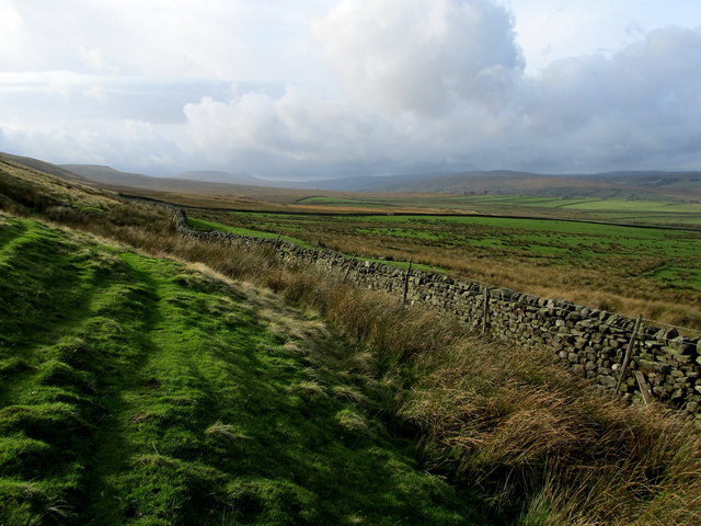
Caldbergh with East Scrafton is a civil parish located in the district of Richmondshire, in the county of North Yorkshire, England. This rural parish is situated in the beautiful countryside of Yorkshire, surrounded by rolling hills and picturesque landscapes.

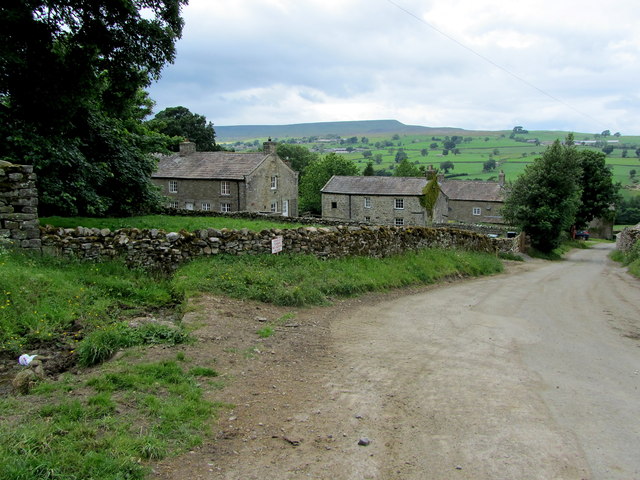
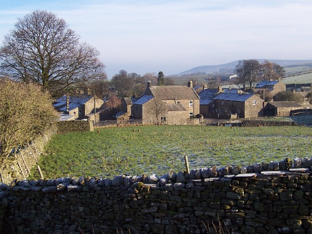
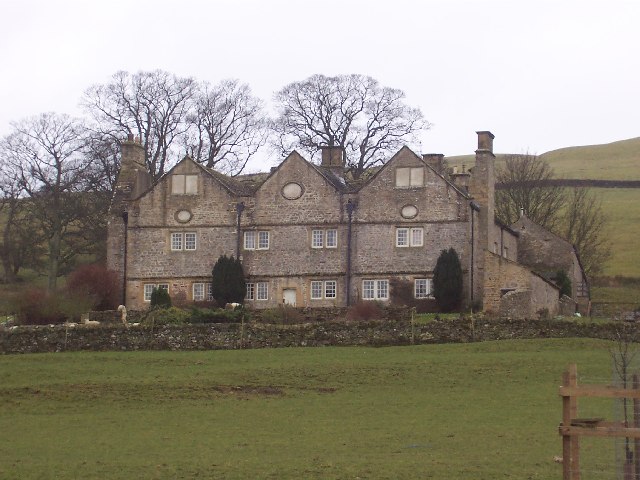
The parish is made up of two small hamlets, Caldbergh and East Scrafton, which are located approximately two miles apart. Both hamlets are characterized by their charming stone-built houses, which add to the traditional and idyllic atmosphere of the area.

Caldbergh is the larger of the two hamlets and is home to the parish church, St. Philip and St. James. This historic church dates back to the 12th century and is a notable feature of the parish. It serves as a place of worship for the local community and also attracts visitors interested in its architectural and historical significance.

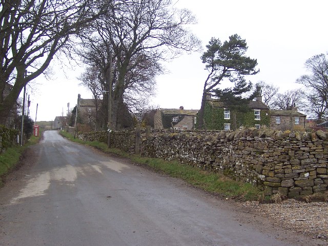
East Scrafton, on the other hand, is a smaller hamlet with a more intimate feel. It is known for its tranquil surroundings and peaceful atmosphere, making it a popular destination for those seeking a quiet retreat away from the hustle and bustle of city life.

The parish offers a range of outdoor activities for nature enthusiasts, including walking, hiking, and cycling. The surrounding countryside provides ample opportunities for exploring the scenic beauty of the area.

Overall, Caldbergh with East Scrafton is a charming and picturesque civil parish that offers a peaceful and idyllic rural setting for its residents and visitors alike.

If you have any feedback on the listing, please let us know in the comments section below.

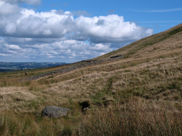
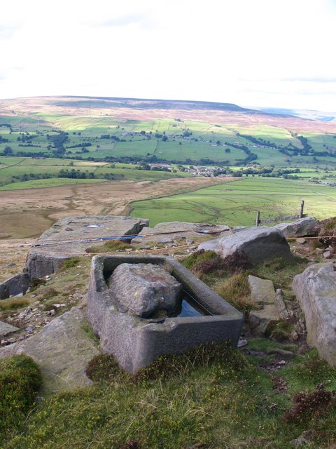
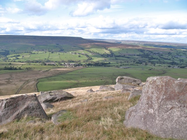
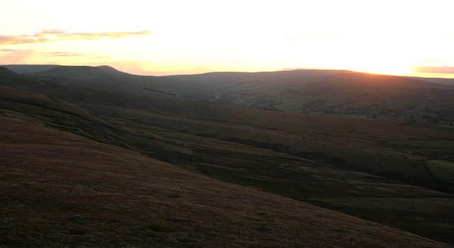
Caldbergh with East Scrafton Images

Images are sourced within 2km of 54.244145/-1.851192 or Grid Reference SE0983. Thanks to Geograph Open Source API. All images are credited.

Top wall on East Moor The wall marks the point where improved land meets the open moor, although even the enclosed pastures here seem to be reverting to moorland as sedges take over from grasses.
Top wall on East Moor
The wall marks the point where improved land meets the open moor, although even the enclosed pastures here seem to be reverting to moorland as sedges take over from grasses.
Heading for Great Roova Crag Following the parish boundary fence across grouse moor towards Great Roova Crag.
Heading for Great Roova Crag
Following the parish boundary fence across grouse moor towards Great Roova Crag.
Oh Bother! Perhaps some stronger expletive was used by the stone mason who was carving this trough from the local gritstone when maybe his mallet and chisel slipped and a section of the rim fell off. Such a shame as there is some excellent detail work on the rest of the trough, which stands high up on Great Roova Crags.
Oh Bother!
Perhaps some stronger expletive was used by the stone mason who was carving this trough from the local gritstone when maybe his mallet and chisel slipped and a section of the rim fell off. Such a shame as there is some excellent detail work on the rest of the trough, which stands high up on Great Roova Crags.
On Great Roova Crags A prominent gritstone outcrop which overlooks Coverdale.
On Great Roova Crags
A prominent gritstone outcrop which overlooks Coverdale.
Shooting hut, Great Roova Crags This shooting hut stands close to the summit of Great Roova Crags and is built against the gritstone outcrop, the back walls being of natural rock.
Shooting hut, Great Roova Crags
This shooting hut stands close to the summit of Great Roova Crags and is built against the gritstone outcrop, the back walls being of natural rock.
Below Great Roova Crags The fellside below the crags has a scattering of large gritstone boulders. The view is across Coverdale towards West Scrafton, Carlton and Penhill.
Below Great Roova Crags
The fellside below the crags has a scattering of large gritstone boulders. The view is across Coverdale towards West Scrafton, Carlton and Penhill.
Gritstone on the fellside Gritstone boulders on the fellside below Great Roova Crags.
Gritstone on the fellside
Gritstone boulders on the fellside below Great Roova Crags.
Looking up to Great Roova Crags Through pasture to the south of West Scrafton, in Coverdale.
Looking up to Great Roova Crags
Through pasture to the south of West Scrafton, in Coverdale.
Great Roova Crags From just south of West Scrafton, in Coverdale.
Great Roova Crags
From just south of West Scrafton, in Coverdale.
Late sun on Great Roova Crags Some hefty lumps of millstone grit close to the 472m (1,550ft) summit.
Late sun on Great Roova Crags
Some hefty lumps of millstone grit close to the 472m (1,550ft) summit.
Great Roova Crags summit A walker tiptoes towards the edge of the millstone grit summit of Great Roova Crags - 472m or around 1,550ft.
Great Roova Crags summit
A walker tiptoes towards the edge of the millstone grit summit of Great Roova Crags - 472m or around 1,550ft.
Coverdale just after sunset From near the top of Great Roova Crags
Coverdale just after sunset
From near the top of Great Roova Crags
On Foss Rakes An extensive view of moorland seen just off the "Red Way"
On Foss Rakes
An extensive view of moorland seen just off the "Red Way"
Red Way Seen here descending towards Caldbergh - part of an ancient thoroughfare that linked Coverdale with Colsterdale.
Red Way
Seen here descending towards Caldbergh - part of an ancient thoroughfare that linked Coverdale with Colsterdale.
Gate across The Red Way
In Caldbergh Tidy farming hamlet on the southern side of Coverdale, affording lovely views across the valley to Pen Hill.
In Caldbergh
Tidy farming hamlet on the southern side of Coverdale, affording lovely views across the valley to Pen Hill.
Below East Fell Moorland Scene above Coverdale
Below East Fell
Moorland Scene above Coverdale
A View up Coverdale A view looking up this quiet dale from below East Fell - the dim outlines of Great and Little Whernside can be seen.
A View up Coverdale
A view looking up this quiet dale from below East Fell - the dim outlines of Great and Little Whernside can be seen.
Show me another place!

Caldbergh with East Scrafton is located at Grid Ref: SE0983 (Lat: 54.244145, Lng: -1.851192)

Division: North Riding

Administrative County: North Yorkshire

District: Richmondshire

Police Authority: North Yorkshire

What 3 Words

///collide.bedspread.vanished. Near Leyburn, North Yorkshire

Related Wikis

East Scrafton

East Scrafton is a hamlet in the Yorkshire Dales in the Richmondshire district of North Yorkshire, England. It is about 3 miles (5 km) south-west of Leyburn...

Caldbergh

Caldbergh (Caldeber in the Domesday Book) is a hamlet within the Yorkshire Dales, North Yorkshire, England. It lies about four miles south of Leyburn....

Caldbergh with East Scrafton

Caldbergh with East Scrafton is a civil parish in the Richmondshire district of North Yorkshire, England. The parish includes the settlements of Caldbergh...

West Scrafton

West Scrafton is a village and civil parish in Coverdale in the Yorkshire Dales, England. It is located 4 miles (6.4 km) south west of Leyburn. It falls...

Melmerby in Coverdale

Melmerby is a village and civil parish in North Yorkshire, England. It lies in Coverdale in the Yorkshire Dales about 3 miles (4.8 km) south-west of Leyburn...

Coverham

Coverham is a village in Coverdale in the Yorkshire Dales in North Yorkshire, England. It lies 2 miles (3.2 km) west of the town of Middleham. == History... ==

Braithwaite Hall

Braithwaite Hall is a 17th-century manor house in Coverdale in the Yorkshire Dales in England. It lies 1.8 miles (2.9 km) west of the village of East...

Holy Trinity Church, Coverham

Holy Trinity Church is a redundant Anglican church in the village of Coverham, North Yorkshire, England. It is recorded in the National Heritage List...

Nearby Amenities

Located within 500m of 54.244145,-1.851192
Access: yes
Barrier: entrance
Lat/Long: 54.2463999/-1.8560806
The data included in this document is from www.openstreetmap.org. The data is made available under ODbL.

Have you been to Caldbergh with East Scrafton?

Leave your review of Caldbergh with East Scrafton below (or comments, questions and feedback).