Cabus

Civil Parish in Lancashire Wyre

England

Cabus

Station Lane at Scorton View from West Coast Main Line Railway
Station Lane at Scorton Credit: Raymond Knapman

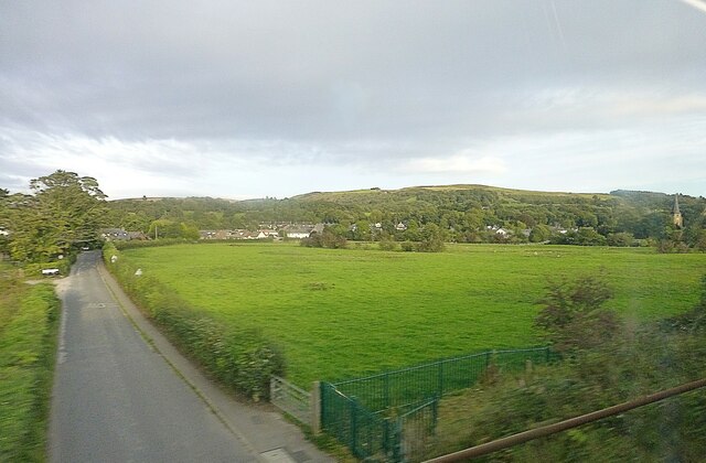
Cabus is a civil parish located in the county of Lancashire, England. Situated in the Wyre district, it covers an area of approximately 6 square miles. The parish is predominantly rural, characterized by lush green fields, meandering rivers, and picturesque countryside views.

The village of Cabus is the main settlement within the parish. It is a small, tight-knit community with a population of around 600 residents. The village is known for its peaceful and tranquil atmosphere, making it an ideal place for those seeking a quiet and idyllic lifestyle.

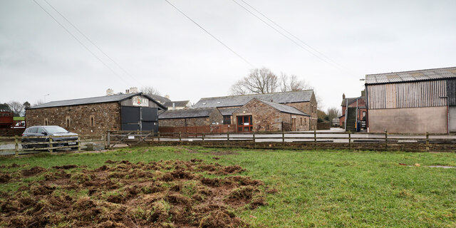
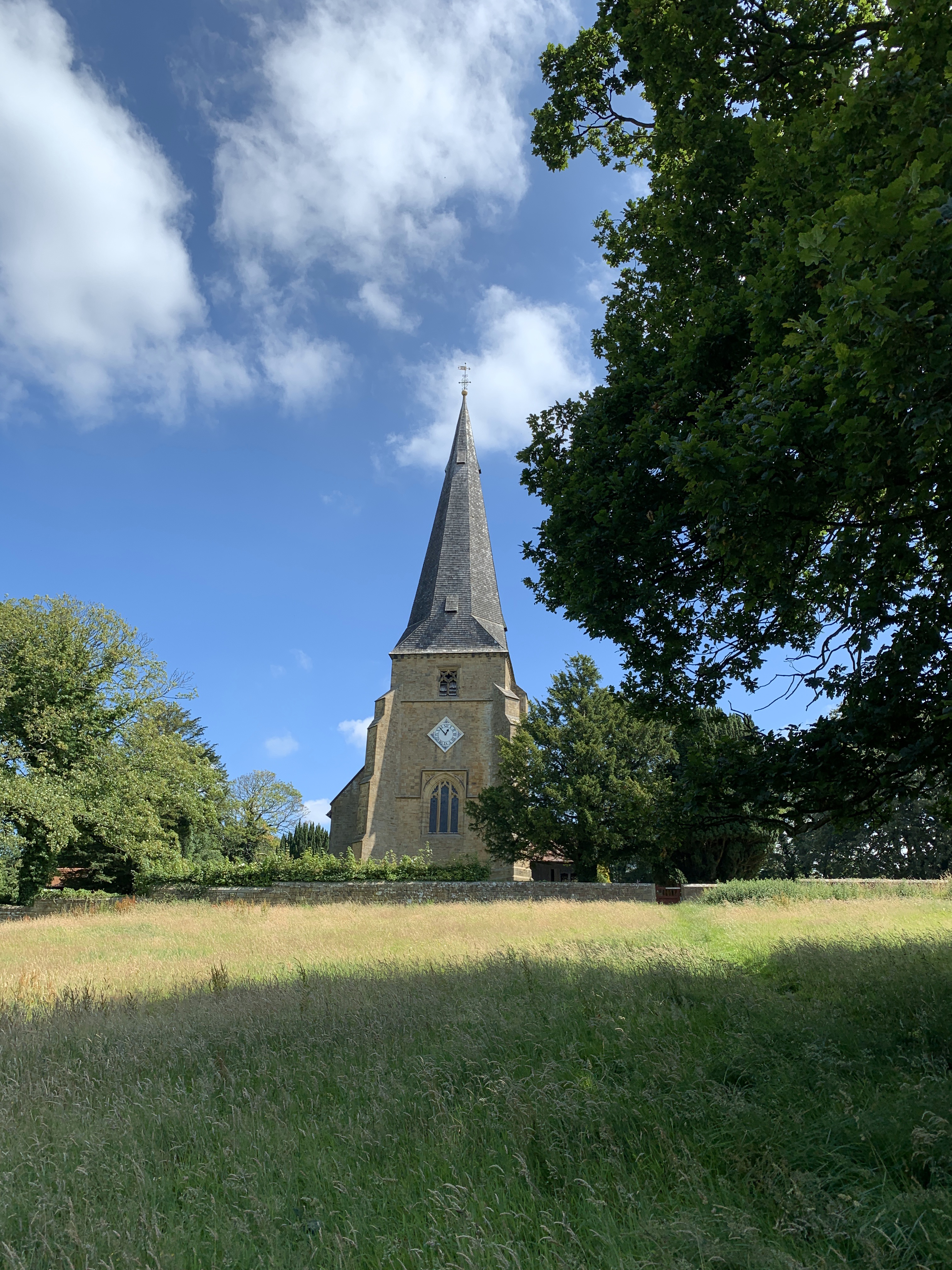
Despite its small size, Cabus boasts a number of amenities and services. These include a primary school, a village hall, a church, and a local pub. The village hall is a popular venue for community events and gatherings, while the church, St. Thomas' Church, holds regular services for the local congregation.

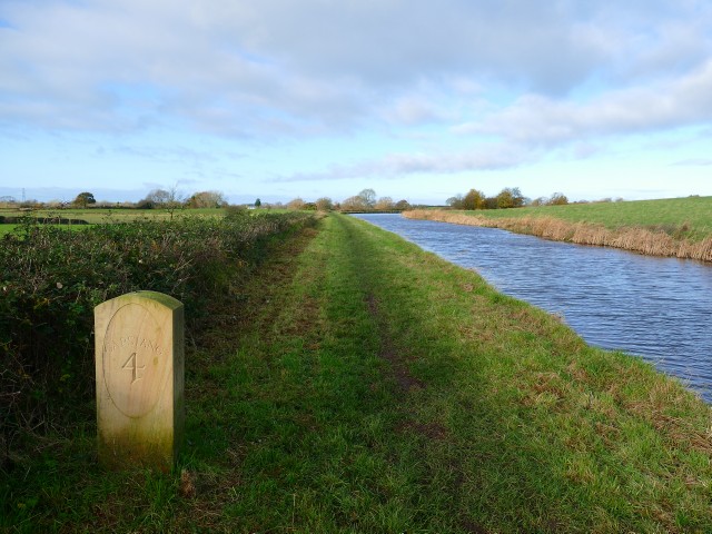
Cabus is also renowned for its scenic beauty and outdoor recreational opportunities. The area is intersected by the Lancaster Canal, providing residents and visitors with the chance to enjoy leisurely walks or bike rides along its towpaths. Additionally, there are several nature reserves nearby, such as Brock Bottoms and the Bowland Wild Boar Park, where one can observe and appreciate the local wildlife.

In summary, Cabus is a charming civil parish in Lancashire, offering a peaceful and rural lifestyle amidst beautiful natural surroundings.

If you have any feedback on the listing, please let us know in the comments section below.
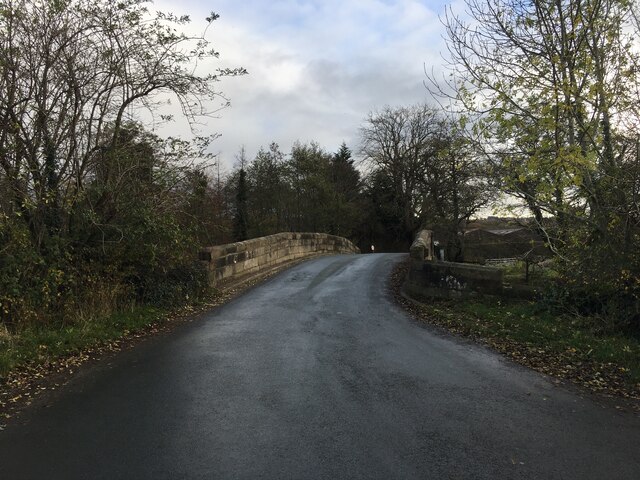
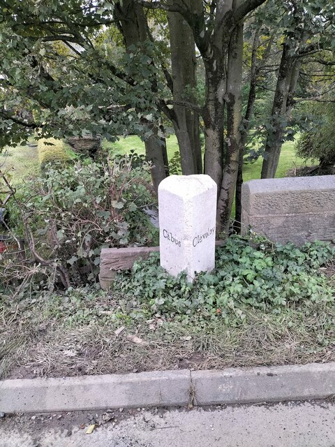
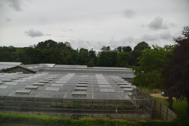
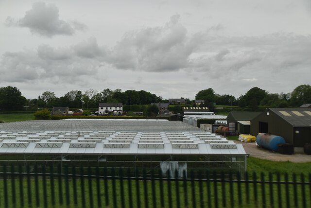
Cabus Images

Images are sourced within 2km of 53.926283/-2.781019 or Grid Reference SD4848. Thanks to Geograph Open Source API. All images are credited.

Station Lane at Scorton View from West Coast Main Line Railway
Station Lane at Scorton
View from West Coast Main Line Railway
Modern Milestone, Lancaster Canal NW of Cabus Nook Bridge, in the parish of Cabus.

Inscription reads: Garstang / 2 // 1819 / 2019 // Lancaster / 11

Milestone Society National ID: LAN-19
Modern Milestone, Lancaster Canal
NW of Cabus Nook Bridge, in the parish of Cabus. Inscription reads: Garstang / 2 // 1819 / 2019 // Lancaster / 11 Milestone Society National ID: LAN-19
Old Holly Farm Old Holly Farm is a family-run working organic dairy farm, which until recently was open to the public with visitor attractions of a nature no longer specified on the farm's website. This aspect of the farm's work was a victim of the Coronavirus Covid-19 pandemic as the owners made the difficult decision not to reopen after the third national lockdown in March 2021.
Old Holly Farm
Old Holly Farm is a family-run working organic dairy farm, which until recently was open to the public with visitor attractions of a nature no longer specified on the farm's website. This aspect of the farm's work was a victim of the Coronavirus Covid-19 pandemic as the owners made the difficult decision not to reopen after the third national lockdown in March 2021.
OS Bench Mark OS rivet bench mark on top of old milestone. 23.53 m above datum. This one seems to have acquired an extra stroke on its arrow.
OS Bench Mark
OS rivet bench mark on top of old milestone. 23.53 m above datum. This one seems to have acquired an extra stroke on its arrow.
OS Bench Mark OS flush bracket bench mark on old building on E side of A6. 29.46 m above datum.
OS Bench Mark
OS flush bracket bench mark on old building on E side of A6. 29.46 m above datum.
OS Bench Mark, damaged OS cut bench mark on W parapet of Park Lane Bridge. At some point presumably the bridge was damaged and the bench mark defaced when replacing the stones. It was 9.39 m above datum.
OS Bench Mark, damaged
OS cut bench mark on W parapet of Park Lane Bridge. At some point presumably the bridge was damaged and the bench mark defaced when replacing the stones. It was 9.39 m above datum.
Milestone Marker 36-21 F (between bridges 74-73), Lancaster Canal Milestone located by the side of the Lancaster Canal
This milestone is 21 miles from the centre of Preston and 36 miles from Kendal

Inscription reads:- 
Garstang / 4 :: Lancaster / 9 

Milestone Society National ID: LAN-21R
Milestone Marker 36-21 F (between bridges 74-73), Lancaster Canal
Milestone located by the side of the Lancaster Canal This milestone is 21 miles from the centre of Preston and 36 miles from Kendal Inscription reads:- Garstang / 4 :: Lancaster / 9 Milestone Society National ID: LAN-21R
Milestone Marker 37-20 F (between bridges 71-70), Lancaster Canal Milestone located by the side of the Lancaster Canal
This milestone is 20 miles from the centre of Preston and 37 miles from Kendal

Inscription reads:- 
Garstang / 3 :: Lancaster / 10 

Milestone Society National ID: LAN-20R
Milestone Marker 37-20 F (between bridges 71-70), Lancaster Canal
Milestone located by the side of the Lancaster Canal This milestone is 20 miles from the centre of Preston and 37 miles from Kendal Inscription reads:- Garstang / 3 :: Lancaster / 10 Milestone Society National ID: LAN-20R
Milestone Marker 38-19 F (between bridges 68-67), Lancaster Canal Milestone located by the side of the Lancaster Canal
This milestone is 19 miles from the centre of Preston and 38 miles from Kendal

Inscription reads:- 
Garstang / 2 :: Lancaster / 11 

Milestone Society National ID: LAN-19R
Milestone Marker 38-19 F (between bridges 68-67), Lancaster Canal
Milestone located by the side of the Lancaster Canal This milestone is 19 miles from the centre of Preston and 38 miles from Kendal Inscription reads:- Garstang / 2 :: Lancaster / 11 Milestone Society National ID: LAN-19R
Minor road crossing Gubberford Bridge
Milestone Marker 38-19 R (between bridges 68-67), Lancaster Canal Old Milestone located by the side of the Lancaster Canal
This milestone is 19 miles from the centre of Preston and 38 miles from Kendal

Inscription reads:-
Garstang / 2 (missing) :: Lancaster / 11 (missing)

Milestone Society National ID: LAN-19
Milestone Marker 38-19 R (between bridges 68-67), Lancaster Canal
Old Milestone located by the side of the Lancaster Canal This milestone is 19 miles from the centre of Preston and 38 miles from Kendal Inscription reads:- Garstang / 2 (missing) :: Lancaster / 11 (missing) Milestone Society National ID: LAN-19
Toll Bar Cottage, Lancaster Road, Garstange Former Toll House on the old A6, dating from 1824 when it served the Garstang & Heronsyke Turnpike Trust.
The original gatepost (pier) with the iron pivot on top still exists, see <a href="https://www.geograph.org.uk/photo/7540947">SD4946 : Toll Gate Gatepost, Lancaster Road, Garstang</a>.
The other gatepost opposite is a re-modelled Roman milestone see <a href="https://www.geograph.org.uk/photo/7540950">SD4946 : Toll Gate Gatepost, Lancaster Road, Garstang</a>.
More information can be read at <span class="nowrap"><a title="https://lancashirepast.com/2021/09/18/garstang-toll-house-and-roman-milestone/" rel="nofollow ugc noopener" href="https://lancashirepast.com/2021/09/18/garstang-toll-house-and-roman-milestone/">Link</a><img style="margin-left:2px;" alt="External link" title="External link - shift click to open in new window" src="https://s1.geograph.org.uk/img/external.png" width="10" height="10"/></span>

Milestone Society National ID: LA.GAR
Toll Bar Cottage, Lancaster Road, Garstange
Former Toll House on the old A6, dating from 1824 when it served the Garstang & Heronsyke Turnpike Trust. The original gatepost (pier) with the iron pivot on top still exists, see SD4946 : Toll Gate Gatepost, Lancaster Road, Garstang. The other gatepost opposite is a re-modelled Roman milestone see SD4946 : Toll Gate Gatepost, Lancaster Road, Garstang. More information can be read at LinkExternal link Milestone Society National ID: LA.GAR
Toll Gate Gatepost, Lancaster Road, Garstang The original 1824 gatepost (pier) with iron pivot on top, on the old A6
This sits on the South side of <a href="https://www.geograph.org.uk/photo/7540943">SD4946 : Toll Bar Cottage, Lancaster Road, Garstange</a>.
Opposite a re-modelled Roman milestone that served as the other gatepost see <a href="https://www.geograph.org.uk/photo/7540950">SD4946 : Toll Gate Gatepost, Lancaster Road, Garstang</a>.
More information can be read at <span class="nowrap"><a title="https://lancashirepast.com/2021/09/18/garstang-toll-house-and-roman-milestone/" rel="nofollow ugc noopener" href="https://lancashirepast.com/2021/09/18/garstang-toll-house-and-roman-milestone/">Link</a><img style="margin-left:2px;" alt="External link" title="External link - shift click to open in new window" src="https://s1.geograph.org.uk/img/external.png" width="10" height="10"/></span>.
Toll Gate Gatepost, Lancaster Road, Garstang
The original 1824 gatepost (pier) with iron pivot on top, on the old A6 This sits on the South side of SD4946 : Toll Bar Cottage, Lancaster Road, Garstange. Opposite a re-modelled Roman milestone that served as the other gatepost see SD4946 : Toll Gate Gatepost, Lancaster Road, Garstang. More information can be read at LinkExternal link.
Toll Gate Gatepost, Lancaster Road, Garstang Opposite the pivot gatepost (pier) <a href="https://www.geograph.org.uk/photo/7540947">SD4946 : Toll Gate Gatepost, Lancaster Road, Garstang</a> 
and Toll House <a href="https://www.geograph.org.uk/photo/7540943">SD4946 : Toll Bar Cottage, Lancaster Road, Garstange</a>. It is a re-modelled Roman milestone.
More information can be read at <span class="nowrap"><a title="https://lancashirepast.com/2021/09/18/garstang-toll-house-and-roman-milestone/" rel="nofollow ugc noopener" href="https://lancashirepast.com/2021/09/18/garstang-toll-house-and-roman-milestone/">Link</a><img style="margin-left:2px;" alt="External link" title="External link - shift click to open in new window" src="https://s1.geograph.org.uk/img/external.png" width="10" height="10"/></span>
Toll Gate Gatepost, Lancaster Road, Garstang
Opposite the pivot gatepost (pier) SD4946 : Toll Gate Gatepost, Lancaster Road, Garstang and Toll House SD4946 : Toll Bar Cottage, Lancaster Road, Garstange. It is a re-modelled Roman milestone. More information can be read at LinkExternal link
Old Milestone by the A6, Garstang Road, Cabus Metal plates (one missing) attached to stone post by the A6, in parish of Cabus (Wyre District), Garstang Road; Fowlers Hill where old curve forms a lay-by, in hedge between road and lay-by, beside lamp-post behind wide grass verge, on West side of road. Lancaster twin iron plate, erected by the Garstang & Heronsyke turnpike trust in the 19th century. 

Inscription reads:-
: (LANCASTER / IX / MILES) : : (CABUS) : : GARSTANG / 1¾ / MILES : 
Pivot benchmark on top. 

Milestone Society National ID: LA_LAGS09
Old Milestone by the A6, Garstang Road, Cabus
Metal plates (one missing) attached to stone post by the A6, in parish of Cabus (Wyre District), Garstang Road; Fowlers Hill where old curve forms a lay-by, in hedge between road and lay-by, beside lamp-post behind wide grass verge, on West side of road. Lancaster twin iron plate, erected by the Garstang & Heronsyke turnpike trust in the 19th century. Inscription reads:- : (LANCASTER / IX / MILES) : : (CABUS) : : GARSTANG / 1¾ / MILES : Pivot benchmark on top. Milestone Society National ID: LA_LAGS09
Old Boundary Marker on the A6 Parish Boundary Marker on the west side of the A6 70 metres north of the junction with Middle Holly. On the boundary of Cabus and Cleveley parishes. Cleveley parish became part of Forton parish in 1935. Grade II Listed details <span class="nowrap"><a title="https://historicengland.org.uk/listing/the-list/list-entry/1163288" rel="nofollow ugc noopener" href="https://historicengland.org.uk/listing/the-list/list-entry/1163288">Link</a><img style="margin-left:2px;" alt="External link" title="External link - shift click to open in new window" src="https://s1.geograph.org.uk/img/external.png" width="10" height="10"/></span>. See also <a title="https://www.geograph.org.uk/photo/6038627" href="https://www.geograph.org.uk/photo/6038627">Link</a> for an older photo.

Milestone Society National ID: LA_LAGS07pb
Old Boundary Marker on the A6
Parish Boundary Marker on the west side of the A6 70 metres north of the junction with Middle Holly. On the boundary of Cabus and Cleveley parishes. Cleveley parish became part of Forton parish in 1935. Grade II Listed details LinkExternal link. See also Link for an older photo. Milestone Society National ID: LA_LAGS07pb
Glasshouses
Glasshouses
Daisy Clough Nursery
Show me another place!

Cabus is located at Grid Ref: SD4848 (Lat: 53.926283, Lng: -2.781019)

Administrative County: Lancashire

District: Wyre

Police Authority: Lancashire

What 3 Words

///enjoy.slouched.ideal. Near Garstang, Lancashire

Nearby Locations

Cabus

Related Wikis

Cabus

Cabus is a village and civil parish in Lancashire, England. It lies 12 miles north of Preston, 9 miles south of Lancaster and 16 miles north east of Blackpool...

Scorton railway station (Lancashire)

Scorton railway station served the village of Scorton, Lancashire, England, from 1840 to 1939 on the Lancaster and Preston Junction Railway. == History... ==

St Peter's Church, Scorton

St Peter's Church is in the village of Scorton, Lancashire, England. It is an active Anglican parish church in the deanery of Garstang, the archdeaconry...

Scorton, Lancashire

Scorton is a small village near the River Wyre, in the Wyre district of Lancashire, England. It is located north of Garstang. The name means "farmstead...

St Luke's Church, Winmarleigh

St Luke's Church is in the village of Winmarleigh, Lancashire, England. It is an active Church of England parish church in the Diocese of Blackburn, the...

Winmarleigh

Winmarleigh is a village and civil parish of the Borough of Wyre in Lancashire, England. The population taken at the 2011 census was 273. The village,...

Winmarleigh Hall

Winmarleigh Hall is a former country house located to the south of the village of Winmarleigh, Lancashire, England, now operated by PGL as an adventure...

Wyresdale Park

Wyresdale Park is an English country house and licensed wedding ceremony venue located within the Forest of Bowland, to the northeast of Scorton, Lancashire...

Nearby Amenities

Located within 500m of 53.926283,-2.781019
The data included in this document is from www.openstreetmap.org. The data is made available under ODbL.

Have you been to Cabus?

Leave your review of Cabus below (or comments, questions and feedback).