Byton

Civil Parish in Herefordshire

England

Byton

Trig pillar above Byton Common. Situated not at the summit, but where there is  a view.
Trig pillar above Byton Common. Credit: Richard Webb

Byton is a civil parish located in the county of Herefordshire, England. It is situated in the northwest part of the county, approximately 13 miles north of the city of Hereford. The parish covers an area of around 4 square miles and is home to a small population.

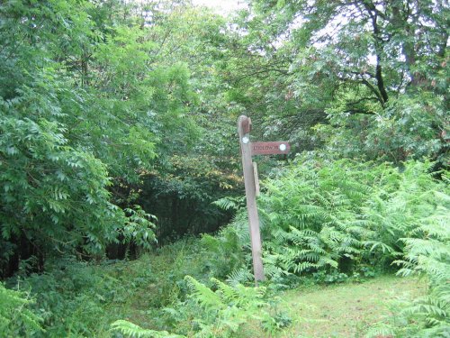
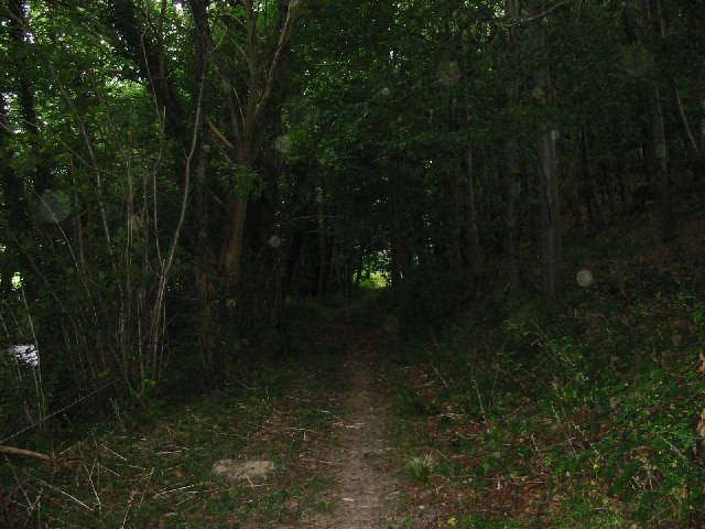
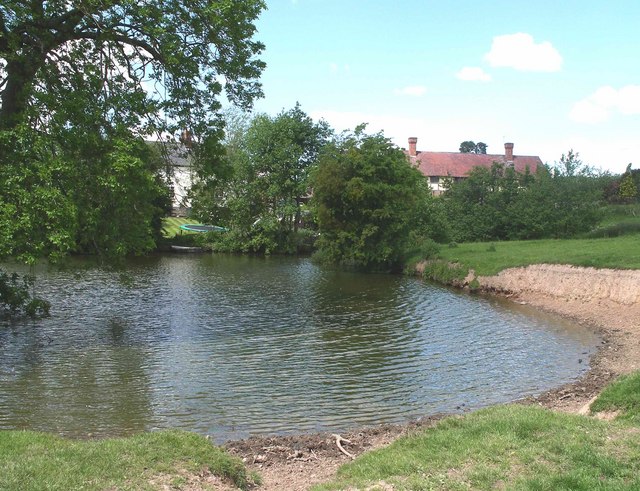
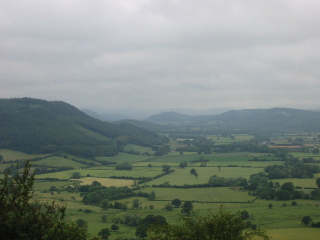
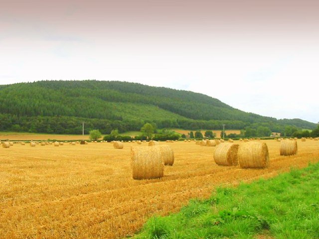
Byton is a rural area characterized by its picturesque countryside and rolling hills. The landscape is dotted with farms and fields, creating a tranquil and peaceful atmosphere. The parish is surrounded by natural beauty, with the River Lugg flowing nearby and the Mortimer Forest to the west.

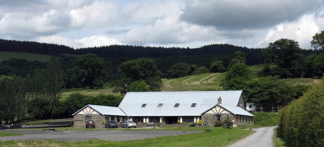
The village of Byton itself is a small and charming settlement, with a scattering of traditional cottages and houses. The centerpiece of the village is the St. John the Baptist Church, a historic building with a rich history dating back several centuries. The church is known for its beautiful stained glass windows and intricate architecture.

The local economy in Byton is primarily based on agriculture, with farming and livestock rearing being the main industries. The fertile soil and favorable climate make it an ideal location for agricultural activities. The parish also benefits from its proximity to larger towns and cities, providing residents with access to a wider range of amenities and employment opportunities.

Byton offers a peaceful and idyllic lifestyle, making it an attractive place for those seeking a rural retreat. The area is popular with nature lovers and outdoor enthusiasts, with numerous walking trails and scenic spots to explore. Overall, Byton is a quintessential English countryside parish, offering a tranquil and picturesque setting for its residents.

If you have any feedback on the listing, please let us know in the comments section below.

Byton Images

Images are sourced within 2km of 52.267422/-2.923656 or Grid Reference SO3763. Thanks to Geograph Open Source API. All images are credited.

Trig pillar above Byton Common. Situated not at the summit, but where there is  a view.
Trig pillar above Byton Common.
Situated not at the summit, but where there is a view.
Byton Common Some years ago, grazing ceased on Byton Common, although there were ponies on the common when this picture was taken. The common has now changed from downland to dense woodland complete with the dreaded bracken. The first trees to appear were hawthorn followed by oak ash and hazel.
Byton Common
Some years ago, grazing ceased on Byton Common, although there were ponies on the common when this picture was taken. The common has now changed from downland to dense woodland complete with the dreaded bracken. The first trees to appear were hawthorn followed by oak ash and hazel.
Shobdon Hill A long straight forest road near the top of Shobdon Hill. A lot of the forest has been recently felled, the trees being just over 30 years old. (I can remember the last time the felled the woods in Shobdon)
Shobdon Hill
A long straight forest road near the top of Shobdon Hill. A lot of the forest has been recently felled, the trees being just over 30 years old. (I can remember the last time the felled the woods in Shobdon)
The Arkwright Hall at Lower Kinsham
The lane between Cadwell and Upper Kinsham looking south-east towards the junction
The lane between Cadwell and Upper Kinsham
looking south-east towards the junction
Fields, Limebrook Wood and the hill beyond looking north-east from the road between Kinsham and Lingen
Fields, Limebrook Wood and the hill beyond
looking north-east from the road between Kinsham and Lingen
Upper Lugg valley Looking West towards the Welsh border along the upper Lugg valley from about SO367643 just to the north of Byton. The closest point of the border is only a mile or so from here
Upper Lugg valley
Looking West towards the Welsh border along the upper Lugg valley from about SO367643 just to the north of Byton. The closest point of the border is only a mile or so from here
Herefordshire Trail leading to Wapley Hillfort This is taken looking North from the Herefordshire Trail towards Combe Moor and Byton Moor from the ridge above Brandhill Wood
Herefordshire Trail leading to Wapley Hillfort
This is taken looking North from the Herefordshire Trail towards Combe Moor and Byton Moor from the ridge above Brandhill Wood
The Lugg Valley to the West of Byton The river is just out of shot to the left - Byton in the distance
The Lugg Valley to the West of Byton
The river is just out of shot to the left - Byton in the distance
Ford at Lower Yeld There is an old footbridge just to the right
Ford at Lower Yeld
There is an old footbridge just to the right
Mortimer Trail Looking east from the path at about SO 357626
Mortimer Trail
Looking east from the path at about SO 357626
Combe From close to the Lugg looking south to Wapley Hill
Combe
From close to the Lugg looking south to Wapley Hill
Byton Common Ponies on the Mortimer Trail
Byton Common
Ponies on the Mortimer Trail
Combe Moor and Byton Moor Taken on a wet July day looking west from the hill above Park Wood just outside the square - Wapley Hill on the left
Combe Moor and Byton Moor
Taken on a wet July day looking west from the hill above Park Wood just outside the square - Wapley Hill on the left
Ryland's Wood
Ryland's Wood
Yeld Wood
Yeld Wood
View from bench seat above Byton The bench is located on the Mortimer Trail, the view is quite obscured by trees, as many views are in the Marches.
View from bench seat above Byton
The bench is located on the Mortimer Trail, the view is quite obscured by trees, as many views are in the Marches.
Pond at Lower Woodhouse Small pond adjacent to Lower Woodhouse farm. The historic farmhouse and farm buildings have been recently renovated and converted into dwellings.
Pond at Lower Woodhouse
Small pond adjacent to Lower Woodhouse farm. The historic farmhouse and farm buildings have been recently renovated and converted into dwellings.
Show me another place!

Byton is located at Grid Ref: SO3763 (Lat: 52.267422, Lng: -2.923656)

Unitary Authority: County of Herefordshire

Police Authority: West Mercia

What 3 Words

///language.dissolves.crossing. Near Kinsham, Herefordshire

Related Wikis

Byton, Herefordshire

Byton is a village and civil parish in Herefordshire, England. Byton is situated on the River Lugg, near the border with Wales. According to the 2001...

Combe Moor

Combe Moor, also known as Coombes Moor, is a linear hamlet in the civil parish of Byton in Herefordshire, England, to the south-east of the Welsh town...

Kinsham

Kinsham is a civil parish which lies in the wooded hills of Herefordshire, England in the Marches near to the border with Wales, about 3 miles (5 km) east...

Kinsham Grange

Kinsham Grange may have been a priory near the River Lugg in Herefordshire, England at grid reference SO380652. It now seems likely that an error by John...

Limebrook Priory

Limebrook Priory was a priory in Lingen, Herefordshire, England at grid reference SO37386604. == History == === Origins === Situated in Lingen, Herefordshire...

Combe, Herefordshire

Combe is a small village and civil parish in the English county of Herefordshire. The village lies 4 km (2 mi) east of Presteigne near the confluence...

Wapley Hill

Wapley Hill is an Iron Age hill fort in Herefordshire, England, 3 km south-east of Presteigne. == Location == Wapley Hill stands in mixed woodland on a...

St John's Church, Shobdon

The Church of St John is a Church of England parish church at Shobdon in the English county of Herefordshire. Of 14th century origins, the church was...

Nearby Amenities

Located within 500m of 52.267422,-2.923656
Barrier: stile
Material: wood
Source: survey;gps
Stile: stepover
Lat/Long: 52.2674266/-2.9207142
Barrier: stile
Material: wood
Source: survey;gps
Stile: stepover
Lat/Long: 52.2696813/-2.9220701
Barrier: kissing_gate
Source: survey;gps
Lat/Long: 52.2711561/-2.9235725
Byton
Place: hamlet
Source: NLS - OS 1:25k 1st Series 1937-61
Wikidata: Q3785232
Lat/Long: 52.2710127/-2.9255632
Fixme: continues
Lat/Long: 52.2678209/-2.9308659
Fixme: continues
Lat/Long: 52.2680835/-2.9299271
Barrier: stile
Source: survey
Lat/Long: 52.2641667/-2.927169
Barrier: stile
Source: survey
Lat/Long: 52.2642596/-2.9271524
Barrier: stile
Source: survey
Lat/Long: 52.2655425/-2.9281864
Barrier: stile
Lat/Long: 52.26712/-2.9296428
Barrier: stile
Source: survey
Lat/Long: 52.2642133/-2.9271644
Barrier: stile
Lat/Long: 52.2670962/-2.9296213
The data included in this document is from www.openstreetmap.org. The data is made available under ODbL.

Have you been to Byton?

Leave your review of Byton below (or comments, questions and feedback).