Broad Green

Settlement in Suffolk West Suffolk

England

Broad Green

Footpath to Great Knowles Green
Footpath to Great Knowles Green Credit: Jonathan Thacker

Broad Green is a small village located in the county of Suffolk, England. Situated approximately 10 miles north of the town of Ipswich, the village is nestled in the heart of the beautiful Suffolk countryside. With a population of around 500 residents, Broad Green offers a peaceful and tranquil environment for its inhabitants.

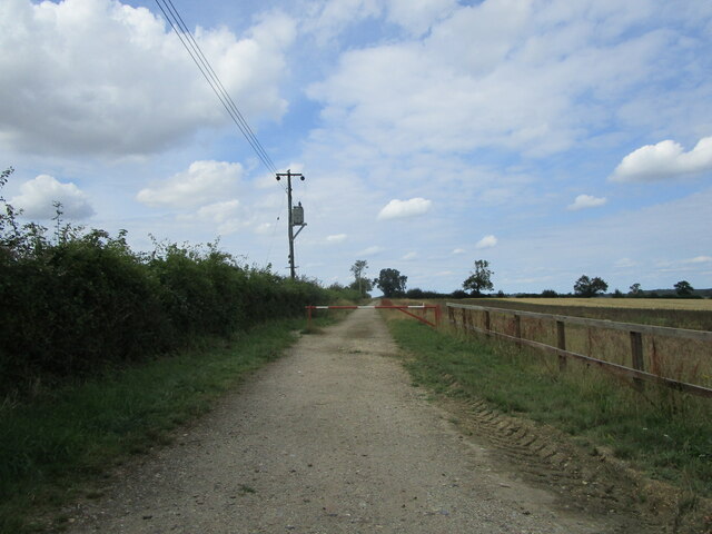
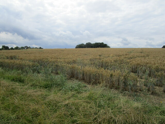
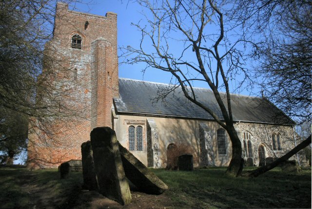
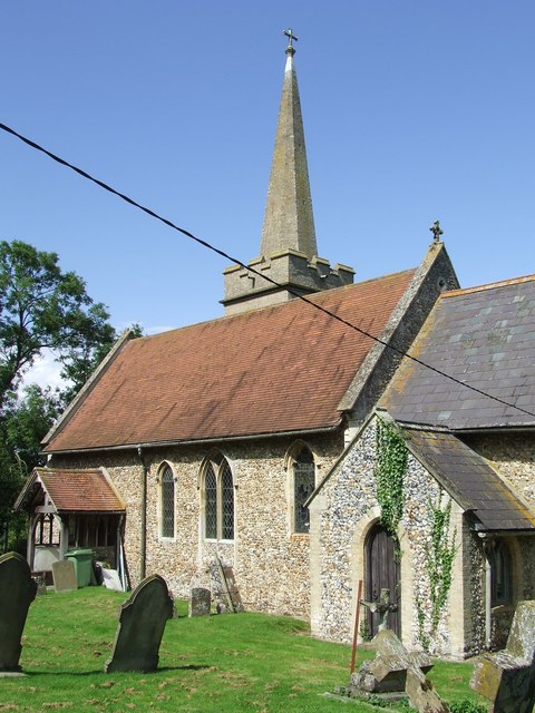
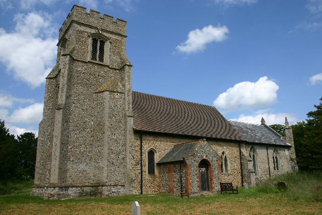
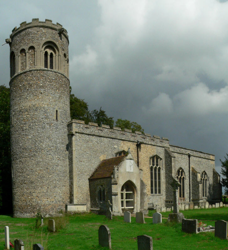
The village is known for its picturesque landscapes, characterized by rolling hills, vast green fields, and charming country lanes. It is a popular destination for nature lovers, offering numerous walking and cycling routes that allow visitors to explore the surrounding countryside. The village is also home to a number of well-preserved historic buildings, including traditional thatched cottages and a quaint village church.

Despite its small size, Broad Green boasts a strong sense of community. The village has a local pub, The Green Man, which serves as a social hub for both residents and visitors. It offers a warm and welcoming atmosphere, where locals gather to socialize and enjoy a range of traditional pub fare. Additionally, the village hosts various community events throughout the year, such as summer fĂȘtes and Christmas markets, fostering a close-knit community spirit.

Broad Green benefits from its proximity to Ipswich, which provides residents with access to a wide range of amenities and services. The town offers a diverse array of shops, restaurants, and entertainment options, ensuring that residents have easy access to all their daily needs.

In summary, Broad Green, Suffolk, offers a picturesque and idyllic setting, with a strong sense of community and a peaceful atmosphere. It is an ideal place for those seeking a serene rural lifestyle while still having access to nearby urban amenities.

If you have any feedback on the listing, please let us know in the comments section below.

Broad Green Images

Images are sourced within 2km of 52.203955/0.60949712 or Grid Reference TL7859. Thanks to Geograph Open Source API. All images are credited.

Footpath to Great Knowles Green
Footpath to Hargrave
House in Church Road, Chevington
Farm track and footpath to Chevington Hill Farm
Houses on Old Post Office Road, Chevington
Fields near Chevington
Between Hargrave and Chevington Typical Suffolk landscape. Not flat, but not really hilly either.
Between Hargrave and Chevington
Typical Suffolk landscape. Not flat, but not really hilly either.
Farm track near The Grove, Hargrave
Footpath along the parish boundary Follows the boundary between Hargrave (left) and Chevington.
Footpath along the parish boundary
Follows the boundary between Hargrave (left) and Chevington.
Footpath to Wickhambrook Road In gently rolling Suffolk countryside.
Footpath to Wickhambrook Road
In gently rolling Suffolk countryside.
Corner of a field A footpath to Little Knowles Green cuts across this corner.
Corner of a field
A footpath to Little Knowles Green cuts across this corner.
Wheatfield and copse Near Little Knowles Green.
Wheatfield and copse
Near Little Knowles Green.
Grass field, Weathercock Hill
All Saints' church, Chevington The top stage of the tower was only built in about 1800 and because it is unroofed its walls are in effect enormous parapets <span class="nowrap"><a title="https://historicengland.org.uk/listing/the-list/list-entry/1186968" rel="nofollow ugc noopener" href="https://historicengland.org.uk/listing/the-list/list-entry/1186968">Link</a><img style="margin-left:2px;" alt="External link" title="External link - shift click to open in new window" src="https://s1.geograph.org.uk/img/external.png" width="10" height="10"/></span>
All Saints' church, Chevington
The top stage of the tower was only built in about 1800 and because it is unroofed its walls are in effect enormous parapets LinkExternal link
Farm track and footpath to Old Post Office Road
Cottage near the church, Chevington
Chevington War Memorial Listed <span class="nowrap"><a title="https://historicengland.org.uk/listing/the-list/list-entry/1454246" rel="nofollow ugc noopener" href="https://historicengland.org.uk/listing/the-list/list-entry/1454246">Link</a><img style="margin-left:2px;" alt="External link" title="External link - shift click to open in new window" src="https://s1.geograph.org.uk/img/external.png" width="10" height="10"/></span>
Chevington War Memorial
Listed LinkExternal link
All Saints' church, Chevington, chancel interior Re-ordered in 1983-4 <span class="nowrap"><a title="https://historicengland.org.uk/listing/the-list/list-entry/1186968" rel="nofollow ugc noopener" href="https://historicengland.org.uk/listing/the-list/list-entry/1186968">Link</a><img style="margin-left:2px;" alt="External link" title="External link - shift click to open in new window" src="https://s1.geograph.org.uk/img/external.png" width="10" height="10"/></span>
All Saints' church, Chevington, chancel interior
Re-ordered in 1983-4 LinkExternal link
Show me another place!

Broad Green is located at Grid Ref: TL7859 (Lat: 52.203955, Lng: 0.60949712)

Administrative County: Suffolk

District: West Suffolk

Police Authority: Suffolk

What 3 Words

///power.cowering.taller. Near Bury St Edmunds, Suffolk

Related Wikis

Chevington, Suffolk

Chevington is a village and civil parish in the West Suffolk district of Suffolk in East Anglia, England. Located around 10 km south-west of Bury St Edmunds...

Hargrave, Suffolk

Hargrave is a village and civil parish in the West Suffolk district of Suffolk in eastern England, located about 7 miles (10 km) away from south west of...

Chedburgh

Chedburgh is a village and civil parish in the West Suffolk district of Suffolk in eastern England. Located on the A143 around five miles south-west of...

Thingoe Rural District

Thingoe Rural District was a rural district in the county of West Suffolk, England between 1894 and 1974. It was named after the ancient Hundred of Thingoe...

Depden

Depden is a village and civil parish in the West Suffolk district of Suffolk in eastern England. Located on the A143 around five miles south-west of Bury...

RAF Chedburgh

Royal Air Force Chedburgh or more simply RAF Chedburgh is a former Royal Air Force satellite station located near Bury St Edmunds, Suffolk, UK. The Bury...

Hay Wood, Whepstead

Hay Wood, Whepstead is a 10.4-hectare (26-acre) biological Site of Special Scientific Interest west of Whepstead in Suffolk.This ancient wood on poorly...

Little Saxham

Little Saxham is a village and former civil parish, now in the parish of The Saxhams, in the West Suffolk district, in the county of Suffolk, England....

Nearby Amenities

Located within 500m of 52.203955,0.60949712
Bus Stop
Greyhound
Naptan AtcoCode: 390050124
Naptan Bearing: S
Naptan CommonName: Greyhound
Naptan Indicator: opp
Naptan Landmark: Greyhound
Naptan NaptanCode: sufgdjtd
Naptan Street: Chedburgh Road
Shelter: yes
Source: naptan_import;survey
Lat/Long: 52.2034446/0.6095481
Bus Stop
Greyhound
Naptan AtcoCode: 390050125
Naptan Bearing: N
Naptan BusStopType: CUS
Naptan CommonName: Greyhound
Naptan Indicator: adj
Naptan Landmark: Greyhound
Naptan NaptanCode: sufgdjtg
Naptan Street: Chedburgh Road
Source: naptan_import;survey
Lat/Long: 52.203526/0.6094278
Post Box
Collection Times: Mo-Fr 16:00; Sa 09:30
Post Box Mounting: telegraph_pole
Post Box Type: lamp
Ref: IP29 2118
Royal Cypher: EIIR
Royal Cypher Wikidata: Q33102113
Lat/Long: 52.2072213/0.6124911
Post Box
Collection Times: Mo-Fr 09:00; Sa 07:00
Post Box Mounting: telegraph_pole
Post Box Type: lamp
Ref: IP29 2094D
Royal Cypher: EIIR
Royal Cypher Wikidata: Q33102113
Lat/Long: 52.2042493/0.6149346
Broad Green
Place: hamlet
Lat/Long: 52.2035305/0.6098356
Addr Housenumber: 3
Addr Postcode: IP29 5QR
Addr Street: Hargrave Road
Lat/Long: 52.2042937/0.606728
Addr Housenumber: 13
Addr Postcode: IP29 5QL
Addr Street: New Road
Lat/Long: 52.2078081/0.6127171
Addr Housenumber: 11
Addr Postcode: IP29 5QL
Addr Street: New Road
Lat/Long: 52.2077391/0.6127171
Addr Housenumber: 7
Addr Postcode: IP29 5QH
Addr Street: Church Road
Lat/Long: 52.2075632/0.6133528
Addr Housenumber: 3
Addr Postcode: IP29 5QL
Addr Street: New Road
Lat/Long: 52.2073083/0.6127466
Addr Housenumber: 5
Addr Postcode: IP29 5QL
Addr Street: New Road
Lat/Long: 52.2073971/0.6127386
Addr Housenumber: 7
Addr Postcode: IP29 5QL
Addr Street: New Road
Lat/Long: 52.2075369/0.6127198
Addr Housenumber: 9
Addr Postcode: IP29 5QL
Addr Street: New Road
Lat/Long: 52.2076339/0.6127144
Addr Housenumber: 17
Addr Postcode: IP29 5QL
Addr Street: New Road
Lat/Long: 52.2079807/0.612693
Addr Housenumber: 1
Addr Postcode: IP29 5QH
Addr Street: Church Road
Lat/Long: 52.2073364/0.6131167
Addr Housenumber: 15
Addr Postcode: IP29 5QL
Addr Street: New Road
Lat/Long: 52.2079116/0.612701
Addr Housenumber: 9
Addr Postcode: IP29 5QH
Addr Street: Church Road
Lat/Long: 52.20767/0.6135244
Addr Housenumber: 3
Addr Postcode: IP29 5QH
Addr Street: Church Road
Lat/Long: 52.2073938/0.6131945
Addr Housenumber: 5
Addr Postcode: IP29 5QH
Addr Street: Church Road
Lat/Long: 52.2075105/0.6133045
Addr Housename: Mill House
Addr Postcode: IP29 5QR
Addr Street: Hargrave Road
Lat/Long: 52.2044039/0.6087799
Addr Housenumber: 12
Addr Postcode: IP29 5QR
Addr Street: Hargrave Road
Lat/Long: 52.2046471/0.6061594
Addr Housename: Old Mill House
Addr Postcode: IP29 5QP
Addr Street: Mill Road
Lat/Long: 52.2044779/0.6089274
Addr Housenumber: 11
Addr Postcode: IP29 5QR
Addr Street: Hargrave Road
Lat/Long: 52.2046028/0.6062559
Addr Housenumber: 4
Addr Postcode: IP29 5QR
Addr Street: Hargrave Road
Lat/Long: 52.2043431/0.6066287
Addr Housenumber: 1
Addr Postcode: IP29 5QR
Addr Street: Hargrave Road
Lat/Long: 52.2041722/0.6074066
Addr Housenumber: 14
Addr Postcode: IP29 5QR
Addr Street: Hargrave Road
Lat/Long: 52.2046965/0.6060923
Addr Housenumber: 2
Addr Postcode: IP29 5QR
Addr Street: Hargrave Road
Lat/Long: 52.2041672/0.6072913
Addr Housenumber: 10
Addr Postcode: IP29 5QR
Addr Street: Hargrave Road
Lat/Long: 52.2045715/0.606323
Man Made: windmill
Lat/Long: 52.2041787/0.608399
Addr Housenumber: 15
Addr Postcode: IP29 5QR
Addr Street: Hargrave Road
Lat/Long: 52.2047412/0.6060634
Defibrillator
Defibrillator Location: Adjacent to the entrance of the village hall.
Emergency: defibrillator
Indoor: no
Operator: Community Heartbeat Trust
Ref: CH-RT-1903
Ref GB The Circuit: C16C6198-5314-446A-B6EB-AF2900C6BC39
Lat/Long: 52.2018605/0.6092153
The data included in this document is from www.openstreetmap.org. The data is made available under ODbL.

Have you been to Broad Green?

Leave your review of Broad Green below (or comments, questions and feedback).