Burton Fleming

Civil Parish in Yorkshire

England

Burton Fleming

Burton Fleming map A map of the village of Burton Fleming
Burton Fleming map Credit: Lauren

Burton Fleming is a civil parish located in the East Riding of Yorkshire, England. It is situated about 4 miles west of the coastal town of Bridlington and lies in the Yorkshire Wolds, a beautiful and picturesque area known for its rolling hills and scenic landscapes.

The village of Burton Fleming itself is a small and charming settlement with a population of around 400 people. It is characterized by its traditional stone-built houses and a sense of community spirit. The parish is surrounded by agricultural land, with farms and fields dominating the countryside.

Burton Fleming has a long history dating back to the medieval period, and some historical buildings can still be found in the village. The All Saints Church, a Grade I listed building, is a notable landmark and a focal point for the community. There are also a few pubs and local shops that serve the needs of the residents.

The parish is well-connected, with good road links to nearby towns and villages. It offers a peaceful and tranquil environment, with opportunities for outdoor activities such as walking and cycling in the surrounding countryside. The village also hosts various events and activities throughout the year, including a summer fair and a Christmas market.

Overall, Burton Fleming is a small but vibrant community that offers a rural lifestyle with easy access to amenities and the beautiful Yorkshire Wolds.

If you have any feedback on the listing, please let us know in the comments section below.

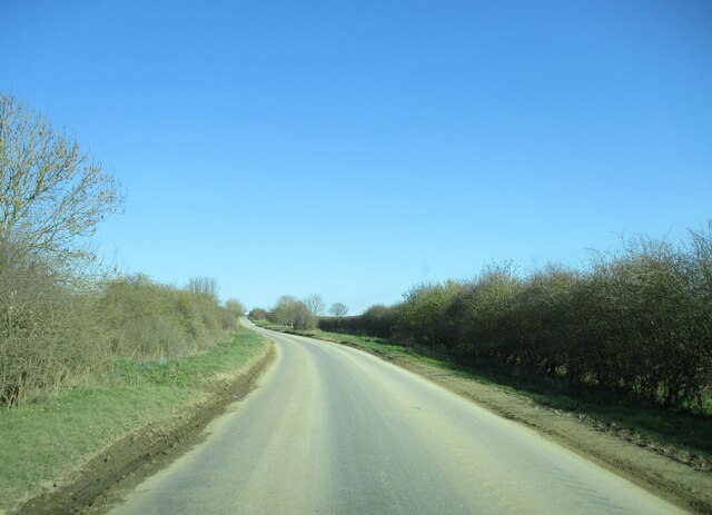
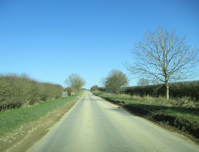
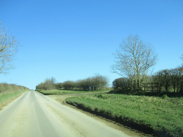
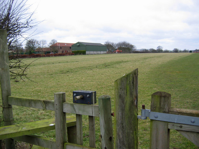
Burton Fleming Images

Images are sourced within 2km of 54.132958/-0.34259 or Grid Reference TA0872. Thanks to Geograph Open Source API. All images are credited.

Burton Fleming map A map of the village of Burton Fleming
Burton Fleming map
A map of the village of Burton Fleming
Entering  Burton  Fleming  on  Thwing  Road On a frosty morning
Entering Burton Fleming on Thwing Road
On a frosty morning
Terraced  cottages  Burton  Fleming
Terraced cottages Burton Fleming
Trig  point  in  hedgerow  at  roadside.  OS BM 86334 On Nine Dikes Road
Trig point in hedgerow at roadside. OS BM 86334
On Nine Dikes Road
War  Memorial  and  St  Cuthbert's  Parish  Church Early morning sun lights the churchyard wall with Hunmanby Road to the right
War Memorial and St Cuthbert's Parish Church
Early morning sun lights the churchyard wall with Hunmanby Road to the right
South  Porch  on  St  Cuthbert's  Parish  Church The porch protects the Norman doorway. The church escaped the thorough restorations beloved by the Victorians and exhibits the restoration by churchwardens and parishioners over centuries. Stone, but patched with cobbles and a lot of brickwork
South Porch on St Cuthbert's Parish Church
The porch protects the Norman doorway. The church escaped the thorough restorations beloved by the Victorians and exhibits the restoration by churchwardens and parishioners over centuries. Stone, but patched with cobbles and a lot of brickwork
Blue  lighting  Ambulance  in  Burton  Fleming
Blue lighting Ambulance in Burton Fleming
The  overgrown  course  of  the  Gipsey  Race This bridge is on Thwing Road.
The overgrown course of the Gipsey Race
This bridge is on Thwing Road.
Heavy  agricultural  machinery  has  compressed  the  soil Rainwater cannot drain through the topsoil
Heavy agricultural machinery has compressed the soil
Rainwater cannot drain through the topsoil
Country  road  toward  Grindale  after  leaving  Burton  Fleming
Country road toward Grindale after leaving Burton Fleming
Country  road  with  access  junctions  to  two  farms On the left West Hale Gate farm, further on the right Maidensgrave farm
Country road with access junctions to two farms
On the left West Hale Gate farm, further on the right Maidensgrave farm
Access  track  to  Maidensgrave  Farm  on  the  right
Access track to Maidensgrave Farm on the right
Willy Howe One of many neolithic sites bordering the Gypsey Race. Looking Northeast along the track.
Willy Howe
One of many neolithic sites bordering the Gypsey Race. Looking Northeast along the track.
Refuge Farm Looking west to the farm. This is a typical view of this grid square.
Refuge Farm
Looking west to the farm. This is a typical view of this grid square.
SW of Burton Fleming Looking NE from the road junction to Thwing, towards Burton Fleming in the adjacent grid square.
SW of Burton Fleming
Looking NE from the road junction to Thwing, towards Burton Fleming in the adjacent grid square.
St. Cuthbert's Church, Burton Fleming The church stands in the fork of the roads, this view north.
St. Cuthbert's Church, Burton Fleming
The church stands in the fork of the roads, this view north.
Burton Fleming View south from in front of the church gate.
Burton Fleming
View south from in front of the church gate.
Water Treatment Works Looking east to the Burton Fleming Water Treatment Works which is just SE of the village. This grid square is just about all farmland.
Water Treatment Works
Looking east to the Burton Fleming Water Treatment Works which is just SE of the village. This grid square is just about all farmland.
Show me another place!

Burton Fleming is located at Grid Ref: TA0872 (Lat: 54.132958, Lng: -0.34259)

Division: East Riding

Unitary Authority: East Riding of Yorkshire

Police Authority: Humberside

What 3 Words

///ownership.pioneered.splash. Near Thwing, East Yorkshire

Related Wikis

Burton Fleming

Burton Fleming is a village and civil parish in the East Riding of Yorkshire, England. It lies close to the border with North Yorkshire. The village is...

Willy Howe

Willy Howe (also Willey-Hou) is a tumulus in the Yorkshire Wolds, East Riding of Yorkshire, England. == History and description == Willy Howe is a large...

Great Wold Valley

The Great Wold Valley is the largest and broadest of the valleys cutting into the Yorkshire Wolds in northern England. It carries the Gypsey Race, an intermittent...

Argam

Argam, or Argham (sometimes Ergam, or Ergham), was a civil parish and village in the East Riding of Yorkshire, England. The site is listed in many historical...

Wold Newton, East Riding of Yorkshire

Wold Newton is a small Yorkshire Wolds village and civil parish in the East Riding of Yorkshire, England. It is situated approximately 9 miles (14 km)...

Thwing, East Riding of Yorkshire

Thwing is a village and civil parish in the Yorkshire Wolds, in the East Riding of Yorkshire, England. == Description == Thwing is located in the Yorkshire...

Rudston Monolith

The Rudston Monolith at over 25 feet (7.6 m) is the tallest megalith (standing stone) in the United Kingdom. It is situated in the churchyard in the village...

Rudston

Rudston is a small village and civil parish in the East Riding of Yorkshire, England. It is situated between Driffield and Bridlington approximately 6...

Nearby Amenities

Located within 500m of 54.132958,-0.34259
Burton Fleming
Is In: East Riding of Yorkshire, England, UK
Is In County: East Riding of Yorkshire
Old Name: North Burton
Place: village
Lat/Long: 54.1330412/-0.3429474
Post Office
Burton Fleming Post Office
Addr City: Driffield
Addr Country: GB
Addr Housename: The Village Shop
Addr Postcode: YO25 3PR
Addr Street: Front Street
Addr Suburb: Burton Fleming
Brand: Post Office
Brand Wikidata: Q1783168
Opening Hours: Mo-We,Fr 10:00-12:00
Ref Pol Id: 111460
Website: https://www.postoffice.co.uk/branch-finder/5224705/burton-fleming
Lat/Long: 54.133767/-0.3433705
Bus Stop
Burton Fleming Front Street
Naptan AtcoCode: 2200YEA01102
Naptan Bearing: N
Naptan CommonName: Burton Fleming Front Street
Naptan Landmark: Chapel
Naptan Street: Front Street
Naptan Verified: no
Source: naptan_import
Lat/Long: 54.1331679/-0.3441795
Power: pole
Lat/Long: 54.1326607/-0.3498059
Power: pole
Lat/Long: 54.1335564/-0.3492332
Power: pole
Lat/Long: 54.1344932/-0.3483231
Power: pole
Lat/Long: 54.1357769/-0.3475928
Pub
Burton Arms
Addr City: Driffield
Addr Postcode: YO25 3PE
Addr Street: Bridlington Road
Addr Suburb: Burton Fleming
Lat/Long: 54.1327515/-0.3439298
Historic: memorial
Lat/Long: 54.1351454/-0.3431106
Post Box
Post Box Type: wall
Ref: YO25 364
Royal Cypher: GR
Royal Cypher Wikidata: Q33102273
Lat/Long: 54.1337931/-0.3434043
Defibrillator
Booth: K6
Covered: booth
Defibrillator Location: In old telephone box.
Disused Amenity: telephone
Emergency: defibrillator
Man Made: telephone_box
Opening Hours: 24/7
Lat/Long: 54.1334169/-0.3437038
Waste Basket
Lat/Long: 54.1323273/-0.3467087
Barrier: kissing_gate
Bicycle: no
Foot: yes
Horse: no
Motor Vehicle: no
Lat/Long: 54.1323559/-0.3467193
Information: map
Tourism: information
Lat/Long: 54.1333579/-0.3437966
Power: pole
Lat/Long: 54.1364155/-0.3397316
The data included in this document is from www.openstreetmap.org. The data is made available under ODbL.

Have you been to Burton Fleming?

Leave your review of Burton Fleming below (or comments, questions and feedback).