Burton and Dalby

Civil Parish in Leicestershire Melton

England

Burton and Dalby

Path and Stile near Burton Lazars Trig Point
Path and Stile near Burton Lazars Trig Point Credit: thejackrustles

Burton and Dalby is a civil parish located in the county of Leicestershire, England. It is situated approximately 10 miles southeast of the city of Leicester. The parish is made up of two small villages, Burton Overy and Dalby, which are located within close proximity to each other.

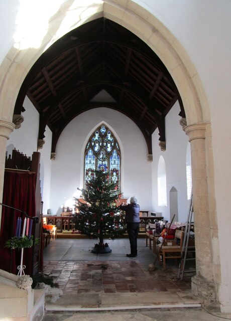
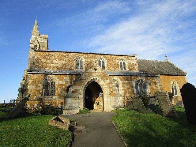
Burton Overy, the larger of the two villages, is a picturesque and traditional English village with a population of around 200 people. It is known for its charming thatched cottages, well-maintained gardens, and a historic Grade I listed church, St. Andrew's. The village also features a local pub, The Bell Inn, which is a popular gathering spot for locals and visitors alike.

Dalby, on the other hand, is a smaller village with a population of around 50 people. It is a quiet and peaceful village, surrounded by beautiful countryside and farmland. Dalby is known for its well-preserved 17th-century manor house, Dalby Hall, which adds to the village's historic charm.

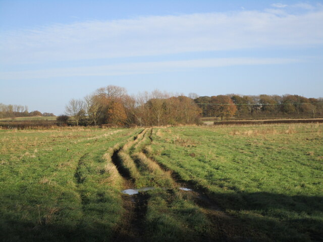
Both villages offer a rural and idyllic lifestyle, with a strong sense of community. Residents can enjoy the tranquility of the countryside while still having access to nearby amenities and services in the larger towns and cities in the region. The area is popular with walkers and nature enthusiasts due to its scenic landscapes and numerous footpaths.

Overall, Burton and Dalby, Leicestershire, offer a quintessentially English countryside experience, with its charming villages, historic buildings, and stunning natural surroundings.

If you have any feedback on the listing, please let us know in the comments section below.

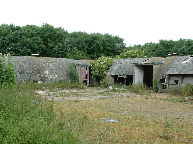
Burton and Dalby Images

Images are sourced within 2km of 52.72702/-0.869694 or Grid Reference SK7614. Thanks to Geograph Open Source API. All images are credited.

Path and Stile near Burton Lazars Trig Point
Burton Lazars Trig Point Flush Bracket S4660
Footpath Sign - Burton Lazars
The churchyard, Burton Lazars The churchyard has a fine collection of Swithland slate headstones.
The churchyard, Burton Lazars
The churchyard has a fine collection of Swithland slate headstones.
Muddy track through woodland OS shows this as a road used as a public footpath but it does not appear on the Leicestershire County Council interactive footpath map.
Muddy track through woodland
OS shows this as a road used as a public footpath but it does not appear on the Leicestershire County Council interactive footpath map.
Track across a grass field OS shows this as a road used as a public footpath but it does not appear on the Leicestershire County Council interactive footpath map.
Track across a grass field
OS shows this as a road used as a public footpath but it does not appear on the Leicestershire County Council interactive footpath map.
Flooded track OS shows this as a road used as a public footpath but it does not appear on the Leicestershire County Council interactive footpath map.
Flooded track
OS shows this as a road used as a public footpath but it does not appear on the Leicestershire County Council interactive footpath map.
Ice covered pool A thin layer of ice covers this pool.
Ice covered pool
A thin layer of ice covers this pool.
Track alongside a sprayed field OS shows this as a road used as a public footpath but it does not appear on the Leicestershire County Council interactive footpath map.
Track alongside a sprayed field
OS shows this as a road used as a public footpath but it does not appear on the Leicestershire County Council interactive footpath map.
Lone tree and sprayed field Burton Lazars in the distance.
Lone tree and sprayed field
Burton Lazars in the distance.
Sprayed field Burton Lazars in the distance.
Sprayed field
Burton Lazars in the distance.
Sprayed field and small area of woodland
Monument to William Squires, Burton Lazars William Squires died in 1781 and half his estate was left to erect this monument <span class="nowrap"><a title="https://historicengland.org.uk/listing/the-list/list-entry/1307784" rel="nofollow ugc noopener" href="https://historicengland.org.uk/listing/the-list/list-entry/1307784">Link</a><img style="margin-left:2px;" alt="External link" title="External link - shift click to open in new window" src="https://s1.geograph.org.uk/img/external.png" width="10" height="10"/></span>
Monument to William Squires, Burton Lazars
William Squires died in 1781 and half his estate was left to erect this monument LinkExternal link
Setting up the Christmas tree, St. James' church, Burton Lazars The chancel of St. James' church was rebuilt in 1850 <span class="nowrap"><a title="https://historicengland.org.uk/listing/the-list/list-entry/1360836" rel="nofollow ugc noopener" href="https://historicengland.org.uk/listing/the-list/list-entry/1360836">Link</a><img style="margin-left:2px;" alt="External link" title="External link - shift click to open in new window" src="https://s1.geograph.org.uk/img/external.png" width="10" height="10"/></span>
Setting up the Christmas tree, St. James' church, Burton Lazars
The chancel of St. James' church was rebuilt in 1850 LinkExternal link
St. James' church, Burton Lazars Medieval church with a chancel of 1850 <span class="nowrap"><a title="https://historicengland.org.uk/listing/the-list/list-entry/1360836" rel="nofollow ugc noopener" href="https://historicengland.org.uk/listing/the-list/list-entry/1360836">Link</a><img style="margin-left:2px;" alt="External link" title="External link - shift click to open in new window" src="https://s1.geograph.org.uk/img/external.png" width="10" height="10"/></span>
St. James' church, Burton Lazars
Medieval church with a chancel of 1850 LinkExternal link
Access track to disused airfield
Little Dalby, All Saints
Show me another place!

Burton and Dalby is located at Grid Ref: SK7614 (Lat: 52.72702, Lng: -0.869694)

Administrative County: Leicestershire

District: Melton

Police Authority: Leicestershire

What 3 Words

///adopters.cuter.graver. Near Melton Mowbray, Leicestershire

Related Wikis

Burton and Dalby

Burton and Dalby is a civil parish in the Melton district of Leicestershire, England, to the south of Melton Mowbray. It covers the villages of Burton...

RAF Melton Mowbray

Royal Air Force Melton Mowbray or more simply RAF Melton Mowbray is a former Royal Air Force station located 2.3 miles (3.7 km) south of the centre of...

Burton Lazars

Burton Lazars is a village and former civil parish, now in the parish of Burton and Dalby, in the Melton district, in the county of Leicestershire, England...

King Edward VII School, Melton Mowbray

King Edward VII School (KE7) was an LEA maintained 11-19 comprehensive secondary school in Melton Mowbray, Leicestershire in England which closed in 2011...

Great Dalby railway station

Great Dalby railway station was a railway station serving the village of Great Dalby, Leicestershire on the Great Northern and London and North Western...

East Goscote Hundred

East Goscote Hundred was a hundred of Leicestershire, that arose from the division of the ancient Goscote hundred (also known as a Wapentake) into two...
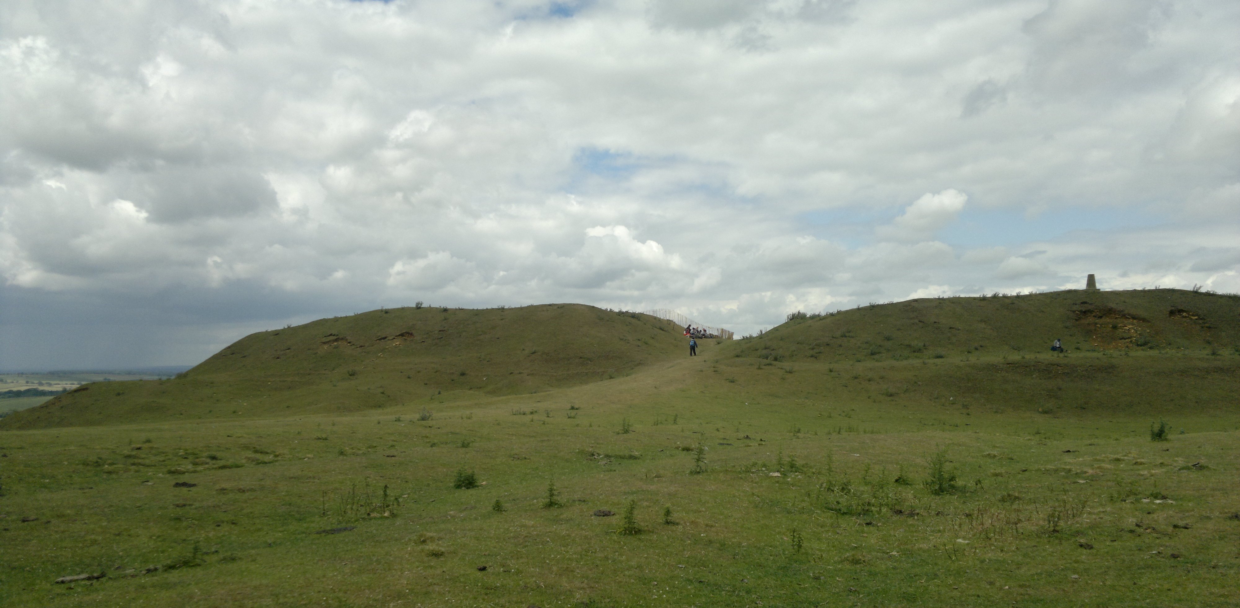
Burrough Hill

Burrough Hill is an Iron Age hillfort in Burrough on the Hill, 7 miles (11 km) south of Melton Mowbray in the English county of Leicestershire. Situated...

Melton Town F.C.

Melton Town Football Club is a football club based in Melton Mowbray, Leicestershire, England. They are currently members of the United Counties League...

Have you been to Burton and Dalby?

Leave your review of Burton and Dalby below (or comments, questions and feedback).