Burnham Overy

Civil Parish in Norfolk King's Lynn and West Norfolk

England

Burnham Overy

Bluetail trail, Holkham Pines Welcome extra paths south of the main track for birdwatching. The name refers to Red-flanked Bluetails, a scarce bird that has been seen here a few times.
Bluetail trail, Holkham Pines Credit: Hugh Venables

Burnham Overy is a civil parish located in the county of Norfolk, England. It is situated on the north coast of the county, on the edge of the North Norfolk Area of Outstanding Natural Beauty. The parish covers an area of approximately 9 square kilometers and has a population of around 300.

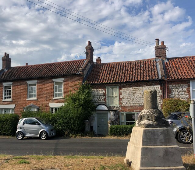
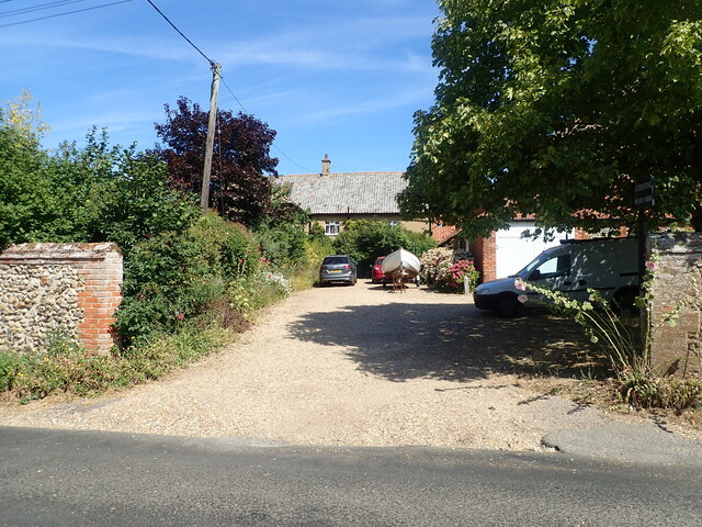
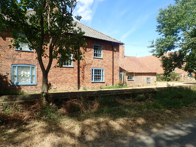
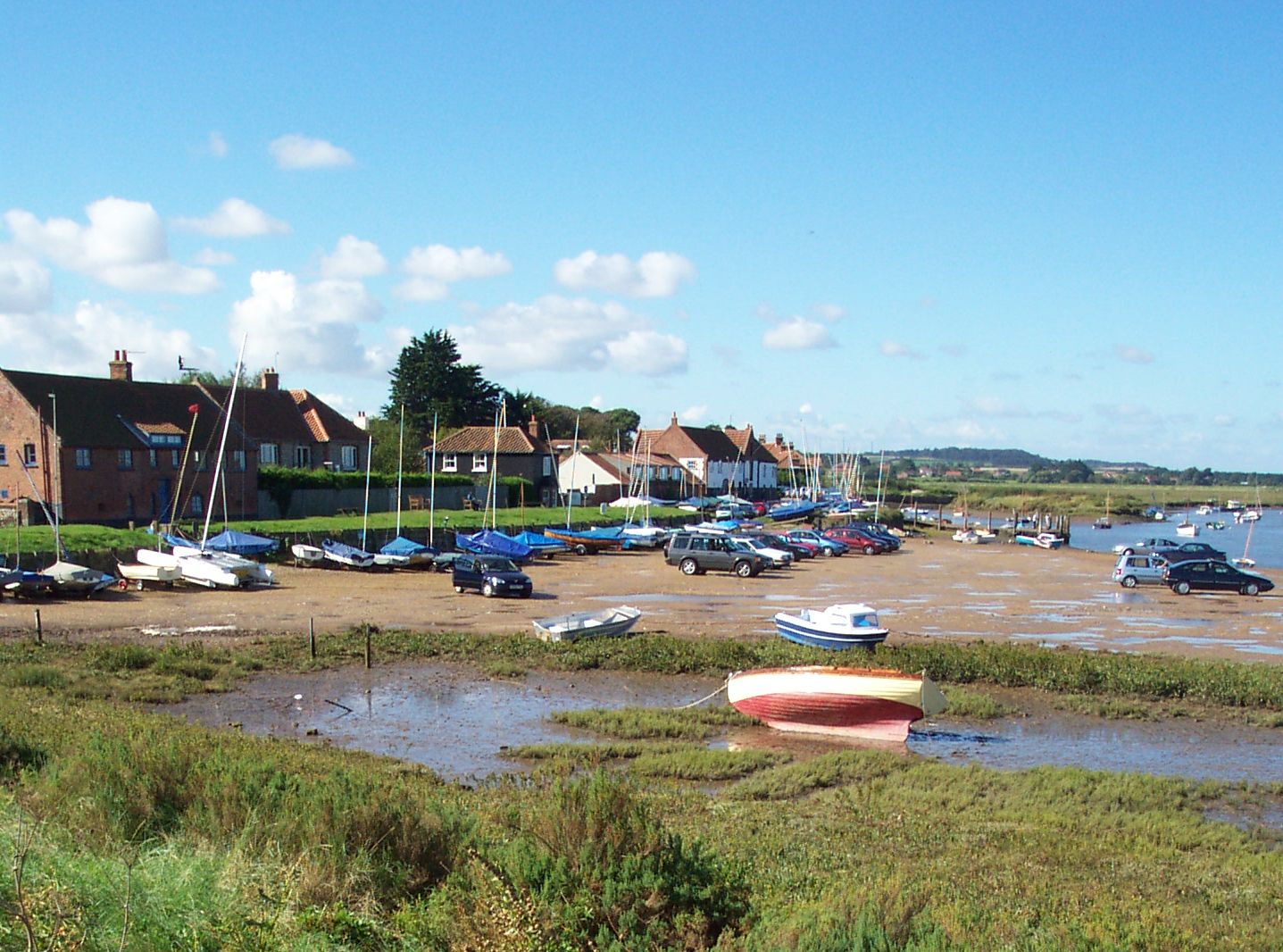
The village of Burnham Overy is a charming and picturesque settlement, known for its quaint cottages and traditional English architecture. It is located close to the larger town of Burnham Market, which provides amenities such as shops, restaurants, and a primary school.

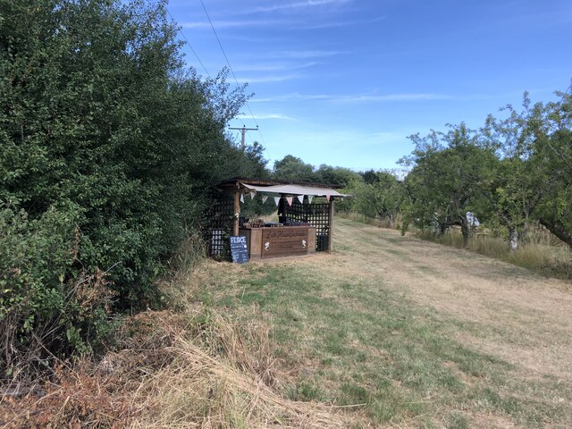
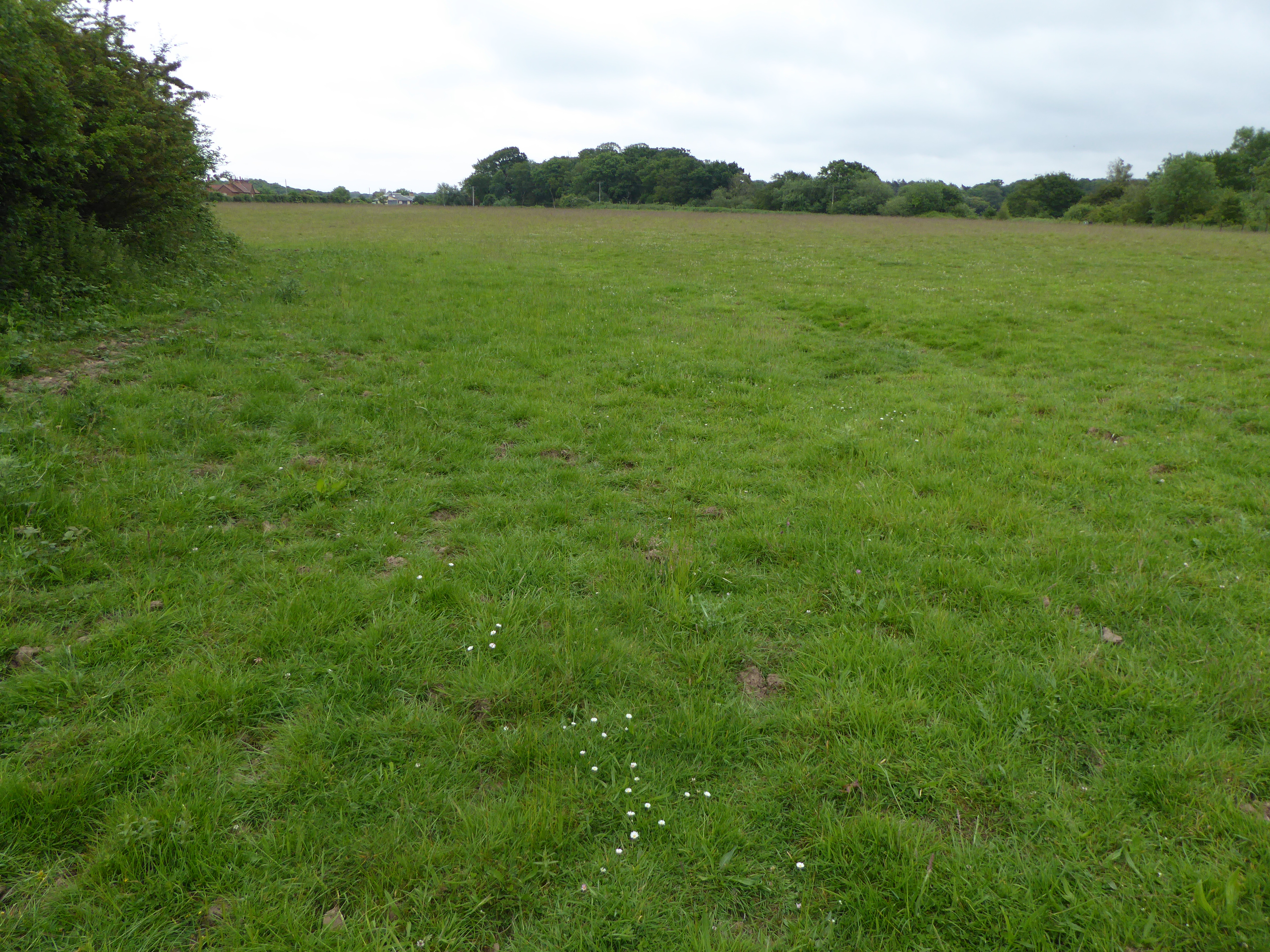
The parish is surrounded by stunning natural landscapes, including vast marshes and sand dunes. The area is popular among nature enthusiasts and birdwatchers, as it is home to several important nature reserves, including the Holkham National Nature Reserve and the Norfolk Coast Area of Outstanding Natural Beauty.

The village is also known for its historic significance. It is home to the 13th-century St. Clement's Church, a beautiful medieval structure that attracts visitors with its impressive architecture and historical artifacts.

The parish of Burnham Overy offers a peaceful and tranquil setting, making it a popular destination for those seeking a relaxing getaway. With its natural beauty, rich history, and close proximity to amenities, it is a delightful place to visit or call home.

If you have any feedback on the listing, please let us know in the comments section below.

Burnham Overy Images

Images are sourced within 2km of 52.963873/0.759508 or Grid Reference TF8544. Thanks to Geograph Open Source API. All images are credited.

Bluetail trail, Holkham Pines Welcome extra paths south of the main track for birdwatching. The name refers to Red-flanked Bluetails, a scarce bird that has been seen here a few times.
Bluetail trail, Holkham Pines
Welcome extra paths south of the main track for birdwatching. The name refers to Red-flanked Bluetails, a scarce bird that has been seen here a few times.
Path in Holkham Pines Pine trees covering the dunes at Holkham.
Path in Holkham Pines
Pine trees covering the dunes at Holkham.
West Harbour, Burnham Overy Staithe
East Harbour, Burnham Overy Staithe
Burnham Overy windmill, A149, Burnham Overy Staithe Grade II* Listed tower windmill. The mill was built in 1816 by Edmund Savory. Savory worked the mill until his death on 9 February 1827, when it passed to his son John. The mill was six storeys high, with a ground floor diameter of 24 feet and had a stage set around the first floor. It had four double shuttered sails with a span of 81 feet, each had 12 bays of 3 shutters and drove 3 pairs of stones. The mill ceased working between 1912 and 1921 depending on who you believe. Mr. Hugh Hughes architect bought the mill in 1926 and by then all the machinery had been removed. Hughes converted the mill for use as holiday lets and added the single storey extensions. Restoration was carried out by R. Thompson & Son of Alford, Lincs. who added a fixed cap, skeleton sails, stage and fan in 1957. The following year Hughes donated the mill to the National Trust who soon after had to again replace the sails as they had deteriorated badly. Plans by the Trust to restore the mill to working order were opposed by the Norfolk County Council due to the inadequate highway in the locality which did not have the capacity to cope with large numbers of visitors. The mill was renovated internally to meet fire safety regulations and retarred in 1981. The stocks and sails were removed in 1983. Two new 62 feet (18.90 m) long stocks of Jamaican Pitch pine were fitted on 17 July 1985, and four new sails the following day. The new stocks and sails cost £26,500. It is now used for holiday self catering accommodation by the National Trust.
Burnham Overy windmill, A149, Burnham Overy Staithe
Grade II* Listed tower windmill. The mill was built in 1816 by Edmund Savory. Savory worked the mill until his death on 9 February 1827, when it passed to his son John. The mill was six storeys high, with a ground floor diameter of 24 feet and had a stage set around the first floor. It had four double shuttered sails with a span of 81 feet, each had 12 bays of 3 shutters and drove 3 pairs of stones. The mill ceased working between 1912 and 1921 depending on who you believe. Mr. Hugh Hughes architect bought the mill in 1926 and by then all the machinery had been removed. Hughes converted the mill for use as holiday lets and added the single storey extensions. Restoration was carried out by R. Thompson & Son of Alford, Lincs. who added a fixed cap, skeleton sails, stage and fan in 1957. The following year Hughes donated the mill to the National Trust who soon after had to again replace the sails as they had deteriorated badly. Plans by the Trust to restore the mill to working order were opposed by the Norfolk County Council due to the inadequate highway in the locality which did not have the capacity to cope with large numbers of visitors. The mill was renovated internally to meet fire safety regulations and retarred in 1981. The stocks and sails were removed in 1983. Two new 62 feet (18.90 m) long stocks of Jamaican Pitch pine were fitted on 17 July 1985, and four new sails the following day. The new stocks and sails cost £26,500. It is now used for holiday self catering accommodation by the National Trust.
Wayside Cross, Burnham Overy The remains of the village Cross at the junction of Mill Road and Wells Road. Grade II listed
Wayside Cross, Burnham Overy
The remains of the village Cross at the junction of Mill Road and Wells Road. Grade II listed
West Lodge, Holkham Hall Built c 1790 and Grade II listed
West Lodge, Holkham Hall
Built c 1790 and Grade II listed
Gate entrance to Model Farm
Peterstone Priory Farm
Leith House
Leith House
Wayside stall at Leith House Orchards Jams, fresh plums and liquors as well as local wine and cider for sale here
Wayside stall at Leith House Orchards
Jams, fresh plums and liquors as well as local wine and cider for sale here
River Burn near Burnham Overy Mill
Burnham Overy Staithe: Sand dunes
Burnham Overy Staithe: The beach by the sand dunes
Burnham Overy Staithe: Sand dune flowers 1, Sea Holly 'Eryngium maritimum'
Burnham Overy Staithe: The highest sand dune
Burnham Overy Staithe: Sand dune flowers 1, Sea Holly 'Eryngium maritimum'
Burnham Overy Staithe: Sand dunes and beach
Show me another place!

Burnham Overy is located at Grid Ref: TF8544 (Lat: 52.963873, Lng: 0.759508)

Administrative County: Norfolk

District: King's Lynn and West Norfolk

Police Authority: Norfolk

What 3 Words

///technical.waitress.ages. Near Wells-next-the-Sea, Norfolk

Nearby Locations

Burnham Overy

Related Wikis

Burnham Overy

Burnham Overy is a civil parish on the north coast of Norfolk, England. In modern times a distinction is often made between the two settlements of Burnham...

Peterstone Priory

Peterstone Priory a house of Augustinian Canons, was a priory in Burnham Overy, Norfolk, England. It was founded before 1200 and incorporated 1449. �...

Holkham Brick Pit

Holkham Brick Pit is a 0.5-hectare (1.2-acre) geological Site of Special Scientific Interest west of Wells-next-the-Sea in Norfolk. It is a Geological...

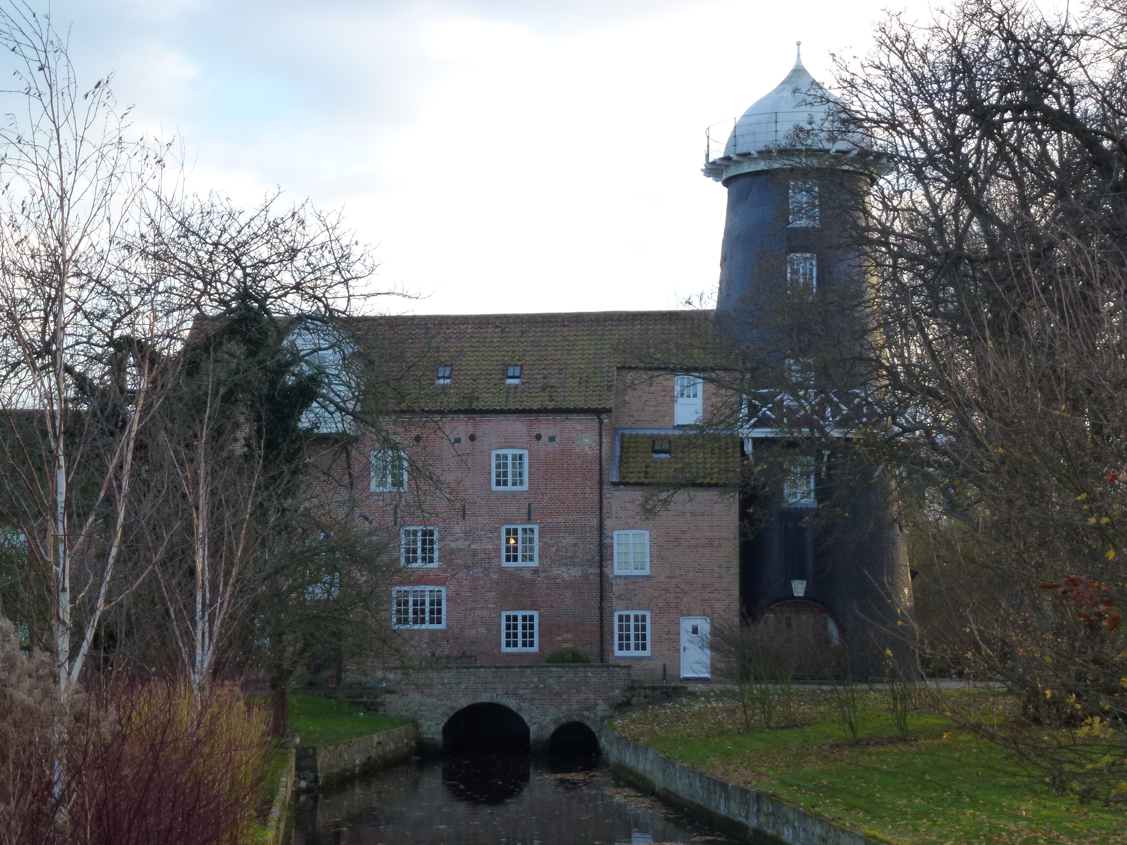
Union Mills, Burnham Overy

Union Mills or Roy's Mills are a Grade II listed combined tower mill and watermill at Burnham Overy, Norfolk, England which has been converted to residential...

Nearby Amenities

Located within 500m of 52.963873,0.759508
Barrier: stile
Foot: yes
Lat/Long: 52.9634204/0.7569661
The data included in this document is from www.openstreetmap.org. The data is made available under ODbL.

Have you been to Burnham Overy?

Leave your review of Burnham Overy below (or comments, questions and feedback).