Burford

Civil Parish in Oxfordshire West Oxfordshire

England

Burford

A361 The A361 runs 213 miles from Illfracombe to Kilsby in Oxfordshire.
<span class="nowrap"><a title="http://www.sabre-roads.org.uk/wiki/index.php?title=A361" rel="nofollow ugc noopener" href="http://www.sabre-roads.org.uk/wiki/index.php?title=A361">Link</a><img style="margin-left:2px;" alt="External link" title="External link - shift click to open in new window" src="https://s1.geograph.org.uk/img/external.png" width="10" height="10"/></span>
A361 Credit: N Chadwick

Burford is a charming civil parish located in the county of Oxfordshire, England. Situated on the River Windrush, this historic town dates back to the Roman era and is renowned for its picturesque streets and medieval architecture. With a population of around 1,400 residents, Burford offers a peaceful and idyllic setting.

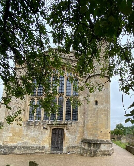
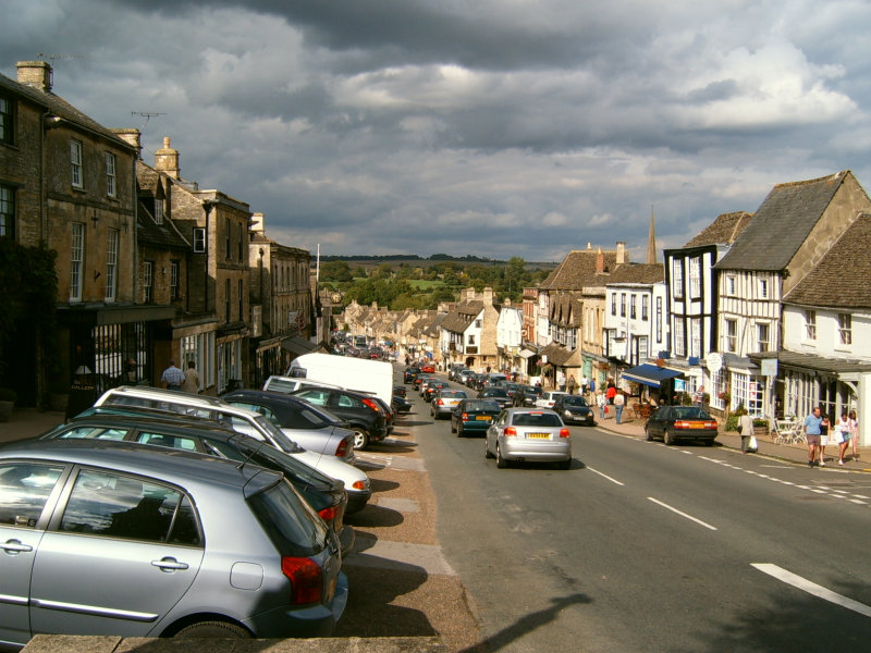
The town's iconic High Street is lined with traditional Cotswold stone buildings, many of which are centuries old. These houses now house a variety of independent shops, boutiques, cafes, and pubs, attracting both locals and tourists alike. Visitors can explore the medieval Church of St. John the Baptist, which features a stunning 15th-century wooden rood screen and beautiful stained glass windows.

Burford is also home to several notable landmarks, including the Burford Priory, a former religious institution turned private residence, and the Tolsey Museum, housed in a 16th-century market hall. The museum offers insights into the town's rich history, showcasing artifacts and exhibits related to the wool trade and local industries.

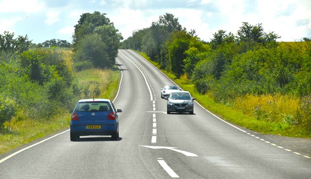
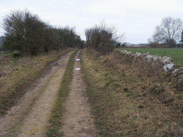
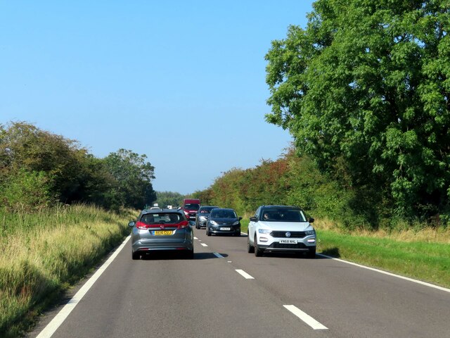
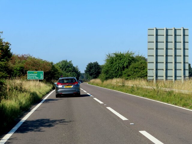
The surrounding countryside provides ample opportunities for outdoor activities and exploration. The rolling hills and scenic landscapes of the Cotswolds are perfect for hiking, cycling, and horseback riding.

Overall, Burford offers a unique blend of history, natural beauty, and a vibrant community. With its well-preserved architecture, quaint streets, and welcoming atmosphere, this charming town continues to captivate visitors and residents alike.

If you have any feedback on the listing, please let us know in the comments section below.

Burford Images

Images are sourced within 2km of 51.800462/-1.649237 or Grid Reference SP2411. Thanks to Geograph Open Source API. All images are credited.

A361 The A361 runs 213 miles from Illfracombe to Kilsby in Oxfordshire.
<span class="nowrap"><a title="http://www.sabre-roads.org.uk/wiki/index.php?title=A361" rel="nofollow ugc noopener" href="http://www.sabre-roads.org.uk/wiki/index.php?title=A361">Link</a><img style="margin-left:2px;" alt="External link" title="External link - shift click to open in new window" src="https://s1.geograph.org.uk/img/external.png" width="10" height="10"/></span>
A361
The A361 runs 213 miles from Illfracombe to Kilsby in Oxfordshire. LinkExternal link
A361, northbound The A361 runs 213 miles from Illfracombe to Kilsby in Oxfordshire.
<span class="nowrap"><a title="http://www.sabre-roads.org.uk/wiki/index.php?title=A361" rel="nofollow ugc noopener" href="http://www.sabre-roads.org.uk/wiki/index.php?title=A361">Link</a><img style="margin-left:2px;" alt="External link" title="External link - shift click to open in new window" src="https://s1.geograph.org.uk/img/external.png" width="10" height="10"/></span>
A361, northbound
The A361 runs 213 miles from Illfracombe to Kilsby in Oxfordshire. LinkExternal link
A361 south of Signet The A361 runs 213 miles from Illfracombe to Kilsby in Oxfordshire.
<span class="nowrap"><a title="http://www.sabre-roads.org.uk/wiki/index.php?title=A361" rel="nofollow ugc noopener" href="http://www.sabre-roads.org.uk/wiki/index.php?title=A361">Link</a><img style="margin-left:2px;" alt="External link" title="External link - shift click to open in new window" src="https://s1.geograph.org.uk/img/external.png" width="10" height="10"/></span>
A361 south of Signet
The A361 runs 213 miles from Illfracombe to Kilsby in Oxfordshire. LinkExternal link
Job's Lane Job's Lane heading towards Holwell
Job's Lane
Job's Lane heading towards Holwell
Belford, St John's The clear benchmark is on the west face of the church, and is cut into the 4th or 5th stone course
Belford, St John's
The clear benchmark is on the west face of the church, and is cut into the 4th or 5th stone course
Belford, St John's This is the west face of St John's Baptist church at Belford. Between the wooden door and the tower there is a benchmark cut into the stone work, and is about 2 to 3 foot from ground level.
Belford, St John's
This is the west face of St John's Baptist church at Belford. Between the wooden door and the tower there is a benchmark cut into the stone work, and is about 2 to 3 foot from ground level.
Signs on A361 at Burford, Oxon The A361 road is here about to descend steeply via the town's famous High Street. The larger of the two signs states the town is twinned with Potenza Picena, a town in Italy. The smaller sign is attached to a small stone and states "Cotswolds Area of Outstanding Natural Beauty".
Signs on A361 at Burford, Oxon
The A361 road is here about to descend steeply via the town's famous High Street. The larger of the two signs states the town is twinned with Potenza Picena, a town in Italy. The smaller sign is attached to a small stone and states "Cotswolds Area of Outstanding Natural Beauty".
Town & Country Fine Flooring, Cheltenham Road, Burford, Oxon Flooring showroom near the Burford roundabout on the A40 road.
Town & Country Fine Flooring, Cheltenham Road, Burford, Oxon
Flooring showroom near the Burford roundabout on the A40 road.
Burford Antiques & Interiors, Cheltenham Road, Burford, Oxon Antique and vintage furniture, lights and other objects. Also decorative statuary and planters for the garden.
Burford Antiques & Interiors, Cheltenham Road, Burford, Oxon
Antique and vintage furniture, lights and other objects. Also decorative statuary and planters for the garden.
Shops on Cheltenham Road, Burford, Oxon A pair of two shops on the edge of the town. On the left is Just Fabrics, a fabrics shop. Next door is Indigenous, which specialises in flooring, tiles for floors and walls, bathroom & garden furniture, lighting and various home accessories.
Shops on Cheltenham Road, Burford, Oxon
A pair of two shops on the edge of the town. On the left is Just Fabrics, a fabrics shop. Next door is Indigenous, which specialises in flooring, tiles for floors and walls, bathroom & garden furniture, lighting and various home accessories.
Eden Flowers, 216 The Hill, Burford, Oxon A florist, whose premises adjoin the Cotswold Gateway Hotel. It uses the same address as the hotel, but it actually fronts onto Cheltenham Road, which is part of the A40 road.
Eden Flowers, 216 The Hill, Burford, Oxon
A florist, whose premises adjoin the Cotswold Gateway Hotel. It uses the same address as the hotel, but it actually fronts onto Cheltenham Road, which is part of the A40 road.
Cotswold Gateway (1), 216 The Hill, Burford, Oxon The main access, including for vehicles, is from The Hill, just around the corner. This view shows the frontage to Cheltenham Road, which is part of the A40. Originally a large farmhouse built around 1820-1830. It later became a public house, which it still is today but also a hotel. It is a Grade II listed building.

When this photograph was taken the business belonged to Wadworth of Devizes, who acquired it when they took over a local Burford brewery many decades ago. However in November 2020 this was one of 21 Wadworth pubs which they contracted to sell to the Liberation Group, owners of Butcombe Brewery. The latter are now running the pub. It has now been renamed The Prince of Burford.

<a href="https://www.geograph.org.uk/photo/6959409">SP2511 : Cotswold Gateway (2) - sign, 216 The Hill, Burford, Oxon</a>.
Cotswold Gateway (1), 216 The Hill, Burford, Oxon
The main access, including for vehicles, is from The Hill, just around the corner. This view shows the frontage to Cheltenham Road, which is part of the A40. Originally a large farmhouse built around 1820-1830. It later became a public house, which it still is today but also a hotel. It is a Grade II listed building. When this photograph was taken the business belonged to Wadworth of Devizes, who acquired it when they took over a local Burford brewery many decades ago. However in November 2020 this was one of 21 Wadworth pubs which they contracted to sell to the Liberation Group, owners of Butcombe Brewery. The latter are now running the pub. It has now been renamed The Prince of Burford. SP2511 : Cotswold Gateway (2) - sign, 216 The Hill, Burford, Oxon.
Cotswold Gateway (2) - sign, 216 The Hill, Burford, Oxon This business is no longer owned by Wadworth, as they have sold it to the Liberation Group. It is now run by the latter's Butcombe Brewery operation. It has now been renamed The Prince of Burford.

<a href="https://www.geograph.org.uk/photo/6959400">SP2511 : Cotswold Gateway (1), 216 The Hill, Burford, Oxon</a>.
Cotswold Gateway (2) - sign, 216 The Hill, Burford, Oxon
This business is no longer owned by Wadworth, as they have sold it to the Liberation Group. It is now run by the latter's Butcombe Brewery operation. It has now been renamed The Prince of Burford. SP2511 : Cotswold Gateway (1), 216 The Hill, Burford, Oxon.
Old Milestone, Carterton Rd, B4020 On the NE verge.

Inscription (was): Burford 1 / Faringdon 10

Milestone Society National ID: OX_FABF10
Old Milestone, Carterton Rd, B4020
On the NE verge. Inscription (was): Burford 1 / Faringdon 10 Milestone Society National ID: OX_FABF10
A busy A40 leaving Burford
The A40 heading west
Tree lined path in St John's churchyard
Show me another place!

Burford is located at Grid Ref: SP2411 (Lat: 51.800462, Lng: -1.649237)

Administrative County: Oxfordshire

District: West Oxfordshire

Police Authority: Thames Valley

What 3 Words

///rubble.micro.mildest. Near Burford, Oxfordshire

Nearby Locations

Burford

Related Wikis

Signet, Oxfordshire

Signet is a hamlet on the A361 road just over 1 mile (1.6 km) south of Burford in Oxfordshire, England. Until 1954 Signet was part of the civil parish...

Upton, West Oxfordshire

Upton is a hamlet on the River Windrush about 1 mile (1.6 km) west of Burford in Oxfordshire, England. Until 1954 Upton was part of the civil parish of...

Battle Edge

Battle-Edge is a former field, located beside Sheep Street and Tanners Lane, in Burford in Oxfordshire, England where King Æthelbald of Mercia was defeated...

Tolsey Museum

The Tolsey Museum is a local museum in the town of Burford, west Oxfordshire, England. It is located in a Tudor style structure, known as The Tolsey, which...

Burford

Burford () is a town on the River Windrush, in the Cotswold hills, in the West Oxfordshire district of Oxfordshire, England. It is often referred to as...
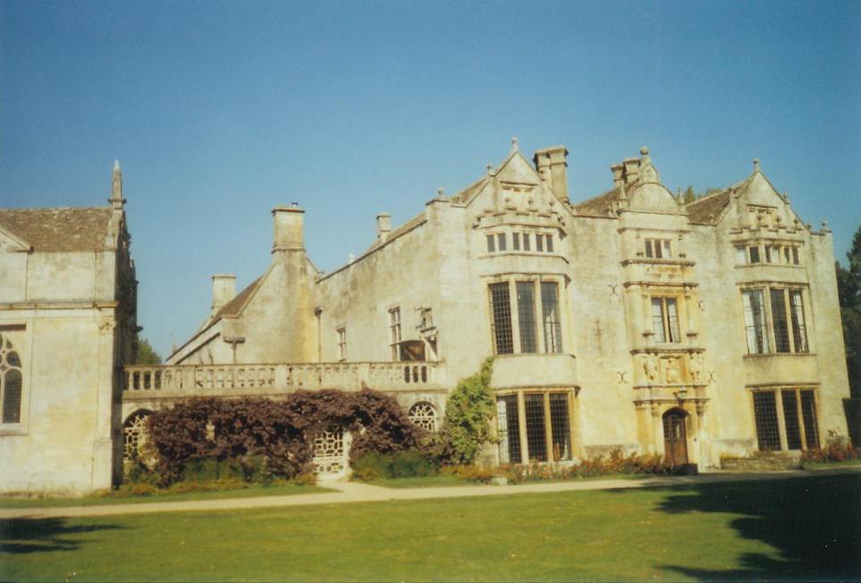
Burford Priory

Burford Priory is a Grade I listed country house and former priory at Burford in West Oxfordshire, England owned by Elisabeth Murdoch, daughter of Rupert...

Burford Methodist Church

Burford Methodist Church is a baroque building in the High Street of Burford, Oxfordshire. It was built between about 1715 and 1730 as a private house...

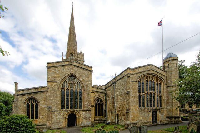
Church of St John the Baptist, Burford

The Anglican Church of St John the Baptist in Burford, Oxfordshire, England is a Grade I listed building.The Church of England parish church is dedicated...

Nearby Amenities

Located within 500m of 51.800462,-1.649237
The data included in this document is from www.openstreetmap.org. The data is made available under ODbL.

Have you been to Burford?

Leave your review of Burford below (or comments, questions and feedback).